Euthulla, Queensland

Last updated

Map all coordinates using: OpenStreetMap
Euthulla
Queensland
Australia Queensland location map.svg
Red pog.svg
Euthulla
Coordinates 26°25′32″S148°51′18″E / 26.4255°S 148.855°E / -26.4255; 148.855 (Euthulla (centre of locality))
Population370 (2016 census) [1]
 • Density0.551/km2 (1.428/sq mi)
Postcode(s) 4455
Area670.9 km2 (259.0 sq mi)
Time zone AEST (UTC+10:00)
Location
LGA(s) Maranoa Region
State electorate(s) Warrego
Federal division(s) Maranoa
Suburbs around Euthulla:
Orallo Eumamurrin Mooga
Bungeworgorai Euthulla Blythdale
Dargal Road Orange Hill
Roma
Tingun

Euthulla is a rural locality in the Maranoa Region, Queensland, Australia. [2] In the 2016 census, Euthulla had a population of 370 people. [1]

Contents

Geography

The locality is loosely bounded by Bungeworgorai Creek to the west. [3]

The Carnarvon Highway enters the locality from the south (Orange Hill) and exits to the north (Eumamurrin), and the Roma-Taroom Road exits to the north-east. [3]

Grafton Range is in the east of the locality ( 26°22′57″S148°56′39″E / 26.3825°S 148.9442°E / -26.3825; 148.9442 (Grafton Range) ) [4] with Mount Bassett ( 26°28′44″S148°52′46″E / 26.4788°S 148.8794°E / -26.4788; 148.8794 (Mount Bassett) ) rising to 496 metres (1,627 ft) above sea level. [3] [5]

There are a number of neighbourhoods within the locality, which take their names from railway sidings on the now-closed Roma-to-Injune railway line which ran through the west of the location along the now Oralla Road. From Roma heading north, the neighbourhoods / stations were:

There is another neighbourhood in the centre of the locality (not associated with the railway): Tabers ( 26°24′00″S148°47′00″E / 26.4°S 148.7833°E / -26.4; 148.7833 (Tabers) ) [10]

The land use is predominantly grazing on native vegetation with some cropping. Most of the residential areas are just outside the boundaries of Roma. [3]

History

Euthulla Provisional School opened circa 1889. On 1 January 1909, it became Euthulla State School. It closed circa 1921 but reopened in 1927. It closed finally circa 1931. [11] The school was on the western side of Emoh Ruo Road ( 26°25′51″S148°46′32″E / 26.43077°S 148.77560°E / -26.43077; 148.77560 (Euthulla State School (former)) ). [12] [3]

Mooga Provisional School opened on 1 August 1904. On 1 January 1909, it became Mooga State School. It closed on 18 April 1937. [11] It was on the northern side of Mountainview Road (then within Mooga) but now within Euthulla ( 26°22′07″S148°49′01″E / 26.36873°S 148.81698°E / -26.36873; 148.81698 (Mooga State School (former)) ). [13] [3]

Fortune's Crossing State School opened on 3 June 1912 and closed on 1928. [11] It was off Orallo Road, immediately east of Bungeworgorai Creek ( 26°25′48″S148°38′08″E / 26.42987°S 148.63562°E / -26.42987; 148.63562 (Fortune's Crossing State School (former)) ). [12] [3]

The locality takes its name Euthulla from the railway station name, given by Queensland Railways Department on 30 November 1916, supposedly an Aboriginal word, meaning unknown. [2]

The neighbourhood Minka also takes it name from a railway station assigned by the Railways Department on 29 April 1915, and is an Aboriginal word referring to a species of tree. [7]

The neighbourhood Nullawurt also takes its name from a railway station and is an Aboriginal word for an Acacia (wattle) species of tree. It was assigned from 11 November 1915, from a suggestion from the Orallo Farmers and Settlers Association. [8]

The neighbourhood name Tineen also comes from a railway station name, assigned on 16 October 1926, being an Aboriginal word, meaning mosquito . [6]

The neighbourhood Yingerbay is again the name of a railway station assigned on 11 November 1915, and taken from a pastoral run established in 1854, from the Mandandanji language, meaning a place of freshwater crayfish (yabbie). [9]

Euthulla Provisional School opened circa 1889. On 1 January 1909 it became Euthulla State School and closed circa 1921. In 1927 it reopened but closed finally in 1931. [11]

In the 2016 census, Euthulla had a population of 370 people. [1]

Education

There are no schools in the locality. The nearest primary and secondary school is Roma State College in Roma to the south. [3]

Related Research Articles

<span class="mw-page-title-main">Mitchell, Queensland</span> Town in Queensland, Australia

Mitchell is a rural town and locality in the Maranoa Region, Queensland, Australia. The town services the local area, a cattle and sheep farming district. In the 2016 census, the locality of Mitchell had a population of 1,031 people.

<span class="mw-page-title-main">Macalister, Queensland</span> Town in Queensland, Australia

Macalister is a rural town and locality in the Western Downs Region, Queensland, Australia. In the 2016 census, the locality of Macalister had a population of 153.

Bungeworgorai is a rural locality in the Maranoa Region, Queensland, Australia. In the 2016 census, Bungeworgorai had a population of 78 people.

<span class="mw-page-title-main">Amby, Queensland</span> Town in Queensland, Australia

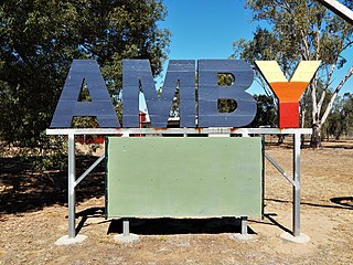
Amby is a rural town and locality in the Maranoa Region, Queensland, Australia. In the 2016 census, the locality of Amby had a population of 86 people.

Hampden is a rural locality in the Mackay Region, Queensland, Australia. In the 2016 census, Hampden had a population of 566 people.

Kuttabul is a rural town and locality in the Mackay Region, Queensland, Australia. In the 2016 census, the locality of Kuttabul had a population of 730 people.

Gunnewin is a rural locality in the Maranoa Region, Queensland, Australia. In the 2016 census Gunnewin had a population of 59 people.

<span class="mw-page-title-main">Hodgson, Queensland</span> Town in Queensland, Australia

Hodgson is a rural town and locality in the Maranoa Region, Queensland, Australia. In the 2016 census, the locality of Hodgson had a population of 61 people.

Orallo is a rural locality in the Maranoa Region, Queensland, Australia. In the 2016 census,Orallo had a population of 41 people.

Mooga is a rural locality in the Maranoa Region, Queensland, Australia. In the 2016 census Mooga had a population of 17 people.

Pickanjinnie is a rural locality in the Maranoa Region, Queensland, Australia. In the 2016 census, Pickanjinnie had a population of 49 people.

Womalilla is a rural town and locality in the Maranoa Region, Queensland, Australia. In the 2016 census, the locality of Womalilla had a population of 39 people.

Yargullen is a rural locality in the Toowoomba Region, Queensland, Australia. In the 2016 census Yargullen had a population of 25 people.

<span class="mw-page-title-main">Warkon</span> Suburb of Maranoa Region, Queensland, Australia

Warkon is a rural locality in the Maranoa Region, Queensland, Australia. In the 2016 census, Warkon had a population of 33 people.

Orange Hill is a rural locality in the Maranoa Region, Queensland, Australia. In the 2016 census, Orange Hill had a population of 201 people.

Dargal Road is a rural locality in the Maranoa Region, Queensland, Australia. In the 2016 census, Dargal Road had a population of 152 people.

Eurella is a rural locality in the Maranoa Region, Queensland, Australia. In the 2016 census, Eurella had a population of 11 people.

Noorindoo is a rural locality in the Maranoa Region, Queensland, Australia. In the 2016 census, Noorindoo had a population of 55 people.

Mount Bindango is a rural locality in the Maranoa Region, Queensland, Australia. In the 2016 census Mount Bindango had a population of 33 people.

Roma–Taroom Road is a continuous 149-kilometre (93 mi) road route in the Maranoa, Western Downs and Banana local government areas of Queensland, Australia. It is a state-controlled regional road, rated as a local road of regional significance (LRRS).

References

  1. 1 2 3 Australian Bureau of Statistics (27 June 2017). "Euthulla (SSC)". 2016 Census QuickStats. Retrieved 20 October 2018. OOjs UI icon edit-ltr-progressive.svg
  2. 1 2 "Euthulla – locality in Maranoa Region (entry 49173)". Queensland Place Names. Queensland Government . Retrieved 18 September 2020.
  3. 1 2 3 4 5 6 7 8 "Queensland Globe". State of Queensland . Retrieved 5 November 2023.
  4. "Grafton Range – range in the Maranoa Region (entry 14526)". Queensland Place Names. Queensland Government . Retrieved 28 October 2020.
  5. "Mount Bassett – mountain in Maranoa Regional (entry 1829)". Queensland Place Names. Queensland Government . Retrieved 18 September 2020.
  6. 1 2 "Tineen – locality unbounded in Maranoa Regional (entry 39329)". Queensland Place Names. Queensland Government . Retrieved 18 September 2020.
  7. 1 2 "Minka – locality unbounded in Maranoa Regional (entry 39292)". Queensland Place Names. Queensland Government . Retrieved 18 September 2020.
  8. 1 2 "Nullawurt – locality unbounded in Maranoa Regional (entry 39300)". Queensland Place Names. Queensland Government . Retrieved 18 September 2020.
  9. 1 2 "Yingerbay – locality unbounded in Maranoa Regional (entry 38705)". Queensland Place Names. Queensland Government . Retrieved 18 September 2020.
  10. "Tabers – locality unbounded in Maranoa Regional (entry 33055)". Queensland Place Names. Queensland Government . Retrieved 18 September 2020.
  11. 1 2 3 4 Queensland Family History Society (2010), Queensland schools past and present (Version 1.01 ed.), Queensland Family History Society, ISBN   978-1-921171-26-0
  12. 1 2 "Parish of Euthulla" (Map). Queensland Government. 1931. Archived from the original on 5 November 2023. Retrieved 6 November 2023.
  13. "Queensland Two Mile series sheet 2m87" (Map). Queensland Government. 1929. Retrieved 5 November 2023.