
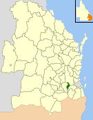
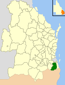
The Shire of Burdekin is a local government area located in North Queensland, Australia in the Dry Tropics region. The district is located between Townsville and Bowen in the delta of the Burdekin River. The shire covers an area of 5,044 square kilometres (1,947 sq mi). It has existed as a local government entity since 1888. In the 2021 census, the shire had a population of 16,692 people.

Capella is a rural town and locality in the Central Highlands Region, Queensland, Australia. At the 2021 census the locality of Capella had a population of 974 people.

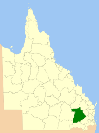
The Shire of Livingstone is a local government area located in the Capricornia region of Central Queensland, Queensland, Australia, to the immediate north and east of the regional city of Rockhampton. The shire, administered from the coastal town of Yeppoon, covers an area of 11,758 square kilometres (4,539.8 sq mi), and existed as a local government entity from 1879 until 2008, when it amalgamated with several other councils to become the Rockhampton Region. The Shire was re-established on 1 January 2014 following a successful de-amalgamation referendum in 2013.
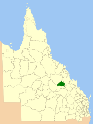
The Shire of Peak Downs was a local government area in the Central Highlands of Queensland, Australia, 320 km west of both Rockhampton and Mackay. On 15 March 2008 the shires of Duaringa, Emerald, Bauhinia and Peak Downs were amalgamated to form the Central Highlands Region.

The Shire of Maroochy was a local government area about 100 kilometres (62 mi) north of Brisbane in the Sunshine Coast region of South East Queensland, Australia. The shire covered an area of 1,162.7 square kilometres (448.9 sq mi), and existed as a local government entity from 1890 until 2008, when it amalgamated with its neighbours to the north and south to form the Sunshine Coast Region.

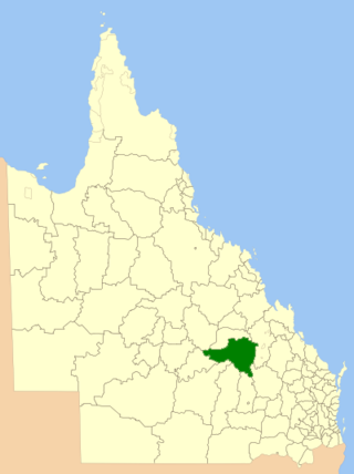
The Shire of Duaringa was a local government area in the Capricornia region of Queensland, Australia. Duaringa Shire covered an area of 18,201 square kilometres and had a population of 6,744 according to the 2006 census. On 15 March 2008 the shires of Duaringa, Emerald, Bauhinia and Peak Downs were amalgamated to form the Central Highlands Region.
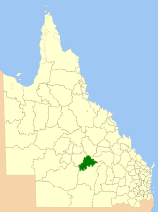
The Shire of Bauhinia was a local government area in Central Queensland, Queensland, Australia. The Shire, administered from the town of Springsure, covered an area of 23,649.6 square kilometres (9,131.2 sq mi), and existed as a local government entity from 1879 until 2008, when it was amalgamated with the Shires of Duaringa, Emerald and Peak Downs to form the Central Highlands Region.

The Shire of Bungil was a local government area in the Maranoa region of Queensland, Australia. It existed from 1880 to 2008.

The Shire of Booringa was a local government area in the Maranoa region of Queensland, Australia. The largest town and home of the shire administration was Mitchell. It existed from 1879 to 2008. The shire is now part of the Maranoa Region.

The Shire of Bulloo is a local government area in South West Queensland, Australia.
The Shire of Tambo was a local government area located in central Queensland south-east of the town of Blackall. It covered an area of 14,083.8 square kilometres (5,437.8 sq mi), and existed as a local government entity from 1881 until 2008, when it amalgamated with neighbouring Shire of Blackall to form the Blackall-Tambo Region.

The Shire of Blackall was a local government area located in central Queensland around the town of Blackall. It covered an area of 16,366.8 square kilometres (6,319.3 sq mi), and existed as a local government entity from 1879 until 2008, when it amalgamated with neighbouring Shire of Tambo to form the Blackall-Tambo Region.

The Shire of Boulia is a local government area in Central West Queensland, bordering the Northern Territory. Its administrative centre is in the town of Boulia.

The Shire of Croydon is a local government area in western Queensland, Australia. The shire, administered from the town of Croydon, covers an area of 29,498 square kilometres (11,389.2 sq mi). The council consists of a mayor plus four councillors, each of whom represents the entire Shire.
The City of Caloundra was a local government area about 90 kilometres (56 mi) north of Brisbane in the Sunshine Coast region of South East Queensland, Australia. The shire covered an area of 1,093.1 square kilometres (422.0 sq mi); it existed as a local government entity from 1912 until 2008, when it amalgamated with councils further north to form the Sunshine Coast Region.
The Shire of Laidley was a local government area located in the Lockyer Valley region between the cities of Toowoomba and Ipswich, and about 70 kilometres (43 mi) west of Brisbane, the state capital of Queensland, Australia. The shire covered an area of 700.6 square kilometres (270.5 sq mi), and existed from 1888 until its merger with the Shire of Gatton to form the Lockyer Valley Region on 15 March 2008.
The Shire of Beaudesert was a local government area located in South East Queensland, Australia, stretching from the New South Wales border, along the Gold Coast hinterland to the urban fringes of the cities of Brisbane and Ipswich. The Shire covered an area of 2,854.3 square kilometres (1,102.1 sq mi), and existed from 1879 until its abolition on 15 March 2008, following which it was split between Logan City and the new Scenic Rim Region.

The Town of Roma was a local government area in the western Downs region of Queensland, Australia. The Town of Roma covered the urban area of Roma and was surrounded by the neighbouring Shire of Bungil. Today it is part of the Maranoa Region. At the 2011 census the Town had a population of 6,906

Central Highlands Region is a local government area in Queensland, Australia.
Western Downs Region is a local government area in Queensland, Australia. The Western Downs Regional Council manages an area of 37,937 square kilometres (14,648 sq mi), which is slightly smaller than Switzerland, although with a population of 34,467 in June 2018, it is over 228 times less densely populated.
