Shire of Beenleigh

Last updated

Map of Beenleigh Division and adjacent local government areas, March 1902. Legend: Cleveland Division (11), Tingalpa Division (16), Waterford Division (18), Yeerongpilly Division (20) Beenleigh Division, March 1902.jpg
Map of Beenleigh Division and adjacent local government areas, March 1902. Legend: Cleveland Division (11), Tingalpa Division (16), Waterford Division (18), Yeerongpilly Division (20)

The Shire of Beenleigh is a former local government area in the south-east of Queensland, Australia, centred on the town of Beenleigh. It existed from 1879 to 1949.

Contents

History

Councillor G. F. Rose, Chairman of the Beenleigh Shire Council, 1909 StateLibQld 1 82683 Councillor G. F. Rose, Chairman of the Beenleigh Shire Council, 1909.jpg
Councillor G. F. Rose, Chairman of the Beenleigh Shire Council, 1909

On 11 November 1879, the Beenleigh Division was created as one of 74 divisions within Queensland under the Divisional Boards Act 1879 with a population of 1578. [1] [2]

With the passage of the Local Authorities Act 1902, it became a Shire on 31 March 1903. [2] [3]

Amalgamations in 1948

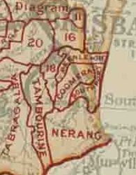
On 9 December 1948, as part of a major reorganisation of local government in South East Queensland, an Order in Council replaced ten former local government areas between the City of Brisbane and the New South Wales border with only four. [4] [5] The former ten were:

The four resulting local government areas were:

The Order came into effect on 10 June 1949, when the first elections were held.

The former council chambers of the Shire were relocated to Beenleigh Historical Village in 1982. [7]

Chairmen

Related Research Articles

<span class="mw-page-title-main">Logan City</span> City in Queensland, Australia

Logan City is a local government area situated within the south of the Brisbane metropolitan area in South East Queensland, Australia. Situated between the City of Brisbane to the north and the City of Gold Coast to the south, the City also borders the Scenic Rim Region, the City of Ipswich, and Redland City LGAs. Logan City is divided into 70 suburbs and 12 divisions; a councillor is elected to each of the latter. The council had a population of 326,615 in June 2018.

<span class="mw-page-title-main">Electoral district of Albert</span> Electoral district of Queensland, Australia

Albert was a Legislative Assembly electorate in the state of Queensland which existed from 1887 to 1949 and 1959 to 2017.

<span class="mw-page-title-main">City of Gold Coast</span> Local government area in Queensland, Australia

The City of Gold Coast is the local government area spanning the Gold Coast, Queensland, Australia and surrounding areas. With a population of 606,774 it is the second most populous local government area in the State of Queensland. Its council maintains a staff of over 2,500. It was established in 1948, but has existed in its present form since 2008. It is on the border with New South Wales with the Tweed Shire to the south in New South Wales.

<span class="mw-page-title-main">South Coast railway line, Queensland</span>

The South Coast railway line was a railway from Brisbane, the capital city of Queensland, Australia. The route via the South Coast to Tweed Heads on the border of Queensland and New South Wales. The line operated from 1889 to 1964. The Gold Coast railway line re-opened in 1996 along a modified alignment in the north and a new route south but does not extend as far south yet as the South Coast line.

<span class="mw-page-title-main">Beaudesert Shire</span> Local government area in Queensland, Australia

The Shire of Beaudesert was a local government area located in South East Queensland, Australia, stretching from the New South Wales border, along the Gold Coast hinterland to the urban fringes of the cities of Brisbane and Ipswich. The Shire covered an area of 2,854.3 square kilometres (1,102.1 sq mi), and existed from 1879 until its abolition on 15 March 2008, following which it was split between Logan City and the new Scenic Rim Region.

The Shire of Albert was a local government area in Queensland, located south of the capital, Brisbane, and taking in areas to the north and west of the Gold Coast. It was named after the Prince Consort of the United Kingdom, and husband of Queen Victoria, Prince Albert. When created in 1948, it was primarily a rural area, but its growth started in earnest in the late 1960s with the development of Logan on Brisbane's southern frontier. After the separate creation of Logan as a shire in 1978, Albert lost most of its population and became more centred upon the Gold Coast, which experienced a massive period of growth from then until the Shire's amalgamation with the City of Gold Coast in 1995.

The Shire of Tingalpa was a local government area in the south-eastern suburbs of Brisbane, Queensland, Australia. The shire, administered from Mount Cotton, covered an area of 120 square miles (311 km2), and existed as a local government entity from 1879 until 1949.

The Mayor of the City of the Gold Coast is presiding officer and public face of the Gold Coast City Council, the local government body of the Gold Coast, Queensland. The current Mayor is Tom Tate.

<span class="mw-page-title-main">Shire of Cleveland</span>

The Shire of Cleveland is a former local government area in the south-east of Queensland, Australia, centred on the town of Cleveland beside Moreton Bay.

The Shire of Waterford is a former local government area in the south-east of Queensland, Australia, centred on the town of Waterford. It existed between 1879 and 1948.

<span class="mw-page-title-main">Shire of Coomera</span>

The Shire of Coomera was a local government area in South East Queensland, Australia. The shire, administered from Coomera, existed as a local government entity from 1879 until 1949.

<span class="mw-page-title-main">Shire of Nerang</span>

The Shire of Nerang was a local government area in South East Queensland, Australia. The shire existed as a local government entity from 1879 until 1949.

The Shire of Tamborine was a local government area in South East Queensland, Australia, centred on the village of Tamborine. It existed from 1890 to 1949.

<span class="mw-page-title-main">Town of Southport</span>

The Town of Southport was a local government area in South East Queensland, Australia.

<span class="mw-page-title-main">Town of Coolangatta</span>

The Town of Coolangatta was a local government area in South East Queensland, Australia, centred on Coolangatta. It existed from 1914 to 1949.

The Town of South Coast was a local government area in South East Queensland, Australia.

<span class="mw-page-title-main">Tamborine, Queensland</span> Suburb of Logan City, Queensland, Australia

Tamborine is a rural town in the Scenic Rim Region and a locality split between the Scenic Rim Region and the City of Logan in Queensland, Australia. In the 2016 census, the locality of Tamborine had a population of 3,950 people.

Beaudesert–Nerang Road is a major inter-regional arterial road that connects the township of Beaudesert with the Gold Coast via Canungra. The road commences in Nerang on the western edge of the Gold Coast and travels west through the Gold Coast hinterland and terminates in central Beaudesert at the intersection of Mount Lindesay Highway.

Beaudesert–Beenleigh Road is a continuous 35.5 kilometres (22.1 mi) road route in the Scenic Rim and Logan City regions of Queensland, Australia. Part of the road is signed as State Route 90 and the rest as State Route 92. Beaudesert–Beenleigh Road is a state-controlled road, part district and part regional.

The Tamborine Mountain road network is a group of roads that provide access to the mountain community from various lowland localities. The network ensures continuity of access in times of flooding or other natural disasters, and during planned maintenance activities. The locality of Tamborine Mountain includes a plateau that hosts a substantial residential community plus many tourism accommodation and activity venues.

References

  1. "Proclamation [Beenleigh Division]". Queensland Government Gazette . 11 November 1879. p. 25:988.
  2. 1 2 "Agency ID 324, Beenleigh Divisional Board". Queensland State Archives . Retrieved 2 September 2013.
  3. "Agency ID 325, Beenleigh Shire Council". Queensland State Archives . Retrieved 2 September 2013.
  4. "New coast names". The Courier-Mail . Brisbane: National Library of Australia. 10 December 1948. p. 3. Retrieved 5 September 2013.
  5. "DETAILS OF SOUTH COAST SHIRES". Queensland Times (DAILY ed.). Ipswich, Queensland: National Library of Australia. 10 December 1948. p. 1. Retrieved 5 September 2013.
  6. "Agency ID 290, Albert Shire Council". Queensland State Archives . Retrieved 4 September 2013.
  7. "Early Australia". Beenleigh Historical Village . Retrieved 18 March 2015.
  8. "General News". The Queenslander . Brisbane: National Library of Australia. 13 March 1880. p. 326. Retrieved 11 May 2014.
  9. Pugh, Theophilus Parsons (1927). Pugh's Almanac for 1927 . Retrieved 13 June 2014.
  10. 1 2 Fox, Matthew Joseph (1923). History of Queensland: its People and its industries (PDF). Brisbane: States Publishing Company. Retrieved 5 April 2014.

27°42′55″S153°12′04″E / 27.7154°S 153.2012°E / -27.7154; 153.2012