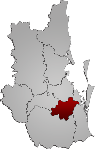
The City of Logan is a local government area (LGA) located in the south of Greater Brisbane in South East Queensland (SEQ), Australia. Situated between the City of Brisbane to the north and the City of Gold Coast to the south, the City of Logan also borders the Scenic Rim Region, the City of Ipswich, and Redland City LGAs. Logan is divided into 70 suburbs and 12 divisions; a councillor is elected to each of the latter. The council had a population of 326,615 as of June 2018.

Beenleigh is a town and suburb in the City of Logan, Queensland, Australia. In the 2021 census, the suburb of Beenleigh had a population of 8,425 people.
Carbrook is a suburb in the City of Logan, Queensland, Australia. Carbrook was previously called Gramzow, a name of German origin. The German name was anglicised in 1916 during World War I. In the 2021 census, Carbrook had a population of 1,330 people.
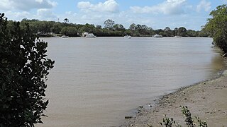
Eagleby is a suburb in the City of Logan, Queensland, Australia. In the 2021 census, Eagleby had a population of 13,594 people.

Beenleigh Rum is among Australia's oldest brands of rum. It is produced at the heritage-listed Beenleigh Rum Distillery in the suburb of Eagleby in the City of Logan, Queensland. Beenleigh Rum is 100 per cent Australian-made from local and imported ingredients and is available in 700 ml Dark Rum aged for 5 years, 700 ml White Rum and 700 ml Honey Liqueur Dark. All rum grades are fermented from Queensland molasses.
Pimpama is a northern suburb in the City of Gold Coast, Queensland, Australia. The name is of Aboriginal origin. The suburb contains numerous schools with the first opening in the 1870s.

Logan Village is a semi-rural town and locality in the City of Logan, Queensland, Australia. Logan Village was once known as the head of the navigable Logan River. Its importance as a town grew again when the railway arrived.

The Beaudesert railway line is a disused branch railway in South East Queensland, Australia. The first section opened in 1885, the line was completed in 1888 and operated as a Queensland Government Railways (QGR) line until 1996. A heritage operation was undertaken for a short period in 2003. The Canungra railway line connected at Logan Village between 1915 and 1955, and the Beaudesert Shire Tramway connected with the terminal between 1903 and 1944. A study was undertaken in 2010 by the Queensland government concerning a potential Salisbury-to-Beaudesert rail corridor as a long-term potential proposal.
Mount Warren Park is a residential suburb in the outer eastern area of the City of Logan, Queensland, Australia. The mountain of Mount Warren is within the suburb.

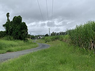
Buccan is a rural locality in the City of Logan, Queensland, Australia. In the 2021 census, Buccan had a population of 2,134 people.
Alberton is a rural locality in the City of Gold Coast, Queensland, Australia. In the 2021 census, Alberton had a population of 547 people.
The Shire of Beenleigh is a former local government area in the south-east of Queensland, Australia, centred on the town of Beenleigh. It existed from 1879 to 1949.

Beenleigh Rum Distillery is a heritage-listed rum distillery at Distillery Road, Eagleby, City of Logan, Queensland, Australia. The distillery produces Beenleigh Rum. It was built from c. 1890 to c. 1980. It was added to the Queensland Heritage Register on 6 March 2004.
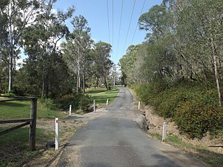
Wolffdene is a rural locality in the City of Logan, Queensland, Australia. In the 2021 census, Wolffdene had a population of 266 people.

Woongoolba is a coastal rural locality in the northern part of City of Gold Coast, Queensland, Australia. In the 2021 census, Woongoolba had a population of 282 people.

Steiglitz is a rural coastal town and locality in the City of Gold Coast, Queensland, Australia. In the 2021 census, the locality of Steiglitz had a population of 682 people.

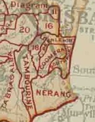
Tamborine is a rural town in the Scenic Rim Region and a locality split between the Scenic Rim Region and the City of Logan in Queensland, Australia. In the 2021 census, the locality of Tamborine had a population of 4,388 people.

Tabragalba is a rural locality in the Scenic Rim Region of South East Queensland, Australia. In the 2021 census, Tabragalba had a population of 48 people.
Beaudesert–Beenleigh Road is a continuous 35.5 kilometres (22.1 mi) road route in the Scenic Rim and Logan City regions of Queensland, Australia. Part of the road is signed as State Route 90 and the rest as State Route 92. Beaudesert–Beenleigh Road is a state-controlled road, part district and part regional.
