
Booroodabin Division is a former local government area of Queensland, Australia, located in inner northern Brisbane immediately north of the Brisbane CBD today. It existed from 1879 to 1903.
Booroodabin Division is a former local government area of Queensland, Australia, located in inner northern Brisbane immediately north of the Brisbane CBD today. It existed from 1879 to 1903.
Booroodabin Division came into existence on 11 November 1879 with a population of 3462, as one of the original divisions created by the Divisional Boards Act 1879. [1] [2]
On 13 Jan 1903, the Booroodabin Division was abolished and absorbed into Town of Brisbane. [2]
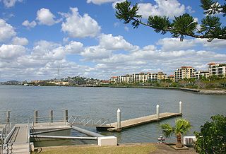
Newstead is an inner northern riverside suburb in the City of Brisbane, Queensland, Australia. In the 2016 census, Newstead had a population of 2,193 people.

The Town of Brisbane was a local government area for Brisbane in Queensland, Australia from 1859 to 1903.
The Shire of Yeerongpilly was a local government area in the southern suburbs of Brisbane, Queensland. The shire, administered from Rocklea, covered an area of 175 square miles (453 km2), and existed as a local government entity from 1879 until 1925, when it was split up following the creation of the City of Brisbane under the City of Brisbane Act 1924.
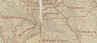
The Shire of Stephens was a local government area in the inner southern suburbs of Brisbane, Queensland, Australia. The shire, administered from Annerley, covered an area of 9 square miles (23 km2), and existed as a local government entity from 1886 until 1925, when it was amalgamated into the City of Brisbane under the City of Brisbane Act 1924.
The Shire of Tingalpa was a local government area in the south-eastern suburbs of Brisbane, Queensland, Australia. The shire, administered from Mount Cotton, covered an area of 120 square miles (311 km2), and existed as a local government entity from 1879 until 1949.

The Town of Hamilton is a former local government area of Queensland, Australia, located in north-eastern Brisbane.
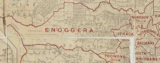
The Ithaca Division is a former local government area of Queensland, Australia, located in north-western Brisbane.

The Town of Wynnum is a former local government area of Queensland, Australia, located in eastern Brisbane adjacent to Moreton Bay around the present day suburb of Wynnum.

The Shire of Balmoral is a former local government area of Queensland, Australia, located in eastern Brisbane.
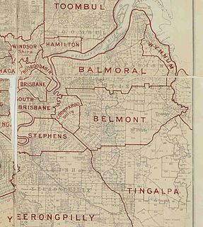
The Shire of Belmont is a former local government area of Queensland, Australia, located in eastern Brisbane including the current suburb of Belmont.

The Shire of Coorparoo is a former local government area of Queensland, Australia, located in eastern Brisbane.
The Shire of Kedron is a former local government area of Queensland, Australia, located in northern Brisbane. It existed between 1879 and 1925.

The Kedron Division is a former local government area of Queensland, Australia, located in northern Brisbane.

The Shire of Toombul was a local government area of Queensland, Australia, located in northern Brisbane from 1883 to 1925.
The Shire of Beenleigh is a former local government area in the south-east of Queensland, Australia, centred on the town of Beenleigh. It existed from 1879 to 1949.

The Shire of Cleveland is a former local government area in the south-east of Queensland, Australia, centred on the town of Cleveland beside Moreton Bay.
The Shire of Waterford is a former local government area in the south-east of Queensland, Australia, centred on the town of Waterford. It existed between 1879 and 1948.

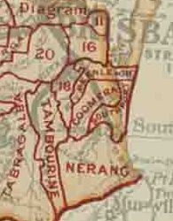
The Shire of Coomera was a local government area in South East Queensland, Australia. The shire, administered from Coomera, existed as a local government entity from 1879 until 1949.
The Shire of Tamborine was a local government area in South East Queensland, Australia, centred on the village of Tamborine. It existed from 1890 to 1949.

The Town of Southport was a local government area in South East Queensland, Australia.
Coordinates: 27°26′39″S153°02′33″E / 27.44429°S 153.04255°E