
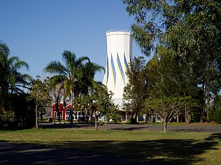
Rockhampton is a city in the Rockhampton Region of Central Queensland, Australia. In the 2021 census, the population of Rockhampton was 79,293. A common nickname for Rockhampton is 'Rocky', and the demonym of Rockhampton is Rockhamptonite.

Gladstone is a coastal city in the Gladstone Region, Queensland, Australia. In the 2016 census, the town of Gladstone had a population of 34,703 people.
Biloela is a rural town and locality in the Shire of Banana, Central Queensland, Australia. It is the administrative centre of the shire. In the 2021 census, the locality of Biloela had a population of 5,692 people.

Westwood is a town in the Rockhampton Region and a locality split between the Rockhampton Region and the Shire of Banana in Queensland, Australia. It was the first town that was gazetted by the Queensland Government. In the 2021 census, the locality of Westwood had a population of 199 people.

The Shire of Livingstone is a local government area located in the Capricornia region of Central Queensland, Queensland, Australia, to the immediate north and east of the regional city of Rockhampton. The shire, administered from the coastal town of Yeppoon, covers an area of 11,758 square kilometres (4,539.8 sq mi), and existed as a local government entity from 1879 until 2008, when it amalgamated with several other councils to become the Rockhampton Region. The Shire was re-established on 1 January 2014 following a successful de-amalgamation referendum in 2013.

Mount Larcom is the name of a mountain, a rural town and locality in the Gladstone Region, Queensland, Australia. In the 2021 census, the locality of Mount Larcom had a population of 332 people.

Theodore is a rural town and locality in the Shire of Banana, Queensland, Australia. It was established in the 1920s as part of Queensland Premier Ted Theodore's ambitious Dawson River Irrigation Scheme which failed to eventuate. It was originally known as Castle Creek, but that name is now used by another locality in the area.

The Shire of Banana is a local government area located in the Capricorn region of Queensland, Australia, inland from the regional city of Gladstone. The shire was named after the first township in the region (Banana), which in turn was named for the burial site of a huge dun coloured bullock named 'Banana'. The council sits in the town of Biloela, which is the largest town in the Shire.
The City of Rockhampton was a local government area in the Central Queensland region of Queensland, Australia, encompassing most of the suburban area of the regional city of Rockhampton. The city covered an area of 188.7 square kilometres (72.9 sq mi), and has existed as a local government entity in various forms from 1860 until 2008, when it amalgamated with several other councils in the surrounding area to become the Rockhampton Region.

Gladstone Region is a local government area in Queensland, Australia. The council covers an area of 10,484 square kilometres (4,048 sq mi), had a resident population at August 2021 of 63,515, and has an estimated operating budget of A$84 million.

Raglan is a rural town and locality in the Gladstone Region, Queensland, Australia. In the 2021 census, the locality of Raglan had a population of 143 people.

Gladstone Central is a coastal suburb of Gladstone in the Gladstone Region, Queensland, Australia. It is the historic centre and central business district of the city of Gladstone and the seat of the Gladstone Regional Council. In the 2021 census, Gladstone Central had a population of 1,550 people.

The Town of North Rockhampton was a local government area in Queensland, Australia. It existed from 1883 to 1919.
Robert Herbertson (1852–1940) was a politician in Queensland, Australia. He was a Member of the Queensland Legislative Assembly.
Yaamba is a rural town and locality in the Livingstone Shire, Queensland, Australia. In the 2021 census, the locality of Yaamba had a population of 51 people.
John Henry Kessell was a member of the Queensland Legislative Assembly.
Lakes Creek is a suburb split between Rockhampton Region and Shire of Livingstone, Queensland, Australia. In the 2021 census, Lakes Creek had a population of 633 people.

Lawgi Dawes is a rural locality in the Shire of Banana, Queensland, Australia. It contains the neighbourhood of Lawgi, a former town.
George Albert Creed was an Australian politician, best known for his work in local government in Queensland.
