Griffin, Queensland

Last updated

Griffin
Moreton Bay,  Queensland
Dohls Rocks Road and Pine River at Griffin, Queensland.jpg
Pine River along Dohles Rocks Road, 2016
Australia Queensland location map.svg
Red pog.svg
Griffin
Griffin, Queensland
Coordinates 27°16′25″S153°02′54″E / 27.2736°S 153.0483°E / -27.2736; 153.0483 (Griffin (centre of suburb))
Population12,295 (2021 census) [1]
 • Density714.8/km2 (1,851/sq mi)
Postcode(s) 4503
Area17.2 km2 (6.6 sq mi)
Time zone AEST (UTC+10:00)
Location
LGA(s) City of Moreton Bay
State electorate(s) Murrumba
Federal division(s) Petrie
Suburbs around Griffin:
Kallangur Mango Hill Clontarf
Murrumba Downs Griffin Hays Inlet
Bald Hills Bald Hills Brighton

Griffin is a suburb in the City of Moreton Bay, Queensland, Australia. [2] In the 2021 census, Griffin had a population of 12,295 people. [1]

Contents

Geography

Griffin contains both residential and agricultural land usage, as well as recreational, boating and fishing facilities along the northern shore of the Pine River. Further inland, the Pine River diverges into the North Pine and South Pine rivers.[ citation needed ]

Osprey House is an environmental centre located in Griffin along the Pine River. The centre features displays, boardwalks, a bird hide and other visitor facilities. [3]

History

The origin of the suburb's name is from the Griffin family who migrated to Australia from the Orkney Islands off the northern coast of Scotland. [4]

Griffin State School opened on 1 January 2016. [5] [6]

Demographics

In the 2011 census, Griffin recorded a population of 2,358 people, 50.9% female and 49.1% male. The median age of the Griffin population was 28 years, 9 years below the national median of 37. 73.6% of people living in Griffin were born in Australia. The other top responses for country of birth were New Zealand 6.9%, England 4.7%, South Africa 1.2%, the Philippines 0.6%, Fiji 0.6%. 89.3% of people spoke only English at home; the next most common languages were 0.6% Tokelauan, 0.5% Samoan, 0.4% Afrikaans, 0.4% Sinhalese, 0.4% Mandarin. [7]

In the 2016 census, Griffin had a population of 6,839 people. [8]

In the 2021 census, Griffin had a population of 12,295 people. [1]

Education

Griffin State School is a government primary (Prep–6) school for boys and girls at 19 Wesley Road ( 27°15′24″S153°01′28″E / 27.2566°S 153.0244°E / -27.2566; 153.0244 (Griffin State School) ). [9] [10] In 2018, the school had an enrolment of 697 students with 46 teachers (45 full-time equivalent) and 26 non-teaching staff (18 full-time equivalent). [11] It includes a special education program. [9]

There is no secondary school in Griffin. The nearest government secondary school is Murrumba State Secondary College in neighbouring Murrumba Downs to the west. [12]

Amenities

There is a boat ramp and floating walkway on Dohles Rocks Road on the north bank of Pine River ( 27°16′39″S153°02′29″E / 27.2776°S 153.0414°E / -27.2776; 153.0414 (Griffin, Dohles Rocks Road boat ramp) ). It is managed by the Moreton Bay City Council. [13]

Related Research Articles

<span class="mw-page-title-main">Scarborough, Queensland</span> Suburb of City of Moreton Bay, Queensland, Australia

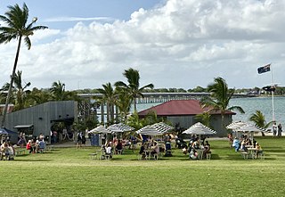
Scarborough is a coastal suburb on the Redcliffe Peninsula in the City of Moreton Bay, Queensland, Australia. In the 2021 census, Scarborough had a population of 9,178 people.

<span class="mw-page-title-main">Petrie, Queensland</span> Suburb of Moreton Bay, Queensland, Australia

Petrie is a suburb in the City of Moreton Bay, Queensland, Australia. In the 2021 census, Petrie had a population of 8,722 people.

<span class="mw-page-title-main">Mount Pleasant, Queensland (Moreton Bay)</span> Suburb of City of Moreton Bay, Queensland, Australia

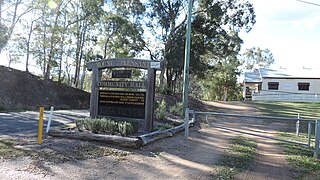
Mount Pleasant is a rural locality in the City of Moreton Bay, Queensland, Australia. In the 2021 census, Mount Pleasant had a population of 390 people.

<span class="mw-page-title-main">Strathpine, Queensland</span> Suburb of City of Moreton Bay, Queensland, Australia

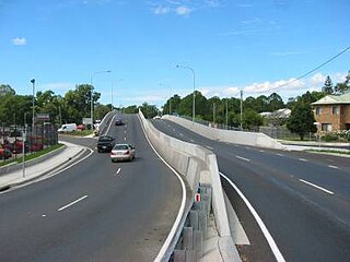
Strathpine is a suburb in the City of Moreton Bay, Queensland, Australia. It is home to the Pine Rivers District offices of the City of Moreton Bay, as well as many businesses, administrative, and local, state and federal government offices. The area is home to Strathpine Centre, a medium-sized urban shopping centre, built by Westfield.

<span class="mw-page-title-main">Kallangur, Queensland</span> Suburb of Moreton Bay, Queensland, Australia

Kallangur is a suburb in the City of Moreton Bay, Queensland, Australia. In the 2021 census, Kallangur had a population of 21,761 people.

<span class="mw-page-title-main">Hope Island, Queensland</span> Suburb of Gold Coast, Queensland, Australia

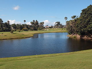
Hope Island is a suburb in the City of Gold Coast, Queensland, Australia. In the 2021 census, Hope Island had a population of 14,522 people.

<span class="mw-page-title-main">North Lakes, Queensland</span> Suburb of Moreton Bay, Queensland, Australia

North Lakes is a suburb in the City of Moreton Bay, Queensland, Australia. In the 2021 census, North Lakes had a population of 23,030 people.

<span class="mw-page-title-main">Murrumba Downs, Queensland</span> Suburb of Moreton Bay, Queensland, Australia

Murrumba Downs is a suburb in the City of Moreton Bay, Queensland, Australia. In the 2021 census, Murrumba Downs had a population of 10,795 people.

<span class="mw-page-title-main">Lawnton, Queensland</span> Suburb of Moreton Bay, Queensland, Australia

Lawnton is a suburb in the City of Moreton Bay, Queensland, Australia. In the 2021 census, Lawnton had a population of 5,905 people.

<span class="mw-page-title-main">Newport, Queensland</span> Suburb of City of Moreton Bay, Queensland, Australia

Newport is a coastal suburb in the City of Moreton Bay, Queensland, Australia. In the 2021 census, Newport had a population of 5,964 people.

<span class="mw-page-title-main">Cashmere, Queensland</span> Suburb of Moreton Bay, Queensland, Australia

Cashmere is a suburb in the City of Moreton Bay, Queensland, Australia. In the 2021 census, Cashmere had a population of 4,970 people.

Bellara is a suburb of Bribie Island in the City of Moreton Bay, Queensland, Australia. In the 2021 census, Bellara had a population of 3,278 people.

<span class="mw-page-title-main">Sandstone Point, Queensland</span> Suburb of City of Moreton Bay, Queensland, Australia

Sandstone Point is a coastal locality in the City of Moreton Bay, Queensland, Australia. In the 2021 census, Sandstone Point had a population of 4,094 people.

<span class="mw-page-title-main">Bulwer, Queensland</span> Town in Queensland, Australia

Bulwer is a coastal town and locality at the north-western end of Moreton Island in the City of Brisbane, Queensland, Australia. In the 2021 census, the locality of Bulwer had a population of 59 people.

<span class="mw-page-title-main">Woorim, Queensland</span> Town in Queensland, Australia

Woorim is a town and suburb of Bribie Island in the City of Moreton Bay, Queensland, Australia. In the 2021 census, the suburb of Woorim had a population of 1,843 people.

<span class="mw-page-title-main">Alberton, Queensland</span> Suburb of Gold Coast, Queensland, Australia

Alberton is a rural locality in the City of Gold Coast, Queensland, Australia. In the 2021 census, Alberton had a population of 547 people.

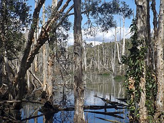
Meldale is a coastal rural locality in the City of Moreton Bay, Queensland, Australia. In the 2021 census, Meldale had a population of 230 people.

<span class="mw-page-title-main">Jacobs Well, Queensland</span> Suburb of Gold Coast, Queensland, Australia

Jacobs Well is a coastal suburb in the City of Gold Coast, Queensland, Australia. In the 2021 census, Jacobs Well had a population of 2,882 people.

<span class="mw-page-title-main">Rush Creek, Queensland</span> Suburb of City of Moreton Bay, Queensland, Australia

Rush Creek is a rural locality in the City of Moreton Bay, Queensland, Australia. In the 2021 census, Rush Creek had a population of 152 people.

Burpengary East is a coastal suburb in the City of Moreton Bay, Queensland, Australia. In the 2021 census, Burpengary East had a population of 9,654 people.

References

  1. 1 2 3 Australian Bureau of Statistics (28 June 2022). "Griffin (SAL)". 2021 Census QuickStats. Retrieved 29 June 2022. OOjs UI icon edit-ltr-progressive.svg
  2. "Griffin – suburb in Moreton Bay Region (entry 50015)". Queensland Place Names. Queensland Government . Retrieved 20 July 2021.
  3. "Osprey House Environmental Centre - Griffin". Moreton Bay Region. Archived from the original on 11 September 2016. Retrieved 21 August 2016.
  4. "Placeames". Archived from the original on 4 September 2007. Retrieved 7 March 2023.
  5. "Register of Recent School Openings, Closures and Name Changes". Queensland Government. Archived from the original on 20 July 2020. Retrieved 17 December 2021.
  6. "Our School". Griffin State School. 12 February 2020. Archived from the original on 7 March 2021. Retrieved 17 December 2021.
  7. Australian Bureau of Statistics (31 October 2012). "Griffin (State Suburb)". 2011 Census QuickStats. Retrieved 11 March 2014. OOjs UI icon edit-ltr-progressive.svg
  8. Australian Bureau of Statistics (27 June 2017). "Griffin (SSC)". 2016 Census QuickStats. Retrieved 20 October 2018. OOjs UI icon edit-ltr-progressive.svg
  9. 1 2 "State and non-state school details". Queensland Government. 9 July 2018. Archived from the original on 21 November 2018. Retrieved 21 November 2018.
  10. "Griffin State School". Griffin State School. 12 February 2020. Archived from the original on 7 March 2021. Retrieved 17 December 2021.
  11. "ACARA School Profile 2018". Australian Curriculum, Assessment and Reporting Authority. Archived from the original on 27 August 2020. Retrieved 28 January 2020.
  12. "Queensland Globe". State of Queensland . Retrieved 17 December 2021.
  13. "Recreational Boating Facilities Queensland". Queensland Open Data. Queensland Government. 12 November 2020. Archived from the original on 22 November 2020. Retrieved 22 November 2020.