Bongaree, Queensland

Last updated

Bongaree
Bribie Island,  Queensland
Bongaree Jetty looking north, 2006.jpg
Bongaree Jetty looking north, 2006
Australia Queensland location map.svg
Red pog.svg
Bongaree
Bongaree, Queensland
Coordinates 27°04′53″S153°09′49″E / 27.0813°S 153.1636°E / -27.0813; 153.1636 (Bongaree (centre of suburb))
Population6,947 (2016 census) [1]
 • Density847/km2 (2,194/sq mi)
Postcode(s) 4507
Area8.2 km2 (3.2 sq mi)
Time zone AEST (UTC+10:00)
Location
LGA(s) City of Moreton Bay
State electorate(s) Pumicestone
Federal division(s) Longman
Suburbs around Bongaree:
Bellara Woorim Woorim
Sandstone Point Bongaree Woorim
Moreton Bay Moreton Bay Moreton Bay

Bongaree is a suburb of Bribie Island in the City of Moreton Bay, Queensland, Australia. [2] It is located on the western side of Bribie Island, adjacent to the Pumicestone Passage. In the 2016 census, Bongaree has a population of 6,947 people. [1]

Contents

Geography

Creek at Bongaree, 2022 Bongaree Creek, Bribie Island, 2022.jpg
Creek at Bongaree, 2022

Bongaree is on the south-western corner of Bribie Island and sits at the northern end of Moreton Bay. The Bribie Island Bridge links the most north-westerly point of Bongaree ( 27°04′06″S153°08′53″E / 27.0683°S 153.1480°E / -27.0683; 153.1480 (Bribie Bridge) ) across the Pumicestone Passage to Sandstone Point on the mainland and is the only bridge to a Moreton Bay Island. [3]

Lagoon at Buckleys Hole Conservation Park, 2022 Buckleys Hole Conservation Park, Bribie Island, 2022.jpg
Lagoon at Buckleys Hole Conservation Park, 2022

The southern part of the locality is within the Buckleys Hole Conservation Park ( 27°05′36″S153°09′51″E / 27.09347°S 153.16405°E / -27.09347; 153.16405 (Buckleys Hole Conservation Park) ). The park is approx 88 hectares (220 acres) with a variety of landscapes, including a freshwater lagoon, awoodland, an open forest and a beach. It is popular with bushwalkers and anglers. [4] [5]

History

Sketch of Bungaree Bungaree australian aboriginal leader.jpg
Sketch of Bungaree

The suburb is named after the Aboriginal explorer Bungaree who accompanied Matthew Flinders on a number of his voyages of exploration of the Australian coastline. [2]

In 1891, a school opened at the Bribie Island Aboriginal Mission. [6]

A provisional school opened in 1908 but closed in 1909. [6]

In 1923, first Methodist church services were held under a gum tree at the site of the current bowls club. In 1924 land was purchased in Banya Street and in 1929 a church building from Enoggera was relocated to the site. The church was officially opened on Saturday 27 December 1930. [7] [8] By the mid 1970s the church was becoming too small for the congregation and land was purchased in Webster Street. On 27 July 1986 the new Bribie Island Unting Church in Webster Street was officially opened. [9] [10]

Bribie Island Provisional School opened on 4 February 1924. On 16 Feb 1925 it became Bribie Island State School. [6]

In April 1927, Anglican residents of Bribie Island decided to build a church in honour of St Peter the fisherman. [11] On Sunday 7 October 1928 Dean Batty performed the stump capping ceremony. [12] On Thursday 27 December 1928 the church was dedicated by Archbishop Gerald Sharp. [13] In 1974 the church was re-positioned and renovated and was re-dedicated on 5 May 1974 by Archbishop Felix Arnott. By 1989 it was decided that the growing congregation needed a new larger church building. The new church of St Peter Apostle & Martyr was dedicated on 24 May 2008 by Archbishop Phillip Aspinall and consecrated by him on 5 November 2016. [14] [15]

In 1947, three former Army huts, each 40 by 20 feet (12.2 by 6.1 m), were donated by Charles Coward and were dragged 18 miles (29 km) from the north of Bribie Island across bogs and creeks to a hill on Bongaree about 300 yards (270 m) from the jetty to establish a Catholic church with a hall and a priest's residence. The journey took four weeks and involved seven men with winches, trucks and semi-trailers. Coward's son Flying Officer Charles G.T. Coward was killed on active service in the Royal Australian Air Force on 23 November 1943 aged 21 years. Before leaving Australia, Coward's son had said "If anything happens to me, Dad, buy me a church". [16] On Thursday 1 January 1948, the church was officially opened by Archbishop James Duhig. A statue of St Michael, the warrior saint, was erected over the sanctuary to commemorate the deaths of Flying Officer Coward and his friend Flight-Lieutenant Virgil Paul Brennan who died on active service on 13 June 1943 aged 23 years. [17]

SS Koopa docked at Bongaree Jetty, 1911-1930 SS KOOPA docked at Bongaree Jetty, 1911-1930 (9677578240).jpg
SS Koopa docked at Bongaree Jetty, 1911-1930

The Bribie Bridge was constructed from 1961 to 1963 and was officially opened on 19 October 1963 by Queensland Premier Frank Nicklin. The bridge was a toll bridge from its opening in 1963 until 1975. The toll for crossing was 5 shillings. [18] [19]

The Bribie Island library opened at Bongaree in 1976 with a major refurbishment in 2016. [20]

The foundation stone of Bribie Island Uniting Church was laid on Sunday 4 May 1986 by Raymond F. Hunt, Moderator of the Queensland Synod. [10]

Bribie Island State High School opened on 23 January 1989. [6]

Bribie Christian Outreach Centre opened in July 2003. [21] [22]

In the 2006 census, Bongaree recorded a population of 6,524 people. The population was 53.4% female and 46.6% male. The median age of the Bongaree population was 62 years, 25 years above the national median of 37. Children under 15 years made up 9.4% of the population and people aged 65 years and over made up 44.8% of the population. 74% of people living in Bongaree were born in Australia. The other top responses for country of birth were England 7.1%, New Zealand 4.1%, Scotland 1%, Netherlands 0.9%, Germany 0.6%. 90.9% of people spoke only English at home; the next most common languages were 0.4% German, 0.3% Dutch, 0.2% Croatian, 0.2% Italian, 0.2% Thai.[ citation needed ]

Bribie Island Seaside Museum opened on 14 May 2010. [23]

In the 2011 census, the suburb recorded a population of 6,524 people, with a median age of 62 years. [24]

In the 2016 census, Bongaree has a population of 6,947 people. [1]

Education

Bribie Island State School is a government primary (Prep-6) school for boys and girls at 31-63 First Avenue ( 27°05′00″S153°09′42″E / 27.0832°S 153.1618°E / -27.0832; 153.1618 (Bribie Island State School) ). [25] [26] In 2018, the school had an enrolment of 647 students with 43 teachers (39 full-time equivalent) and 30 non-teaching staff (22 full-time equivalent). [27] It includes a special education program. [25]

Bribie Island State High School is a government secondary (7-12) school for boys and girls at 65-101 First Avenue ( 27°04′58″S153°09′58″E / 27.0829°S 153.1660°E / -27.0829; 153.1660 (Bribie Island State High School) ). [25] [28] In 2018, the school had an enrolment of 1,189 students with 97 teachers (93 full-time equivalent) and 39 non-teaching staff (34 full-time equivalent). [27] It includes a special education program. [25] [29]

Amenities

Bribie Island Library, 2006 Bribie Island Library.jpg
Bribie Island Library, 2006

The Moreton Bay City Council operates the Bribie Island Library at 1 Welsby Parade ( 27°05′00″S153°09′33″E / 27.0834°S 153.1591°E / -27.0834; 153.1591 (Bribie Island Library) ). [30] [31]

St Peter's Anglican Church is at 10 Banya Street (corner Foster Street, 27°05′06″S153°09′39″E / 27.0850°S 153.1609°E / -27.0850; 153.1609 (St Peter Apostle & Martyr Anglican Church) ). [32] It hold services on Sundays and Wednesdays. [33]

The Little Flower Catholic Church is at 41-47 First Avenue ( 27°05′00″S153°09′47″E / 27.0832°S 153.1631°E / -27.0832; 153.1631 (Little Flower Catholic Church) ). [34] [35]

Bribie Island Uniting Church is at 76-82 Webster Street ( 27°05′10″S153°10′03″E / 27.0860°S 153.1676°E / -27.0860; 153.1676 (Bribie Island Uniting Church) ). [36] [10] [37]

Bribie Island Baptist Church is at 7-9 Cotterill Avenue ( 27°04′41″S153°09′31″E / 27.0781°S 153.1587°E / -27.0781; 153.1587 (Bribie Island Baptist Church) ). [38] [39]

Bribie Island Church of Christ is at 42 Foley Street ( 27°04′47″S153°09′42″E / 27.0797°S 153.1617°E / -27.0797; 153.1617 (Bribie Island Church of Christ) ). [40] [41] The congregation commenced in 1975. [42]

Bribie Christian Outreach Centre (also known as the Awesome Bribie Island Church) is at 7/1 Toorbul Street ( 27°05′04″S153°09′33″E / 27.0844°S 153.1593°E / -27.0844; 153.1593 (Bribie Christian Outreach Centre) ). It is part of the International Network of Churches. [21] [22]

Attractions

Matthew Flinders exhibition, Bribie Island Seaside Museum, 2010 Flinders bongaree Bribie.jpg
Matthew Flinders exhibition, Bribie Island Seaside Museum, 2010

Bribie Island Seaside Museum is at 1 South Esplanade ( 27°05′10″S153°09′34″E / 27.0860°S 153.1595°E / -27.0860; 153.1595 (Bribie Island Seaside Museum) ). [43]

Related Research Articles

<span class="mw-page-title-main">Caloundra</span> Town in Queensland, Australia

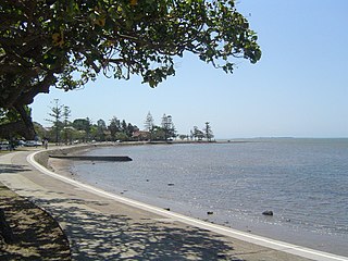
Caloundra is a coastal town in the Sunshine Coast Region, Queensland, Australia.

<span class="mw-page-title-main">Buderim</span> Town in Queensland, Australia

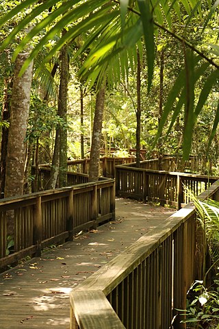
Buderim is an urban centre on the Sunshine Coast, Queensland, Australia. It sits on a 180-metre (590 ft) mountain which overlooks the southern Sunshine Coast communities. In the 2016 census, the urban area of Buderim had a population of 54,483.

<span class="mw-page-title-main">Bribie Island</span> Island in Queensland, Australia

Bribie Island is the smallest and most northerly of three major sand islands forming the coastline sheltering the northern part of Moreton Bay, Queensland, Australia. The others are Moreton Island and North Stradbroke Island. Bribie Island is 34 kilometres long, and 8 kilometres at its widest. Archibald Meston believed that the name of the island came from a corruption of a mainland word for it, Boorabee meaning koala. However, the correct Joondaburri name for the island is in fact Yarun.

<span class="mw-page-title-main">Caboolture, Queensland</span> Suburb of Brisbane, Queensland, Australia

Caboolture is a town and suburb in the City of Moreton Bay, Queensland, Australia. In the 2021 census, the suburb of Caboolture had a population of 29,534 people. It is located on the northern side of the Caboolture River.

Ningi is a town and locality in the City of Moreton Bay, Queensland, Australia. In the 2016 census, the locality of Ningi had a population of 4,675 people. It is near Caboolture.

<span class="mw-page-title-main">Cleveland, Queensland</span> Suburb of Redland City, Queensland, Australia

Cleveland is a coastal and central locality in the City of Redland, Queensland, Australia. In the 2016 census, Cleveland had a population of 14,801 people.

<span class="mw-page-title-main">Wynnum, Queensland</span> Suburb of Brisbane, Queensland, Australia

Wynnum is a coastal suburb in the City of Brisbane, Queensland, Australia. In the 2016 census, Wynnum had a population of 12,915 people. The suburb is a popular destination in Brisbane due to its coastline, jetty and tidal wading pool.

<span class="mw-page-title-main">Manly, Queensland</span> Suburb of Brisbane, Queensland, Australia

Manly is an eastern bayside suburb in the City of Brisbane, Queensland, Australia. In the 2016 census, Manly had a population of 4,064 people.

<span class="mw-page-title-main">Shorncliffe, Queensland</span> Suburb of Brisbane, Queensland, Australia

Shorncliffe is a coastal north-eastern suburb in the City of Brisbane, Queensland, Australia. It is on the shore of Bramble Bay, part of Moreton Bay. In the 2016 census, Shorncliffe had a population of 1,870 people. The suburb attracts visitors to its historic Shorncliffe pier, and Lovers Walk, a walking path along the coastline between Shorncliffe and neighbouring Sandgate.

<span class="mw-page-title-main">Dunwich, Queensland</span> Town in Queensland, Australia

Dunwich is a town and locality on the western side of North Stradbroke Island in Queensland, Australia. Dunwich is part of the Redland City local government area, administered from the bayside town of Cleveland on the Queensland mainland. In the 2016 census, Dunwich had a population of 864 people.

<span class="mw-page-title-main">Deception Bay, Queensland</span> Suburb of Moreton Bay, Queensland, Australia

Deception Bay is a coastal suburb in the City of Moreton Bay, Queensland, Australia. In the 2016 census, Deception Bay had a population of 19,850 people.

<span class="mw-page-title-main">Banksia Beach, Queensland</span> Suburb of Bribie Island, Queensland, Australia

Banksia Beach is a town and suburb on Bribie Island in the City of Moreton Bay, Queensland, Australia. In the 2016 census the suburb of Banksia Beach had a population of 5,995 people.

<span class="mw-page-title-main">Bulimba, Queensland</span> Suburb of Brisbane, Queensland, Australia

Bulimba is a suburb in the City of Brisbane, Queensland, Australia. In the 2016 census, Bulimba had a population of 6,843 people.

<span class="mw-page-title-main">Lota, Queensland</span> Suburb of Brisbane, Queensland, Australia

Lota is an eastern bayside suburb in the City of Brisbane, Queensland, Australia. In the 2021 census, Lota had a population of 3,518 people.

<span class="mw-page-title-main">Beachmere, Queensland</span> Town in Queensland, Australia

Beachmere is a coastal rural town and locality in the City of Moreton Bay, Queensland, Australia. In the 2021 census, the locality of Beachmere had a population of 4,782 people.

Bellara is a suburb of Bribie Island in the City of Moreton Bay, Queensland, Australia. In the 2016 census, Bellara had a population of 3,225 people.

<span class="mw-page-title-main">Sandstone Point, Queensland</span> Suburb of City of Moreton Bay, Queensland, Australia

Sandstone Point is a coastal locality in the City of Moreton Bay, Queensland, Australia. In the 2016 census, Sandstone Point had a population of 3,959 people.

<span class="mw-page-title-main">Woorim, Queensland</span> Suburb of Bribie Island, Queensland, Australia

Woorim is a town and suburb of Bribie Island in the City of Moreton Bay, Queensland, Australia. In the 2016 census, Woorim had a population of 1,829 people.

<span class="mw-page-title-main">White Patch, Queensland</span> Town in Queensland, Australia

White Patch is a coastal town and locality of Bribie Island in the City of Moreton Bay, Queensland, Australia. In the 2016 census the locality of White Patch had a population of 142 people.

<span class="mw-page-title-main">Welsby, Queensland</span> Suburb of Bribie Island, Queensland, Australia

Welsby is a coastal locality on Bribie Island in the City of Moreton Bay, Queensland, Australia. In the 2016 census Welsby had a population of 5 people.

References

  1. 1 2 3 Australian Bureau of Statistics (27 June 2017). "Bongaree (State Suburb)". 2016 Census QuickStats. Retrieved 18 April 2018. OOjs UI icon edit-ltr-progressive.svg
  2. 1 2 "Bongaree (entry 45493)". Queensland Place Names. Queensland Government . Retrieved 30 May 2014.
  3. Sweedman, David (16 May 2019). "History - The STORY of our BRIDGE". The Bribie Islander. Archived from the original on 22 September 2020. Retrieved 22 September 2020.
  4. "Buckleys Hole Conservation Park – conservation park in the Moreton Bay Region (entry 39392)". Queensland Place Names. Queensland Government . Retrieved 30 December 2022.
  5. "Buckleys Hole Conservation Park". Tourism & Events Queensland. Queensland Government. Retrieved 30 December 2022.
  6. 1 2 3 4 Queensland Family History Society (2010), Queensland schools past and present (Version 1.01 ed.), Queensland Family History Society, ISBN   978-1-921171-26-0
  7. "Bribie Island". The Telegraph . No. 17, 532. Queensland, Australia. 11 February 1929. p. 5. Archived from the original on 23 May 2021. Retrieved 23 May 2021 via National Library of Australia.
  8. "Redcliffe". The Telegraph . No. 18, 116. Queensland, Australia. 29 December 1930. p. 14. Archived from the original on 23 May 2021. Retrieved 23 May 2021 via National Library of Australia.
  9. "About Us". BRIBIE ISLAND UNITING CHURCH. Archived from the original on 23 May 2021. Retrieved 22 May 2021.
  10. 1 2 3 "Bribie Island Uniting Church". Churches Australia. Archived from the original on 23 May 2021. Retrieved 22 May 2021.
  11. "BRIBIE ISLAND". Humpybong Weekly And Advertiser . No. 7. Queensland, Australia. 21 April 1927. p. 4. Archived from the original on 22 September 2020. Retrieved 22 September 2020 via National Library of Australia.
  12. "CHURCH NEWS". The Brisbane Courier . No. 22, 058. Queensland, Australia. 6 October 1928. p. 7. Archived from the original on 22 September 2020. Retrieved 22 September 2020 via National Library of Australia.
  13. "Bribie Island". The Telegraph . No. 17, 494. Queensland, Australia. 28 December 1928. p. 16. Archived from the original on 22 September 2020. Retrieved 22 September 2020 via National Library of Australia.
  14. "Year Book" (PDF). Anglican Archdiocese of Brisbane. 2019. p. 134. Archived (PDF) from the original on 15 September 2020. Retrieved 15 September 2020.
  15. "History". Anglican Church Bribie Island. Archived from the original on 22 September 2020. Retrieved 22 September 2020.
  16. "FORMER ARMY HUTS". Cairns Post . No. 14, 033. Queensland, Australia. 24 February 1947. p. 2. Archived from the original on 23 May 2021. Retrieved 23 May 2021 via National Library of Australia.
  17. "SO WELL REMEMBERED". The Courier-mail . No. 3465. Queensland, Australia. 2 January 1948. p. 3. Archived from the original on 23 May 2021. Retrieved 23 May 2021 via National Library of Australia.
  18. "Untitled". The Canberra Times . Vol. 38, no. 10, 676. Australian Capital Territory, Australia. 25 October 1963. p. 4. Archived from the original on 23 May 2021. Retrieved 22 September 2020 via National Library of Australia.
  19. Sweedman, David (16 May 2019). "History - The Story of our Bridge". The Bribie Islander. Archived from the original on 22 September 2020. Retrieved 22 September 2020.
  20. "Queensland Public Libraries Statistical Bulletin 2016-17". Public Libraries Connect. November 2017. Archived from the original on 15 January 2018. Retrieved 15 January 2018.
  21. 1 2 "Bribie Christian Outreach Centre". Churches Australia. Archived from the original on 28 August 2021. Retrieved 23 May 2021.
  22. 1 2 "Welcome to Awesome Bribie Island Church". Archived from the original on 3 March 2021. Retrieved 23 May 2021.
  23. "Bribie Island Seaside Museum". Visit Bribie Island. Archived from the original on 22 September 2020. Retrieved 22 September 2020.
  24. Australian Bureau of Statistics (31 October 2012). "Bongaree (State Suburb)". 2011 Census QuickStats. Retrieved 29 December 2015. OOjs UI icon edit-ltr-progressive.svg
  25. 1 2 3 4 "State and non-state school details". Queensland Government. 9 July 2018. Archived from the original on 21 November 2018. Retrieved 21 November 2018.
  26. "Bribie Island State School". Bribie Island State School. 29 November 2020. Retrieved 30 December 2022.
  27. 1 2 "ACARA School Profile 2018". Australian Curriculum, Assessment and Reporting Authority. Archived from the original on 27 August 2020. Retrieved 28 January 2020.
  28. "Bribie Island State High School". Archived from the original on 18 May 2020. Retrieved 21 November 2018.
  29. "Bribie Island SHS - Special Education Program". Archived from the original on 18 May 2020. Retrieved 21 November 2018.
  30. "Bribie Island Library". Public Libraries Connect. Archived from the original on 15 January 2018. Retrieved 30 January 2018.
  31. "Bribie Island Library". Moreton Bay Regional Council . Archived from the original on 22 September 2020. Retrieved 22 September 2020.
  32. "St Peter's Anglican Church". Churches Australia. Archived from the original on 23 May 2021. Retrieved 22 May 2021.
  33. "Worship". Anglican Church Bribie Island. Archived from the original on 22 September 2020. Retrieved 22 September 2020.
  34. "The Little Flower Catholic Church". Churches Australia. Archived from the original on 23 May 2021. Retrieved 22 May 2021.
  35. "MASS TIMES". Living Waters Catholic Parish. Archived from the original on 16 March 2021. Retrieved 22 May 2021.
  36. "Bribie Island Uniting Church". Archived from the original on 23 May 2021. Retrieved 22 May 2021.
  37. "Find a Church". Uniting Church in Australia, Queensland Synod. Archived from the original on 24 October 2020. Retrieved 22 November 2020.
  38. "Bribie Island Baptist Church". Churches Australia. Archived from the original on 23 May 2021. Retrieved 22 May 2021.
  39. "Bribie Baptist Church". Archived from the original on 27 February 2021. Retrieved 22 May 2021.
  40. "Bribie Island Church of Christ". Churches Australia. Archived from the original on 28 August 2021. Retrieved 23 May 2021.
  41. "In His steps". Bribie Island Church of Christ. 1 May 2021. Archived from the original on 30 November 2020. Retrieved 23 May 2021.
  42. "Bribie Island Church of Christ: Who we are". Bribie Island Church of Christ. Archived from the original on 6 April 2017. Retrieved 23 May 2021.
  43. "Bribie Island Seaside Museum". Moreton Bay Regional Council . Archived from the original on 22 September 2020. Retrieved 22 September 2020.