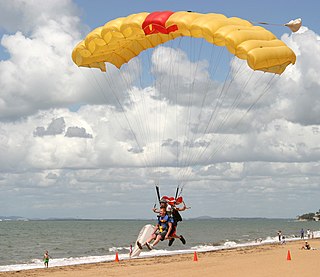
Bribie Island is an Australian national park in the Moreton Bay Region, Queensland, 68 kilometres north of Brisbane. The park covers approximately one third of Bribie Island. The tidal wetlands and areas of water around the islands are protected within the Moreton Bay Marine Park.

Brisbane is the capital of and the most populated city in the Australian state of Queensland, and the third most populous city in Australia. Brisbane's metropolitan area has a population of over 2.5 million, and the South East Queensland metropolitan region, centred on Brisbane, encompasses a population of more than 3.6 million. The Brisbane central business district stands on the historic European settlement and is situated inside a peninsula of the Brisbane River, about 15 kilometres from its mouth at Moreton Bay, a bay of the Coral Sea. The metropolitan area extends in all directions along the hilly floodplain of the Brisbane River Valley between Moreton Bay and the Taylor and D'Aguilar mountain ranges. It sprawls across several of Australia's most populous local government areas (LGAs)—most centrally the City of Brisbane, which is by far the most populous LGA in the nation. The demonym of Brisbane is "Brisbanite", whilst common nicknames include "Brissy", "River City" and "Brisvegas".

Moreton Bay is a bay located on the eastern coast of Australia 14 kilometres (8.7 mi) from central Brisbane, Queensland. It is one of Queensland's most important coastal resources. The waters of Moreton Bay are a popular destination for recreational anglers and are used by commercial operators who provide seafood to market.

Moreton Island is an island on the eastern side of Moreton Bay on the coast of South East Queensland, Australia. The Coral Sea lies on the east coast of the island. Moreton Island lies 58 kilometres (36 mi) northeast of the Queensland capital, Brisbane. 95% of the island is contained within a national park and a popular destination for day trippers, four wheel driving, camping, recreational angling and whale watching and a 75-minute ferry ride from Brisbane. It is the third largest sand island in the world. Together with Fraser Island, Moreton Island forms the largest sand structure in the world. It was the traditional country of the Ngugi before the onset of colonization.

Redcliffe is the name of a residential suburb in the Moreton Bay Region LGA in the north-east of the Brisbane metropolitan area in Queensland, Australia. It also refers colloquially to the Redcliffe Peninsula as a whole, a peninsula jutting into Moreton Bay which contains several other suburbs. Since the 1880s, Redcliffe has been a popular seaside resort in South East Queensland.

The Redcliffe Peninsula is a peninsula located in the Moreton Bay Region LGA in the northeast of the Brisbane metropolitan area in Queensland, Australia. The area covers the suburbs of Clontarf, Kippa-Ring, Margate, Newport, Redcliffe, Rothwell, Scarborough and Woody Point.

Scarborough is a coastal residential suburb on the Redcliffe Peninsula in the north of the Brisbane metropolitan area in Queensland, Australia. It falls within the Moreton Bay Region local government area. Along with its neighbouring coastal suburbs on the Redcliffe Peninsula, the suburb is a popular recreational destination within the Brisbane metropolitan area.

Bribie Island is the smallest and most northerly of three major sand islands forming the coastline sheltering the northern part of Moreton Bay, Queensland, Australia. The others are Moreton Island and North Stradbroke Island. Bribie Island is 34 kilometres long, and 8 kilometres at its widest. Archibald Meston believed that the name of the island came from a corruption of a mainland word for it, Boorabee. meaning 'koala'.

Caboolture is a town and suburb in Moreton Bay Region, Queensland, Australia. In the 2016 census, the suburb of Caboolture had a population of 26,433 people. It is located on the north side of the Caboolture River, which separates the town from Morayfield and Caboolture South.

Ian Fairweather was a Scottish painter resident in Australia for much of his life. He combined western and Asian influences in his work.

The County of Canning is a county in Queensland, Australia. The county consists of almost all of the former Shires of Caboolture, Maroochy and Kilcoy and the former City of Caloundra. Its main urbanised areas are centred on the Sunshine Coast and the areas surrounding Caboolture.
Banksia Beach is a suburb in Moreton Bay Region, Queensland, Australia. It is on Bribie Island, approximately 49 kilometres (30 mi) north of Brisbane, the state capital.

Beachmere is a coastal rural town and locality in the Moreton Bay Region, Queensland, Australia. In the 2016 census, Beachmere had a population of 4,112 people.

Bongaree is a suburb of Bribie Island in Moreton Bay Region, Queensland, Australia. It is located on the western side of Bribie Island, adjacent to the Pumicestone Passage. In the 2016 census Bongaree has a population of 6,947 people.

Tourism in Brisbane is an important industry for the Queensland economy, being the third-most popular destination for international tourists after Sydney and Melbourne.

Sandstone Point is a coastal locality within the Moreton Bay Region, Queensland, Australia.

The 2009 southeast Queensland oil spill occurred off the coast of southeast Queensland, Australia on 11 March 2009, when 230 tonnes of fuel oil, 30 tonnes of other fuel and 31 shipping containers containing 620 tonnes of ammonium nitrate spilled into the Coral Sea, north of Moreton Bay during Cyclone Hamish. It happened after unsecured cargo on MV Pacific Adventurer damaged other cargo, causing the spillage. Over the following days, the spill washed ashore along 60 kilometres (37 mi) of coastline encompassing the Sunshine Coast, Moreton Bay, Bribie Island and Moreton Island.

Woorim is a suburb of Bribie Island in the Moreton Bay Region, Queensland, Australia.

White Patch is a coastal locality of the Moreton Bay Region in Queensland, Australia.

The Bribie Island Second World War Fortifications are heritage-listed fortifications at Woorim and Bribie Island North on Bribie Island, Queensland, Australia. They were built from 1939 to 1943 and were added to the Queensland Heritage Register on 20 July 1993.


