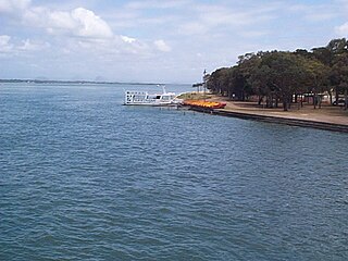
Welsby, Queensland

Last updated

Map all coordinates using: OpenStreetMap
Welsby
Bribie Island,  Queensland
On Bribie Beach Australia (145417691).jpeg
Off roading on eastern side of Welsby with Moreton Island on the horizon
Australia Queensland location map.svg
Red pog.svg
Welsby
Welsby, Queensland
Coordinates 26°59′12″S153°07′25″E / 26.9866°S 153.1236°E / -26.9866; 153.1236 (Welsby (centre of locality))
Population5 (2016 census) [1]
 • Density0.074/km2 (0.190/sq mi)
Postcode(s) 4507
Area68.0 km2 (26.3 sq mi)
Time zone AEST (UTC+10:00)
Location
LGA(s) City of Moreton Bay
State electorate(s) Glass House
Federal division(s) Longman
Suburbs around Welsby:
Beerburrum Bribie Island North Coral Sea
Donnybrook
Meldale
Welsby Coral Sea
Toorbul White Patch
Banksia Beach
Woorim

Welsby is a coastal locality on Bribie Island in the City of Moreton Bay, Queensland, Australia. [2] In the 2016 census Welsby had a population of 5 people. [1]

Contents

Geography

Welsby is the central part of Bribie Island. The Pumicestone Channel (also known as Pumicestone Passage) is its western coastal border and the Coral Sea is its eastern coastal border. Almost all of Welsby is within the Bribie Island National Park or the Bribie Island State Forest. Apart from these protected areas, the remaining land is a very narrow strip along the west coast beside the Pumicestone Channel. [3]

Welsby has the following points:

Welsby has the following passages:

Poverty Creek flows into the Pumicestone Channel ( 26°59′27″S153°05′35″E / 26.9908°S 153.0931°E / -26.9908; 153.0931 (Poverty Creek) ). [8]

There are two lagoons on the eastern shore of the locality:

History

Thomas Welsby, sitting by the sea Thomas Welsby.jpg
Thomas Welsby, sitting by the sea

The locality is named for Thomas Welsby, a Queensland politician who enjoyed yachting and fishing in Moreton Bay. [2]

At the 2011 census Welsby had a population of 4 people. [11]

In the 2016 census Welsby had a population of 5 people. [1]

Education

There are no schools in Welsby. The nearest government primary school is Banksia Beach State School in neighbouring Banksia Beach to the south. The nearest government secondary school is Bribie Island State High School in Bongaree to the south. [3]

Attractions

Wild Banks is a 176.213-hectare (435.43-acre) artificial reef in the Moreton Bay Marine Park ( 26°54′31″S153°17′34″E / 26.9086°S 153.2927°E / -26.9086; 153.2927 (Wild Banks) ) offshore on the western (ocean) side of Welsby. [12] This reef has a number of "fish cages" which are designed to attract pelargic fish species such as mackerel, dolphin fish and wahoo. [13]

Related Research Articles

<span class="mw-page-title-main">Bribie Island National Park</span> Protected area in Queensland, Australia

Bribie Island National Park is an Australian national park in the City of Moreton Bay, Queensland, 68 kilometres north of Brisbane. The park covers approximately one third of Bribie Island. The tidal wetlands and areas of water around the islands are protected within the Moreton Bay Marine Park.

<span class="mw-page-title-main">Bribie Island</span> Island in Queensland, Australia

Bribie Island is the smallest and most northerly of three major sand islands forming the coastline sheltering the northern part of Moreton Bay, Queensland, Australia. The others are Moreton Island and North Stradbroke Island. Bribie Island is 34 kilometres long, and 8 kilometres at its widest. Archibald Meston believed that the name of the island came from a corruption of a mainland word for it, Boorabee meaning koala. However, the correct Joondaburri name for the island is in fact Yarun.

Ningi is a town and locality in the City of Moreton Bay, Queensland, Australia. In the 2016 census, the locality of Ningi had a population of 4,675 people. It is near Caboolture.

Donnybrook is a coastal town and locality in the City of Moreton Bay, Queensland, Australia. In the 2016 census, the locality of Donnybrook had a population of 617 people.

<span class="mw-page-title-main">Banksia Beach, Queensland</span> Suburb of Bribie Island, Queensland, Australia

Banksia Beach is a town and suburb on Bribie Island in the City of Moreton Bay, Queensland, Australia. In the 2016 census the suburb of Banksia Beach had a population of 5,995 people.

<span class="mw-page-title-main">Beachmere, Queensland</span> Town in Queensland, Australia

Beachmere is a coastal rural town and locality in the City of Moreton Bay, Queensland, Australia. In the 2021 census, the locality of Beachmere had a population of 4,782 people.

<span class="mw-page-title-main">Pumicestone Channel</span> Strait in Queensland, Australia

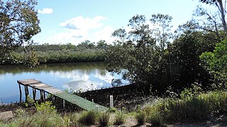
Pumicestone Channel, also known as the Pumicestone Passage, is a narrow, mesotidal waterway around 45 kilometres in length, between Bribie Island and the mainland in Queensland, Australia. The northern extent of the passage is at Caloundra, while at the south is Deception Bay. The waterway is a two way tidal estuary that has 11 creeks flowing into it. At each end of the passage the channels are the deepest and widest.

Bellara is a suburb of Bribie Island in the City of Moreton Bay, Queensland, Australia. In the 2016 census, Bellara had a population of 3,225 people.

<span class="mw-page-title-main">Bongaree, Queensland</span> Suburb of Bribie Island, Queensland, Australia

Bongaree is a suburb of Bribie Island in the City of Moreton Bay, Queensland, Australia. It is located on the western side of Bribie Island, adjacent to the Pumicestone Passage. In the 2016 census, Bongaree has a population of 6,947 people.

<span class="mw-page-title-main">Sandstone Point, Queensland</span> Suburb of City of Moreton Bay, Queensland, Australia

Sandstone Point is a coastal locality in the City of Moreton Bay, Queensland, Australia. In the 2016 census, Sandstone Point had a population of 3,959 people.

<span class="mw-page-title-main">Golden Beach, Queensland</span> Suburb of Caloundra, Queensland, Australia

Golden Beach is a coastal suburb of Caloundra in the Sunshine Coast Region, Queensland, Australia. It is located within the Caloundra urban centre directly southwest of the Caloundra CBD. In the 2021 census, Golden Beach had a population of 5,646 people.

<span class="mw-page-title-main">Bribie Island Seaside Museum</span>

Bribie Island Seaside Museum opened on 14 May 2010 at 1 South Esplanade, Bongaree, on the Pumicestone Passage side of Bribie Island, City of Moreton Bay in Queensland, Australia. It is run by Moreton Bay City Council.

<span class="mw-page-title-main">Woorim, Queensland</span> Suburb of Bribie Island, Queensland, Australia

Woorim is a town and suburb of Bribie Island in the City of Moreton Bay, Queensland, Australia. In the 2016 census, Woorim had a population of 1,829 people.

Meldale is a coastal rural locality in the City of Moreton Bay, Queensland, Australia. In the 2016 census, Meldale had a population of 223 people.

<span class="mw-page-title-main">Toorbul, Queensland</span> Town in Queensland, Australia

Toorbul is a coastal town and a locality in the City of Moreton Bay, Queensland, Australia. In the 2016 census, Toorbul had a population of 930 people.

<span class="mw-page-title-main">White Patch, Queensland</span> Town in Queensland, Australia

White Patch is a coastal town and locality of Bribie Island in the City of Moreton Bay, Queensland, Australia. In the 2016 census the locality of White Patch had a population of 142 people.

Kooringal is a coastal town and locality on the south-west coast of Moreton Island within the City of Brisbane, Queensland, Australia. In the 2016 census the locality of Kooringal had a population of 45 people.

<span class="mw-page-title-main">Bribie Island Second World War Fortifications</span> Historic site in Queensland, Australia

The Bribie Island Second World War Fortifications are heritage-listed fortifications at Woorim and Bribie Island North on Bribie Island, Queensland, Australia. They were built from 1939 to 1943 and were added to the Queensland Heritage Register on 20 July 1993.

<span class="mw-page-title-main">Bribie Island North</span> Suburb of Sunshine Coast Region, Queensland, Australia

Bribie Island North is a locality on Bribie Island in the Sunshine Coast Region, Queensland, Australia. In the 2016 census, Bribie Island North had a population of 0 people.

Caboolture–Bribie Island Road is a continuous 19.2 kilometres (11.9 mi) road route in the City of Moreton Bay, Queensland, Australia. The route is designated as part of State Route 85. It is a state-controlled district road rated as a local road of regional significance (LRRS).

References

  1. 1 2 3 Australian Bureau of Statistics (27 June 2017). "Welsby (SSC)". 2016 Census QuickStats. Retrieved 20 October 2018. OOjs UI icon edit-ltr-progressive.svg
  2. 1 2 "Welsby – locality in Moreton Bay Region (entry 45497)". Queensland Place Names. Queensland Government . Retrieved 28 December 2020.
  3. 1 2 "Queensland Globe". State of Queensland . Retrieved 22 March 2021.
  4. 1 2 "Mountain peaks and capes - Queensland". Queensland Open Data. Queensland Government. 12 November 2020. Archived from the original on 25 November 2020. Retrieved 25 November 2020.
  5. "Gallagher Point – point in Moreton Bay Region (entry 13329)". Queensland Place Names. Queensland Government . Retrieved 25 November 2020.
  6. "Mission Point – point in Moreton Bay Region (entry 22316)". Queensland Place Names. Queensland Government . Retrieved 25 November 2020.
  7. 1 2 3 4 "Mountain ranges beaches and sea passages - Queensland". Queensland Open Data. Queensland Government. 12 November 2020. Archived from the original on 25 November 2020. Retrieved 25 November 2020.
  8. "Poverty Creek – watercourse in Moreton Bay Regional (entry 27417)". Queensland Place Names. Queensland Government . Retrieved 28 December 2020.
  9. "Mermaid Lagoon – lagoon in Moreton Bay Regional (entry 21658)". Queensland Place Names. Queensland Government . Retrieved 28 December 2020.
  10. "Welsby Lagoon – lagoon in Moreton Bay Regional (entry 36982)". Queensland Place Names. Queensland Government . Retrieved 28 December 2020.
  11. Australian Bureau of Statistics (31 October 2012). "Welsby (State Suburb)". 2011 Census QuickStats. Retrieved 17 May 2014. OOjs UI icon edit-ltr-progressive.svg
  12. "Artificial reef sites - Queensland". Queensland Open Data. Queensland Government. 18 November 2020. Archived from the original on 24 November 2020. Retrieved 24 November 2020.
  13. "Moreton Bay artificial reefs, Moreton Bay Marine Park". Parks and forests, Department of Environment and Science, Queensland. Queensland Government. 27 October 2009. Archived from the original on 15 March 2021. Retrieved 23 March 2021.