England Creek, Queensland

Last updated

England Creek
Queensland
England Creek Road England Creek.jpg
View north east from England Creek Road, 2014
Australia Queensland location map.svg
Red pog.svg
England Creek
England Creek, Queensland
Coordinates 27°21′22″S152°43′17″E / 27.3561°S 152.7214°E / -27.3561; 152.7214 (England Creek (centre of locality))
Population39 (2021 census) [1]
 • Density0.671/km2 (1.739/sq mi)
Postcode(s) 4306
Area58.1 km2 (22.4 sq mi)
Time zone AEST (UTC+10:00)
Location
LGA(s)
State electorate(s)
Federal division(s)
Suburbs around England Creek:
Dundas Dundas Mount Glorious
Split Yard Creek England Creek Mount Nebo
Banks Creek
Wivenhoe Pocket Fernvale Banks Creek

England Creek is a rural locality split between Somerset Region and City of Brisbane, Queensland, Australia. [2] [3] In the 2021 census, England Creek had a population of 39 people. [1]

Contents

Geography

The locality lies a short distance south-east of Lake Wivenhoe.[ citation needed ]

England Creek (the watercourse) forms part of the eastern boundary before flowing through to the Brisbane River . [4]

The Brisbane Valley Highway and the Wivenhoe Somerset Road (State Route 31) pass to the south-west, while the Mount Nebo Road (also part of State Route 32) runs along the north-eastern boundary. The main route through the locality is England Creek Road, which enters from the Brisbane Valley Highway.[ citation needed ]

History

The locality presumably takes its name from the creek.

Demographics

In the 2016 census, England Creek had a population of 33 people. [5]

In the 2021 census, England Creek had a population of 39 people. [1]

Education

There are no schools in England Creek. The nearest government primary schools are Mount Nebo State School in neighbouring Mount Nebo to the south-east and Fernvale State School in neighbouring Fernvale to the south-west. The nearest government secondary schools are Lowood State High School in Lowood to the south-west and Ferny Grove State High School in Ferny Grove to the south-west. [6]

Related Research Articles

<span class="mw-page-title-main">Brisbane Valley Highway</span> Highway in Queensland, Australia

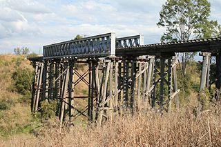
The Brisbane Valley Highway is a state highway in Queensland, Australia. It links the Warrego Highway near Ipswich and the D'Aguilar Highway about 4 km (2 mi) north of Harlin. Its direction follows the approximate course of the Brisbane River. It is part of State Route A17, which is duplexed with the D'Aguilar Highway to Nanango and then becomes the Burnett Highway. State Route 85 is duplexed with the Brisbane Valley Highway from Esk to the D'Aguilar Highway.

<span class="mw-page-title-main">Mount Glorious</span> Suburb of City of Moreton Bay, Queensland, Australia

Mount Glorious is a rural locality in the City of Moreton Bay, Queensland, Australia. In the 2021 census, Mount Glorious had a population of 343 people.

<span class="mw-page-title-main">Lowood, Queensland</span> Town in Queensland, Australia

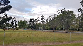
Lowood is a rural town and locality in the Somerset Region, Queensland, Australia. In the 2021 census, the locality of Lowood had a population of 4,082 people.

<span class="mw-page-title-main">Fernvale, Queensland</span> Town in Queensland, Australia

Fernvale is a rural town and locality in the Somerset Region, Queensland, Australia. In the 2021 census, the locality of Fernvale had a population of 3,629 people.

<span class="mw-page-title-main">Fairney View, Queensland</span> Suburb of Somerset Region, Queensland, Australia

Fairney View is a rural locality in the Somerset Region, Queensland, Australia. In the 2021 census, Fairney View had a population of 221 people.

<span class="mw-page-title-main">Vernor, Queensland</span> Suburb of Somerset Region, Queensland, Australia

Vernor is a rural locality in the Somerset Region, Queensland, Australia. In the 2021 census, Vernor had a population of 235 people.

<span class="mw-page-title-main">Coolana, Queensland</span> Suburb of Somerset Region, Queensland, Australia

Coolana is a rural locality in the Somerset Region, Queensland, Australia. In the 2021 census, Coolana had a population of 175 people.

<span class="mw-page-title-main">Clarendon, Queensland</span> Suburb of Somerset Region, Queensland, Australia

Clarendon is a rural locality in the Somerset Region, Queensland, Australia. In the 2021 census, Clarendon had a population of 232 people.

<span class="mw-page-title-main">Bryden, Queensland</span> Suburb of Somerset Region, Queensland, Australia

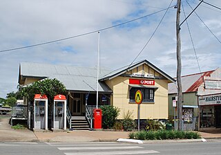
Bryden is a rural locality in the Somerset Region, Queensland, Australia. In the 2021 census, Bryden had a population of 22 people.

<span class="mw-page-title-main">Highvale, Queensland</span> Suburb of Moreton Bay City, Queensland, Australia

Highvale is a rural residential locality in the City of Moreton Bay, Queensland, Australia. In the 2021 census, Highvale had a population of 1,979 people.

<span class="mw-page-title-main">Cedar Creek, Queensland (Moreton Bay)</span> Suburb of City of Moreton Bay, Queensland, Australia

Cedar Creek is a rural locality in the City of Moreton Bay, Queensland, Australia. In the 2021 census, Cedar Creek had a population of 831 people.

<span class="mw-page-title-main">Dundas, Queensland</span> Suburb of Somerset Region, Queensland, Australia

Dundas is a rural locality in the Somerset Region, Queensland, Australia. In the 2021 census, Dundas had a population of 58 people.

<span class="mw-page-title-main">Crossdale, Queensland</span> Suburb of Somerset Region, Queensland, Australia

Crossdale is a rural locality in the Somerset Region, Queensland, Australia. In the 2021 census, Crossdale had a population of 68 people.

Buaraba is a rural locality in the Somerset Region, Queensland, Australia. In the 2021 census, Buaraba had a population of 170 people.

Coal Creek is a rural locality in the Somerset Region, Queensland, Australia. In the 2021 census, Coal Creek had a population of 50 people.

<span class="mw-page-title-main">Wivenhoe Hill, Queensland</span> Suburb of Somerset Region, Queensland, Australia

Wivenhoe Hill is a rural locality in the Somerset Region, Queensland, Australia. In the 2021 census, Wivenhoe Hill had "no people or a very low population".

Moombra is a rural locality in the Somerset Region, Queensland, Australia. In the 2021 census, Moombra had a population of 9 people.

Caboonbah is a rural locality in the Somerset Region, Queensland, Australia. In the 2021 census, Caboonbah had a population of 13 people.

Mount Hallen is a rural locality in the Somerset Region, Queensland, Australia. In the 2021 census, Mount Hallen had a population of 457 people.

References

  1. 1 2 3 Australian Bureau of Statistics (28 June 2022). "England Creek (SAL)". 2021 Census QuickStats. Retrieved 28 February 2023. OOjs UI icon edit-ltr-progressive.svg
  2. "England Creek (Brisbane City) (entry 41383)". Queensland Place Names. Queensland Government . Retrieved 7 June 2014.
  3. "England Creek (Somerset Regional) (entry 50057)". Queensland Place Names. Queensland Government . Retrieved 7 June 2014.
  4. Google (15 September 2021). "England Creek, Queensland" (Map). Google Maps . Google. Retrieved 15 September 2021.
  5. Australian Bureau of Statistics (27 June 2017). "England Creek (SSC)". 2016 Census QuickStats. Retrieved 20 October 2018. OOjs UI icon edit-ltr-progressive.svg
  6. "Queensland Globe". State of Queensland . Retrieved 19 May 2022.

Commons-logo.svg Media related to England Creek, Queensland at Wikimedia Commons