Deagon, Queensland

Last updated

Map all coordinates using: OpenStreetMap
Deagon
Brisbane,  Queensland
Deagon Railway Station, Queensland, June 2012.JPG
Deagon Railway Station, Queensland, June 2012
Australia Queensland location map.svg
Red pog.svg
Deagon
Coordinates 27°19′42″S153°03′36″E / 27.3283°S 153.0599°E / -27.3283; 153.0599
Population3,675 (2016 census) [1]
 • Density1,225/km2 (3,170/sq mi)
Postcode(s) 4017
Area3.0 km2 (1.2 sq mi)
Time zone AEST (UTC+10:00)
Location18 km (11 mi) from Brisbane CBD
LGA(s) City of Brisbane
(Deagon Ward) [2]
State electorate(s) Sandgate
Federal division(s)
Suburbs around Deagon:
Bracken Ridge Sandgate Sandgate
Fitzgibbon Deagon Sandgate
Taigum Boondall Boondall

Deagon is an outer northern suburb in the City of Brisbane, Queensland, Australia. [3] In the 2016 census, Deagon had a population of 3,675 people. [1]

Contents

Geography

Deagon is 18 kilometres (11 mi) north of the CBD.[ citation needed ]

The Gateway Arterial Road runs through the western side of the suburb.[ citation needed ]

Deagon has a flat topography with one of its boundaries being Cabbage Tree Creek. The Creek's catchment is largely urbanised but the Boondall Wetlands, which is separated from Deagon by the Creek, plays an important role in providing essential habitat for a range of birds and animals, including migratory birds, which make their way from the arctic circle. The Boondall Wetlands near Deagon have ecosystems that are fresh as well as areas that are salt water. The smaller reserves such as Brighton and Deagon Wetlands are fresh water only. The Deagon Wetland is an important remnant of tea tree woodland on a 50ha site. Notable bird species include the striped honeyeater and the white-cheeked honeyeater.[ citation needed ]

History

The Jagera and Turrbal groups occupied land in the Brisbane and Ipswich areas. The exact boundaries are not known; however, the Turrbal generally occupied the area north of the Brisbane River. Both groups had closely related languages which are classified as belonging to the larger Yaggera language group. In nearby Shorncliffe the Ningy-Ningy clan had displaced the Turrbal by the 1850s.[ citation needed ]

The area has a rich Aboriginal history. Evidence of Aboriginal occupation can be found in a bora ring at Nudgee Waterhole; in sites of special importance at Dinah Island near Nundah; and by Aboriginal camps on the banks of the Cabbage Tree Creek.[ citation needed ]

The suburb was named after its railway station, which in turn was named in 1887 after William Deagon, who was Mayor of Sandgate from 1882 to 1884. [3] William Deagon was an old identity of the area, and his name was used for the locality when the railway line went through in 1887. He owned the Sandgate Hotel, a stopping place for the Cobb & Co. coaches. Deagon Street, the racecourse, the railway station and the Deagon Wetlands all bear his name.[ citation needed ]

Deagon Baptist Mission Church opened in 1918. [4] [5] It was on a block of land near Deagon railway station and a stump-capping ceremony was held in September 1918. [6]

Deagon Post Office opened on 18 June 1947 at Mr Torpie's store next to the railway station.[ citation needed ]

Sandgate District State High School opened in 1959. When the Minister of Education Jack Pizzey officially opened it in 1961, he said the school, which had an elaborate man-made lake in its grounds, was one of the most attractive in Queensland. Extensions were then completed four years after that. In the 1980s a performance hall and library building were added and then, in 2001–03, under the secondary school renewal program, a modern sports hall and home economics block.[ citation needed ]

On Sunday 20 November 1994 the current Sandgate Uniting Church building was officially opened and dedicated by Reverend Donald W. Whebell, Moderator of the Queensland Synod of the Uniting Church in Australia. It brings together the Uniting congregations of Boondall, Brighton, Sandgate and Shorncliffe, a decision made by those congregations in June 1990. [7]

In May 2012, the Sandgate Baptist congregation merged with the Geebung Baptist congregation and established a new church, Connect Baptist Church at 21 Braun Street, Deagon. [8] [9]

Demographics

In the 2011 census, the population of Deagon was 3,460, [10]

In the 2016 census, Deagon had a population of 3,675 people, 51.1% female and 48.9% male. The median age of the Deagon population was 42 years of age, 4 years above the Australian median. 75.7% of people living in Deagon were born in Australia, compared to the national average of 66.7%; the next most common countries of birth were England 3.9%, New Zealand 2.2%, Philippines 0.3%, Ireland 0.3%, Germany 0.4%. 87.3% of people spoke only English at home; the next most popular languages were 0.5% Tagalog, 0.4% Samoan, 0.4% Dutch, 0.4% Mandarin, 0.3% Japanese. 14.3% of Deagon residents were born overseas and 8.8% speak a language other than English at home. This compares with 28.9% for Queensland as a whole. The most common foreign languages spoken were Tagalog, Samoan, Dutch, Mandarin and Japanese. 2.5% were of Aboriginal or Torres Strait Islander descent, compared to 4.0% for Queensland. [1]

Education

There is no primary school within Deagon; the nearest one is in Sandgate with other primary schools in other neighbouring suburbs. [11]

Sandgate District State High School is a government secondary (7–12) school for boys and girls at 41 Braun Street ( 27°19′44″S153°03′26″E / 27.3290°S 153.0572°E / -27.3290; 153.0572 (Sandgate District State High School) ). [12] [13] In 2017, the school had an enrolment of 1,056 students with 93 teachers (86 full-time equivalent) and 46 non-teaching staff (32 full-time equivalent). [14] It includes a special education program. [12]

Amenities

Green Pine Taoist Temple, 2007 Green Pine Taoist Temple in Deagon, Brisbane, Australia (2).jpg
Green Pine Taoist Temple, 2007

A Queensland Racing training facility, Deagon Racecourse, lies to the north of the suburb. Horse racing in Deagon ceased in 1941, but the racecourse remains a first rate training establishment. [15] The Bligh government intended to make the racecourse the centre for all greyhound racing in Brisbane (replacing Albion Park Raceway) but this plan was cancelled in February 2012. [16]

The (Evergreen) Ching Chung Taoist Temple sits next to the Gateway Arterial Road. It was built at Deagon in 1991. There are three Halls which were built according to Taoist beliefs. The three halls are: The Hall of Three Purities, the Hall of Three Masters and the Hall of the Spiritual Garden. There is also a Memorial Hall of Ancestors.

Sandgate Uniting Church is at 116 Board Street ( 27°19′32″S153°03′32″E / 27.3255°S 153.0589°E / -27.3255; 153.0589 (Sandgate Uniting Church) ). [17] [18] [7]

Transport

Deagon can be easily accessed via Sandgate Road and the Gateway Motorway. Deagon also has a railway line with three stations easily accessed by Deagon residents: North Boondall, Deagon, and Sandgate. Deagon also has a variety of bus services operated by Transport for Brisbane and Hornibrook Bus Lines. All public transport services in Deagon are operated under Translink Including school bus services operated by Thompson Bus Lines.

Notable residents

Related Research Articles

<span class="mw-page-title-main">Sandgate, Queensland</span> Suburb of Brisbane, Queensland, Australia

Sandgate is a northern coastal suburb in the City of Brisbane, Queensland, Australia. In the 2016 census, Sandgate had a population of 4,909 people.

<span class="mw-page-title-main">Albion, Queensland</span> Suburb of Brisbane, Queensland, Australia

Albion is an inner north-eastern suburb in the City of Brisbane, Queensland, Australia. In the 2016 census, Albion had a population of 2,296 people.

<span class="mw-page-title-main">Aspley, Queensland</span> Suburb of Brisbane, Queensland, Australia

Aspley is a suburb in the City of Brisbane, Queensland, Australia. In the 2016 census, Aspley had a population of 12,108 people.

<span class="mw-page-title-main">Geebung, Queensland</span> Suburb of Brisbane, Australia

Geebung is a suburb in the City of Brisbane, Queensland, Australia. In the 2016 census, Geebung had a population of 4,626 people.

<span class="mw-page-title-main">Bald Hills, Queensland</span> Suburb of Brisbane, Queensland, Australia

Bald Hills is the northernmost suburb in the City of Brisbane, Queensland, Australia. In the 2021 census, Bald Hills had a population of 7,000 people.

<span class="mw-page-title-main">Division of Lilley</span> Australian federal electoral division

The Division of Lilley is an Australian Electoral Division in Queensland.

<span class="mw-page-title-main">Ascot, Queensland</span> Suburb of Brisbane, Queensland, Australia

Ascot is a north-east suburb in the City of Brisbane, Queensland, Australia. In the 2016 census, Ascot had a population of 5,777 people.

<span class="mw-page-title-main">Bracken Ridge, Queensland</span> Suburb of Brisbane, Queensland, Australia

Bracken Ridge is a northern suburb in the City of Brisbane, Queensland, Australia. In the 2016 census, Bracken Ridge had a population of 16,936 people.

<span class="mw-page-title-main">Clayfield, Queensland</span> Suburb of Brisbane, Queensland, Australia

Clayfield is a suburb in the City of Brisbane, Queensland, Australia. In the 2016 census, Clayfield had a population of 10,555 people.

<span class="mw-page-title-main">Nundah, Queensland</span> Suburb of Brisbane, Queensland, Australia

Nundah is an inner suburb in the City of Brisbane, Queensland, Australia. It contains the neighbourhood of Toombul. In the 2016 census, Nundah had a population of 12,141 people.

<span class="mw-page-title-main">Boondall, Queensland</span> Suburb of Brisbane, Australia

Boondall is a suburb in the City of Brisbane, Queensland, Australia. In the 2021 census, Boondall had a population of 9,603 people.

<span class="mw-page-title-main">Wynnum, Queensland</span> Suburb of Brisbane, Queensland, Australia

Wynnum is a coastal suburb in the City of Brisbane, Queensland, Australia. In the 2016 census, Wynnum had a population of 12,915 people. The suburb is a popular destination in Brisbane due to its coastline, jetty and tidal wading pool.

<span class="mw-page-title-main">Brighton, Queensland</span> Suburb of Brisbane, Queensland, Australia

Brighton is a coastal northern suburb of Brisbane, in the state of Queensland, in Australia. In the 2016 census, Brighton had a population of 9,479 people.

<span class="mw-page-title-main">Shorncliffe, Queensland</span> Suburb of Brisbane, Queensland, Australia

Shorncliffe is a coastal north-eastern suburb in the City of Brisbane, Queensland, Australia. It is on the shore of Bramble Bay, part of Moreton Bay. In the 2016 census, Shorncliffe had a population of 1,870 people. The suburb attracts visitors to its historic Shorncliffe pier, and Lovers Walk, a walking path along the coastline between Shorncliffe and neighbouring Sandgate.

<span class="mw-page-title-main">Hendra, Queensland</span> Suburb of Brisbane, Queensland, Australia

Hendra is a suburb of the City of Brisbane, Queensland, Australia. In the 2021 census, Hendra had a population of 4,914 people.

<span class="mw-page-title-main">Banyo, Queensland</span> Suburb of Brisbane, Queensland, Australia

Banyo is a northern suburb in the City of Brisbane, Queensland, Australia. In the 2016 census, Banyo had a population of 5,868 people.

<span class="mw-page-title-main">Zillmere, Queensland</span> Suburb of Brisbane, Queensland, Australia

Zillmere is a suburb in the City of Brisbane, Queensland, Australia. In the 2016 census, Zillmere had a population of 8,967 people.
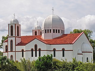
<span class="mw-page-title-main">Northgate, Queensland</span> Suburb of Brisbane, Queensland, Australia

Northgate is a suburb in the City of Brisbane, Queensland, Australia. In the 2016 census, Northgate had a population of 4,568 people.
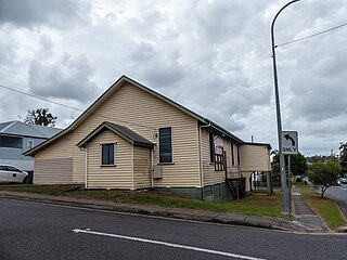
<span class="mw-page-title-main">Hamilton, Queensland</span> Suburb of Brisbane, Queensland, Australia

Hamilton is an affluent riverside mixed-use suburb in the north-east of the City of Brisbane, Queensland, Australia. Hamilton is located along the north bank of the Brisbane River. In the 2016 census, Hamilton had a population of 6,995 people.

<span class="mw-page-title-main">Wynnum West, Queensland</span> Suburb of Brisbane, Queensland, Australia

Wynnum West and Lindum are outer eastern suburb in the City of Brisbane, Queensland, Australia. In the 2016 census, Wynnum West including the locality of Lindum had a population of 12,292 people.

References

  1. 1 2 3 Australian Bureau of Statistics (27 June 2017). "Deagon (SSC)". 2016 Census QuickStats. Retrieved 20 October 2018. OOjs UI icon edit-ltr-progressive.svg
  2. "Deagon Ward". Brisbane City Council. Archived from the original on 9 March 2017. Retrieved 12 March 2017.
  3. 1 2 "Deagon – suburb in City of Brisbane (entry 41702)". Queensland Place Names. Queensland Government . Retrieved 10 June 2019.
  4. "Queensland Baptist churches by date of erection/opening". Baptist Church Archives Queensland. Archived from the original on 26 November 2021. Retrieved 29 November 2021.
  5. "1918 Deagon Mission Church". Baptist Church Archives Queensland. Archived from the original on 26 November 2021. Retrieved 29 November 2021.
  6. "RELIGIOUS". The Brisbane Courier . No. 18, 926. Queensland, Australia. 14 September 1918. p. 16. Archived from the original on 19 May 2022. Retrieved 30 November 2021 via National Library of Australia.
  7. 1 2 "Sandgate Uniting Church". Churches Australia. Archived from the original on 4 August 2020. Retrieved 13 September 2021.
  8. "Better together! Recent church mergers in Queensland Baptists". The Qb Magazine: 32–33. August–September 2017. Archived from the original on 9 August 2019. Retrieved 9 August 2019.
  9. "Connect Baptist Church – Deagon". Connect Baptist Church. Archived from the original on 9 August 2019. Retrieved 9 August 2019.
  10. Australian Bureau of Statistics (31 October 2012). "Deagon (State Suburb)". 2011 Census QuickStats. Retrieved 25 October 2013. OOjs UI icon edit-ltr-progressive.svg
  11. "Queensland Globe". State of Queensland . Retrieved 9 August 2019.
  12. 1 2 "State and non-state school details". Queensland Government. 9 July 2018. Archived from the original on 21 November 2018. Retrieved 21 November 2018.
  13. "Sandgate District State High School". Archived from the original on 19 April 2013. Retrieved 21 November 2018.
  14. "ACARA School Profile 2017". Archived from the original on 22 November 2018. Retrieved 22 November 2018.
  15. "Deagon". Queensland History of Racing. Archived from the original on 2 January 2015. Retrieved 2 January 2015.
  16. Sinclair, Bart (2 February 2012). "Racing Queensland concedes defeat on plans for Deagon training track". The Courier-Mail . Archived from the original on 19 May 2022. Retrieved 2 January 2015.
  17. "Find a Church". Uniting Church in Australia, Queensland Synod. Archived from the original on 24 October 2020. Retrieved 22 November 2020.
  18. "Sandgate Uniting Church". Archived from the original on 17 January 2006. Retrieved 13 September 2021.