Upper Brookfield, Queensland

Last updated

Upper Brookfield
Brisbane,  Queensland
Upper Brookfield Community Hall.jpg
The Upper Brookfield Community Hall
Australia Queensland location map.svg
Red pog.svg
Upper Brookfield
Coordinates 27°28′11″S152°51′11″E / 27.4697°S 152.8530°E / -27.4697; 152.8530 (Upper Brookfield (centre of suburb))
Population857 (2021 census) [1]
 • Density23.48/km2 (60.81/sq mi)
Postcode(s) 4069
Area36.5 km2 (14.1 sq mi)
Time zone AEST (UTC+10:00)
Location22.5 km (14 mi) W of Brisbane CBD
LGA(s) City of Brisbane
(Pullenvale Ward) [2]
State electorate(s) Moggill
Federal division(s) Ryan
Suburbs around Upper Brookfield:
Lake Manchester Enoggera Reservoir Enoggera Reservoir
Lake Manchester Upper Brookfield Brookfield
Kholo Kholo Pullenvale

Upper Brookfield is an outer western suburb in the City of Brisbane, Queensland, Australia. [3] In the 2021 census, Upper Brookfield had a population of 857 people. [1]

Contents

Geography

Upper Brookfield is a mountainous rural suburb consisting of acreage properties. It is 22.5 kilometres (14.0 mi) by road west of the Brisbane CBD. [4]

Marshalls Flat is a plain ( 27°28′13″S152°50′49″E / 27.4702°S 152.8469°E / -27.4702; 152.8469 (Marshalls Flat) ) alongside Moggill Creek in the centre of the suburb. It named after husband and wife Arthur John (Jack) Marshall (1913-2003) and Kathleen Bell Marshall (1915-2005), owners and farmer of the flats from 1944 to 1976. [5]

History

Brookfield Fruit Farms Estate, 1914 Brookfield Fruit Farms Estate, 1914.jpg
Brookfield Fruit Farms Estate, 1914

Upper Brookfield is named after its neighbouring suburb Brookfield. The name came into use about 1910 but it was not officially named and bounded until 11 August 1975. [3]

In 1914 there was a sale of 23 fruit farm blocks of land in the vicinity of Upper Brookfield Road and its junctions with Kittani Street and Pacey Road (near the Upper Brookfield State School, 27°28′42″S152°52′11″E / 27.4782°S 152.8696°E / -27.4782; 152.8696 (Brookfield Fruit Farms Estate) ). It was called the Brookfield Fruit Farms Estate and was marketed by W.R. Moon. The land was described as "virgin scrub" suitable for growing bananas, pineapples and vegetables. [6] [7] [8]

Upper Brookfield State School (also known as Brookfield Upper State School) opened on 1916 but closed in 1921 due to low student numbers. It reopened in 1923. [9]

In March 1933, a local resident decided to raise funds to erect a public hall. Fred Meilandt offered to donate the land, while others donated timber and cash. [10] A working bee began clearing the land on 24 June 1933 with construction of the ball commencing in September 1933. [11] [12]

A Methodist church opened in Upper Brookfield on Saturday 29 November 1952. The local congregation had met in other locations for 17 years before establishing their own church. It was ajact to the public hall at 508 Upper Brookfield Road ( 27°28′39″S152°52′05″E / 27.4774°S 152.8681°E / -27.4774; 152.8681 (Upper Brookfield Uniting Church (former)) ). [13] [14] [15] With the amalgamation of the Methodist Church into the Uniting Church in Australia in 1977, it became the Upper Brookfield Uniting Church. It closed in November 2001 and in April 2003 the church building was relocated to the Moreton Bay College in Manly West (operated by the Uniting Church) to become their Centenary Chapel. [16]

Demographics

In the 2011 census, Upper Brookfield had a population of 655 people, 49.6% female and 50.4% male.> The median age of the Upper Brookfield population was 42 years, 5 years above the Australian median. 78.7% of people living in Upper Brookfield were born in Australia, compared to the national average of 69.8%; the next most common countries of birth were England 6%, South Africa 2%, New Zealand 1.8%, Netherlands 1.4%, United States of America 1.1%. 96% of people speak only English at home; the next most common languages were 0.6% Dutch, 0.6% German, 0.5% French, 0.5% Italian, 0.5% Spanish. [17]

In the 2016 census, Upper Brookfield had a population of 785 people. Of these 49.2% were male and 50.8% were female. Aboriginal and/or Torres Strait Islander people made up 0.5% of the population. The median age of people was 42 years. Children aged 0 – 14 years made up 21.9% of the population and people aged 65 years and over made up 14.4% of the population. The most common responses for religion were No Religion, so described 42.1%, Catholic 14.9%, Not stated 13.6%, Anglican 10.3% and Uniting Church 6.1%. In Upper Brookfield (State Suburbs), No Religion, so described was the largest religious group reported overall (49.1%) (this figure excludes not stated responses). The most common countries of birth for male parents were Australia 59.1%, England 9.8%, South Africa 3.3%, New Zealand 2.8% and Netherlands 2.5%. The most common countries of birth for female parents were Australia 60.2%, England 7.9%, South Africa 3.3%, Netherlands 2.8% and New Zealand 1.9%. 87.1% of people only spoke English at home. The only other responses for language spoken at home were German 1.6%, Spanish 0.8%, Dutch 0.5% and Italian 0.4%. [18]

In the 2021 census, Upper Brookfield had a population of 857 people. [1]

Heritage listings

Upper Brookfield has heritage-listed sites, including:

Education

Upper Brookfield State School, 2021 Upper Brookfield State School, 2021 01.jpg
Upper Brookfield State School, 2021

Upper Brookfield State School is a government primary (Prep-6) school for boys and girls at 496 Upper Brookfield Road ( 27°28′41″S152°52′09″E / 27.4780°S 152.8691°E / -27.4780; 152.8691 (Upper Brookfield State School) ). [20] [21] In 2018, the school had an enrolment of 54 students with 7 teachers (4 full-time equivalent) and 6 non-teaching staff (3 full-time equivalent). [22]

There is no secondary school in Upper Brookfield. The nearest secondary school is Kenmore State High School in Kenmore to the south-east. [8]

Amenities

Upper Brookfield Community Hall, 2021 Upper Brookfield Community Hall, 2021 01.jpg
Upper Brookfield Community Hall, 2021

Upper Brookfield Community Hall is at 506 Upper Brookfield Road ( 27°28′39″S152°52′06″E / 27.4775°S 152.8682°E / -27.4775; 152.8682 (Upper Brookfield Community Hall) ). [23]

Related Research Articles

<span class="mw-page-title-main">Chapel Hill, Queensland</span> Suburb of Brisbane, Queensland, Australia

Chapel Hill is a western suburb in the City of Brisbane, Queensland, Australia. In the 2021 census, Chapel Hill had a population of 10,511 people.

<span class="mw-page-title-main">Alderley, Queensland</span> Suburb of Brisbane, Queensland, Australia

Alderley is a northern suburb in the City of Brisbane, Queensland, Australia. In the 2021 census, Alderley had a population of 6,748 people.

<span class="mw-page-title-main">Darra, Queensland</span> Suburb of Brisbane, Queensland, Australia

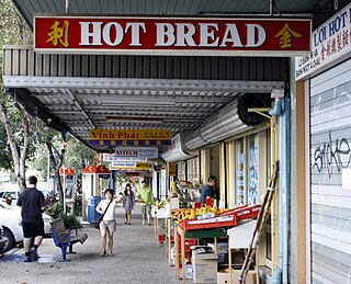
Darra is a south-western suburb in the City of Brisbane, Queensland, Australia. In the 2021 census, Darra had a population of 4,098 people.

<span class="mw-page-title-main">The Gap, Queensland</span> Suburb of Brisbane, Queensland, Australia

The Gap is a north-western suburb in the City of Brisbane, Queensland, Australia. In the 2021 census, The Gap had a population of 17,318 people.

<span class="mw-page-title-main">Gaythorne, Queensland</span> Suburb of Brisbane, Queensland, Australia

Gaythorne is a suburb in the City of Brisbane, Queensland, Australia. In the 2021 census, Gaythorne had a population of 3,158 people.

<span class="mw-page-title-main">Indooroopilly, Queensland</span> Suburb of Brisbane, Queensland, Australia

Indooroopilly is a riverside suburb 7.8 kilometres (4.8 mi) south-west of the Brisbane CBD, Queensland, Australia. In the 2021 census, Indooroopilly had a population of 13,622 people.

<span class="mw-page-title-main">Middle Park, Queensland</span> Suburb of Brisbane, Queensland, Australia

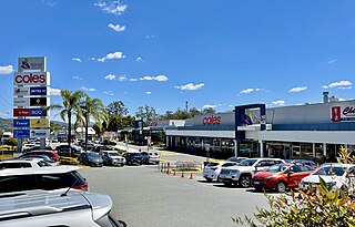
Middle Park is a residential south-western suburb in the Centenary Suburbs in the City of Brisbane, Queensland, Australia. In the 2021 census, Middle Park had a population of 3,845 people.

<span class="mw-page-title-main">Brookfield, Queensland</span> Suburb of Brisbane, Queensland, Australia

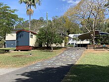
Brookfield is a rural residential suburb in the City of Brisbane, Queensland, Australia. In the 2021 census, Brookfield had a population of 3,640 people.

<span class="mw-page-title-main">Dayboro, Queensland</span> Town in Queensland, Australia

Dayboro is a rural town and locality in the City of Moreton Bay, Queensland, Australia. In the 2021 census, the locality of Dayboro had a population of 2,376 people.

<span class="mw-page-title-main">Graceville, Queensland</span> Suburb of Brisbane, Queensland, Australia

Graceville is a suburb in the City of Brisbane, Queensland, Australia. In the 2021 census, Graceville had a population of 4,764 people.

<span class="mw-page-title-main">Kenmore, Queensland</span> Suburb of Brisbane, Queensland, Australia

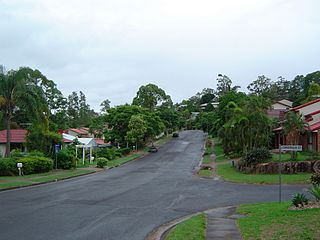
Kenmore is a riverside suburb in the City of Brisbane, Queensland, Australia. In the 2021 census, Kenmore had a population of 9,675 people.

<span class="mw-page-title-main">Kenmore Hills, Queensland</span> Suburb of Brisbane, Queensland, Australia

Kenmore Hills is a suburb in the City of Brisbane, Queensland, Australia. In the 2021 census, Kenmore Hills had a population of 2,448 people.

<span class="mw-page-title-main">Manly West, Queensland</span> Suburb of Brisbane, Queensland, Australia

Manly West is a suburb in the City of Brisbane, Queensland, Australia. In the 2021 census, Manly West had a population of 12,436 people.

<span class="mw-page-title-main">Ellen Grove, Queensland</span> Suburb of Brisbane, Queensland, Australia

Ellen Grove is an outer south-western suburb in the City of Brisbane, Queensland, Australia. In the 2021 census, Ellen Grove had a population of 3,586 people.

<span class="mw-page-title-main">Sherwood, Queensland</span> Suburb of Brisbane, Queensland, Australia

Sherwood is a suburb in the City of Brisbane, Queensland, Australia. In the 2021 census, Sherwood had a population of 6,082 people.

<span class="mw-page-title-main">Arana Hills, Queensland</span> Suburb of Moreton Bay, Queensland, Australia

Arana Hills is a suburb in Division 10 of the City of Moreton Bay, Queensland, Australia. In the 2021 census, Arana Hills had a population of 6,971 people.

<span class="mw-page-title-main">Brassall, Queensland</span> Suburb of Ipswich, Queensland, Australia

Brassall is a suburb in the City of Ipswich, Queensland, Australia. In the 2021 census, Brassall had a population of 12,115 people.

<span class="mw-page-title-main">Sadliers Crossing, Queensland</span> Suburb of Ipswich, Queensland, Australia

Sadliers Crossing is a suburb of Ipswich in the City of Ipswich, Queensland, Australia. In the 2021 census, Sadliers Crossing had a population of 1,358 people.
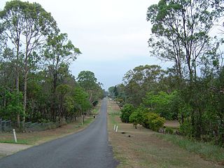
<span class="mw-page-title-main">Hatton Vale</span> Suburb of Lockyer Valley Region, Queensland, Australia

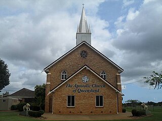
Hatton Vale is a rural locality in the Lockyer Valley Region, Queensland, Australia. In the 2021 census, Hatton Vale had a population of 1,555 people.

<span class="mw-page-title-main">Torbanlea</span> Town in Queensland, Australia

Torbanlea is a rural town and locality in the Fraser Coast Region, Queensland, Australia. In the 2021 census, the locality of Torbanlea had a population of 841 people.

References

  1. 1 2 3 Australian Bureau of Statistics (28 June 2022). "Upper Brookfield (SAL)". 2021 Census QuickStats. Retrieved 28 February 2023. OOjs UI icon edit-ltr-progressive.svg
  2. "Pullenvale Ward". Brisbane City Council. Archived from the original on 12 March 2017. Retrieved 12 March 2017.
  3. 1 2 "Upper Brookfield – suburb in City of Brisbane (entry 49694)". Queensland Place Names. Queensland Government . Retrieved 12 October 2020.
  4. Google (29 May 2022). "Brisbane GPO to Upper Brookfield" (Map). Google Maps . Google. Retrieved 29 May 2022.
  5. "Marshalls Flat – plain in City of Brisbane (entry 49834)". Queensland Place Names. Queensland Government . Retrieved 12 October 2020.
  6. "Brookfield Fruit Farms Estate" (Real estate map). State Library of Queensland. 1914. hdl:10462/deriv/411135. Archived from the original on 20 July 2021. Retrieved 20 July 2021.
  7. "Advertising". The Brisbane Courier . No. 17, 494. Queensland, Australia. 7 February 1914. p. 9. Archived from the original on 20 July 2021. Retrieved 20 July 2021 via National Library of Australia.
  8. 1 2 "Queensland Globe". State of Queensland . Retrieved 20 July 2021.
  9. Queensland Family History Society (2010), Queensland schools past and present (Version 1.01 ed.), Queensland Family History Society, ISBN   978-1-921171-26-0
  10. "UPPER BROOKFIELD". The Brisbane Courier . No. 23, 436. Queensland, Australia. 11 March 1933. p. 16. Archived from the original on 25 December 2021. Retrieved 24 September 2021 via National Library of Australia.
  11. "COUNTRY NEWS. BROOKFIELD". The Brisbane Courier . No. 23, 533. Queensland, Australia. 4 July 1933. p. 18. Archived from the original on 25 December 2021. Retrieved 24 September 2021 via National Library of Australia.
  12. "BROOKFIELD". The Courier-mail . No. 20. Queensland, Australia. 19 September 1933. p. 11. Archived from the original on 25 December 2021. Retrieved 24 September 2021 via National Library of Australia.
  13. "SCOTS TO HOLD ANNUAL NATIONAL SERVICE". Brisbane Telegraph . Queensland, Australia. 29 November 1952. p. 18 (LAST RACE). Archived from the original on 12 October 2020. Retrieved 12 October 2020 via National Library of Australia.
  14. "Worked years for church". Sunday Mail . No. 1679. Queensland, Australia. 30 November 1952. p. 2. Archived from the original on 25 December 2021. Retrieved 19 September 2021 via National Library of Australia.
  15. Blake, Thom. "Upper Brookfield Methodist Church". Queensland religious places database. Archived from the original on 25 December 2021. Retrieved 25 December 2021.
  16. "Our history". Moreton Bay College. 20 February 2020. Archived from the original on 9 March 2020. Retrieved 20 February 2020.
  17. Australian Bureau of Statistics (31 October 2012). "Upper Brookfield (State Suburb)". 2011 Census QuickStats. Retrieved 16 February 2014. OOjs UI icon edit-ltr-progressive.svg
  18. Australian Bureau of Statistics (27 June 2017). "Upper Brookfield (SSC)". 2016 Census QuickStats. Retrieved 20 October 2018. OOjs UI icon edit-ltr-progressive.svg
  19. "Gold Creek Reservoir". Brisbane Heritage Register. Brisbane City Council . Retrieved 20 July 2020.
  20. "State and non-state school details". Queensland Government. 9 July 2018. Archived from the original on 21 November 2018. Retrieved 21 November 2018.
  21. "Upper Brookfield State School". Archived from the original on 17 March 2020. Retrieved 21 November 2018.
  22. "ACARA School Profile 2018". Australian Curriculum, Assessment and Reporting Authority. Archived from the original on 27 August 2020. Retrieved 28 January 2020.
  23. "Upper Brookfield Hall". Brisbane Community Directory. Archived from the original on 25 December 2021. Retrieved 19 September 2021.