
Esk is a rural town and locality in the Somerset Region in South East Queensland, Australia. In the 2021 census, the locality of Esk had a population of 1,641 people.

Aratula is a rural town and locality in the Scenic Rim Region, Queensland, Australia. In the 2021 census, the locality of Aratula had a population of 609 people.

Mount Crosby is a semi-rural outer western locality in the City of Brisbane, Queensland, Australia. In the 2021 census, Mount Crosby had a population of 1,860 people.
Moggill is a suburb in the City of Brisbane, Queensland, Australia. In the 2021 census, Moggill had a population of 5,029 people.

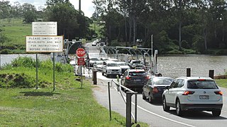
Lake Manchester is both a lake in the City of Brisbane and the surrounding locality which is split between the City of Brisbane and Somerset Region in Queensland, Australia. It is 30 kilometres (19 mi) west of the CBD. In the 2021 census, Lake Manchester had a population of 17 people.

Kholo is a rural locality in the City of Brisbane, Queensland, Australia. In the 2021 census, Kholo had a population of 374 people.

Chuwar is a town and suburb of Ipswich in the City of Ipswich and a locality of the City of Brisbane in South East Queensland, Australia. In the 2021 census, the suburb of Chuwar had a population of 2,178 people.

Pullenvale is a rural residential suburb in the City of Brisbane, Queensland, Australia. In the 2021 census, Pullenvale had a population of 3,276 people.

North Ipswich is a suburb of Ipswich in the City of Ipswich, Queensland, Australia. In the 2021 census, North Ipswich had a population of 4,527 people.

Tivoli is a suburb in the City of Ipswich, Queensland, Australia. In the 2021 census, Tivoli had a population of 1,460 people.

Dinmore is a suburb of Ipswich in the City of Ipswich, Queensland, Australia. In the 2021 census, Dinmore had a population of 1,109 people.

Wulkuraka is a western suburb of Ipswich in the City of Ipswich, Queensland, Australia. In the 2021 census, Wulkuraka had a population of 1,325 people.

Gailes is a suburb of Ipswich in the City of Ipswich, Queensland, Australia. In the 2021 census, Gailes had a population of 1,831 people.

Thagoona is a mixed-use locality in the City of Ipswich, Queensland, Australia. In the 2021 census, Thagoona had a population of 1,077 people.
Walloon is a town and rural residential locality in the City of Ipswich, Queensland, Australia. In the 2021 census, the locality of Walloon had a population of 2,305 people.
The Shire of Moreton was a local government area in South East Queensland, Australia, located about 50 kilometres (31 mi) southwest of Queensland's capital, Brisbane. It represented an area surrounding but not including Ipswich, and existed from 1917 until 1995, when it merged into the City of Ipswich, City of Brisbane, and Shire of Esk.

Ipswich Central is the central suburb of Ipswich in the City of Ipswich, Queensland, Australia. In the 2021 census, Ipswich had a population of 2,468 people.

Mount Lofty is a residential locality on the north-eastern edge of the suburban area of Toowoomba, in the Toowoomba Region, Queensland, Australia. In the 2021 census, Mount Lofty had a population of 3,825 people.

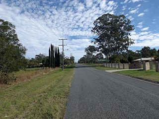
Mount Mort is a rural locality in the City of Ipswich, Queensland, Australia. In the 2021 census, Mount Mort had a population of 78 people.

Goomburra is a rural town and locality in the Southern Downs Region, Queensland, Australia. In the 2021 census, the locality of Goomburra had a population of 256 people.


