
Sandgate is a northern coastal suburb in the City of Brisbane, Queensland, Australia. In the 2021 census, Sandgate had a population of 4,926 people.

Gordon Park is a northern suburb in the City of Brisbane, Queensland, Australia. In the 2021 census, Gordon Park had a population of 4,390 people.

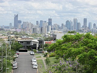
Coorparoo is a suburb in the inner City of Brisbane, Queensland, Australia. In the 2021 census, Coorparoo had a population of 18,132 people.

Acacia Ridge is a southern suburb in the City of Brisbane, Queensland, Australia. In the 2021 census, Acacia Ridge had a population of 7,486 people.

Alderley is a northern suburb in the City of Brisbane, Queensland, Australia. In the 2021 census, Alderley had a population of 6,748 people.

Annerley is a suburb in the City of Brisbane, Queensland, Australia. In the 2021 census, Annerley had a population of 11,891 people.

Moorooka is a southern suburb in the City of Brisbane, Queensland, Australia. In the 2021 census, Moorooka had a population of 10,783 people.

Clayfield is a suburb in the City of Brisbane, Queensland, Australia. In the 2021 census, Clayfield had a population of 10,897 people.

Rocklea is a suburb in the City of Brisbane, Queensland, Australia. In the 2021 census, Rocklea had a population of 1,672 people.

Camp Hill is a suburb in the City of Brisbane, Queensland, Australia. In the 2021 census, Camp Hill had a population of 12,254 people.
Greenslopes is a southern suburb in the City of Brisbane, Queensland, Australia. It is 6.0 kilometres (3.7 mi) by road south of the Brisbane CBD. In the 2021 census, Greenslopes had a population of 7,941 people.

Hendra is a suburb of the City of Brisbane, Queensland, Australia. In the 2021 census, Hendra had a population of 4,914 people.
Newmarket is a north-west suburb in the City of Brisbane, Queensland, Australia. In the 2021 census, Newmarket had a population of 5,083 people.

Banyo is a northern suburb in the City of Brisbane, Queensland, Australia. In the 2021 census, Banyo had a population of 6,105 people.

Enoggera is a north-western suburb in the City of Brisbane, Queensland, Australia. It is home to the Gallipoli Barracks.

Hamilton is an affluent riverside mixed-use suburb in the north-east of the City of Brisbane, Queensland, Australia. Hamilton is located along the north bank of the Brisbane River. In the 2021 census, Hamilton had a population of 8,922 people.

Bulimba is a suburb in the City of Brisbane, Queensland, Australia. In the 2021 census, Bulimba had a population of 7,623 people.

Yeerongpilly is a southern suburb in the City of Brisbane, Queensland, Australia. In the 2021 census, Yeerongpilly had a population of 2,033 people.

Hemmant is a eastern riverside suburb of the City of Brisbane, Queensland, Australia. In the 2021 census, Hemmant had a population of 2,886 people.

Salisbury is a southern suburb in the City of Brisbane, Queensland, Australia. In the 2021 census, Salisbury had a population of 6,790 people.


