Willawong, Queensland

Last updated

Willawong
Brisbane,  Queensland
Kingdom Hall of Jehovah's Witnesses, 174 Learoyd Road, Willawong, 2022 01.jpg
Kingdom Hall of Jehovah's Witnesses, Willawong, 2022
Australia Queensland location map.svg
Red pog.svg
Willawong
Coordinates 27°35′39″S153°00′17″E / 27.5941°S 153.0047°E / -27.5941; 153.0047 (Willawong (centre of suburb))
Population145 (2021 census) [1]
 • Density17.26/km2 (44.7/sq mi)
Established1970
Postcode(s) 4110
Area8.4 km2 (3.2 sq mi)
Time zone AEST (UTC+10:00)
Location17.3 km (11 mi) S of Brisbane CBD
LGA(s) City of Brisbane
(Moorooka Ward) [2]
State electorate(s) Algester
Federal division(s) Oxley
Suburbs around Willawong:
Oxley Rocklea
Archerfield
Acacia Ridge
Durack Willawong Acacia Ridge
Doolandella Pallara Algester

Willawong is an outer southern suburb in the City of Brisbane, Queensland, Australia. [3] In the 2021 census, Willawong had a population of 145 people. [1]

Contents

Geography

Willawong is 17.3 kilometres (10.7 mi) by road south of the Brisbane GPO. [4]

The suburb's boundary is mostly defined by the course of the two creeks, Oxley Creek and Blunder Creek. [5] The Sydney–Brisbane rail corridor is aligned along the eastern edge of the suburb. [6]

History

The suburb of Willawong was officially created and named by the Queensland Places Names Board in 1970. Willawong is an Aboriginal word meaning the junction of two creeks. [3] [5]

During the 1974 Brisbane flood, most of the suburb was inundated. [5] In 1983, local residents in Willawong and nearby suburbs began a campaign to stop sand mining in the area. [5]

Willawong once contained a toxic waste dump, which was closed in 1998. [7]

Demographics

In the 2011 census, Willawong had a population of 192 people, 45.8% female and 54.2% male. The median age of the Willawong population was 40 years, 3 years above the Australian median. 59.8% of people living in Willawong were born in Australia, compared to the national average of 69.8%; the next most common countries of birth were Taiwan 9.3%, Vietnam 5.2%, England 4.6%, Indonesia 2.6%, New Zealand 2.6%. 62.1% of people spoke only English at home; the next most common languages were 11.8% Vietnamese, 7.7% Mandarin, 1.5% Urdu, 1.5% Dutch, 1.5% Greek. [8]

In the 2016 census, Willawong had a population of 177 people. [9]

In the 2021 census, Willawong had a population of 145 people. [1]

Education

There are no schools in Willawong. The nearest primary schools are Acacia Ridge State School and Watson Road State School, both in neighbouring Acacia Ridge to the east, Durack State School in neighbouring Durack to the west, and Inala State School in Inala to the west. The nearest secondary schools are Glenala State High School in Inala to the west and Calamvale Community College in Calamvale to the east. [6]

Facilities

Brisbane City Council operates a resource recovery centre at 360 Sherbrooke Road ( 27°36′08″S153°00′20″E / 27.6021°S 153.0056°E / -27.6021; 153.0056 (Willawong resource recovery centre) ). Residents can dispose of general waste, garden waste, and recyclables this centre. [10]

There is a Transport for Brisbane bus depot at 399 Sherbrooke Road. The 6-hectare (15-acre) site is Brisbane's largest bus depot and can accommodate over 200 buses with facilities for refueling, vehicle maintenance, administration, and staff facilitities for car parking and recreation. [11] [12]

Amenities

Congregational Christian Church of Samoa, 2022 Congregational Christian Church of Samoa, EFKS Southwest Brisbane, 228 Learoyd Road, Willawong, 2022 01.jpg
Congregational Christian Church of Samoa, 2022

The Kingdom Hall of Jehovah's Witnesses is at 174 Learoyd Road ( 27°35′53″S153°01′37″E / 27.5980°S 153.0270°E / -27.5980; 153.0270 (Kingdom Hall of Jehovah's Witnesses) ). [13]

Congregational Christian Church of Samoa is at 228 Learoyd Road ( 27°35′50″S153°01′21″E / 27.5973°S 153.0224°E / -27.5973; 153.0224 (Congregational Christian Church of Samoa) ). It is also known as EFKS Southwest Brisbane, where EFKS is an abbreviation of Ekalesia Fa'apotopotoga Kerisiano Samoa, which translates as Congregational Christian Church of Samoa. Over the entrance door are the Samoan words Puna O Le Olataga which translate as Source of Salvation. [14]

Related Research Articles

<span class="mw-page-title-main">Calamvale, Queensland</span> Suburb of Brisbane, Queensland, Australia

Calamvale is a southern suburb in the City of Brisbane, Queensland, Australia. In the 2021 census, Calamvale had a population of 17,994 people.

<span class="mw-page-title-main">Inala, Queensland</span> Suburb of Brisbane, Queensland, Australia

Inala is a south-western suburb in the City of Brisbane, Queensland, Australia. In the 2021 census, Inala had a population of 15,273 people.

<span class="mw-page-title-main">Acacia Ridge, Queensland</span> Suburb of Brisbane, Queensland, Australia

Acacia Ridge is a southern suburb in the City of Brisbane, Queensland, Australia. In the 2021 census, Acacia Ridge had a population of 7,486 people.

<span class="mw-page-title-main">Algester, Queensland</span> Suburb of Brisbane, Queensland, Australia

Algester is a southern suburb in the City of Brisbane, Queensland, Australia. In the 2021 census, Algester had a population of 9,020 people.

<span class="mw-page-title-main">Oxley, Queensland</span> Suburb of Brisbane, Queensland, Australia

Oxley is a south-western suburb in the City of Brisbane, Queensland, Australia. In the 2021 census, Oxley had a population of 9,100 people.

<span class="mw-page-title-main">Sunnybank Hills, Queensland</span> Suburb of Brisbane, Queensland, Australia

Sunnybank Hills is an outer southern suburb in the City of Brisbane, Queensland, Australia. In the 2021 census, Sunnybank Hills had a population of 18,085 people.
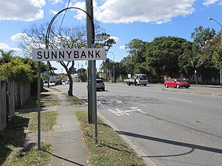
<span class="mw-page-title-main">Stretton, Queensland</span> Suburb of Brisbane, Queensland, Australia

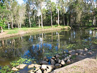
Stretton is a southern suburb in the City of Brisbane, Queensland, Australia. In the 2021 census, Stretton had a population of 4,686 people.

<span class="mw-page-title-main">Forest Lake, Queensland</span> Suburb of Brisbane, Queensland, Australia

Forest Lake is an outer south-western suburb of the City of Brisbane, Queensland, Australia. In the 2021 census, Forest Lake had a population of 22,676 people.

<span class="mw-page-title-main">Newstead, Queensland</span> Suburb of Brisbane, Queensland, Australia

Newstead is an inner northern riverside suburb of Brisbane, Queensland, Australia. In the 2021 census, Newstead had a population of 7,496 people.

<span class="mw-page-title-main">Larapinta, Queensland</span> Suburb of Brisbane, Queensland, Australia

Larapinta is an outer southern industrial suburb in the City of Brisbane, Queensland, Australia.

<span class="mw-page-title-main">Grange, Queensland</span> Suburb of Brisbane, Queensland, Australia

Grange is a northern suburb in the City of Brisbane, Queensland, Australia. In the 2021 census, Grange had a population of 4,615 people.

<span class="mw-page-title-main">Virginia, Queensland</span> Suburb of Brisbane, Queensland, Australia

Virginia is a suburb in the City of Brisbane, Queensland, Australia. In the 2021 census, Virginia had a population of 2,395 people.

<span class="mw-page-title-main">Heathwood, Queensland</span> Suburb of Brisbane, Queensland, Australia

Heathwood is an outer south-western suburb in the City of Brisbane, Queensland, Australia. In the 2021 census, Heathwood had a population of 4,944 people.

<span class="mw-page-title-main">Archerfield, Queensland</span> Suburb of Brisbane, Queensland, Australia

Archerfield is a mixed-use southern suburb in the City of Brisbane, Queensland, Australia. In the 2021 census, Archerfield had a population of 533 people.

<span class="mw-page-title-main">Ellen Grove, Queensland</span> Suburb of Brisbane, Queensland, Australia

Ellen Grove is an outer south-western suburb in the City of Brisbane, Queensland, Australia. In the 2021 census, Ellen Grove had a population of 3,586 people.

<span class="mw-page-title-main">Durack, Queensland</span> Suburb of Brisbane, Queensland, Australia

Durack is an outer south-western suburb in the City of Brisbane, Queensland, Australia. In the 2016 census, Durack had a population of 7,487 people.

<span class="mw-page-title-main">Doolandella, Queensland</span> Suburb of Brisbane, Queensland, Australia

Doolandella is an outer western suburb in the City of Brisbane, Queensland, Australia. In the 2021 census, Doolandella had a population of 7,123 people.

<span class="mw-page-title-main">Pallara, Queensland</span> Suburb of Brisbane, Queensland, Australia

Pallara is an outer southern suburb in the City of Brisbane, Queensland, Australia. In the 2021 census, Pallara had a population of 3,861 people.

<span class="mw-page-title-main">Parkinson, Queensland</span> Suburb of Brisbane, Queensland, Australia

Parkinson is an outer southern suburb in the City of Brisbane, Queensland, Australia. In the 2021 census, Parkinson had a population of 11,148 people.

<span class="mw-page-title-main">Richlands, Queensland</span> Suburb of Brisbane, Queensland, Australia

Richlands is an outer south-western suburb in the City of Brisbane, Queensland, Australia. In the 2021 census, Richlands had a population of 5,621 people.

References

  1. 1 2 3 Australian Bureau of Statistics (28 June 2022). "Willawong (SAL)". 2021 Census QuickStats. Retrieved 28 February 2023. OOjs UI icon edit-ltr-progressive.svg
  2. "Moorooka Ward". Brisbane City Council. Archived from the original on 12 March 2017. Retrieved 12 March 2017.
  3. 1 2 "Willawong – suburb in City of Brisbane (entry 50235)". Queensland Place Names. Queensland Government . Retrieved 12 October 2020.
  4. Google (21 August 2022). "Brisbane GPO to Willawong" (Map). Google Maps . Google. Retrieved 21 August 2022.
  5. 1 2 3 4 Mynott, Wicki (2009). 150 years: Richlands, Inala & neighbouring suburbs in Brisbane's South West. Richlands, Inala & Suburbs History Group. pp. 226–229.
  6. 1 2 "Queensland Globe". State of Queensland . Retrieved 21 August 2022.
  7. John McCarthy (16 October 2007). 6000 houses near Willawong toxic dump. The Courier-Mail. News Queensland. Retrieved 2 July 2012.
  8. Australian Bureau of Statistics (31 October 2012). "Willawong (SSC)". 2011 Census QuickStats. Retrieved 29 May 2022. OOjs UI icon edit-ltr-progressive.svg
  9. Australian Bureau of Statistics (27 June 2017). "Willawong (SSC)". 2016 Census QuickStats. Retrieved 20 October 2018. OOjs UI icon edit-ltr-progressive.svg
  10. "Resource recovery centres". Brisbane City Council . Retrieved 21 August 2022.
  11. "Brisbane bus depots". Brisbane City Council . Retrieved 21 August 2022.
  12. "Willawong Bus Depot. Brisbane, QLD. 2009". Dot Dash. Retrieved 21 August 2022.
  13. Blake, Thom. "Kingdom Hall of Jehovah's Witnesses, Willawong". Queensland religious places database. Retrieved 21 August 2022.
  14. Blake, Thom. "EFKS Southwest Brisbane". Queensland religious places database. Retrieved 22 August 2022.