Westlake, Queensland

Last updated

Westlake
Brisbane,  Queensland
Spring in suburbia, Brisbane (19835765613).jpg
Spring flowering trees in Wendouree Crescent, 2014
Australia Queensland location map.svg
Red pog.svg
Westlake
Coordinates 27°32′56″S152°54′45″E / 27.5489°S 152.9124°E / -27.5489; 152.9124 (Westlake (centre of suburb))
Population4,368 (2016 census) [1]
 • Density1,990/km2 (5,140/sq mi)
Postcode(s) 4074
Area2.2 km2 (0.8 sq mi)
Time zone AEST (UTC+10:00)
Location18.9 km (12 mi) SW of Brisbane GPO
LGA(s) City of Brisbane
State electorate(s) Mount Ommaney
Federal division(s) Oxley
Suburbs around Westlake:
Pinjarra Hills Pinjarra Hills Pinjarra Hills
Pinjarra Hills Westlake Mount Ommaney
Bellbowrie Riverhills Middle Park

Westlake is a south-western suburb in the City of Brisbane, Queensland, Australia. [2] In the 2016 census, Westlake had a population of 4,368 people. [1]

Contents

Geography

Westlake adjoins the suburbs of Riverhills, Middle Park and Mount Ommaney. [3]

History

Westlake was developed as part of the Hooker Centenary Project which commenced in 1959. [4] It and the surrounding suburbs such as Jindalee are known as the Centenary Suburbs. It was officially named by the Queensland Place Names Board on 8 January 1973 with its boundaries determined on 11 August 1975. The suburb takes its name from the lake ( 27°32′46″S152°54′48″E / 27.5462°S 152.9134°E / -27.5462; 152.9134 (Westlake) ) constructed by the development project. [2]

The western part of the original land holdings that became the Centenary Suburbs were part of the Wolston Estate, consisting of 54 farms on an area of 3000 acres, offered for auction at Centennial Hall, Brisbane, on 16 October 1901. [5] Wolston Estate is the property of M. B. Goggs, whose father obtained the land forty years previously in the 1860s and after whom Goggs Road is named. [6] Only three of the farms sold at the original auction. [7]

In 1879, the local government area of Yeerongpilly Division was created. In 1891, parts of Yeerongpilly Division were excised to create Sherwood Division becoming a Shire in 1903 which contained the areas of Wolston Estate. In 1925, the Shire of Sherwood was amalgamated into the City of Brisbane. [8]

Westlake has much riverside properties and in the early 1990s expanded to include the development Westlake Waters with the 'natural lakes'.

As residential expansion occurred, the 1990s also saw the rise of community efforts to preserve riverfront bushland and encourage environmental protection of remnant natural areas. Groups which formed to forge this greater interest in environmental protection include Save Our Riverfront Bushland (1991), [9] Westlake-Riverhills Bushcare Group (1993) and Centenary & District Environment Action Inc (1996). [10]

Demographics

In the 2011 census, the population of Westlake was 4,380, 49.6% female and 50.4% male. The median age of the Westlake population was 41 years, 4 years above the Australian median. 62.8% of people living in Westlake were born in Australia, compared to the national average of 69.8%; the next most common countries of birth were England 5.6%, New Zealand 3.5%, South Africa 2.8%, Vietnam 2.4%, Sri Lanka 1.6%. 75.4% of people spoke only English at home; the next most common languages were 3.9% Vietnamese, 3.3% Cantonese, 2.6% Mandarin, 1.8% Tamil, 1.2% Hindi. [11]

In the 2016 census, Westlake had a population of 4,368 people. [1]

Education

There are no schools in Westlake. The nearest primary schools are Middle Park State School in neighbouring Middle Park to the south and Jamboree Heights State School in Jamboree Heights to the east. The nearest secondary school is Centenary State High School in Jindalee to the north-east. [3]

Related Research Articles

<span class="mw-page-title-main">Oxley, Queensland</span> Suburb of Brisbane, Queensland, Australia

Oxley is a south-western suburb in the City of Brisbane, Queensland, Australia. In the 2016 census, Oxley had a population of 8,336 people.

<span class="mw-page-title-main">Darra, Queensland</span> Suburb of Brisbane, Queensland, Australia

Darra is a south-western suburb in the City of Brisbane, Queensland, Australia. In the 2016 census, Darra had a population of 4,343 people.

<span class="mw-page-title-main">Jindalee, Queensland</span> Suburb of Brisbane, Queensland, Australia

Jindalee is a south-western residential suburb in the City of Brisbane, Queensland, Australia. In the 2016 census, Jindalee had a population of 5,320 people.

<span class="mw-page-title-main">Bellbowrie, Queensland</span> Suburb of Brisbane, Queensland, Australia

Bellbowrie is a suburb in the City of Brisbane, Queensland, Australia. In the 2016 census Bellbowrie had a population of 5,462 people.

Centenary State High School is a government secondary (7–12) school at 1 Moolanda Street, Jindalee, City of Brisbane, Queensland, Australia.

<span class="mw-page-title-main">Sinnamon Park, Queensland</span> Suburb of Brisbane, Queensland, Australia

Sinnamon Park is a suburb in the City of Brisbane, Queensland, Australia. In the 2016 census, Sinnamon Park had a population of 6,419 people.

<span class="mw-page-title-main">Middle Park, Queensland</span> Suburb of Brisbane, Queensland, Australia

Middle Park is a residential south-western suburb in the Centenary Suburbs in the City of Brisbane, Queensland, Australia. In the 2016 census, Middle Park had a population of 3,955 people.

<span class="mw-page-title-main">Electoral district of Mount Ommaney</span> State electoral district of Queensland, Australia

Mount Ommaney is an electoral district of the Legislative Assembly in the Australian state of Queensland. It was created with the 1992 redistribution.

<span class="mw-page-title-main">Corinda, Queensland</span> Suburb of Brisbane, Queensland, Australia

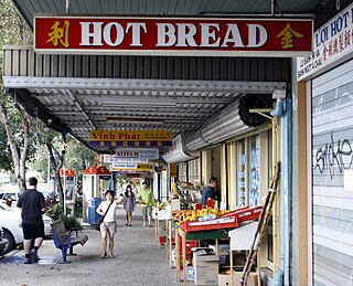
Corinda is a suburb in the City of Brisbane, Queensland, Australia. In the 2016 census, Corinda had a population of 5,064 people.

<span class="mw-page-title-main">Wacol, Queensland</span> Suburb of Brisbane, Queensland, Australia

Wacol is a suburb in the City of Brisbane, Queensland, Australia. In the 2016 census, Wacol had a population of 3,761 people.

<span class="mw-page-title-main">Mount Ommaney, Queensland</span> Suburb of Brisbane, Queensland, Australia

Mount Ommaney is a south-western riverside suburb in the City of Brisbane, Queensland, Australia. The mountain of the same name is located within the locality. In the 2016 census, Mount Ommaney had a population of 2,360 people.

<span class="mw-page-title-main">Yeerongpilly, Queensland</span> Suburb of Brisbane, Queensland, Australia

Yeerongpilly is a southern suburb in the City of Brisbane, Queensland, Australia. In the 2016 census, Yeerongpilly had a population of 1,934 people.

<span class="mw-page-title-main">Jamboree Heights, Queensland</span> Suburb of Brisbane, Queensland, Australia

Jamboree Heights is a south-western suburb in the City of Brisbane, Queensland, Australia. In the 2016 census, Jamboree Heights had a population of 3,093 people.

<span class="mw-page-title-main">Sumner, Queensland</span> Suburb of Brisbane, Queensland, Australia

Sumner is a south-western suburb in the City of Brisbane, Queensland, Australia. In the 2016 census, Sumner had a population of 595 people.

<span class="mw-page-title-main">Sherwood, Queensland</span> Suburb of Brisbane, Queensland, Australia

Sherwood is a suburb in the City of Brisbane, Queensland, Australia. In the 2021 census, Sherwood had a population of 6,082 people.

<span class="mw-page-title-main">Seventeen Mile Rocks, Queensland</span> Suburb of Brisbane, Queensland, Australia

Seventeen Mile Rocks is a suburb in the City of Brisbane, Queensland, Australia. In the 2016 census, Seventeen Mile Rocks had a population of 2,720 people.

Riverhills is a south-western suburb in the City of Brisbane, Queensland, Australia. It is one of the Centenary suburbs. In the 2016 census, Riverhills had a population of 4,042 people.

The Centenary Suburbs are a group of suburbs in the south-west in the City of Brisbane, Queensland, Australia. The suburbs originated as an "ambitious long-term suburban development proposal that included a number of neighbourhoods, or suburbs, each with sufficient services and facilities for its residents to have their day-to-day needs met without having to go elsewhere".

The Shire of Yeerongpilly was a local government area in the southern suburbs of Brisbane, Queensland. The shire, administered from Rocklea, covered an area of 175 square miles (453 km2), and existed as a local government entity from 1879 until 1925, when it was split up following the creation of the City of Brisbane under the City of Brisbane Act 1924.

<span class="mw-page-title-main">Shire of Sherwood</span> Former local government area of Queensland

The Shire of Sherwood is a former local government area of Queensland, Australia, located in south-western Brisbane in and around the suburb of Sherwood.

References

  1. 1 2 3 Australian Bureau of Statistics (27 June 2017). "Westlake (SSC)". 2016 Census QuickStats. Retrieved 20 October 2018. OOjs UI icon edit-ltr-progressive.svg
  2. 1 2 "Westlake – suburb in City of Brisbane (entry 41943)". Queensland Place Names. Queensland Government . Retrieved 11 October 2020.
  3. 1 2 "Queensland Globe". State of Queensland . Retrieved 12 October 2020.
  4. "Town To Be Built", The Sydney Morning Herald, 11 November 1961. Retrieved 25 November 2017.
  5. "Plan of the Wolston Estate" (1901) [Map]. Collections. State Library of Queensland.
  6. "SALE OF WOLSTON ESTATE". The Brisbane Courier . Vol. LVIII, no. 13, 651. Queensland, Australia. 12 October 1901. p. 4. Archived from the original on 10 October 2020. Retrieved 21 May 2019 via National Library of Australia.
  7. "LATEST NEWS IN BRIEF". The Queenslander . Vol. LXI, no. 1353. Queensland, Australia. 26 October 1901. p. 780. Archived from the original on 10 October 2020. Retrieved 21 May 2019 via National Library of Australia.
  8. Fones, Ralph (1 January 1993). "Suburban conservatism in the Sherwood Shire 1891-1920". UQ eSpace. Archived from the original on 2 March 2020. Retrieved 2 March 2020.
  9. "Save Our Riverfront Bushland (SORB)". sorb.org.au. Archived from the original on 20 September 2017. Retrieved 12 October 2020.
  10. "Centenary and District Environment Action - CDEA Home". cdea.org.au. Archived from the original on 3 August 2020. Retrieved 12 October 2020.
  11. Australian Bureau of Statistics (31 October 2012). "Westlake (Brisbane City) (State Suburb)". 2011 Census QuickStats. Retrieved 28 February 2008. OOjs UI icon edit-ltr-progressive.svg