
St Lucia is a riverside suburb in the City of Brisbane, Queensland, Australia. The University of Queensland is the main attraction of St Lucia, with the university and its residential colleges covering a large proportion of the suburb. According to the 2021 census, St Lucia had a population of 12,220 people.

Chapel Hill is a western suburb in the City of Brisbane, Queensland, Australia. In the 2021 census, Chapel Hill had a population of 10,511 people.
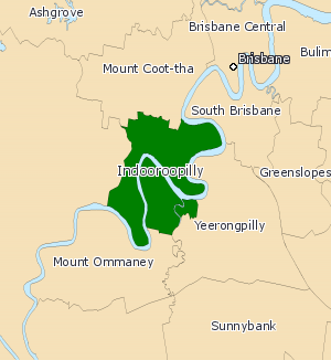
The Division of Ryan is an Australian Electoral Division in Queensland.

Oxley is a south-western suburb in the City of Brisbane, Queensland, Australia. In the 2021 census, Oxley had a population of 9,100 people.

Jindalee is a south-western residential suburb in the City of Brisbane, Queensland, Australia. In the 2021 census, Jindalee had a population of 5,320 people.

Taringa is a suburb in the City of Brisbane, Queensland, Australia. In the 2021 census, Taringa had a population of 8,732 people.

Bellbowrie is a suburb in the City of Brisbane, Queensland, Australia. In the 2021 census, Bellbowrie had a population of 5,495 people.

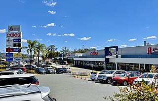
Indooroopilly is a riverside suburb 7.8 kilometres (4.8 mi) south-west of the Brisbane CBD, Queensland, Australia. In the 2021 census, Indooroopilly had a population of 13,622 people.

Brookfield is a rural residential suburb in the City of Brisbane, Queensland, Australia. In the 2021 census, Brookfield had a population of 3,640 people.

Chelmer is a south-western suburb in the City of Brisbane, Queensland, Australia. In the 2021 census, Chelmer had a population of 3,325 people.

Corinda is a suburb in the City of Brisbane, Queensland, Australia. In the 2021 census, Corinda had a population of 5,555 people.

Auchenflower is an inner western riverside suburb of the City of Brisbane, Queensland, Australia. In the 2021 census, Auchenflower had a population of 6,053 people.
Kenmore is a riverside suburb in the City of Brisbane, Queensland, Australia. In the 2021 census, Kenmore had a population of 9,675 people.
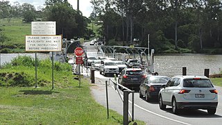
Moggill is a suburb in the City of Brisbane, Queensland, Australia. In the 2021 census, Moggill had a population of 5,029 people.
Kenmore Hills is a suburb in the City of Brisbane, Queensland, Australia. In the 2021 census, Kenmore Hills had a population of 2,448 people.

Jamboree Heights is a south-western suburb in the City of Brisbane, Queensland, Australia. In the 2021 census, Jamboree Heights had a population of 3,141 people.

Anstead is an outer western suburb in the City of Brisbane, Queensland, Australia. In the 2021 census, Anstead had a population of 1,522 people.

Chuwar is a town and suburb of Ipswich in the City of Ipswich and a locality of the City of Brisbane in South East Queensland, Australia. In the 2021 census, the suburb of Chuwar had a population of 2,178 people.

Seventeen Mile Rocks is a suburb in the City of Brisbane, Queensland, Australia. In the 2021 census, Seventeen Mile Rocks had a population of 2,699 people.
Indooroopilly was an electoral district of the Legislative Assembly in the Australian state of Queensland from 1992 to 2017.


