Carina Heights, Queensland

Last updated

Carina Heights
Brisbane,  Queensland
Carina Heights 2022.jpg
View from Whites Hill Reserve, 2022
Australia Queensland location map.svg
Red pog.svg
Carina Heights
Carina Heights, Queensland
Coordinates 27°30′23″S153°05′33″E / 27.5063°S 153.0925°E / -27.5063; 153.0925 (Carina Heights (centre of suburb))
Population7,103 (2021 census) [1]
 • Density2,089/km2 (5,410/sq mi)
Postcode(s) 4152 [2]
Area3.4 km2 (1.3 sq mi)
Time zone AEST (UTC+10:00)
Location10.1 km (6 mi) SE of Brisbane CBD
LGA(s) City of Brisbane
(Coorparoo Ward) [3]
State electorate(s)
Federal division(s) Griffith
Suburbs around Carina Heights:
Camp Hill Carina Carindale
Camp Hill Carina Heights Carindale
Holland Park Mount Gravatt East Mansfield

Carina Heights is both a hill and a suburb in the City of Brisbane, Queensland, Australia. [4] It is 10.1 kilometres (6.3 mi) by road south-east of the Brisbane GPO. [5] In the 2021 census, Carina Heights had a population of 7,103 people. [1]

Contents

Geography

Carina Heights borders Camp Hill, Carina, Carindale, Mansfield, Mount Gravatt East, and Holland Park. [6]

Carina Heights (the hill) is in the north-east corner of the suburb ( 27°30′02″S153°05′56″E / 27.5006°S 153.0989°E / -27.5006; 153.0989 (Carina Heights) ) rising to 36 metres (118 ft) above sea level. [7] [8]

Pine Mountain is in the south of the suburb ( 27°30′35″S153°05′20″E / 27.5096°S 153.0889°E / -27.5096; 153.0889 (Pine Mountain) ) rising to 106 metres (348 ft) above sea level. [8] [9] It is within Whites Hill Reserve which occupies the south-west of the suburb, extending into neighbouring Camp Hill. Most of the developed recreational facilities are in the Camp Hill part of the reserve. [6] The major use of the reserve within Carina Heights is the former Pine Mountain quarry, which is now used as a site to recycle asphalt removed from roads to create new asphalt. [10]

History

Carina Heights is named after the neighbouring suburb Carina, from which it was officially separated in 1975. The name Carina comes from an estate on Creek Road constructed in the 1850s. The property belonged to Ebenezer Thorne, and was named after Thorne's daughter Kate Carina Thorne. [11] [12] [13] [14] [15]

Demographics

In the 2011 census, Carina Heights had a population of 6,110 people, of whom 52.5% were female and 47.5% were male. The median age of the population was 35; 2 years below the Australian median. 72.3% of people living in Carina Heights were born in Australia compared to the national average of 69.8%, with the next most common countries of birth being New Zealand (4.3%), England (3.3%), South Korea (1.3%), India (1.1%), and the Philippines (1%). 80.8% of people spoke only English at home; the next most popular languages were Spanish (1.5%), Korean (1.4%), Italian (1.4%), Greek (1%), and Cantonese 0.9%. [16]

In the 2016 census, Carina Heights had a population of 6,732 people. [11]

In the 2021 census, Carina Heights had a population of 7,103 people. [1]

Education

There are no schools in Carina Heights. The nearest government primary schools are Whites Hill State College in neighbouring Camp Hill to the west, Carina State School in neighbouring Carina to the north, and Mount Gravatt East State School in neighbouring Mount Gravatt East. The nearest government secondary schools are Whites Hill State College in neighbouring Camp Hill to the west and Cavendish Road State High School in neighbouring Holland Park to the south-west. [6]

Facilities

Belmont Private Hospital is a 150-bed private psychiatric hospital. [17] It is at 1220 Creek Road on the top of the hill Carina Heights ( 27°30′04″S153°05′56″E / 27.5010°S 153.0989°E / -27.5010; 153.0989 (Belmont Private Hospital) ). [6] [18]

Amenities

Living Faith Uniting Church is at 330 Pine Mountain Road ( 27°31′02″S153°05′46″E / 27.5173°S 153.0961°E / -27.5173; 153.0961 (Living Faith Uniting Church) ). [19] It holds weekly Sunday services. [20] [21]

There are a number of parks in the suburb, including:

Street names

A number of street names in Carina Heights are identical to the surnames of former Members of the Queensland Legislative Assembly. These include:

Some other street names are identical to the surnames of prominent citizens of Brisbane. These include:

Another group of street names are derived from World War I. They include:

Related Research Articles

<span class="mw-page-title-main">Geebung, Queensland</span> Suburb of Brisbane, Australia

Geebung is a suburb in the City of Brisbane, Queensland, Australia. In the 2021 census, Geebung had a population of 4,850 people.

<span class="mw-page-title-main">Chermside, Queensland</span> Suburb of Queensland, Australia

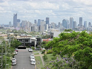
Chermside is a suburb in the City of Brisbane, Queensland, Australia. The suburb is situated 9.8 kilometres (6.1 mi) by road north of the Brisbane CBD. It is home to a large Westfield shopping centre. In the 2021 census, Chermside had a population of 11,426 people.

<span class="mw-page-title-main">Bald Hills, Queensland</span> Suburb of Brisbane, Queensland, Australia

Bald Hills is the northernmost suburb in the City of Brisbane, Queensland, Australia. In the 2021 census, Bald Hills had a population of 7,000 people.

<span class="mw-page-title-main">Bowen Hills, Queensland</span> Suburb of Brisbane, Queensland, Australia

Bowen Hills is an inner north-eastern suburb in the City of Brisbane, Queensland, Australia. In the 2021 census, Bowen Hills had a population of 4,898 people.

<span class="mw-page-title-main">Alderley, Queensland</span> Suburb of Brisbane, Queensland, Australia

Alderley is a northern suburb in the City of Brisbane, Queensland, Australia. In the 2021 census, Alderley had a population of 6,748 people.

<span class="mw-page-title-main">Carseldine, Queensland</span> Suburb of Brisbane, Queensland, Australia

Carseldine is a suburb in the City of Brisbane, Queensland, Australia. In the 2021 census, Carseldine had a population of 10,093 people.

<span class="mw-page-title-main">Carina, Queensland</span> Suburb of Brisbane, Queensland, Australia

Carina is an eastern suburb in the City of Brisbane, Queensland, Australia. In the 2021 census, Carina had a population of 11,678 people.

<span class="mw-page-title-main">Stafford, Queensland</span> Suburb of Brisbane, Queensland, Australia

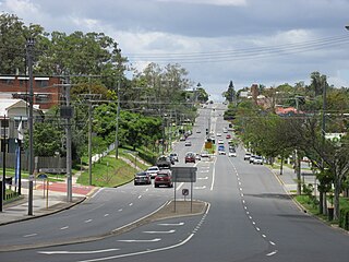
Stafford is a northern suburb in the City of Brisbane, Queensland, Australia. In the 2021 census, Stafford had a population of 6,978 people.

<span class="mw-page-title-main">Camp Hill, Queensland</span> Suburb of Brisbane, Queensland, Australia

Camp Hill is a suburb in the City of Brisbane, Queensland, Australia. In the 2021 census, Camp Hill had a population of 12,254 people.

<span class="mw-page-title-main">Whites Hill</span>

Whites Hill is a hill in the suburb of Camp Hill, City of Brisbane, Queensland, Australia. Surrounding the hill is Whites Hill Reserve, a public reserve occupying the south of the suburbs of Camp Hill and Carina Heights. The reserve covers an area of over 170 hectares. The reserve offering many sporting and recreational facilities. Whites Hill lies within the catchment area of Bulimba Creek.

<span class="mw-page-title-main">Carindale, Queensland</span> Suburb of Brisbane, Queensland, Australia

Carindale is a suburb of the City of Brisbane, Queensland, Australia. It is located 13.1 kilometres (8.1 mi) by road south-east of the Brisbane GPO, and borders Belmont, Carina, Carina Heights, Mackenzie, Mansfield, Mount Gravatt East, and Tingalpa. In the 2021 census, Carindale had a population of 16,535 people.

<span class="mw-page-title-main">Highgate Hill, Queensland</span> Suburb of Brisbane, Queensland, Australia

Highgate Hill is a riverside inner southern suburb of the City of Brisbane, Queensland, Australia. In the 2021 census, Highgate Hill had a population of 6,229 people.

<span class="mw-page-title-main">Seven Hills, Queensland</span> Suburb of Brisbane, Queensland, Australia

Seven Hills is a suburb in the City of Brisbane, Queensland, Australia. In the 2021 census, Seven Hills had a population of 2,732 people.

<span class="mw-page-title-main">Greenslopes, Queensland</span> Suburb of Brisbane, Queensland, Australia

Greenslopes is a southern suburb in the City of Brisbane, Queensland, Australia. It is 6.0 kilometres (3.7 mi) by road south of the Brisbane CBD. In the 2021 census, Greenslopes had a population of 7,941 people.

<span class="mw-page-title-main">Fitzgibbon, Queensland</span> Suburb of Brisbane, Queensland, Australia

Fitzgibbon is a northern suburb of the City of Brisbane, Queensland, Australia. In the 2021 census, Fitzgibbon had a population of 6,296 people.

<span class="mw-page-title-main">Holland Park West, Queensland</span> Suburb of Brisbane, Queensland, Australia

Holland Park West is a suburb in the City of Brisbane, Queensland, Australia. In the 2021 census, Holland Park West had a population of 6,468 people.

<span class="mw-page-title-main">Bridgeman Downs, Queensland</span> Suburb of Brisbane, Queensland, Australia

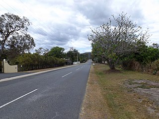
Bridgeman Downs is a northern suburb in the City of Brisbane, Queensland, Australia. It is located 15.2 kilometres (9.4 mi) from the city centre and borders City of Moreton Bay to the west. In the 2021 census, Bridgeman Downs had a population of 10,938 people.

<span class="mw-page-title-main">Belmont, Queensland</span> Suburb of Brisbane, Queensland, Australia

Belmont is an outer suburb in the City of Brisbane, Queensland, Australia. In the 2021 census, Belmont had a population of 4,498 people.

<span class="mw-page-title-main">Stafford Heights, Queensland</span> Suburb of Brisbane, Queensland, Australia

Stafford Heights is a northern suburb in the City of Brisbane, Queensland, Australia. In the 2021 census, Stafford Heights had a population of 6,992 people.

<span class="mw-page-title-main">Yaroomba, Queensland</span> Suburb of Sunshine Coast, Queensland, Australia

Yaroomba is a coastal suburb in the Sunshine Coast Region, Queensland, Australia. In the 2021 census, Yaroomba had a population of 2,043 people.

References

  1. 1 2 3 Australian Bureau of Statistics (28 June 2022). "Carina Heights (SAL)". 2021 Census QuickStats. Retrieved 28 February 2023. OOjs UI icon edit-ltr-progressive.svg
  2. "Find a postcode". Australia Post . Archived from the original on 24 August 2011. Retrieved 4 January 2014.
  3. "Coorparoo Ward". Brisbane City Council. Archived from the original on 4 February 2017. Retrieved 12 March 2017.
  4. "Carina Heights – suburb in City of Brisbane (entry 47602)". Queensland Place Names. Queensland Government . Retrieved 26 December 2020.
  5. Google (2 May 2021). "Brisbane GPO to Carina Heights" (Map). Google Maps . Google. Retrieved 2 May 2021.
  6. 1 2 3 4 "Queensland Globe". State of Queensland . Retrieved 2 May 2021.
  7. "Carina Heights – hill in the City of Brisbane (entry 6246)". Queensland Place Names. Queensland Government . Retrieved 26 August 2020.
  8. 1 2 "Mountain peaks and capes - Queensland". Queensland Open Data. Queensland Government. 12 November 2020. Archived from the original on 25 November 2020. Retrieved 25 November 2020.
  9. "Pine Mountain – mountain in Brisbane City (entry 26825)". Queensland Place Names. Queensland Government . Retrieved 25 November 2020.
  10. "Products and Services of Field Services". Brisbane City Council . Archived from the original on 12 August 2020. Retrieved 2 May 2021.
  11. 1 2 Australian Bureau of Statistics (27 June 2017). "Carina Heights (SSC)". 2016 Census QuickStats. Retrieved 20 October 2018. OOjs UI icon edit-ltr-progressive.svg
  12. Centre for the Government of Queensland. "Carina Heights". Archived from the original on 4 January 2014. Retrieved 4 January 2014.
  13. "Carina (entry 42562)". Queensland Place Names. Queensland Government . Retrieved 11 April 2014.
  14. "Carina". Queensland Places. Centre for the Government of Queensland, University of Queensland. Archived from the original on 27 January 2014. Retrieved 11 April 2014.
  15. Williams, Brian. "Secrets of Brisbane's suburbs: C". News Ltd. Archived from the original on 22 December 2014. Retrieved 4 January 2014.
  16. Australian Bureau of Statistics (31 October 2012). "Carina Heights, Qld (State Suburb)". 2011 Census QuickStats. Retrieved 10 October 2013. OOjs UI icon edit-ltr-progressive.svg
  17. "Homepage". Belmont Private Hospital. 2 May 2021. Archived from the original on 2 May 2021. Retrieved 2 May 2021.
  18. "Landmark Areas - Queensland". Queensland Open Data. Queensland Government. 18 November 2020. Archived from the original on 21 November 2020. Retrieved 21 October 2020.
  19. "Building points - Queensland". Queensland Open Data. Queensland Government. 17 November 2020. Archived from the original on 25 November 2020. Retrieved 25 November 2020.
  20. "Welcome to Living Faith Uniting Church". Living Faith Uniting Church. Archived from the original on 19 January 2021. Retrieved 2 May 2021.
  21. "Find a Church". Uniting Church in Australia, Queensland Synod. Archived from the original on 24 October 2020. Retrieved 22 November 2020.
  22. 1 2 3 4 5 6 7 8 9 10 "Land for public recreation - Queensland". Queensland Open Data. Queensland Government. 20 November 2020. Archived from the original on 22 November 2020. Retrieved 22 November 2020.
  23. "Obituary - Mr G.W.Whatmore". The Sydney Morning Herald. 1 June 1929. Archived from the original on 18 October 2017. Retrieved 18 October 2017.
  24. "Nyrambla, Ascot". The Courier-Mail. 4 August 2014. Archived from the original on 18 October 2017. Retrieved 18 October 2017.