Jindalee, Queensland

Last updated

Map all coordinates using: OpenStreetMap
Jindalee
Brisbane,  Queensland
Jindalee Boat Ramp (7162648724).jpg
Jindalee Boat Ramp, 2010
Australia Queensland location map.svg
Red pog.svg
Jindalee
Coordinates 27°32′04″S152°56′12″E / 27.5345°S 152.9366°E / -27.5345; 152.9366
Population5,320 (2016 census) [1]
 • Density1,716/km2 (4,440/sq mi)
Postcode(s) 4074
Area3.1 km2 (1.2 sq mi)
Time zone AEST (UTC+10:00)
Location15.2 km (9 mi) SW of Brisbane GPO
LGA(s) City of Brisbane
(Jamboree Ward) [2]
State electorate(s) Mount Ommaney
Federal division(s) Oxley
Suburbs around Jindalee:
Kenmore Kenmore Fig Tree Pocket
Pinjarra Hills Jindalee Sinnamon Park
Mount Ommaney Mount Ommaney Sinnamon Park

Jindalee is a south-western residential suburb in the City of Brisbane, Queensland, Australia. [3] In the 2016 census, Jindalee had a population of 5,320 people. [1]

Contents

Geography

Jindalee is 15.2 km (9 mi) by road south-west of the Brisbane CBD, and is a part of the Centenary suburbs. It is bordered by the Brisbane River to the north.

The Centenary Motorway enters the suburb from the north (Jamboree Heights), crossing the river on the Centenary Bridge ( 27°31′40″S152°56′49″E / 27.5278°S 152.9470°E / -27.5278; 152.9470 ), and forms the south-eastern boundary of the suburb before exiting on the south-east corner of the suburb into Mount Ommaney / Sinnamon Park. [4]

The older part of the suburb is to the west of the motorway and is predominantly residential in character with individual houses. The Jindalee Golf Course is immediately west of the motorway ( 27°32′11″S152°56′39″E / 27.5363°S 152.9441°E / -27.5363; 152.9441 (Jindalee Golf Course) ). To the east of the motorway are two large retail centres, separated by Sinnamon Road ( 27°31′58″S152°56′52″E / 27.5327°S 152.9479°E / -27.5327; 152.9479 (Retail precinct, Jindalee) ). Also to the east of the motorway is a more recent townhouse estate between the retail precinct and the river ( 27°31′48″S152°56′54″E / 27.5299°S 152.9483°E / -27.5299; 152.9483 (Townhouse estate, Jindalee) ). [4]

The north-western boundary with the river has a riverside park with boat ramp ( 27°31′47″S152°55′43″E / 27.5296°S 152.9287°E / -27.5296; 152.9287 (Jindalee Boat Ramp) ) provided by the Brisbane City Council. [4] [5]

History

Wolston Estate was the property of M. B. Goggs, whose father obtained the land forty years previously in the 1860s and after whom Goggs Road is named. [6]

In 1879, the local government area of Yeerongpilly Division was created. In 1891, parts of Yeerongpilly Division were excised to create Sherwood Division, which contained the area of Wolston Estate.

A small portion of Jindalee comes from the Wolston Estate, consisting of fifty-four farms on an area of three thousand acres, offered for auction at Centennial Hall, Brisbane, on 16 October 1901. [7] Only three of the farms sold at the original auction. [8]

In 1903, the Sherwood Division became the Shire of Sherwood.

In 1925, the Shire of Sherwood was amalgamated into the City of Brisbane. [9]

The Aboriginal meaning for Jindalee is "bare hills". Jindalee was the first of a series of suburbs originally called the "Centenary" suburbs, as planning for them commenced in 1959, the year of Queensland's centenary.

Prior to development, the area had been largely used for grazing and dairy farming; however, it was developed as part of the Hooker Centenary Project, beginning in 1960. [10] The 8th Australian Scout Jamboree was held in the southwestern corner of Jindalee, which was subdivided and became Jamboree Heights, a suburb in its own right.[ citation needed ]

Jindalee State School opened on 24 January 1966. [11]

The 1974 floods caused extensive damage to Jindalee, including inundation of many houses, as well as severe damage to the Centenary Bridge. A gravel barge rammed into the upstream side, blocking the floodwaters and raising real fears that the bridge would collapse. The barge was partly sunk using explosives to reduce pressure on the bridge. When the floodwater receded, the barge was refloated and beached downstream to be cut up for scrap. The damage sustained by the bridge required its partial closure for repairs. For two years after the floods, the bridge was reduced to a single lane. The bridge was duplicated in 1980, providing two lanes each way.[ citation needed ]

Brisbane River in flood at Jindalee at the Centenary Bridge, 2011 Brisbane River in flood.jpg
Brisbane River in flood at Jindalee at the Centenary Bridge, 2011

In 1987 Our Lady of the Sacred Heart School in Darra opened a pre-school in Jindalee, renaming the school Darra-Jindalee Catholic School. In 2003 the facility in Jindalee closed and on 14 July 2008 the school returned to the name of the Our Lady of the Sacred Heart School operating only at Darra. [11]

Centenary State High School opened in January 1999. [11]

The 2011 floods badly affected the suburb. [12] [13] [14]

In the 2016 census, Jindalee had a population of 5,320 people. [1]

Education

Jindalee State School is a government primary (Prep-6) school for boys and girls at 114 Burrendah Road ( 27°31′47″S152°56′06″E / 27.5298°S 152.9349°E / -27.5298; 152.9349 (Jindalee State School) ). [15] [16] In 2017, the school had an enrolment of 820 students with 65 teachers (54 full-time equivalent) and 36 non-teaching staff (22 full-time equivalent). [17] It includes a special education program. [15]

Centenary State High School is a government secondary (7-12) school for boys and girls at 1 Moolanda Street ( 27°32′19″S152°56′25″E / 27.5386°S 152.9403°E / -27.5386; 152.9403 (Centenary State High School) ). [15] [18] In 2017, the school had an enrolment of 1,484 students with 119 teachers (113 full-time equivalent) and 48 non-teaching staff (35 full-time equivalent). [17] It includes a special education program. [15]

Transport

Jindalee is accessible via the Centenary Highway. Some bus routes service the suburb, namely:

See also

Related Research Articles

<span class="mw-page-title-main">Centenary Bridge</span> Bridge in Queensland, Australia

The Centenary Bridge is a motorway crossing of the Brisbane River. As it forms part of Brisbane's Centenary Motorway, it is used primarily by vehicular traffic, although it includes footpaths for pedestrian traffic. The bridge was used by 85,000 vehicles per day in 2023.

<span class="mw-page-title-main">Oxley, Queensland</span> Suburb of Brisbane, Queensland, Australia

Oxley is a south-western suburb in the City of Brisbane, Queensland, Australia. In the 2016 census, Oxley had a population of 8,336 people.

<span class="mw-page-title-main">Darra, Queensland</span> Suburb of Brisbane, Queensland, Australia

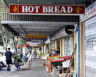
Darra is a south-western suburb in the City of Brisbane, Queensland, Australia. In the 2016 census, Darra had a population of 4,343 people.

Centenary State High School is a government secondary (7–12) school at 1 Moolanda Street, Jindalee, City of Brisbane, Queensland, Australia.

<span class="mw-page-title-main">Sinnamon Park, Queensland</span> Suburb of Brisbane, Queensland, Australia

Sinnamon Park is a suburb in the City of Brisbane, Queensland, Australia. In the 2016 census, Sinnamon Park had a population of 6,419 people.

<span class="mw-page-title-main">Forest Lake, Queensland</span> Suburb of Brisbane, Queensland, Australia

Forest Lake is an outer south-western suburb of the City of Brisbane, Queensland, Australia. In the 2016 census, Forest Lake had a population of 22,904 people.

<span class="mw-page-title-main">Middle Park, Queensland</span> Suburb of Brisbane, Queensland, Australia

Middle Park is a residential south-western suburb in the Centenary Suburbs in the City of Brisbane, Queensland, Australia. In the 2016 census, Middle Park had a population of 3,955 people.

<span class="mw-page-title-main">Westlake, Queensland</span> Suburb of Brisbane, Queensland, Australia

Westlake is a south-western suburb in the City of Brisbane, Queensland, Australia. In the 2016 census, Westlake had a population of 4,368 people.

<span class="mw-page-title-main">Electoral district of Mount Ommaney</span> State electoral district of Queensland, Australia

Mount Ommaney is an electoral district of the Legislative Assembly in the Australian state of Queensland. It was created with the 1992 redistribution.

<span class="mw-page-title-main">Wacol, Queensland</span> Suburb of Brisbane, Queensland, Australia

Wacol is a suburb in the City of Brisbane, Queensland, Australia. In the 2016 census, Wacol had a population of 3,761 people.

<span class="mw-page-title-main">Springfield railway line</span> Railway line in Australia

Springfield railway line is a 13.6 km (8.5 mi) suburban railway line in Brisbane, Australia that branches from the Ipswich/Rosewood line after Darra railway station. Construction of the line started on 5 July 2010, and it opened on 2 December 2013. The line was developed along with the widening of the nearby Centenary Motorway.

<span class="mw-page-title-main">Mount Ommaney, Queensland</span> Suburb of Brisbane, Queensland, Australia

Mount Ommaney is a south-western riverside suburb in the City of Brisbane, Queensland, Australia. The mountain of the same name is located within the locality. In the 2016 census, Mount Ommaney had a population of 2,360 people.

<span class="mw-page-title-main">Jamboree Heights, Queensland</span> Suburb of Brisbane, Queensland, Australia

Jamboree Heights is a south-western suburb in the City of Brisbane, Queensland, Australia. In the 2016 census, Jamboree Heights had a population of 3,093 people.

<span class="mw-page-title-main">Ellen Grove, Queensland</span> Suburb of Brisbane, Queensland, Australia

Ellen Grove is an outer south-western suburb in the City of Brisbane, Queensland, Australia. In the 2016 census, Ellen Grove had a population of 2,906 people.

<span class="mw-page-title-main">Sumner, Queensland</span> Suburb of Brisbane, Queensland, Australia

Sumner is a south-western suburb in the City of Brisbane, Queensland, Australia. In the 2016 census, Sumner had a population of 595 people.

<span class="mw-page-title-main">Sherwood, Queensland</span> Suburb of Brisbane, Queensland, Australia

Sherwood is a suburb in the City of Brisbane, Queensland, Australia. In the 2021 census, Sherwood had a population of 6,082 people.

<span class="mw-page-title-main">Seventeen Mile Rocks, Queensland</span> Suburb of Brisbane, Queensland, Australia

Seventeen Mile Rocks is a suburb in the City of Brisbane, Queensland, Australia. In the 2016 census, Seventeen Mile Rocks had a population of 2,720 people.

<span class="mw-page-title-main">Richlands, Queensland</span> Suburb of Brisbane, Queensland, Australia

Richlands is an outer south-western suburb in the City of Brisbane, Queensland, Australia. In the 2016 census, Richlands had a population of 3,598 people.

Riverhills is a south-western suburb in the City of Brisbane, Queensland, Australia. It is one of the Centenary suburbs. In the 2016 census, Riverhills had a population of 4,042 people.

The Centenary Suburbs are a group of suburbs in the south-west in the City of Brisbane, Queensland, Australia. The suburbs originated as an "ambitious long-term suburban development proposal that included a number of neighbourhoods, or suburbs, each with sufficient services and facilities for its residents to have their day-to-day needs met without having to go elsewhere".

References

  1. 1 2 3 Australian Bureau of Statistics (27 June 2017). "Jindalee (SSC)". 2016 Census QuickStats. Retrieved 20 October 2018. OOjs UI icon edit-ltr-progressive.svg
  2. "Jamboree Ward". Brisbane City Council. Archived from the original on 12 March 2017. Retrieved 12 March 2017.
  3. "Jindalee – suburb in City of Brisbane (entry 41946)". Queensland Place Names. Queensland Government . Retrieved 25 January 2020.
  4. 1 2 3 "Queensland Globe". State of Queensland . Retrieved 30 March 2020.
  5. "Boating facilities in Queensland listed by district and local government area". Maritime Safety Queensland. Queensland Government . Retrieved 31 March 2020.
  6. "SALE OF WOLSTON ESTATE". The Brisbane Courier . Vol. LVIII, no. 13, 651. Queensland, Australia. 12 October 1901. p. 4. Retrieved 21 May 2019 via National Library of Australia.
  7. "Plan of the Wolston Estate" (1901) [Map]. Collections. State Library of Queensland.
  8. "LATEST NEWS IN BRIEF". The Queenslander . Vol. LXI, no. 1353. Queensland, Australia. 26 October 1901. p. 780. Retrieved 21 May 2019 via National Library of Australia.
  9. Fones, Ralph (1 January 2020). "Suburban conservatism in the Sherwood Shire 1891-1920". UQ eSpace. Archived from the original on 2 March 2020. Retrieved 2 March 2020.
  10. "Town To Be Built", The Sydney Morning Herald, 11 November 1961. Retrieved 25 November 2017.
  11. 1 2 3 Queensland Family History Society (2010), Queensland schools past and present (Version 1.01 ed.), Queensland Family History Society, ISBN   978-1-921171-26-0
  12. "Havoc as flood peak hits Brisbane". ABC News. 12 January 2011. Retrieved 31 March 2020.
  13. "Brisbane floods: Before and after". ABC News . Retrieved 31 March 2020.
  14. Calligeros, Marissa (13 January 2011). "Brisbane flood victims to confront the destruction". The Sydney Morning Herald. Retrieved 31 March 2020.
  15. 1 2 3 4 "State and non-state school details". Queensland Government. 9 July 2018. Archived from the original on 21 November 2018. Retrieved 21 November 2018.
  16. "Jindalee State School" . Retrieved 21 November 2018.
  17. 1 2 "ACARA School Profile 2017". Archived from the original on 22 November 2018. Retrieved 22 November 2018.
  18. "Centenary State High School" . Retrieved 21 November 2018.
  19. "Route 450 timetable". Translink .
  20. "Route 453 timetable". Translink .
  21. "Route P456 timetable". Translink .
  22. "Route P457 timetable". Translink .
  23. "Route P458 timetable". Translink .