Middle Park, Queensland

Last updated

Map all coordinates using: OpenStreetMap
Middle Park
Brisbane,  Queensland
Spring in the air... (43212230630).jpg
Middle Park, 2018
Australia Queensland location map.svg
Red pog.svg
Middle Park
Coordinates 27°33′22″S152°55′17″E / 27.5561°S 152.9213°E / -27.5561; 152.9213 (Middle Park (centre of suburb))
Population3,955 (2016 census) [1]
 • Density2,640/km2 (6,830/sq mi)
Established1970
Postcode(s) 4074
Area1.5 km2 (0.6 sq mi)
Time zone AEST (UTC+10:00)
Location17.4 km (11 mi) SW of Brisbane GPO
LGA(s) City of Brisbane
(Jamboree Ward) [2]
State electorate(s) Mount Ommaney
Federal division(s) Oxley
Suburbs around Middle Park:
Westlake Mount Ommaney Mount Ommaney
Westlake Middle Park Jamboree Heights
Riverhills Riverhills Sumner
Suburb map MiddlePark.gif
Suburb map

Middle Park is a residential south-western suburb in the Centenary Suburbs in the City of Brisbane, Queensland, Australia. [3] In the 2016 census, Middle Park had a population of 3,955 people. [1]

Contents

Geography

Middle Park is located 17.4 kilometres (10.8 mi) by road south-west of the Brisbane GPO. [4]

Middle Park is bounded to the north by the McLeod Country Golf Club, to the West by Baronga Street and Horizon Drive, Lalina Street and Macfarlane Street, to the south by Sumners Road and to the east by Estate Road and Beanland Street. [5]

All but 73 of the houses in Middle Park are stand-alone, with townhouses accounting for most of the remainder. Townhouses are commonly two-storey buildings on a small plot of land in a gated community.[ citation needed ]

The typical Middle Park house is 220 m2 in area on a block of land of 600 m2. It has a large open-plan living area, four bedrooms, two bathrooms (one ensuite) and a double garage. It is single-storey "brick and tile", built on a concrete slab, with a brick outer skin and plasterboard inner skin on wooden framing, and a tile roof on wooden framing. It has a pool in the back yard.[ citation needed ]

History

The suburb was named by Queensland Place Names Board on 8 January 1973. [3] It was one of the six "Centenary Suburbs" developed by L.J. Hooker Real Estate . It was released for development in July 1976, the last of the 6 suburbs to be developed.[ citation needed ]

The western part of the original land holdings that became the Centenary Suburbs were part of the Wolston Estate, consisting of 54 farms on an area of 3000 acres, offered for auction at Centennial Hall, Brisbane, on 16 October 1901. [6] Wolston Estate is the property of M. B. Goggs, whose father obtained the land forty years previously in the 1860s and after whom Goggs Road is named. [7] Only three of the farms sold at the original auction. [8]

Most housing was constructed between 1980 and 1990.[ citation needed ]

St Catherine's Anglican Church was dedicated in 1980. [9]

Good News Lutheran Primary School opened on 31 January 1984. [10]

Middle Park State School opened on 27 January 1987. [10]

Demographics

In the 2011 census, the population of Middle Park was 4,026, 51.2% female and 48.8% male. [11] The median age of the Middle Park population was 38 years of age, 1 year above the Australian median. 61.2% of people living in Middle Park were born in Australia, compared to the national average of 69.8%; the next most common countries of birth were England 5.6%, New Zealand 3.7%, Vietnam 2.6%, China 2.3%, Sri Lanka 1.8%. 72.5% of people spoke only English at home; the next most common languages were 3.7% Cantonese, 3.7% Vietnamese, 3.4% Mandarin, 2% Tamil, 0.9% Hindi. [11]

In the 2016 census, Middle Park had a population of 3,955 people. [1]

Representation

The people of Middle Park are represented by government at three levels. In the House of Representatives of the Parliament of Australia by Milton Dick, the Australian Labor Party Member for the electorate of Oxley. In the Queensland Parliament by Jessica Pugh, the Australian Labor Party Member for Mount Ommaney. On Brisbane City Council by Councillor Sarah Hutton, the Liberal National Party Member for the Jamboree Ward. [12]

Education

Middle Park State School is a government primary (Prep-6) school for boys and girls at Cnr Sumners Road & Macfarlane Street ( 27°33′34″S152°55′02″E / 27.5594°S 152.9171°E / -27.5594; 152.9171 (Middle Park State School) ). [13] [14] In 2017, the school had an enrolment of 646 students with 50 teachers (42 full-time equivalent) and 26 non-teaching staff (16 full-time equivalent). [15] It includes a special education program. [13] The School's motto is "Each to Succeed".

Good News Lutheran School is a private primary (Prep-6) school for boys and girls at 49 Horizon Drive ( 27°33′19″S152°55′39″E / 27.5553°S 152.9276°E / -27.5553; 152.9276 (Good News Lutheran School) ). [13] [16] In 2017, the school had an enrolment of 352 students with 26 teachers (24 full-time equivalent) and 21 non-teaching staff (14 full-time equivalent). [15]

Amenities

Park Village Shopping Centre (also known as Metro Middle Park) is located on the corner of Horizon Drive and Riverhills Road ( 27°33′20″S152°55′22″E / 27.5556°S 152.9229°E / -27.5556; 152.9229 (Park Village Shopping Centre (Metro Middle Park)) ). It has a Coles supermarket and 25 speciality shops. [17]

Centenary Baptist Church is at 8 Riverhills Road ( 27°33′20″S152°55′27″E / 27.5556°S 152.9242°E / -27.5556; 152.9242 (Centenary Baptist Church) ). [18]

Centenary Uniting Church is at 37 Riverhills Road ( 27°33′22″S152°55′18″E / 27.5562°S 152.9217°E / -27.5562; 152.9217 (Centenary Uniting Church) ). [19]

Good News Lutheran Church is at 49 Horizon Drive ( 27°33′19″S152°55′40″E / 27.5552°S 152.92784°E / -27.5552; 152.92784 (Good News Lutheran Church) ). [20]

St Catherine's Anglican Community is at 43 MacFarlane Street ( 27°33′29″S152°55′04″E / 27.5581°S 152.9177°E / -27.5581; 152.9177 (St Catherine's Anglican Community – Centenary Suburbs) ). [21]

The Salvation Army Centenary Corps is on the corner of MacFarlane Street and Lalina Street ( 27°33′29″S152°55′02″E / 27.5580°S 152.9171°E / -27.5580; 152.9171 (Salvation Army Centenary Corps) ). [22]

Related Research Articles

<span class="mw-page-title-main">Yandina, Queensland</span> Town in Queensland, Australia

Yandina is a rural town and locality in the Sunshine Coast Region, Queensland, Australia. In the 2016 census the locality of Yandina had a population of 2,371 people.

<span class="mw-page-title-main">Mitchelton, Queensland</span> Suburb of Brisbane, Queensland, Australia

Mitchelton is a north-western suburb in the City of Brisbane, Queensland, Australia. In the 2016 census, Mitchelton had a population of 8,559 people.

<span class="mw-page-title-main">Darra, Queensland</span> Suburb of Brisbane, Queensland, Australia

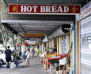
Darra is a south-western suburb in the City of Brisbane, Queensland, Australia. In the 2016 census, Darra had a population of 4,343 people.

<span class="mw-page-title-main">Jindalee, Queensland</span> Suburb of Brisbane, Queensland, Australia

Jindalee is a south-western residential suburb in the City of Brisbane, Queensland, Australia. In the 2016 census, Jindalee had a population of 5,320 people.

<span class="mw-page-title-main">Ashgrove, Queensland</span> Suburb of Brisbane, Queensland, Australia

Ashgrove is a suburb in the City of Brisbane, Queensland, Australia. In the 2021 census, Ashgrove had a population of 13,716 people.

<span class="mw-page-title-main">Bardon, Queensland</span> Suburb of Brisbane, Queensland, Australia

Bardon is a western suburb of the City of Brisbane, Queensland, Australia. It is located approximately 5 kilometres (3.1 mi) north-west of the Brisbane CBD. Bardon is a leafy residential suburb, much of which nestles into the foothills of Mount Coot-tha. It includes the neighbourhood of Rainworth. In the 2021 census, Bardon had a population of 10,153 people.

<span class="mw-page-title-main">Westlake, Queensland</span> Suburb of Brisbane, Queensland, Australia

Westlake is a south-western suburb in the City of Brisbane, Queensland, Australia. In the 2016 census, Westlake had a population of 4,368 people.

<span class="mw-page-title-main">Wacol, Queensland</span> Suburb of Brisbane, Queensland, Australia

Wacol is a suburb in the City of Brisbane, Queensland, Australia. In the 2016 census, Wacol had a population of 3,761 people.

<span class="mw-page-title-main">Aratula</span> Town in Queensland, Australia

Aratula is a rural town and locality in the Scenic Rim Region, Queensland, Australia. In the 2016 census, the locality of Aratula had a population of 532 people.

<span class="mw-page-title-main">Graceville, Queensland</span> Suburb of Brisbane, Queensland, Australia

Graceville is a suburb in the City of Brisbane, Queensland, Australia. In the 2021 census, Graceville had a population of 4,764 people.

<span class="mw-page-title-main">Everton Park, Queensland</span> Suburb of Brisbane, Queensland, Australia

Everton Park is a suburb of the City of Brisbane, Queensland, Australia. In the 2016 census, Everton Park had a population of 8,862 people.

<span class="mw-page-title-main">Mount Ommaney, Queensland</span> Suburb of Brisbane, Queensland, Australia

Mount Ommaney is a south-western riverside suburb in the City of Brisbane, Queensland, Australia. The mountain of the same name is located within the locality. In the 2016 census, Mount Ommaney had a population of 2,360 people.

<span class="mw-page-title-main">Jamboree Heights, Queensland</span> Suburb of Brisbane, Queensland, Australia

Jamboree Heights is a south-western suburb in the City of Brisbane, Queensland, Australia. In the 2016 census, Jamboree Heights had a population of 3,093 people.

<span class="mw-page-title-main">Sumner, Queensland</span> Suburb of Brisbane, Queensland, Australia

Sumner is a south-western suburb in the City of Brisbane, Queensland, Australia. In the 2016 census, Sumner had a population of 595 people.

<span class="mw-page-title-main">Sherwood, Queensland</span> Suburb of Brisbane, Queensland, Australia

Sherwood is a suburb in the City of Brisbane, Queensland, Australia. In the 2021 census, Sherwood had a population of 6,082 people.

<span class="mw-page-title-main">Seventeen Mile Rocks, Queensland</span> Suburb of Brisbane, Queensland, Australia

Seventeen Mile Rocks is a suburb in the City of Brisbane, Queensland, Australia. In the 2016 census, Seventeen Mile Rocks had a population of 2,720 people.

<span class="mw-page-title-main">Richlands, Queensland</span> Suburb of Brisbane, Queensland, Australia

Richlands is an outer south-western suburb in the City of Brisbane, Queensland, Australia. In the 2016 census, Richlands had a population of 3,598 people.

Riverhills is a south-western suburb in the City of Brisbane, Queensland, Australia. It is one of the Centenary suburbs. In the 2016 census, Riverhills had a population of 4,042 people.

The Centenary Suburbs are a group of suburbs in the south-west in the City of Brisbane, Queensland, Australia. The suburbs originated as an "ambitious long-term suburban development proposal that included a number of neighbourhoods, or suburbs, each with sufficient services and facilities for its residents to have their day-to-day needs met without having to go elsewhere".

<span class="mw-page-title-main">Brassall, Queensland</span> Suburb of Ipswich, Queensland, Australia

Brassall is a suburb in the City of Ipswich, Queensland, Australia. In the 2016 census, Brassall had a population of 10,898 people.

References

  1. 1 2 3 Australian Bureau of Statistics (27 June 2017). "Middle Park (SSC)". 2016 Census QuickStats. Retrieved 20 October 2018. OOjs UI icon edit-ltr-progressive.svg
  2. "Jamboree Ward". Brisbane City Council. Archived from the original on 12 March 2017. Retrieved 12 March 2017.
  3. 1 2 "Middle Park – suburb in City of Brisbane (entry 41942)". Queensland Place Names. Queensland Government . Retrieved 26 January 2020.
  4. Google (28 May 2022). "Brisbane GPO to Middle Park" (Map). Google Maps . Google. Retrieved 28 May 2022.
  5. "Queensland Globe". State of Queensland . Retrieved 4 April 2020.
  6. "Plan of the Wolston Estate" (1901) [Map]. Collections. State Library of Queensland.
  7. "SALE OF WOLSTON ESTATE". The Brisbane Courier . Vol. LVIII, no. 13, 651. Queensland, Australia. 12 October 1901. p. 4. Retrieved 21 May 2019 via National Library of Australia.
  8. "LATEST NEWS IN BRIEF". The Queenslander . Vol. LXI, no. 1353. Queensland, Australia. 26 October 1901. p. 780. Retrieved 21 May 2019 via National Library of Australia.
  9. "Year Book" (PDF). Anglican Archdiocese of Brisbane. 2019. p. 138. Archived (PDF) from the original on 15 September 2020. Retrieved 15 September 2020.
  10. 1 2 Queensland Family History Society (2010), Queensland schools past and present (Version 1.01 ed.), Queensland Family History Society, ISBN   978-1-921171-26-0
  11. 1 2 Australian Bureau of Statistics (31 October 2012). "Middle Park (State Suburb)". 2011 Census QuickStats. Retrieved 16 April 2015. OOjs UI icon edit-ltr-progressive.svg
  12. "Jamboree Ward". Brisbane City Council. Archived from the original on 24 May 2015. Retrieved 16 April 2015.
  13. 1 2 3 "State and non-state school details". Queensland Government. 9 July 2018. Archived from the original on 21 November 2018. Retrieved 21 November 2018.
  14. "Middle Park State School" . Retrieved 21 November 2018.
  15. 1 2 "ACARA School Profile 2017". Archived from the original on 22 November 2018. Retrieved 22 November 2018.
  16. "Good News Lutheran School". Archived from the original on 11 November 2018. Retrieved 21 November 2018.
  17. "Metro Middle Park – See you at Metro". Archived from the original on 14 March 2020. Retrieved 4 April 2020.
  18. "Centenary Baptist Church". Archived from the original on 8 March 2020. Retrieved 5 April 2020.
  19. "Location – Centenary Uniting Church" . Retrieved 4 April 2020.
  20. "Good News Lutheran Church". Good News Lutheran Church. Archived from the original on 8 March 2020. Retrieved 4 April 2020.
  21. "St Catherine's Anglican Community – Centenary Suburbs". Archived from the original on 15 July 2006. Retrieved 4 April 2020.
  22. "Centenary Corps". Salvation Army . Retrieved 5 April 2020.