Karawatha, Queensland

Last updated

Karawatha
Brisbane,  Queensland
Karawatha Forest (6971530886).jpg
Karawatha Forest, 2012
Australia Queensland location map.svg
Red pog.svg
Karawatha
Coordinates 27°37′56″S153°04′59″E / 27.6322°S 153.0830°E / -27.6322; 153.0830 (Karawatha (centre of suburb))
Population337 (2021 census) [1]
 • Density39.19/km2 (101.5/sq mi)
Postcode(s) 4117
Area8.6 km2 (3.3 sq mi)
Time zone AEST (UTC+10:00)
Location25.4 km (16 mi) SSE of Brisbane CBD
LGA(s) City of Brisbane
(Calamvale Ward) [2]
State electorate(s) Stretton
Federal division(s) Moreton
Suburbs around Karawatha:
Stretton Kuraby Woodridge
Stretton Karawatha Woodridge
Drewvale Berrinba Logan Central

Karawatha is an outer southern suburb in the City of Brisbane, Queensland, Australia. [3] In the 2021 census, Karawatha had a population of 337 people. [1]

Contents

Geography

Karawatha is 22 kilometres (14 mi) south-east of the Brisbane CBD.

Karawatha is a sparsely populated suburb with few structures and the majority of the land used as undeveloped park land, known as Karawatha Forest.

History

The naming of the suburb Karawatha originates from an Aboriginal word meaning a place with pine trees. [4]

It was formerly known as Berrinba, but now Berrinba is the name of the suburb to the south within Logan City. [4] [5]

Islamic College of Brisbane opened on 5 January 1995. [6]

Faith Christian School opened in 2012. [7]

Demographics

In the 2016 census, Karawatha had a population of 19 people. [8]

In the 2021 census, Karawatha had a population of 337 people. [1]

Education

Islamic College of Brisbane is a private primary and secondary (Prep-12) school for boys and girls at 45 Acacia Road ( 27°37′07″S153°05′35″E / 27.6186°S 153.0931°E / -27.6186; 153.0931 (Islamic College of Brisbane) ). [9] [10] It is adjacent to the Karawatha Forest. In 2018, the school had an enrolment of 1,117 students with 86 teachers (82 full-time equivalent) and 31 non-teaching staff (29 full-time equivalent). [11]

Faith Christian School of Distance Education is a private primary and secondary (Prep-12) school at 129 Garfield Road ( 27°38′26″S153°05′33″E / 27.6406°S 153.0925°E / -27.6406; 153.0925 (Faith Christian School of Distance Education) ). [9] It offers home-based education within a framework of Christian beliefs. [12] It is operated by Christian Home Based Education Ltd. [7]

Attractions

Karawatha Forest Discovery Centre is in Acacia Road ( 27°37′27″S153°05′33″E / 27.6243°S 153.0926°E / -27.6243; 153.0926 (Karawatha Forest Discovery Centre) ). It is operated by Brisbane City Council. [13]

See also

Related Research Articles

<span class="mw-page-title-main">Mansfield, Queensland</span> Suburb of Brisbane, Queensland, Australia

Mansfield is a suburb in the City of Brisbane, Queensland, Australia. In the 2021 census, Mansfield had a population of 8,851 people.

<span class="mw-page-title-main">Algester, Queensland</span> Suburb of Brisbane, Queensland, Australia

Algester is a southern suburb in the City of Brisbane, Queensland, Australia. In the 2021 census, Algester had a population of 9,020 people.

<span class="mw-page-title-main">Mount Gravatt, Queensland</span> Suburb of Brisbane, Queensland, Australia

Mount Gravatt is a southern suburb of the City of Brisbane, Queensland, Australia and a prominent hill and lookout within this suburb. In the 2021 census, Mount Gravatt had a population of 3,733 people.

<span class="mw-page-title-main">Stretton, Queensland</span> Suburb of Brisbane, Queensland, Australia

Stretton is a southern suburb in the City of Brisbane, Queensland, Australia. In the 2021 census, Stretton had a population of 4,686 people.

<span class="mw-page-title-main">Boondall, Queensland</span> Suburb of Brisbane, Australia

Boondall is a northern suburb in the City of Brisbane, Queensland, Australia. In the 2021 census, Boondall had a population of 9,603 people.

<span class="mw-page-title-main">Woodridge, Queensland</span> Town in Queensland, Australia

Woodridge is a town and suburb in the City of Logan, Queensland, Australia. In the 2021 census, the suburb of Woodridge had a population of 12,982 people.

<span class="mw-page-title-main">Nathan, Queensland</span> Suburb of Brisbane, Queensland, Australia

Nathan is a southern suburb in the City of Brisbane, Queensland, Australia. In the 2021 census, Nathan had a population of 1,085 people.

<span class="mw-page-title-main">Thornlands, Queensland</span> Suburb of Redland City, Queensland, Australia

Thornlands is a coastal residential locality in the City of Redland, Queensland, Australia. In the 2021 census, Thornlands had a population of 19,263 people.

<span class="mw-page-title-main">Berrinba, Queensland</span> Suburb of Logan City, Queensland, Australia

Berrinba is a suburb in Logan City, Queensland, Australia. In the 2021 census, Berrinba had a population of 2,615 people.

<span class="mw-page-title-main">Grange, Queensland</span> Suburb of Brisbane, Queensland, Australia

Grange is a northern suburb in the City of Brisbane, Queensland, Australia. In the 2021 census, Grange had a population of 4,615 people.

<span class="mw-page-title-main">Nudgee, Queensland</span> Suburb of Brisbane, Queensland, Australia

Nudgee is a north-eastern suburb in the City of Brisbane, Queensland, Australia. In the 2021 census, Nudgee had a population of 4,377 people.

<span class="mw-page-title-main">Nudgee Beach, Queensland</span> Suburb of Brisbane, Queensland, Australia

Nudgee Beach is a suburb and beach in the City of Brisbane, Queensland, Australia. In the 2021 census, Nudgee Beach had a population of 308 people.

<span class="mw-page-title-main">Archerfield, Queensland</span> Suburb of Brisbane, Queensland, Australia

Archerfield is a mixed-use southern suburb in the City of Brisbane, Queensland, Australia. In the 2021 census, Archerfield had a population of 533 people.

<span class="mw-page-title-main">Willawong, Queensland</span> Suburb of Brisbane, Queensland, Australia

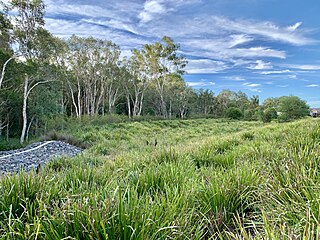
Willawong is an outer southern suburb in the City of Brisbane, Queensland, Australia. In the 2021 census, Willawong had a population of 145 people.

<span class="mw-page-title-main">Durack, Queensland</span> Suburb of Brisbane, Queensland, Australia

Durack is an outer south-western suburb in the City of Brisbane, Queensland, Australia. In the 2016 census, Durack had a population of 7,487 people.

<span class="mw-page-title-main">Carina Heights, Queensland</span> Suburb of Brisbane, Queensland, Australia

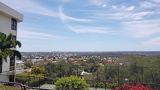
Carina Heights is both a hill and a suburb in the City of Brisbane, Queensland, Australia. It is 10.1 kilometres (6.3 mi) by road south-east of the Brisbane GPO. In the 2021 census, Carina Heights had a population of 7,103 people.

<span class="mw-page-title-main">Salisbury, Queensland</span> Suburb of Brisbane, Queensland, Australia

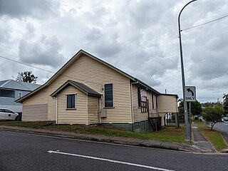
Salisbury is a southern suburb in the City of Brisbane, Queensland, Australia. In the 2021 census, Salisbury had a population of 6,790 people.

<span class="mw-page-title-main">Pallara, Queensland</span> Suburb of Brisbane, Queensland, Australia

Pallara is an outer southern suburb in the City of Brisbane, Queensland, Australia. In the 2021 census, Pallara had a population of 3,861 people.

The Islamic College of Brisbane (ICB) is a co-educational P-12 school in the suburb of Karawatha, City of Brisbane, Queensland, Australia. It offers teaching from Prep year to year twelve.

<span class="mw-page-title-main">Wongaling Beach, Queensland</span> Town in Queensland, Australia

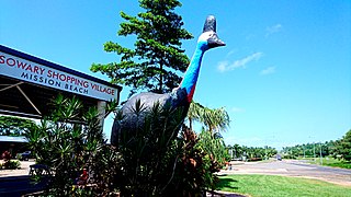
Wongaling Beach is a tropical beachside coastal town and locality in the Cassowary Coast Region, Queensland, Australia. In the 2021 census, Wongaling Beach had a population of 1,323 people.

References

  1. 1 2 3 Australian Bureau of Statistics (28 June 2022). "Karawatha (SAL)". 2021 Census QuickStats. Retrieved 28 February 2023. OOjs UI icon edit-ltr-progressive.svg
  2. "Calamvale Ward". Brisbane City Council. Archived from the original on 4 February 2017. Retrieved 12 March 2017.
  3. "Karawatha – suburb in City of Brisbane (entry 47000)". Queensland Place Names. Queensland Government . Retrieved 18 July 2021.
  4. 1 2 "Karawatha (entry 47000)". Queensland Place Names. Queensland Government . Retrieved 9 May 2014.
  5. "Berrinba (entry 46568)". Queensland Place Names. Queensland Government . Retrieved 9 May 2014.
  6. Queensland Family History Society (2010), Queensland schools past and present (Version 1.01 ed.), Queensland Family History Society, ISBN   978-1-921171-26-0
  7. 1 2 "FaithCSDE – About FaithCSDE". faithcsde.com. Retrieved 20 December 2021.
  8. Australian Bureau of Statistics (27 June 2017). "Karawatha (SSC)". 2016 Census QuickStats. Retrieved 20 October 2018. OOjs UI icon edit-ltr-progressive.svg
  9. 1 2 "State and non-state school details". Queensland Government. 9 July 2018. Archived from the original on 21 November 2018. Retrieved 21 November 2018.
  10. "Islamic College of Brisbane". Archived from the original on 6 December 2018. Retrieved 21 November 2018.
  11. "ACARA School Profile 2018". Australian Curriculum, Assessment and Reporting Authority. Archived from the original on 27 August 2020. Retrieved 28 January 2020.
  12. "Faith Christian School of Distance Education". Archived from the original on 16 January 2019. Retrieved 21 November 2018.
  13. "Karawatha Forest Discovery Centre". Brisbane City Council . Retrieved 20 December 2021.