Glen Esk, Queensland

Last updated

Glen Esk
Queensland
Australia Queensland location map.svg
Red pog.svg
Glen Esk
Coordinates 27°13′24″S152°27′19″E / 27.2233°S 152.4552°E / -27.2233; 152.4552 (Glen Esk (centre of locality))
Population55 (SAL 2021) [1]
Postcode(s) 4312
Area27.1 km2 (10.5 sq mi)
Time zone AEST (UTC+10:00)
Location
LGA(s) Somerset Region
State electorate(s) Nanango
Federal division(s) Blair
Suburbs around Glen Esk:
Esk Murrumba Lake Wivenhoe
Esk Glen Esk Lake Wivenhoe
Esk Esk Moombra

Glen Esk is a locality in the Somerset Region, Queensland, Australia. [2] In the 2021 census, Glen Esk had a population of 55 people. [3]

Contents

Geography

The locality is on the western side of Lake Wivenhoe created by the Wivenhoe Dam across the Brisbane River, although the lake and its shoreline are within the locality of Lake Wivenhoe. [4]

The terrain is mountainous in the north of the locality with named peaks: Mount Esk 444 metres (1,457 ft) and Burrundon Mountain 247 metres (810 ft) above sea level. The southern part of the locality is mostly 80 to 100 metres (260 to 330 ft). For comparison, the lake shoreline is approximately 70 metres (230 ft) above sea level. [4]

The predominant land use is cattle grazing. [4]

History

The locality presumably takes its name from Mount Esk. The mountain and the associated pastoral station were named by pastoralists David Graham and James Ivory in 1843 after the Esk River in Scotland. [5]

A police station was constructed at Glen Esk in 1877. [6]

Glen Esk State School opened circa 1932 and closed circa 1955. [7]

Demographics

In the 2016 census, Glen Esk had a population of 54 people. [8]

In the 2021 census, Glen Esk had a population of 55 people. [3]

Education

There are no schools in Glen Esk. The nearest government primary school is Esk State School in neighbouring Esk to the west. The nearest government secondary school is Toogoolawah State High School in Toogoolawah to the north-west. [4]

Related Research Articles

<span class="mw-page-title-main">Esk, Queensland</span> Town in Queensland, Australia

Esk is a town and locality in the Somerset Region in South East Queensland, Australia. In the 2016 census, Esk had a population of 1,698 people.

<span class="mw-page-title-main">Moore, Queensland</span> Town in Queensland, Australia

Moore is a rural town and locality in the Somerset Region, Queensland, Australia. In the 2016 census, the locality of Moore had a population of 296 people.

<span class="mw-page-title-main">West Moreton</span> Region in Queensland, Australia

West Moreton is a region of the Australian state of Queensland, consisting of the entire rural western portion of South East Queensland. It sits inland from both the Brisbane metropolitan area and the Gold Coast and to the east of the Darling Downs. Much of the region lies in the Great Dividing Range. The name appears in the names of many community organisations and is used by the Australian Bureau of Statistics, although is not widely used otherwise due to the prevalence of South East Queensland in planning and other documents.

<span class="mw-page-title-main">Bryden, Queensland</span> Suburb of Somerset Region, Queensland, Australia

Bryden is a rural locality in the Somerset Region, Queensland, Australia. In the 2016 census, Bryden had a population of 33 people.

<span class="mw-page-title-main">Colinton, Queensland</span> Suburb of Somerset Region, Queensland, Australia

Colinton is a rural locality in the Somerset Region, Queensland, Australia. In the 2016 census, Colinton had a population of 75 people.

<span class="mw-page-title-main">Crossdale, Queensland</span> Suburb of Somerset Region, Queensland, Australia

Crossdale is a rural locality in the Somerset Region, Queensland, Australia. In the 2016 census, Crossdale had a population of 75 people.

<span class="mw-page-title-main">Mount Byron, Queensland</span> Suburb of Somerset Region, Queensland, Australia

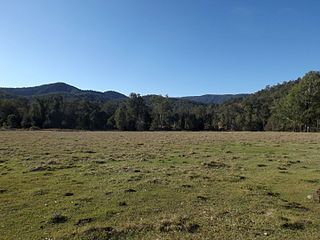
Mount Byron is a rural locality in the Somerset Region, Queensland, Australia. In the 2016 census, Mount Byron had a population of 18 people.

<span class="mw-page-title-main">Hazeldean, Queensland</span> Suburb of Somerset Region, Queensland, Australia

Hazeldean is a rural locality in the Somerset Region, Queensland, Australia. In the 2016 census, Hazeldean had a population of 262 people.

Coal Creek is a rural locality in the Somerset Region, Queensland, Australia. In the 2021 census, Coal Creek had a population of 50 people.

Cooeeimbardi is a rural locality in the Somerset Region, Queensland, Australia. In the 2016 census Cooeeimbardi had a population of 7 people.

Murrumba is a rural locality in the Somerset Region, Queensland, Australia. In the 2016 census, Murrumba had a population of 16 people.

Mount Stanley is a rural locality in the Somerset Region, Queensland, Australia. In the 2016 census Mount Stanley had a population of 7 people.

<span class="mw-page-title-main">Wivenhoe Hill, Queensland</span> Suburb of Somerset Region, Queensland, Australia

Wivenhoe Hill is a locality in the Somerset Region, Queensland, Australia. In the 2016 census, Wivenhoe Hill had a population of 9 people.

Moombra is a locality in the Somerset Region, Queensland, Australia. In the 2016 census, Moombra had a population of 9 people.

Caboonbah is a rural locality in the Somerset Region, Queensland, Australia. In the 2016 census, Caboonbah had a population of 14 people.

<span class="mw-page-title-main">Biarra, Queensland</span> Suburb of Somerset Region, Queensland, Australia

Biarra is a rural locality in the Somerset Region, Queensland, Australia. In the 2021 census, Biarra had a population of 270 people.

Scrub Creek is a rural locality in the Somerset Region, Queensland, Australia. In the 2016 census, Scrub Creek had a population of 32 people.

Eskdale is a rural locality in the Somerset Region, Queensland, Australia. In the 2021 census, Eskdale had a population of 34 people.

Ivory Creek is a rural locality in the Somerset Region, Queensland, Australia. In the 2021 census, Ivory Creek had a population of 49 people.

Ottaba is a rural locality in the Somerset Region, Queensland, Australia. In the 2016 census, Ottaba had a population of 54 people.

References

  1. Australian Bureau of Statistics (28 June 2022). "Glen Esk (Suburb and Locality)". Australian Census 2021 QuickStats. Retrieved 28 June 2022.  OOjs UI icon edit-ltr-progressive.svg
  2. "Glen Esk – locality in Somerset Region (entry 45518)". Queensland Place Names. Queensland Government . Retrieved 11 June 2019.
  3. 1 2 Australian Bureau of Statistics (28 June 2022). "Glen Esk (SAL)". 2021 Census QuickStats. Retrieved 28 February 2023. OOjs UI icon edit-ltr-progressive.svg
  4. 1 2 3 4 "Queensland Globe". State of Queensland . Retrieved 11 June 2019.
  5. "Mount Esk – mountain in the Somerset Region (entry 11859)". Queensland Place Names. Queensland Government . Retrieved 16 May 2019.
  6. "The Brisbane Courier". The Brisbane Courier . Vol. XXXI, no. 3, 035. Queensland, Australia. 9 February 1877. p. 2. Archived from the original on 9 August 2023. Retrieved 16 June 2019 via National Library of Australia.
  7. Queensland Family History Society (2010), Queensland schools past and present (Version 1.01 ed.), Queensland Family History Society, ISBN   978-1-921171-26-0
  8. Australian Bureau of Statistics (27 June 2017). "Glen Esk (SSC)". 2016 Census QuickStats. Retrieved 20 October 2018. OOjs UI icon edit-ltr-progressive.svg

Further reading