Hazeldean Queensland | |||||||||||||||
---|---|---|---|---|---|---|---|---|---|---|---|---|---|---|---|
Coordinates | 27°01′25″S152°32′47″E / 27.0236°S 152.5463°E Coordinates: 27°01′25″S152°32′47″E / 27.0236°S 152.5463°E | ||||||||||||||
Population | 262 (2016 census) [1] | ||||||||||||||
• Density | 3.018/km2 (7.818/sq mi) | ||||||||||||||
Postcode(s) | 4515 | ||||||||||||||
Area | 86.8 km2 (33.5 sq mi) | ||||||||||||||
Time zone | AEST (UTC+10:00) | ||||||||||||||
Location | |||||||||||||||
LGA(s) | Somerset Region | ||||||||||||||
State electorate(s) | Nanango | ||||||||||||||
Federal division(s) | Blair | ||||||||||||||
|
Hazeldean is a rural locality in the Somerset Region, Queensland, Australia. [2] In the 2016 census, Hazeldean had a population of 262 people. [1]
Lake Somerset occupies the east of the locality. Lake Somerset is the reservoir created by the Somerset Dam impounding the Stanley River. [3] [4]
The western part of the locality is elevated and remains mostly vegetated. The strip of land between the lake and the mountains is mostly rural-residential. [3]
The Deer Reserve National Park ( 27°04′52″S152°31′34″E / 27.0811°S 152.526°E ) is in the south-west of the locality and includes Mount Brisbane ( 27°05′19″S152°31′38″E / 27.0886°S 152.5272°E ) in the south-western corner of the locality which is 684 metres (2,244 ft) above sea level. [3] [5] [6] The national park is 3,228 hectares (7,980 acres) and extends into the neighbouring localities of Fulham to the west, Cooeeimbardi to the south-west and Somerset Dam (the locality) to the south. [3]
The Deer Reserve State Forest ( 27°00′02″S152°29′41″E / 27.0006°S 152.4947°E ) is in the north-west of the locality and includes Mount Goonneringerringgi ( 27°00′00″S152°31′17″E / 26.9999°S 152.5215°E ) at 495 metres (1,624 ft) and Mount McConnel ( 26°59′44″S152°30′32″E / 26.9956°S 152.5089°E ) at 277 metres (909 ft). [7] [8] The state forest is 2,894 hectares (7,150 acres) and extends into the neighbouring localities of Gregors Creek to the north-west and Fulham to the west. [3]
Stanley River Provisional School opened on 26 January 1898 with an initial enrolment of 24 students. [9] On 1 January 1909, it became Stanley River State School. The school was on the eastern side of the Esk Kilcoy Road (approx 27°00′24″S152°33′14″E / 27.0068°S 152.5538°E ). [10] [11] [3]
In the 1920s, a 300 metre tramway was constructed in Hazeldean to move timber down a steep descent from mountain top to bottom. [12]
As parts of Hazeldean would be flooded following the completion of the Somerset Dam across the Stanley River, in 1951, it was necessary to plan for road re-alignments. As part of this, it was decided to relocate the Stanley River State School to higher ground. A new 5.5 acres (2.2 ha) was chosen for the new school site further south on the Esk Kilcoy Road and the school buildings including the teacher's residence relocated to the new site. [9] [13] Down to 12 students enrolled, the school closed on 31 December 1973. On 9 July 1975, the Stanley River Field Study Centre opened in the school buildings, becoming the Stanley River Environmental Education Centre in 1990. [9] [14]
In the 2011 census, the population of Hazeldean was 267. [15]
In the 2016 census, Hazeldean had a population of 262 people. [1]
Stanley River Environmental Education Centre is an Outdoor and Environmental Education Centre at 3856 Esk-Kilcoy Road ( 27°00′39″S152°33′09″E / 27.0107°S 152.5526°E ). [16] [17]
There are no mainstream schools in Hazeldean. The nearest government primary school is Kilcoy State School in Kilcoy to the north-east. The nearest government secondary schools are Kilcoy State High School in Kilcoy and Toogoolawah State High School in Toogoolawah to the south-west. [3]
There are two boat ramps into the Lake Somerset Dam off Kirkleigh Road: [18]
Lake Somerset Holiday Park is a large park on the edge of Somerset Dam which offers a range of accommodation including cabins and camping.[ citation needed ]
Esk is a town and locality in the Somerset Region in South East Queensland, Australia. In the 2016 census, Esk had a population of 1,698 people.
Lake Wivenhoe is the name both a lake formed by the Wivenhoe Dam and the locality which contains it in the Somerset Region, Queensland, Australia. In the 2016 census, Lake Wivenhoe had a population of three people.
Kilcoy is a rural town and locality in the Somerset Region, Queensland, Australia. In the 2016 census, the locality of Kilcoy had a population of 1,898 people.
Woodford is a rural town and locality in the Moreton Bay Region, Queensland, Australia. In the 2016 census, the locality of Woodford had a population of 3,458 people.
The Shire of Kilcoy was a local government area in South East Queensland, Australia, about 95 kilometres (59 mi) northwest of Brisbane along the D'Aguilar Highway, not far from the Sunshine Coast. The shire covered an area of 1,445.2 square kilometres (558.0 sq mi), and existed from 1912 until its merger with the Shire of Esk to form the Somerset Region on 15 March 2008.
The Somerset Region is a local government area located in the West Moreton region of South East Queensland, Australia, about 100 kilometres (62 mi) northwest of Brisbane and centred on the town of Esk. It was created in 2008 from a merger of the Shire of Esk and the Shire of Kilcoy. It is commonly known as the Brisbane Valley, due to the Brisbane River which courses through the region, although significant parts of the region lie outside the hydrological Brisbane Valley itself.
Moore is a rural town and locality in the Somerset Region, Queensland, Australia. In the 2016 census the locality of Moore had a population of 296 people.
Crossdale is a rural locality in the Somerset Region, Queensland, Australia. In the 2016 census Crossdale had a population of 75 people.
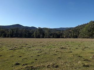
Mount Byron is a rural locality in the Somerset Region, Queensland, Australia. In the 2016 census Mount Byron had a population of 18 people.
Mount Delaney is a rural locality in the Moreton Bay Region, Queensland, Australia. In the 2016 census Mount Delaney had a population of 85 people.
Mount Archer is a mountain and a rural locality in the Somerset Region, Queensland, Australia. In the 2016 census the locality of Mount Archer had a population of 305 people.
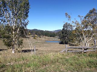
Glenfern is a rural locality in the Somerset Region, Queensland, Australia. In the 2016 census Glenfern had a population of 10 people.
Winya is a rural locality in the Somerset Region, Queensland, Australia. In the 2016 census, Winya had a population of 72 people.
Cooeeimbardi is a rural locality in the Somerset Region, Queensland, Australia. In the 2016 census Cooeeimbardi had a population of 7 people.
Fulham is a rural locality in the Somerset Region, Queensland, Australia. In the 2016 census Fulham had a population of 35 people.
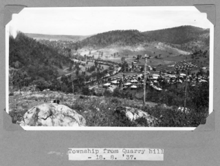
Somerset Dam is a rural town and locality in the Somerset Region, Queensland, Australia. In the 2016 census, Somerset Dam had a population of 69 people. When first being planned, it was unofficially known as the Stanley River township.
Glen Esk is a locality in the Somerset Region, Queensland, Australia. In the 2016 census, Glen Esk had a population of 54 people.
Westvale is a locality in the Somerset Region, Queensland, Australia. In the 2016 census, Westvale had a population of 0 people.
Biarra is a rural locality in the Somerset Region, Queensland, Australia. In the 2016 census, Biarra had a population of 257 people.
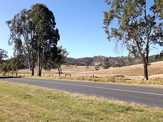
Gregors Creek is a rural locality in the Somerset Region, Queensland, Australia. In the 2016 census, Gregors Creek had a population of 96 people.
Media related to Hazeldean, Queensland at Wikimedia Commons