Colinton, Queensland

Last updated

Map all coordinates using: OpenStreetMap
Colinton
Queensland
Colinton War Memorial.JPG
Colinton War Memorial, 2010
Australia Queensland location map.svg
Red pog.svg
Colinton
Coordinates 26°55′54″S152°19′34″E / 26.9316°S 152.3261°E / -26.9316; 152.3261 (Colinton (centre of locality))
Population75 (2016 census) [1]
 • Density0.536/km2 (1.388/sq mi)
Postcode(s) 4314
Area139.9 km2 (54.0 sq mi)
Time zone AEST (UTC+10:00)
Location
LGA(s) Somerset Region
State electorate(s) Nanango
Federal division(s) Blair
Suburbs around Colinton:
Cherry Creek Moore Harlin
Cherry Creek Colinton Harlin
Anduramba Harlin Harlin

Colinton is a rural locality in the Somerset Region, Queensland, Australia. [2] In the 2016 census, Colinton had a population of 75 people. [1]

Contents

Geography

Colinton lies within the water catchment area of Emu Creek, a tributary of the Brisbane River. The creek marks a portion of both the southern and western boundary and the Brisbane River is aligned with the eastern boundary. The D'Aguilar Highway passes through the east where the Brisbane Valley railway line also once passed. Benarkin State Forest roughly covers the western third of Colinton.[ citation needed ]

Colinton has the following mountains:

History

House at Colinton pastoral run, 1904 StateLibQld 2 46259 House at Colinton Station, Queensland, 1904.jpg
House at Colinton pastoral run, 1904
Land sales for Colinton, 1904 StateLibQld 2 47760 Advertisement for the sale of the Colinton Estate, Colinton, ca. 1904.jpg
Land sales for Colinton, 1904

The district takes its name from the pastoral run owned by the Balfour family which was in turn named for their home town in Colinton, Lothian, Scotland. [2]

In 1877, 23,000 acres (9,300 ha) were resumed from the Colinton pastoral run and offered for selection on 19 April 1877. [6]

Colinton Provisional School opened in 1879 but closed in early 1880. It reopened in 1906 and on 1 January 1909 became Colinton State School. It closed in 1969. [7] It was on Emu Creek Road ( 26°56′00″S152°19′02″E / 26.9333°S 152.3171°E / -26.9333; 152.3171 (Colinton State School (former)) ). [8] [9] [10]

On 22 November 1910, the Brisbane Valley railway line opened its fifth stage from Toogoolawah to Linville via Colinton, [11] which was served by the Nurinda railway station ( 26°55′50″S152°20′06″E / 26.9306°S 152.3351°E / -26.9306; 152.3351 (Nurinda railway station (former)) ). [12] The Brisbane Valley railway ceased operations in 1993. [13]

The Colinton War Memorial was unveiled outside the School of Arts on 18 January 1917 by Member of the Queensland Legislative Assembly for Stanley, Henry Plantagenet Somerset. [14] [15] [16] The 1974 flood of the Brisbane River did not affect the Colinton War Memorial, but resulted in changes to the highway. As part of these changes, the Esk Shire Council relocated the war memorial to its current position in the road reserve at the corner of Emu Creek Road and the D'Aguilar Highway. [17]

In the 2011 census, Colinton was included within the neighbouring locality of Moore, which together had a population of 315 people. [18]

In the 2016 census, Colinton had a population of 75 people. [1]

On 1 February 2018, Colinton's postcode changed from 4306 to 4314. [19]

Heritage listings

Colinton has the following heritage-listed sites:

Economy

There are a number of homesteads in the locality: [20]

Education

There are no schools in Colinton. The nearest government primary schools are Harlin State School in neighbouring Harlin to the east and Linville State School in Linville to the north. The nearest government secondary schools are Yarraman State School (to Year 10 only) in Yarraman to the north-west. For secondary education to Year 12, the nearest government schools are Toogoolawah State High School in Toogoolawah to the south and Nanango State High School in Nanango to the north-west. [10]

Related Research Articles

<span class="mw-page-title-main">Toogoolawah</span> Town in Queensland, Australia

Toogoolawah is a rural town and locality in the Somerset Region, Queensland, Australia. In the 2016 census, Toogoolawah had a population of 1,279 people.

<span class="mw-page-title-main">Linville, Queensland</span> Town in Queensland, Australia

Linville is a rural town and locality in the Somerset Region, Queensland, Australia. In the 2016 census, Linville had a population of 156 people.

<span class="mw-page-title-main">Somerset Region</span> Local government area in Queensland, Australia

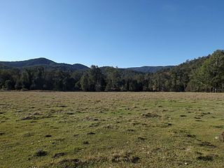
The Somerset Region is a local government area located in the West Moreton region of South East Queensland, Australia, about 100 kilometres (62 mi) northwest of Brisbane and centred on the town of Esk. It was created in 2008 from a merger of the Shire of Esk and the Shire of Kilcoy. It is commonly known as the Brisbane Valley, due to the Brisbane River which courses through the region, although significant parts of the region lie outside the hydrological Brisbane Valley itself.

<span class="mw-page-title-main">Brisbane Valley railway line</span>

The Brisbane Valley railway line was a railway connection in Queensland, Australia connecting Ipswich, west of Brisbane, to the upper Brisbane River valley. Progressively opened between 1884 and 1913, the railway provided a vital transport link between Ipswich and Yarraman and forged development and prosperity along its path. The line acquired its serpentine reputation because it did not take a straight course when faced with a hill or gully.

<span class="mw-page-title-main">Moore, Queensland</span> Town in Queensland, Australia

Moore is a rural town and locality in the Somerset Region, Queensland, Australia. In the 2016 census, the locality of Moore had a population of 296 people.

<span class="mw-page-title-main">Harlin</span> Town in Queensland, Australia

Harlin is a rural town and locality in the Somerset Region, Queensland, Australia. In the 2016 census, the locality of Harlin had a population of 173 people.

<span class="mw-page-title-main">Bryden, Queensland</span> Suburb of Somerset Region, Queensland, Australia

Bryden is a rural locality in the Somerset Region, Queensland, Australia. In the 2016 census, Bryden had a population of 33 people.

<span class="mw-page-title-main">Benarkin</span> Town in Queensland, Australia

Benarkin is a rural town and locality in the South Burnett Region, Queensland, Australia. The nearby town of Blackbutt is the origin of the town and the two towns are often referred to as the joint entity Blackbutt-Benarkin. In the 2016 census, Benarkin had a population of 61 people.

<span class="mw-page-title-main">Crossdale, Queensland</span> Suburb of Somerset Region, Queensland, Australia

Crossdale is a rural locality in the Somerset Region, Queensland, Australia. In the 2016 census, Crossdale had a population of 75 people.

<span class="mw-page-title-main">Mount Byron, Queensland</span> Suburb of Somerset Region, Queensland, Australia

Mount Byron is a rural locality in the Somerset Region, Queensland, Australia. In the 2016 census, Mount Byron had a population of 18 people.

<span class="mw-page-title-main">Harlin Rail Bridge</span> Historic site in Queensland, Australia

Harlin Rail Bridge is a heritage-listed railway bridge over Ivory Creek at Harlin, Somerset Region, Queensland, Australia. It was designed by Queensland Railways and built in 1910 by Queensland Railways. It was added to the Queensland Heritage Register on 27 November 2008. It was destroyed in 2013 as a consequence of flooding associated with Cyclone Oswald.

Mount Stanley is a rural locality in the Somerset Region, Queensland, Australia. In the 2016 census Mount Stanley had a population of 7 people.

<span class="mw-page-title-main">Colinton War Memorial</span> Historic site in Queensland, Australia

Colinton War Memorial is a heritage-listed war memorial at the corner of the D'Aguilar Highway and Emu Creek Road, Colinton, Somerset Region, Queensland, Australia. It was built in 1917. It was added to the Queensland Heritage Register on 15 July 2016.

Caboonbah is a rural locality in the Somerset Region, Queensland, Australia. In the 2016 census, Caboonbah had a population of 14 people.

Gregors Creek is a rural locality in the Somerset Region, Queensland, Australia. In the 2021 census, Gregors Creek had a population of 87 people.

Scrub Creek is a rural locality in the Somerset Region, Queensland, Australia. In the 2016 census, Scrub Creek had a population of 32 people.

Ivory Creek is a rural locality in the Somerset Region, Queensland, Australia. In the 2021 census, Ivory Creek had a population of 49 people.

Mount Hallen is a rural locality in the Somerset Region, Queensland, Australia. In the 2021 census, Mount Hallen had a population of 457 people.

Ottaba is a rural locality in the Somerset Region, Queensland, Australia. In the 2016 census, Ottaba had a population of 54 people.

Emu Creek is a rural locality in the Toowoomba Region, Queensland, Australia. In the 2021 census, Emu Creek had a population of 113 people.

References

  1. 1 2 3 Australian Bureau of Statistics (27 June 2017). "Colinton (SSC)". 2016 Census QuickStats. Retrieved 20 October 2018. OOjs UI icon edit-ltr-progressive.svg
  2. 1 2 "Colinton – locality in Somerset Region (entry 44853)". Queensland Place Names. Queensland Government . Retrieved 29 December 2020.
  3. 1 2 "Mountain peaks and capes - Queensland". Queensland Open Data. Queensland Government. 12 November 2020. Archived from the original on 25 November 2020. Retrieved 25 November 2020.
  4. "Glenhowden Mountain – mountain in Somerset Region (entry 13987)". Queensland Place Names. Queensland Government . Retrieved 25 November 2020.
  5. "Mount Calabash – mountain in Somerset Region (entry 5699)". Queensland Place Names. Queensland Government . Retrieved 25 November 2020.
  6. "Proclamations under the New Land Acts". The Brisbane Courier . Queensland, Australia. 2 March 1877. p. 3. Archived from the original on 27 August 2020. Retrieved 19 February 2020 via Trove.
  7. Queensland Family History Society (2010), Queensland schools past and present (Version 1.01 ed.), Queensland Family History Society, ISBN   978-1-921171-26-0
  8. "Parish of Colinton sheet 2" (Map). Queensland Government. 1961. Archived from the original on 6 April 2022. Retrieved 6 April 2022.
  9. "Blackbutt" (Map). Queensland Government. 1944. Archived from the original on 25 January 2021. Retrieved 6 April 2022.
  10. 1 2 "Queensland Globe". State of Queensland . Retrieved 6 April 2022.
  11. Kerr, John (1990). Triumph of narrow gauge : a history of Queensland Railways. Boolarong Publications. pp. 224–225. ISBN   978-0-86439-102-5.
  12. "Railway stations and sidings - Queensland". Queensland Open Data. Queensland Government. 2 October 2020. Archived from the original on 5 October 2020. Retrieved 5 October 2020.
  13. "Steaming ahead on the Brisbane Valley rail trail". ABC Brisbane. Australian Broadcasting Corporation. 29 July 2010. Archived from the original on 13 December 2013. Retrieved 9 August 2012.
  14. "Colinton War Memorial". Monument Australia. Archived from the original on 7 April 2014. Retrieved 4 April 2014.
  15. "Esk Notes". Queensland Times . Vol. LVII, no. 9763. Queensland, Australia. 25 January 1917. p. 6 (DAILY.). Archived from the original on 6 April 2022. Retrieved 6 April 2022 via National Library of Australia.
  16. "COLINTON HONOUR ROLL". Queensland Times . Vol. LVII, no. 9765. Queensland, Australia. 27 January 1917. p. 5 (DAILY). Archived from the original on 6 April 2022. Retrieved 6 April 2022 via National Library of Australia.
  17. 1 2 "Colinton War Memorial (entry 650029)". Queensland Heritage Register . Queensland Heritage Council. Retrieved 16 February 2018.
  18. Australian Bureau of Statistics (31 October 2012). "Moore". 2011 Census QuickStats. Retrieved 19 April 2014. OOjs UI icon edit-ltr-progressive.svg
  19. "Blackbutt To Get New Postcode". southburnett.com.au. 17 November 2017. Archived from the original on 17 May 2018. Retrieved 5 July 2021.
  20. "Homesteads - Queensland". Queensland Open Data. Queensland Government. 18 November 2020. Archived from the original on 24 November 2020. Retrieved 24 November 2020.

Further reading