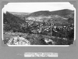
Lake Wivenhoe

Last updated

Map all coordinates using: OpenStreetMap
Lake Wivenhoe
Queensland
Lake Wivenhoe, Queensland.JPG
Australia Queensland location map.svg
Red pog.svg
Lake Wivenhoe
Coordinates 27°18′55″S152°34′04″E / 27.3152°S 152.5677°E / -27.3152; 152.5677 (Lake Wivenhoe (centre of locality))
Population3 (2016 census) [1]
 • Density0.0148/km2 (0.038/sq mi)
Postcode(s) 4311
Area202.5 km2 (78.2 sq mi)
Time zone AEST (UTC+10:00)
LGA(s) Somerset Region
State electorate(s) Nanango
Federal division(s) Blair

Lake Wivenhoe is the name both an artificial lake formed by the Wivenhoe Dam and the locality which contains it in the Somerset Region, Queensland, Australia. [2] [3] In the 2016 census, Lake Wivenhoe had a population of three people. [1]

Contents

Geography

The locality includes the dam wall and associated water management infrastructure at the south, the lake created by the dam, sections of Brisbane River and Stanley River as they flow into the lake from the north and a narrow strip of land around the dam, the lake and river the sections. The lake's boundaries are very irregular and this is reflected in the very irregular boundaries of the locality. The locality is entirely set aside for water management purposes. [4]

Due to its unusual shape, Lake Wivenhoe has many adjacent localities including (commencing from the dam wall in the south and proceeding clockwise: Wivenhoe Pocket, Patrick Estate, Wivenhoe Hill, Coominya, Moombra, Glen Esk, Murrumba, Coal Creek, Caboonbah, Mount Beppo, Cressbrook, Lower Cressbrook, Cooeeimbardi, Somerset Dam, Crossdale, Bryden, Dundas, and Split Yard Creek. [4]

The Brisbane Valley Highway passes through the south of the locality as it travels across the top of the dam wall. [4]

Wash Pool Knoll is a hill on the south-western bank of the lake ( 27°22′17″S152°36′30″E / 27.3714°S 152.6084°E / -27.3714; 152.6084 (Wash Pool Knoll) ) 84 metres (276 ft) above sea level. [5]

The formation of the lake created numerous headlands, inlets, bays and islands.

Headlands

Headlands into the lake include: [6]

Inlets and bays

Inlets and bays in the lake include: [22]

Islands

There is one island in the lake itself: [43]

and two others in the Brisbane River leading into the lake:

History

The name Wivenhoe comes from the name of the pastoral property established circa 1845 by Edmund Blucher Uhr, which took its name from the town of Wivenhoe in Essex, England. [2]

The heritage-listed Caboonbah Homestead was located on to the north-west of the lake (near but not within the locality of Caboonbah) where it was a tourist attraction operated by the Brisbane Valley Historical Society until the homestead burned down in 2009. [47]

In the 2016 census Lake Wivenhoe had a population of 3 people. [1]

Heritage listings

Caboonbah homestead, 2009 Caboonbah homestead 2009.jpg
Caboonbah homestead, 2009

Lake Wivenhoe has a number of heritage-listed sites, including:

Transport

There are three main roads in the area. The Brisbane Valley Highway comes to the lake from the south and then travels along the western side of the lake towards Esk. Wivenhoe Somerset Road separates from the highway at the south of the lake and travels along the eastern side of the dam towards Somerset Dam. Due to the irregular shape of the boundaries of the locality around the lake, both roads weave through the locality and the adjacent localities on each side of the lake. Northbank Parkway comes from Mount Glorious to the east and terminates on the east of the lake at Wivenhoe Somerset Road. [4]

Northbrook Parkway heliport is at the junction of Wivenhoe Somerset Road and Northbank Parkway ( 27°18′40″S152°37′07″E / 27.3110°S 152.6185°E / -27.3110; 152.6185 (Northbrook Parkway heliport) ). [49]

Attractions and amenities

Although it is not a populated area, Lake Wivenhoe offers a range of outdoor recreational facilities for camping, picnics, swimming, fishing and water sports. A stocked impoundment permit is required to fish in the dam. [50] Swimming is permitted and camp sites have been established. Electric and non-powered boating with a permit is allowed, but domestic animals are banned. [51]

West of the lake

Cormorant Bay Recreation Area has picnic and barbeque facilities and a children's playground. It is suitable for walking and fishing. It is off the Brisbane Valley Highway ( 27°24′01″S152°37′15″E / 27.4003°S 152.6207°E / -27.4003; 152.6207 (Cormorant Bay Recreation Area) ). [52]

Wivenhoe Dam Spillway has a lookout over the dam spillway. It has picnic and barbeque facilities. It is off the Brisbane Valley Highway ( 27°23′46″S152°36′32″E / 27.3962°S 152.6088°E / -27.3962; 152.6088 (Wivenhoe Dam Spillway Lookout) ). [53] [52]

Lake Wivenhoe Information Centre provides information about the dam and the lake. It is off the Brisbane Valley Highway ( 27°23′25″S152°35′39″E / 27.3904°S 152.5942°E / -27.3904; 152.5942 (Wivenhoe Information Centre) ). [54]

Wivenhoe Hill Trails are for walking, cycling and horse riding. They are off Fig Tree Road ( 27°22′55″S152°36′11″E / 27.3820°S 152.6031°E / -27.3820; 152.6031 (Wivenhoe Hill Trails) ). [52]

Logan Complex has three separate areas, one for day use ( 27°20′57″S152°32′43″E / 27.3493°S 152.5453°E / -27.3493; 152.5453 (Logan Inlet day use area) ) and two for camping: Captain Logan camp ground ( 27°20′57″S152°32′57″E / 27.3493°S 152.5491°E / -27.3493; 152.5491 (Logan Inlet camping area) ) and the Lumley Hill camp ground ( 27°20′50″S152°33′07″E / 27.3473°S 152.5520°E / -27.3473; 152.5520 (Lumley Hill camp ground) ). There are picnic and barbeque facilities and a children's playground. This area is suitable for swimming, fishing, canoeing and water sports. [52] Logan Complex is on Logan Inlet Road on the western side of the lake. [52] It has a boat ramp ( 27°21′00″S152°32′37″E / 27.3499°S 152.5435°E / -27.3499; 152.5435 (Logan Inlet boat ramp) ). [55]

Hamon Cove Recreation Area has picnic and barbeque facilities and is suitable for fishing, canoeing and water sports. It is on the western side of the lake off the Brisbane Valley Highway ( 27°18′03″S152°31′05″E / 27.3009°S 152.5180°E / -27.3009; 152.5180 (Hamon Cove Recreation Area) ). [52] It has a boat ramp ( 27°18′04″S152°31′06″E / 27.3012°S 152.5184°E / -27.3012; 152.5184 (Hamon Cove boat ramp) ). [55]

East of the lake

Billies Bay Recreation Area has picnic and barbeque facilities. This area is suitable for swimming, fishing, canoeing and water sports. It is off Bryden Road ( 27°20′22″S152°36′50″E / 27.3394°S 152.6138°E / -27.3394; 152.6138 (Billies Bay Recreation Area) ). [52] It has a boat ramp ( 27°20′27″S152°36′52″E / 27.3408°S 152.6145°E / -27.3408; 152.6145 (Billies Bay boat ramp) ). [55]

Hays Landing Recreation Area has picnic and barbeque facilities. This area is suitable for fishing, canoeing and water sports. It is off Bryden Road ( 27°20′05″S152°36′23″E / 27.3348°S 152.6064°E / -27.3348; 152.6064 (Hays Landing Recreation Area) ). It has a boat ramp ( 27°20′02″S152°36′36″E / 27.3340°S 152.6099°E / -27.3340; 152.6099 (Hays Landing boat ramp) ). [52]

North of the lake

O'Shea's Crossing Rest Area has picnic and barbeque facilities and is suitable for fishing and canoeing. It is on the corner of Esk Kilcoy Road and Cooeeimbardi Road ( 27°08′14″S152°30′41″E / 27.1373°S 152.5115°E / -27.1373; 152.5115 (O'Shea's Crossing Rest Area) ). [52]

Related Research Articles

<span class="mw-page-title-main">Esk, Queensland</span> Town in Queensland, Australia

Esk is a town and locality in the Somerset Region in South East Queensland, Australia. In the 2016 census, Esk had a population of 1,698 people.

<span class="mw-page-title-main">Wivenhoe Dam</span> Dam in South East Queensland

The Wivenhoe Dam is a rock and earth-fill embankment dam with a concrete spillway across the Brisbane River in South East Queensland, Australia. The dam takes it names from the local Wivenhoe Pocket rural community. The dam wall is located about 80 kilometres (50 mi) by road from the centre of Brisbane. The primary purpose of the dam is the supply of potable water for the Brisbane and Ipswich regions. The dam also provides for flood mitigation control, hydroelectricity, and recreation. The impounded reservoir is called Lake Wivenhoe and the dam, the lake and a narrow strip of surrounding land forms a locality also called Lake Wivenhoe.

<span class="mw-page-title-main">Fraser Island, Queensland</span> Town in Queensland, Australia

K'gari, also known as Fraser Island, is a locality on the island of K'gari in the Fraser Coast Region, Queensland, Australia. In the 2016 census the locality then known as Fraser Island had a population of 182 people.

<span class="mw-page-title-main">Fernvale, Queensland</span> Town in Queensland, Australia

Fernvale is a rural town and locality in the Somerset Region, Queensland, Australia. In the 2016 census, the locality of Fernvale had a population of 3,209 people.

<span class="mw-page-title-main">Somerset Region</span> Local government area in Queensland, Australia

The Somerset Region is a local government area located in the West Moreton region of South East Queensland, Australia, about 100 kilometres (62 mi) northwest of Brisbane and centred on the town of Esk. It was created in 2008 from a merger of the Shire of Esk and the Shire of Kilcoy. It is commonly known as the Brisbane Valley, due to the Brisbane River which courses through the region, although significant parts of the region lie outside the hydrological Brisbane Valley itself.

<span class="mw-page-title-main">Caboonbah Undenominational Church</span>

Caboonbah Undenominational Church is a union church on the Cressbrook-Caboonbah Road, Mount Beppo, approximately 21 kilometres (13 mi) from Toogoolawah in the Somerset Region of South East Queensland, Australia. It was founded by Henry Plantagenet Somerset, and built by Lars Andersen in 1905 to serve a farming community at Mount Beppo. The wooden structure was designed by Mrs Katherine Rose Somerset and takes its name, "Caboonbah", from the Somerset family homestead, Caboonbah Homestead, nearby.

<span class="mw-page-title-main">Dundas, Queensland</span> Suburb of Somerset Region, Queensland, Australia

Dundas is a rural locality in the Somerset Region, Queensland, Australia. In the 2016 census Dundas had a population of 77 people.

<span class="mw-page-title-main">Crossdale, Queensland</span> Suburb of Somerset Region, Queensland, Australia

Crossdale is a rural locality in the Somerset Region, Queensland, Australia. In the 2016 census, Crossdale had a population of 75 people.

<span class="mw-page-title-main">Mount Beppo, Queensland</span> Suburb of Somerset Region, Queensland, Australia

Mount Beppo is a rural locality in the Somerset Region, Queensland, Australia. In the 2016 census, Mount Beppo had a population of 216 people.

<span class="mw-page-title-main">Caboonbah Homestead</span> Historic site in Queensland, Australia

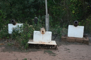
Caboonbah Homestead was a heritage-listed homestead at Esk-Kilcoy Road, Lake Wivenhoe, Somerset Region, Queensland, Australia. It was built from 1889 to 1890. It was added to the Queensland Heritage Register on 12 December 1996. It was destroyed by fire in 2009 and removed from the Queensland Heritage Register in 2014.

<span class="mw-page-title-main">Hazeldean, Queensland</span> Suburb of Somerset Region, Queensland, Australia

Hazeldean is a rural locality in the Somerset Region, Queensland, Australia. In the 2016 census, Hazeldean had a population of 262 people.

Coal Creek is a rural locality in the Somerset Region, Queensland, Australia. In the 2021 census, Coal Creek had a population of 50 people.

Cooeeimbardi is a rural locality in the Somerset Region, Queensland, Australia. In the 2016 census Cooeeimbardi had a population of 7 people.

Fulham is a rural locality in the Somerset Region, Queensland, Australia. In the 2016 census Fulham had a population of 35 people.

<span class="mw-page-title-main">Moogerah, Queensland</span> Suburb of Scenic Rim Region, Queensland, Australia

Moogerah is a rural locality in the Scenic Rim Region, Queensland, Australia. In the 2016 census, Moogerah had a population of 234 people.

Murrumba is a rural locality in the Somerset Region, Queensland, Australia. In the 2016 census, Murrumba had a population of 16 people.

<span class="mw-page-title-main">Somerset Dam, Queensland</span> Town in Queensland, Australia

Somerset Dam is a rural town and locality in the Somerset Region, Queensland, Australia. In the 2016 census, Somerset Dam had a population of 69 people. When first being planned, it was unofficially known as the Stanley River township.

<span class="mw-page-title-main">Callemondah</span> Suburb of Gladstone, Queensland, Australia

Callemondah is a coastal suburb of Gladstone in the Gladstone Region, Queensland, Australia. It contains the Port of Gladstone. In the 2016 census Callemondah had a population of 18 people.

<span class="mw-page-title-main">Wivenhoe Hill, Queensland</span> Suburb of Somerset Region, Queensland, Australia

Wivenhoe Hill is a locality in the Somerset Region, Queensland, Australia. In the 2016 census, Wivenhoe Hill had a population of 9 people.

Moombra is a rural locality in the Somerset Region, Queensland, Australia. In the 2021 census, Moombra had a population of 9 people.

References

  1. 1 2 3 Australian Bureau of Statistics (27 June 2017). "Lake Wivenhoe (SSC)". 2016 Census QuickStats. Retrieved 20 October 2018. OOjs UI icon edit-ltr-progressive.svg
  2. 1 2 "Lake Wivenhoe (entry 37792)". Queensland Place Names. Queensland Government . Retrieved 4 July 2015.
  3. "Lake Wivenhoe (entry 44880)". Queensland Place Names. Queensland Government . Retrieved 4 July 2015.
  4. 1 2 3 4 "Queensland Globe". State of Queensland . Retrieved 9 January 2021.
  5. "Wash Pool Knoll – mountain in Somerset Region (entry 36649)". Queensland Place Names. Queensland Government . Retrieved 25 November 2020.
  6. "Mountain peaks and capes - Queensland". Queensland Open Data. Queensland Government. 12 November 2020. Archived from the original on 25 November 2020. Retrieved 25 November 2020.
  7. "Bauer Point – mountain in Somerset Region (entry 1877)". Queensland Place Names. Queensland Government . Retrieved 25 November 2020.
  8. "Brough Point – mountain in Somerset Region (entry 4713)". Queensland Place Names. Queensland Government . Retrieved 25 November 2020.
  9. "Conroys Point – mountain in Somerset Region (entry 7967)". Queensland Place Names. Queensland Government . Retrieved 25 November 2020.
  10. "Crowe Point – mountain in Somerset Region (entry 8872)". Queensland Place Names. Queensland Government . Retrieved 25 November 2020.
  11. "Harris Point – mountain in Somerset Region (entry 15443)". Queensland Place Names. Queensland Government . Retrieved 25 November 2020.
  12. "Lees Point – mountain in Somerset Region (entry 19139)". Queensland Place Names. Queensland Government . Retrieved 25 November 2020.
  13. "Loganview Point – mountain in Somerset Region (entry 19918)". Queensland Place Names. Queensland Government . Retrieved 25 November 2020.
  14. "Monreid Point – mountain in Somerset Region (entry 22526)". Queensland Place Names. Queensland Government . Retrieved 25 November 2020.
  15. "O'Briens Point – mountain in Somerset Region (entry 39737)". Queensland Place Names. Queensland Government . Retrieved 25 November 2020.
  16. "Pakleppa Point – mountain in Somerset Region (entry 25824)". Queensland Place Names. Queensland Government . Retrieved 25 November 2020.
  17. "Robenlea Point – mountain in Somerset Region (entry 28564)". Queensland Place Names. Queensland Government . Retrieved 25 November 2020.
  18. "Rockville Point – mountain in Somerset Region (entry 28669)". Queensland Place Names. Queensland Government . Retrieved 25 November 2020.
  19. "Sinnamon Point – mountain in Somerset Region (entry 30906)". Queensland Place Names. Queensland Government . Retrieved 25 November 2020.
  20. "Wheelers Point – mountain in Somerset Region (entry 37211)". Queensland Place Names. Queensland Government . Retrieved 25 November 2020.
  21. "Whitfield Point – mountain in Somerset Region (entry 37366)". Queensland Place Names. Queensland Government . Retrieved 25 November 2020.
  22. "Bays - Queensland". Queensland Open Data. Queensland Government. 12 November 2020. Archived from the original on 25 November 2020. Retrieved 25 November 2020.
  23. "Apel Inlet – inlet in Somerset Regional (entry 667)". Queensland Place Names. Queensland Government . Retrieved 29 December 2020.
  24. "Bellevue Bay – bay in Somerset Regional (entry 2191)". Queensland Place Names. Queensland Government . Retrieved 29 December 2020.
  25. "Billies Bay – bay in Somerset Regional (entry 2584)". Queensland Place Names. Queensland Government . Retrieved 29 December 2020.
  26. "Burrundon Bay – bay in Somerset Regional (entry 5456)". Queensland Place Names. Queensland Government . Retrieved 29 December 2020.
  27. "Coal Inlet – inlet in Somerset Regional (entry 7531)". Queensland Place Names. Queensland Government . Retrieved 29 December 2020.
  28. "Conroys Cove – bay in Somerset Regional (entry 7966)". Queensland Place Names. Queensland Government . Retrieved 29 December 2020.
  29. "Cormorant Bay – bay in Somerset Regional (entry 8484)". Queensland Place Names. Queensland Government . Retrieved 29 December 2020.
  30. "Davis Bay – bay in Somerset Regional (entry 9436)". Queensland Place Names. Queensland Government . Retrieved 29 December 2020.
  31. "Five Mile Water – inlet in Somerset Regional (entry 12633)". Queensland Place Names. Queensland Government . Retrieved 29 December 2020.
  32. "Logan Inlet – inlet in Somerset Regional (entry 19902)". Queensland Place Names. Queensland Government . Retrieved 29 December 2020.
  33. "McGraths Bay – bay in Somerset Regional (entry 21377)". Queensland Place Names. Queensland Government . Retrieved 29 December 2020.
  34. "Middle Inlet – inlet in Somerset Regional (entry 21961)". Queensland Place Names. Queensland Government . Retrieved 29 December 2020.
  35. "Moioo Bay – bay in Somerset Regional (entry 22438)". Queensland Place Names. Queensland Government . Retrieved 29 December 2020.
  36. "Moombra Bay – bay in Somerset Regional (entry 22630)". Queensland Place Names. Queensland Government . Retrieved 29 December 2020.
  37. "Northbrook Inlet – inlet in Somerset Regional (entry 24751)". Queensland Place Names. Queensland Government . Retrieved 29 December 2020.
  38. "Paddys Inlet – inlet in Somerset Regional (entry 25797)". Queensland Place Names. Queensland Government . Retrieved 29 December 2020.
  39. "Sheep Station Inlet – inlet in Somerset Regional (entry 30659)". Queensland Place Names. Queensland Government . Retrieved 29 December 2020.
  40. "Tea Tree Inlet – inlet in Somerset Regional (entry 33490)". Queensland Place Names. Queensland Government . Retrieved 29 December 2020.
  41. "Tulungra Inlet – inlet in Somerset Regional (entry 35310)". Queensland Place Names. Queensland Government . Retrieved 29 December 2020.
  42. "Varleys Cove – bay in Somerset Regional (entry 35946)". Queensland Place Names. Queensland Government . Retrieved 29 December 2020.
  43. "Waterbody islands - Queensland". Queensland Open Data. Queensland Government. 12 November 2020. Archived from the original on 25 November 2020. Retrieved 25 November 2020.
  44. "Murrumba Island – island (entry 23640)". Queensland Place Names. Queensland Government . Retrieved 25 November 2020.
  45. "Marshall Island – island (entry 21099)". Queensland Place Names. Queensland Government . Retrieved 25 November 2020.
  46. "Stanley Island – island (entry 32186)". Queensland Place Names. Queensland Government . Retrieved 25 November 2020.
  47. Earley, David (11 May 2009). "Fire destroys Caboonbah Homestead". Courier-Mail . Archived from the original on 18 April 2012. Retrieved 4 July 2015.
  48. "Caboonbah Homestead (entry 601139)". Queensland Heritage Register . Queensland Heritage Council. Retrieved 12 July 2013.
  49. "Heliports and landing grounds - Queensland". Queensland Open Data. Queensland Government. 22 October 2020. Archived from the original on 16 November 2020. Retrieved 3 November 2020.
  50. "Do I need a permit to go fishing in a dam?". Department of Agriculture, Fisheries and Forestry. Queensland Government. 5 February 2013. Archived from the original on 4 July 2014. Retrieved 5 July 2014.
  51. "Lake Wivenhoe". ourbrisbane.com. Brisbane City Council. Archived from the original on 14 April 2010. Retrieved 21 September 2010.
  52. 1 2 3 4 5 6 7 8 9 "Lake Wivenhoe" (PDF). Seqwater . October 2019. Archived (PDF) from the original on 13 March 2020. Retrieved 9 January 2021.
  53. "Tourist points - Queensland". Queensland Open Data. Queensland Government. 18 November 2020. Archived from the original on 24 November 2020. Retrieved 24 November 2020.
  54. "Wivenhoe". Seqwater . Archived from the original on 1 October 2020. Retrieved 9 January 2021.
  55. 1 2 3 "Recreational Boating Facilities Queensland". Queensland Open Data. Queensland Government. 12 November 2020. Archived from the original on 22 November 2020. Retrieved 22 November 2020.