Valkyrie, Queensland

Last updated

Valkyrie
Queensland
Australia Queensland location map.svg
Red pog.svg
Valkyrie
Coordinates 22°11′38″S148°39′54″E / 22.1938°S 148.6649°E / -22.1938; 148.6649 Coordinates: 22°11′38″S148°39′54″E / 22.1938°S 148.6649°E / -22.1938; 148.6649
Postcode(s) 4742
Area2,816.9 km2 (1,087.6 sq mi)
LGA(s) Isaac Region
State electorate(s)
Federal Division(s) Capricornia
Suburbs around Valkyrie:
Coppabella Oxford Oxford
Dysart Valkyrie Lotus Creek
Dysart May Downs May Downs

Valkyrie is a locality in the Isaac Region, Queensland, Australia. [1]

Contents

Geography

The Isaac River passes through the locality forming part of the locality's south-western boundary. The Fitzroy Developmental Road passes through the locality from north to south. [2]

The Duania open-cut coal mine is in the western part of the locality and is serviced by the Goonyella railway line. [3] However, the land use of Valkyrie is predominantly cattle grazing. [4]

History

Valkyrie State School opened on 9 January 1974. [5]

In 2011, there was a proposal to develop the Codrilla coal mine on a site approximately 800 metres from the school. The proposal included the relocation of the school and its teacher's residence to a new location to avoid any environmental impacts from the mine. [6] [7] As of 2017, the mine proposal and school relocation have not yet occurred.

Education

Valkyrie State School is primary (K-6) school for boys and girls operated by the Queensland Government on the Fitzroy Developmental Road ( 22°03′34″S148°34′46″E / 22.0594°S 148.5794°E / -22.0594; 148.5794 (Valkyrie State School) ). In 2016, the school had an enrolment of 19 students with 2 teachers and 6 non-teaching staff (2 full-time equivalent). [4]

Related Research Articles

Blackwater, Queensland Town in Queensland, Australia

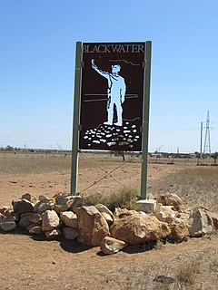
Blackwater is a rural town and locality in the Central Highlands Region, Queensland, Australia. In the 2016 census, Blackwater had a population of 4,749 people.

Emerald, Queensland Town in Queensland, Australia

Emerald is a rural town and locality in the Central Highlands Region, Queensland, Australia. As at June 2018, Emerald had an urban population of 14,119. The town is the headquarters for the Central Highlands Regional Council.

Central Queensland Region in Queensland, Australia

Central Queensland is an ambiguous geographical division of Queensland that centres on the eastern coast, around the Tropic of Capricorn. Its major regional centre is Rockhampton. The region extends from the Capricorn Coast west to the Central Highlands at Emerald, north to the Mackay Regional Council southern boundary, and south to Gladstone. The region is also known as Capricornia. It is one of Australia's main coal exporting regions.

Clermont, Queensland Town in Queensland, Australia

Clermont is a town and a locality in the Isaac Region, Queensland, Australia. Clermont is a major hub for the large coal mines in the region as well as serving agricultural holdings. In the 2016 census, Clermont had a population of 3,031 people, but its boundaries have subsequently changed.

Alpha, Queensland Town in Queensland, Australia

Alpha is a rural town and a locality in the Barcaldine Region, Queensland, Australia. In the 2016 census, Alpha had a population of 335 people.

Middlemount, Queensland Town in Queensland, Australia

Middlemount is a town and locality in Isaac Region, Queensland, Australia. It is nicknamed the "Giant Peanut" by some locals due to its peanut-shaped road layout.

Collinsville, Queensland Town in Queensland, Australia

Collinsville is a rural town and locality in the Whitsunday Region, Queensland, Australia. In the 2016 census, Collinsville had a population of 1,248 people.

Dysart, Queensland Town in Queensland, Australia

Dysart is a town and a locality in the Isaac Region, Queensland, Australia. Dysart is a service centre for the nearby Norwich Park coal mine, which closed in 2012, the Saraji coal mine, and the Lake Vermont Coal Mine, as well as grazing properties in the district. Most residents are employed by the coal mines. At the 2016 Census, Dysart had a population of 2,991.

Mackenzie River, Queensland Suburb of Isaac Region, Queensland, Australia

Mackenzie River is a locality in the Isaac Region, Queensland, Australia. In the 2016 census, Mackenzie River had a population of 71 people.

Nebo, Queensland Town in Queensland, Australia

Nebo is a small town and locality in the Isaac Region, Queensland, Australia.

Warra, Queensland Town in Queensland, Australia

Warra is a town and locality in the Western Downs Region, Queensland, Australia.

Bauhinia, Queensland Suburb of Central Highlands Region, Queensland, Australia

Bauhinia is a rural town in the Central Highlands Region and a rural locality split between the Central Highlands Region and the Aboriginal Shire of Woorabinda, both in Queensland, Australia. In the 2016 census, Bauhinia had a population of 47 people.

Glenden, Queensland Town in Queensland, Australia

Glenden is a mining town and rural locality in the Isaac Region, Queensland, Australia.

Mistake Creek, Queensland Suburb of Isaac Region, Queensland, Australia

Mistake Creek is a former rural locality in Isaac Region, Queensland, Australia. In the 2016 census, Mistake Creek had a population of 38 people.

Ogmore, Queensland Town in Queensland, Australia

Ogmore is a rural town and coastal locality in the Livingstone Shire, Queensland, Australia. In the 2016 census the locality of Ogmore had a population of 105 people.

Strathfield, Queensland Suburb of Isaac Region, Queensland, Australia

Strathfield is a rural locality in the Isaac Region, Queensland, Australia. In the 2016 census Strathfield had a population of 8 people.

Eaglefield, Queensland Suburb of Isaac Region, Queensland, Australia

Eaglefield is a locality in the Isaac Region, Queensland, Australia. In the 2016 census, Eaglefield had a population of 0 people.

Coppabella, Queensland Suburb of Isaac Region, Queensland, Australia

Coppabella is a rural locality in the Isaac Region, Queensland, Australia. In the 2016 census, Coppabella had a population of 466 people.

Kilcummin, Queensland Suburb of Isaac Region, Queensland, Australia

Kilcummin is a rural locality in the Isaac Region, Queensland, Australia. In the 2016 census Kilcummin had a population of 260 people.

Hail Creek, Queensland Suburb of Isaac Region, Queensland, Australia

Hail Creek is a rural locality in the Isaac Region, Queensland, Australia. In the 2016 census, Hail Creek had a population of 148 people.

References

  1. "Valkyrie - locality in Isaac Region (entry 47040)". Queensland Place Names. Queensland Government . Retrieved 6 November 2017.
  2. "Queensland Globe". State of Queensland . Retrieved 19 November 2017.
  3. "Daunia Mine". Queensland Government. Archived from the original on 19 November 2017. Retrieved 19 November 2017.
  4. 1 2 "2016 Annual Report" (PDF). Valkyrie State School. Archived (PDF) from the original on 19 November 2017. Retrieved 19 November 2017.
  5. Queensland Family History Society (2010), Queensland schools past and present (Version 1.01 ed.), Queensland Family History Society, ISBN   978-1-921171-26-0
  6. "EIS Assessment Report for the Codrilla Coal Mine Project" (PDF). Department of Environment and Heritage Protection. October 2011. Archived (PDF) from the original on 19 November 2017. Retrieved 19 November 2017.
  7. "School brawl over new site". Mackay Daily Mercury . Queensland Government. 24 November 2011. Archived from the original on 19 November 2017. Retrieved 19 November 2017.