Glenden Queensland | |||||||||||||||
---|---|---|---|---|---|---|---|---|---|---|---|---|---|---|---|
Coordinates | 21°21′14″S148°06′53″E / 21.3539°S 148.1147°E | ||||||||||||||
Population | 477 (2021 census) [1] | ||||||||||||||
• Density | 1.3061/km2 (3.383/sq mi) | ||||||||||||||
Postcode(s) | 4743 | ||||||||||||||
Area | 365.2 km2 (141.0 sq mi) | ||||||||||||||
Time zone | AEST (UTC+10:00) | ||||||||||||||
Location | |||||||||||||||
LGA(s) | Isaac Region | ||||||||||||||
State electorate(s) | Burdekin | ||||||||||||||
Federal division(s) | Capricornia | ||||||||||||||
|
Glenden is a mining town and rural locality in the Isaac Region, Queensland, Australia. [2] [3]
In the 2021 census, the locality of Glenden had a population of 477 people. [1] The population subsequently declined rapidly, when the local mine changed its roster to a seven-days-on, seven-days-off roster, and is expected to continue to do so. Many residents are relocating to towns like Proserpine that offer a more stable environment. [4]
Glenden was constructed by the Mount Isa Mines company (now Glencore) to provide accommodation for workers at their Newlands coal mine. The site, 30 kilometres from the mine, was chosen in 1981 and was constructed by the company and then given to the Shire of Nebo (which was amalgamated in 2008 to become Isaac Region) to administer. [5]
Glenden State School opened on 25 January 1982. [6]
Glenden Post Office opened circa 1983. [7]
Glenden Christian School opened on 5 January 1995 but closed on 3 February 1997. [6] [8]
In 2023, there was outrage when it was announced that the town of Glenden would be demolished as it was a requirement of the original mine approval that a complete rehabilitiation of the area was undertaken when the mine closed. This announcement came at a time of high levels of homelessness in Queensland due to a shortage of homes. [9] On 18 August 2023, the Queensland Premier Annastacia Palaszczuk announced that legislation would be enacted to prevent the demolition of the town. [10]
In the 2011 census, the locality of Glenden had a population of 1,308 people. [11]
In the 2016 census, the locality of Glenden had a population of 620 people. [12]
In the 2021 census, the locality of Glenden had a population of 477 people. [1]
The mine is the major employer in the town. The surrounding rural areas are mostly cattle grazing stations. [13]
Glenden State School is a government primary and secondary (Prep-12) school for boys and girls at Gillham Terrace ( 21°21′14″S148°06′57″E / 21.3539°S 148.1158°E ). [14] [15] In 2013, the school had 317 students and 25 teachers (24 full-time equivalent). [16] In 2018, the school had an enrolment of 91 students with 15 teachers (14 full-time equivalent) and 12 non-teaching staff (8 full-time equivalent). [17]
Glenden Police Station is at 8 Bell Place ( 21°21′31″S148°07′09″E / 21.3586°S 148.1191°E ). [18] [19] [20]
Glenden Fire Station is at 2 Bell Place ( 21°21′30″S148°07′08″E / 21.3584°S 148.1190°E ). [18] [21]
Glenden Primary Health Care Centre is at 4 Bell Place ( 21°21′30″S148°07′08″E / 21.3582°S 148.1189°E ). [22] [23] Glenden Ambulance Station is also located there ( 21°21′28″S148°07′07″E / 21.3579°S 148.1187°E ). [18]
Glenden Water Treatment Plant is on Usher the south-west of the town ( 21°21′31″S148°06′31″E / 21.3586°S 148.1086°E ). [22] Glenden SES Facility is within the water treatment site on the south-east corner on Usher Street ( 21°21′33″S148°06′36″E / 21.3592°S 148.1100°E ). [18] [20]
The Isaac Regional Council operates a public library in Glenden Shopping Centre in the Town Centre on Ewan Drive ( 21°21′31″S148°06′59″E / 21.3585°S 148.1164°E ). [24] The council also operates the Glenden Recreation Centre in the Town Centre ( 21°21′31″S148°06′56″E / 21.3586°S 148.1155°E ). [25] It also provides tennis and basketball courts off Bell Place ( 21°21′23″S148°07′06″E / 21.3564°S 148.1184°E ), the Maddern Oval on Gilbert Avenue, and the Glenden Swimming Pool at 21 Bell Place ( 21°21′27″S148°07′04″E / 21.3576°S 148.1178°E ). [26]
St Paul's Anglican and Catholic Church is on the western corner of Perry Drive and Bell Place ( 21°21′33″S148°07′07″E / 21.3591°S 148.1185°E ). [27] [28]
Glenden Golf Club is an 18-hole golf course at the end of Golf Club Road ( 21°21′01″S148°07′22″E / 21.3502°S 148.1228°E ). [29]
Emerald is a rural town and locality in the Central Highlands Region, Queensland, Australia. In the 2021 census, the locality of Emerald had a population of 14,906 people.
Clermont is a rural town and locality in the Isaac Region, Queensland, Australia. In the 2021 census, the locality of Clermont had a population of 2,952 people.
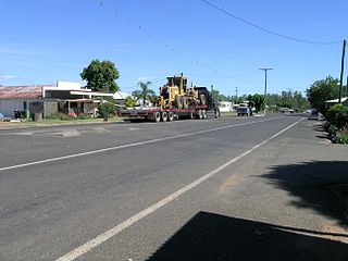
Rolleston is a rural town and locality in the Central Highlands Region, Queensland, Australia. In the 2016 census, the locality of Rolleston had a population of 309 people.
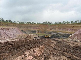
Middlemount is a rural town and locality in the Isaac Region, Queensland, Australia. In the 2021 census, the locality of Middlemount had a population of 1,899 people.
Calen is a rural town and coastal locality in the Mackay Region, Queensland, Australia. In the 2021 census, the locality of Calen had a population of 427 people.
Mount Britton is a rural locality in the Isaac Region, Queensland, Australia. It contains the abandoned gold rush town of Mount Britton in the former Nebo Shire. In the 2021 census, Mount Britton had a population of 4 people.
Dysart is a town and rural locality in the Isaac Region, Queensland, Australia. It is a service centre for mines and grazing properties in the district. In the 2021 census, the locality of Dysart had a population of 2,918 people. Most residents are employed by the coal mines.
Tieri is a small mining town and rural locality in the Central Highlands Region, Queensland, Australia. Established in 1983, the town is a service centre for local coal mines, similar to nearby Middlemount and Dysart,
Mackenzie River is a locality in the Isaac Region, Queensland, Australia. In the 2021 census, Mackenzie River had a population of 84 people.
Nebo is a rural town and locality in the Isaac Region, Queensland, Australia. In the 2021 census, the locality of Nebo had a population of 857 people.
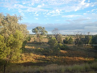
Comet is a historically-rich rural town and locality in the Central Highlands Region, Queensland, Australia. In the 2021 census, the locality of Comet had a population of 360 people.
Mirani is a rural town and locality in the Mackay Region, Queensland, Australia. In the 2016 census, the locality of Mirani had a population of 1,541 people.
Cannonvale is a coastal locality in the Whitsunday Region, Queensland, Australia. In the 2021 census, Cannonvale had a population of 6,596 people.
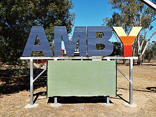
Amby is a rural town and locality in the Maranoa Region, Queensland, Australia. In the 2021 census, the locality of Amby had a population of 49 people.
Ilbilbie is a rural town and coastal locality in the Isaac Region, Queensland, Australia. In the 2021 census, the locality of Ilbilbie had a population of 385 people.
Kuttabul is a rural town and locality in the Mackay Region, Queensland, Australia. In the 2021 census, the locality of Kuttabul had a population of 707 people.
Hodgson is a rural town and locality in the Maranoa Region, Queensland, Australia. In the 2021 census, the locality of Hodgson had a population of 95 people.
Burton is a rural locality in the Isaac Region, Queensland, Australia. In the 2021 census, Burton had a population of 7 people.
Winchester is a rural locality in the Isaac Region, Queensland, Australia. In the 2021 census, Winchester had "no people or a very low population".
Kemmis is a rural locality in the Isaac Region, Queensland, Australia. In the 2021 census, Kemmis had "no people or a very low population".