Stamford, Queensland

Last updated

Map all coordinates using: OpenStreetMap  
Download coordinates as: KML
Stamford
Queensland
Stamford Kennedy Developmental Road.jpg
The Kennedy Developmental Road seen at Stamford Roadhouse
Australia Queensland location map.svg
Red pog.svg
Stamford
Coordinates 21°15′51″S143°48′31″E / 21.2641°S 143.8086°E / -21.2641; 143.8086 (Stamford (town centre))
Population43 (2016 census locality) [1]
 • Density0.00639/km2 (0.01656/sq mi)
Postcode(s) 4821
Area6,724.8 km2 (2,596.5 sq mi)
Time zone AEST (UTC+10:00)
Location
LGA(s) Shire of Flinders
State electorate(s) Traeger
Federal Division(s) Kennedy
Localities around Stamford:
Richmond Dutton River Hughenden
Richmond Stamford Tangorin
Albion Corfield Tangorin

Stamford is a rural town and locality in the Shire of Flinders, Queensland, Australia. [2] [3] In the 2016 census the locality of Stamford had a population of 43 people. [1]

Contents

Geography

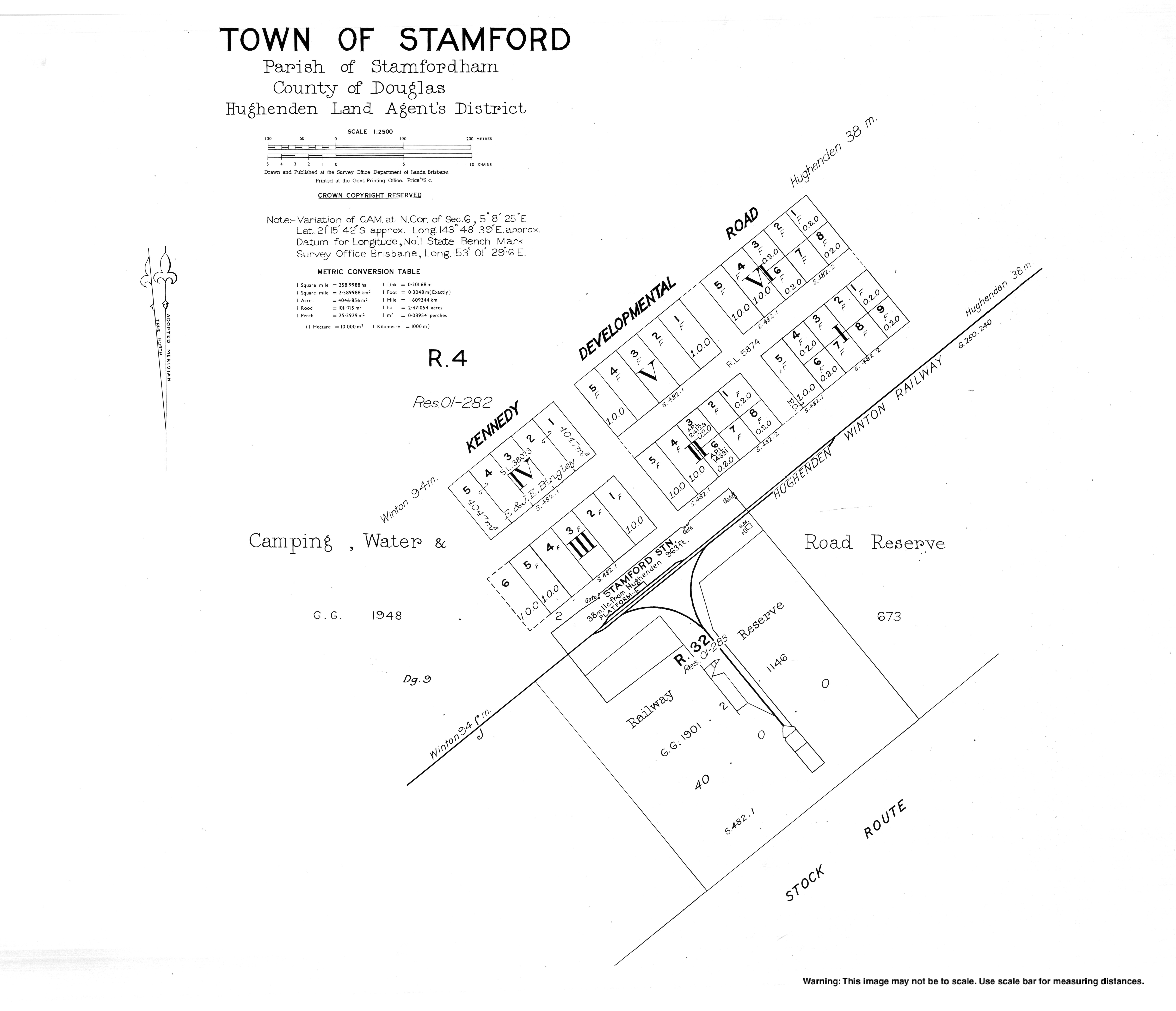
The town is on the Kennedy Developmental Road that links Hughenden and Winton, 1,504 kilometres (935 mi) north west of the state capital, Brisbane and 446 kilometres (277 mi) west of the regional centre of Townsville. It is situated slightly east of the centre of the locality. [4]

The town of Marathon ( 20°51′39″S143°34′12″E / 20.8608°S 143.57°E / -20.8608; 143.57 (Marathon) ) is in the far north of the locality. The town never developed. [5]

The Great Northern railway line passes through the north of the locality, entering from the north-east (Hughenden) and exiting to the north-west (Richmond) with the locality served by the following railway stations (from east to west):

Chinbi is a neighbourhood ( 21°23′00″S143°41′00″E / 21.3833°S 143.6833°E / -21.3833; 143.6833 (Chinbi (neighbourhood)) ) within the locality to the south-west of the town of Stamford based around the former Chinbi railway station. [7] [4]

Whitewood is a neighbourhood ( 21°28′00″S143°35′00″E / 21.4666°S 143.5833°E / -21.4666; 143.5833 (Whitewood (neighbourhood)) ) within the locality south-west of Chinbi based around the former Whitewood railway station. [8] [4]

The land use is grazing on native vegetation. [9]

History

The town of Marathon takes its name from pastoral run name, which was named by its lessees in 1863 after Marathon in Greece. The name was proposed to them by William Lempriere Frederick Sheaffe, the Commissioner of Crown Lands Kennedy District. The town of Marathon first appears on the 1916 survey plan numbered M6851. [5] [10]

Stamford was once an overnight stop for Cobb & Co coaches travelling between Winton and Hughenden. [11]

The Hughenden-Winton railway line (a branch line of the Great Northern railway line) opened to Stamford in 1897, closing officially in 2008 and dismantled in 2012. [11] It followed the same route as the Kennedy Developmental Road. There were a number of now-abandoned railway stations on the line within the locality (from north-west to south-east):

Stamford Provisional School opened in 1899 and closed in 1906. [12]

The neighbourhood of Chinbi takes its name from the Chinbi railway station, which in turn was named on 18 February 1915 by the Queensland Railways Department. It is an Aboriginal word meaning star . [7]

Stamford State School opened on 23 January 1984. [12] It closed on 29 July 2013. [13] The school was located at 5 Marathon Stamford Road ( 21°15′57″S143°48′30″E / 21.2658°S 143.8083°E / -21.2658; 143.8083 (Stamford State School (former)) ). [9]

On 9 June 2003 in the Queen's Birthday Honours List, Mrs Jean Eva Anderson of Ballater Station of Stamford was awarded the Medal of the Order of Australia for her "service to the community of Hughenden, particularly through the Country Womens Association". She had given 52 years of service to the Hughenden branch of the Queensland Country Women's Association. Her award was presented to her by the then Governor of Queensland, Quentin Bryce. [14] [15]

At the 2006 census, Stamford and the surrounding area had a population of 75. [16]

In 2012 the town of Stamford consisted of a roadhouse and has a permanent population of 3. [11]

In the 2016 census the locality of Stamford had a population of 43 people. [1]

Economy

There are a number of homesteads in the locality, including: [17]

Education

There are no schools in Stamford. The nearest primary schools are Hughenden State School in neighbouring Hughenden to the north-east and Cameron Downs State School in neighbouring Tangorin to the east. The nearest secondary school is Hughenden State School which provides schooling to Year 12. However, given the size of the locality, the distances involved may necessitate using alternatives such as distance education and boarding schools. [4]

Events

Men from Winton attending the Stamford races, 1912 StateLibQld 1 96408 Stamford races in the Winton district, 1912.jpg
Men from Winton attending the Stamford races, 1912
Ladies from Winton attending the Stamford Races, 1912 StateLibQld 1 93104 Stamford Races in the Winton district, 1912.jpg
Ladies from Winton attending the Stamford Races, 1912

The Stamford Races are a popular social event in the area involving horse racing. [11]

Related Research Articles

Hebel, Queensland Town in Queensland, Australia

Hebel is a rural town and locality in the Shire of Balonne, Queensland, Australia. It is on the border of Queensland and New South Wales. In the 2016 census, Hebel had a population of 67 people.

Thargomindah Town in Queensland, Australia

Thargomindah is a rural town and locality in the Shire of Bulloo, Queensland, Australia. The town of Thargomindah is the administrative centre for the Shire of Bulloo. In the 2016 census, Thargomindah had a population of 270 people. It was founded on Wongkumara and Kalali territory.

Hughenden, Queensland Town in Queensland, Australia

Hughenden is a town and locality in the Shire of Flinders, Queensland, Australia. At the 2016 census, Hughenden had a population of 1,136.

Richmond, Queensland Town in Queensland, Australia

Richmond is a rural town and locality in the Shire of Richmond, Queensland, Australia. In the 2016 census the locality of Richmond had a population of 648 people.

Kaimkillenbun Town in Queensland, Australia

Kaimkillenbun is a rural town and locality in the Western Downs Region, Queensland, Australia. In the 2016 census the locality of Kaimkillenbun had a population of 293 people.

Shire of Flinders (Queensland) Local government area in Queensland, Australia

The Shire of Flinders is a local government area in north-western Queensland, Australia.

Goovigen Town in Queensland, Australia

Goovigen is a rural town and locality in the Shire of Banana, Queensland, Australia. In the 2016 census the locality of Goovigen had a population of 215 people.

Glenmorgan, Queensland Town in Queensland, Australia

Glenmorgan is a rural town in the Western Downs Region and a locality split between the Western Downs Region and the Maranoa Region, Queensland, Australia. In the 2016 census the locality of Glenmorgan had a population of 148 people.

Prairie, Queensland Town in Queensland, Australia

Prairie is a rural town and locality in the Flinders Shire, Queensland, Australia. In the 2016 census the locality of Prairie had a population of 143 people.

Corfield, Queensland Town in Queensland, Australia

Corfield is a town and locality in the Shire of Winton in north-western Queensland, Australia. In the 2016 census, Corfield had a population of 183 people.

Abbotsford Station, Queensland

Abbotsford Station is a 20,000 acres (8,100 ha) mitchell grass downs block near Stamford, Queensland, Australia. The block was balloted on the 7 November 1912 off the Stamfordham block of the home station of Katandra. It was the western portion of the block called Sloane Creek, so named after the creek that runs through the block and into the Flinders River. This block also had a sub-artesian bore which was situated centrally on the land making it the prime block in the 1912 ballot process.

Duchess, Queensland Town in Queensland, Australia

Duchess is a rural town and locality in the Shire of Cloncurry, Queensland, Australia. In the 2016 census, Duchess had a population of 23 people.

Durham, Queensland Suburb of Bulloo Shire, Queensland, Australia

Durham is a rural locality in the Shire of Bulloo, Queensland, Australia. In the 2016 census Durham had a population of 36 people.

Deuchar, Queensland Suburb of Southern Downs Region, Queensland, Australia

Deuchar is a rural locality in the Southern Downs Region, Queensland, Australia. In the 2016 census Deuchar had a population of 295 people.

Dutton River Suburb of Shire of Flinders, Queensland, Australia

Dutton River is a rural locality in the Flinders Shire, Queensland, Australia. In the 2016 census Dutton River had a population of 33 people.

Tangorin Town in Queensland, Australia

Tangorin is a rural town and locality in the Flinders Shire, Queensland, Australia. In the 2016 census the locality of Tangorin had a population of 58 people.

Desailly, Queensland Suburb of Shire of Mareeba, Queensland, Australia

Desailly is a rural locality in the Shire of Mareeba, Queensland, Australia. In the 2016 census Desailly had a population of 0 people.

Marathon, Queensland Town in Queensland, Australia

Marathon is a town within the locality of Stamford in the Flinders Shire, Queensland, Australia that failed to develop.

Ward, Queensland Suburb of Shire of Murweh, Queensland, Australia

Ward is a rural locality in the Shire of Murweh, Queensland, Australia. In the 2016 census Ward had a population of 74 people.

Kunwarara, Queensland Suburb of Livingstone Shire, Queensland, Australia

Kunwarara is a rural locality in the Livingstone Shire, Queensland, Australia. In the 2016 census Kunwarara had a population of 71 people.

References

  1. 1 2 3 Australian Bureau of Statistics (27 June 2017). "Stamford (SSC)". 2016 Census QuickStats. Retrieved 20 October 2018. OOjs UI icon edit-ltr-progressive.svg
  2. "Stamford – town in Flinders Shire (entry 32168)". Queensland Place Names. Queensland Government . Retrieved 27 December 2020.
  3. "Stamford – locality in Flinders Shire (entry 42488)". Queensland Place Names. Queensland Government . Retrieved 27 December 2020.
  4. 1 2 3 4 "Queensland Globe". State of Queensland . Retrieved 14 March 2021.
  5. 1 2 "Marathon – population centre in Flinders Shire (entry 20895)". Queensland Place Names. Queensland Government . Retrieved 27 December 2020.
  6. 1 2 3 4 5 6 7 8 9 10 "Railway stations and sidings - Queensland". Queensland Open Data. Queensland Government. 2 October 2020. Archived from the original on 5 October 2020. Retrieved 5 October 2020.
  7. 1 2 "Chinbi – locality unbounded in Flinders Shire (entry 7130)". Queensland Place Names. Queensland Government . Retrieved 27 December 2020.
  8. "Whitewood – locality unbounded in Flinders Shire (entry 37355)". Queensland Place Names. Queensland Government . Retrieved 27 December 2020.
  9. 1 2 Google (14 March 2021). "Stamford State School (former)" (Map). Google Maps . Google. Retrieved 14 March 2021.
  10. "Historic township of Marathon in north-west Queensland proposed to be recognised". Mirage News. 15 May 2020. Retrieved 14 March 2021.
  11. 1 2 3 4 "Stamford". Shire of Flinders. Archived from the original on 20 April 2012. Retrieved 22 April 2012.
  12. 1 2 Queensland Family History Society (2010), Queensland schools past and present (Version 1.01 ed.), Queensland Family History Society, ISBN   978-1-921171-26-0
  13. "Opening and closing dates of Queensland Schools". Queensland Government . Retrieved 14 March 2021.
  14. "Portrait of Mrs Jean Anderson of Stamford with Order of Australia medal, 2003". Archived from the original on 14 September 2020. Retrieved 3 January 2019.
  15. "ANDERSON, Jean Eva". It's an Honour. Australian Government. Archived from the original on 2 January 2019. Retrieved 3 January 2019.
  16. Australian Bureau of Statistics (25 October 2007). "Stamford (Flinders Shire) (State Suburb)". 2006 Census QuickStats. Retrieved 22 April 2012.
  17. "Homesteads - Queensland". Queensland Open Data. Queensland Government. 18 November 2020. Archived from the original on 24 November 2020. Retrieved 24 November 2020.