Related Research Articles

Cape Upstart is a national park in the locality of Guthalungra in the Whitsunday Region local government area of North Queensland, Australia, 1,016 km northwest of Brisbane.

The Shire of Burdekin is a local government area located in North Queensland, Australia in the Dry Tropics region. The district is located between Townsville and Bowen in the delta of the Burdekin River.

Bowen is a coastal town and locality in the Whitsunday Region on the eastern coast of Queensland, Australia. The locality is a large one, and contains two other towns, Heronvale and Merinda. The Abbot Point coal shipping port is also within the locality. At the 2016 census, Bowen had a population of 10,377.

The Burdekin River is a river located in North and Far North Queensland, Australia. The river rises on the northern slopes of Boulder Mountain at Valley of Lagoons, part of the western slope of the Seaview Range, and flows into the Coral Sea at Upstart Bay over 200 kilometres (124 mi) to the southeast of the source, with a catchment area of approximately 130,000 square kilometres (50,000 sq mi). The Burdekin River is Australia's largest river by (peak) discharge volume.
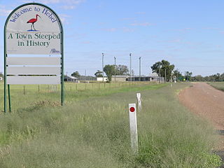
Hebel is a rural town and locality in the Shire of Balonne, Queensland, Australia. It is on the border of Queensland and New South Wales. In the 2016 census, Hebel had a population of 67 people.

Ayr is a town and locality in the Shire of Burdekin, Queensland, Australia. It is the centre of a sugarcane-growing region. In the 2016 census, Ayr had a population of 8,738 people.

Giru is a town and coastal locality in the Shire of Burdekin, Queensland, Australia, situated on the Haughton River, 54 kilometres (34 mi) south-east of Townsville. In the 2016 census, Giru had a population of 354 people.

Home Hill is a town and locality in the Burdekin Shire, Queensland, Australia at the delta of the Burdekin River. It is a sugarcane growing area with underground water supplies to irrigate crops.

North Queensland or the Northern Region is the northern part of the Australian state of Queensland that lies just south of Far North Queensland. Queensland is a massive state, larger than many countries, and the tropical northern part of it has been historically remote and undeveloped, resulting in a distinctive regional character and identity.

Doomadgee is a town and a locality in the Aboriginal Shire of Doomadgee, Queensland, Australia. In the 2016 census, Doomadgee had a population of 1405 people.
The Lower Burdekin languages were probably three distinct Australian Aboriginal languages spoken around the mouth of the Burdekin River in north Queensland. One short wordlist in each was collected in the 19th century, and published in the second volume of The Australian Race in 1886. These languages have since gone extinct, with no more having been recorded. Due to the paucity of the available data, we know almost nothing of their grammatical structure.
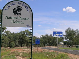
Bollon is a rural town and locality in the Shire of Balonne, Queensland, Australia. In the 2016 census, Bollon had a population of 221 people.
Brandon is a rural town and locality in the Shire of Burdekin, Queensland, Australia. In the 2016 census, Brandon had a population of 1,094 people.
The Suttor River is a river in Central Queensland, Australia. The Belyando River is its main tributary. The river has its origins in the Leichhardt Range, north west of Glenden. It flows into Lake Dalrymple, becoming a tributary of the Burdekin River.
Guthalungra is a town and a coastal locality in the Whitsunday Region, Queensland, Australia.
The Bindal were an indigenous Australian people of the state of Queensland.
The Juru (Yuru) are an indigenous Australian people of the state of Queensland
Jerona is a town and coastal locality in the Shire of Burdekin, Queensland, Australia. In the 2016 census, Jerona had a population of 40 people.
Barratta is a rural town and a locality in the Shire of Burdekin, Queensland, Australia. In the 2016 census, Barratta had a population of 69 people.
Mount Kelly is a rural locality in the Shire of Burdekin, Queensland, Australia. In the 2016 census, Mount Kelly had a population of 280 people.
References
- 1 2 "Upstart Bay - bay in Shire of Burdekin (entry 35853)". Queensland Place Names. Queensland Government . Retrieved 26 July 2017.
- ↑

