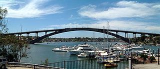
Gladesville Bridge is a heritage-listed concrete arch road bridge that carries Victoria Road over the Parramatta River, linking the Sydney suburbs of Huntleys Point and Drummoyne, in the local government areas of Canada Bay and Hunter's Hill, in New South Wales, Australia. Despite its name, the bridge is not located in Gladesville.

The Newell Highway is a national highway in New South Wales (NSW), Australia. It provides the major road link between southeastern Queensland and Victoria via central NSW and as such carries large amounts of freight. At 1,058 kilometres (657 mi) in length, the Newell is the longest highway in NSW, and passes through fifteen local government areas. The highway is part of Australian national route 39 and was signposted accordingly until 2013. Since then it has been signposted as NSW route A39.
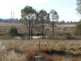
The Severn River, a perennial river that forms part of the Border Rivers group, is part of the Macintyre catchment of the Murray–Darling basin, located in the Northern Tablelands and North West Slopes regions of New South Wales, Australia.

Inglewood is a rural town and locality in the Goondiwindi Region, Queensland, Australia. In the 2016 census, Inglewood had a population of 954 people. Inglewood is the second largest town in the Goondiwindi Region.
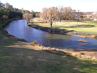
The Macintyre River, a perennial river that forms part of the Border Rivers group, is part of the Barwon catchment of the Murray-Darling basin, located in the Northern Tablelands and North West Slopes regions of New South Wales, and the Southern Downs region of Queensland, Australia.
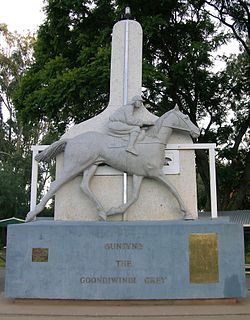
Goondiwindi is a rural town and locality in the Goondiwindi Region, Queensland, Australia. It is on the border of Queensland and New South Wales. In the 2016 census, Goondiwindi had a population of 6,355 people.

Mungindi is a town and locality on the border of New South Wales (NSW) and Queensland, Australia. The town is within Moree Plains Shire in New South Wales. Within Queensland, the locality is split between the Shire of Balonne and the Goondiwindi Region with the town in the Shire of Balonne. It possesses a New South Wales postcode. Mungindi sits on the Carnarvon Highway and straddles the Barwon River which is the border between New South Wales and Queensland. At the 2016 census, Mungindi had a population of 601 on the New South Wales side, while the population on the Queensland side was 146.

Dickabram Bridge is a heritage-listed road-and-rail bridge over the Mary River between Miva and Theebine, both in the Gympie Region, Queensland, Australia. It was the major bridge on the Kingaroy railway line. It was designed by Henry Charles Stanley and built from 1885 to 1886 by Owen McDermott & Co. It is also known as Mary River Bridge (Miva). The bridge was registered on the former Register of the National Estate in 1988. It was added to the Queensland Heritage Register on 21 October 1992.

The Taemas Bridge is a two-lane road bridge that carries the Wee Jasper Road across the Murrumbidgee River, at the settlement of Taemas, near Wee Jasper in the Yass Valley Council local government area of New South Wales, Australia. The bridge crosses on the river just before it enters Lake Burrinjuck, which has been created by the Burrinjuck Dam. The bridge is a key part of the road between Yass and Wee Jasper, and from there, to Tumut. The bridge is located approximately 26 kilometres (16 mi) from Yass and 22 kilometres (14 mi) from Wee Jasper. The property is owned by Transport for NSW. Under the Heritage Act, 1977 (NSW) s 170, the bridge was added to the New South Wales State agency heritage register on 18 August 2005.

The Bethanga Bridge is a steel truss road bridge that carries the Riverina Highway across Lake Hume, an artificial lake on the Murray River in Australia. The dual heritage-listed bridge crosses the border between the Australian states of New South Wales and Victoria, linking the Victorian towns of Bellbridge and Bethanga with the regional New South Wales city of Albury.
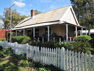
Customs House Museum is a heritage-listed former detached house and now museum at 1 McLean Street, Goondiwindi, Goondiwindi Region, Queensland, Australia. It was built from 1860s circa to 1900s circa. It was added to the Queensland Heritage Register on 21 October 1992.
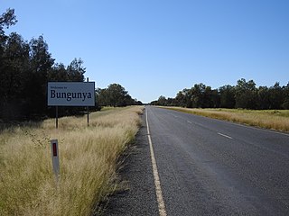
Bungunya is a rural town and locality in the Goondiwindi Region, Queensland, Australia. The locality is on the border of Queensland and New South Wales. In the 2016 census, Bungunya had a population of 75 people.

The Murray River railway bridge is a heritage-listed Australian railway bridge over the Murray River on the Main Southern line south of Albury in the City of Albury, New South Wales, and on the North Eastern line north of Wodonga in Victoria. The bridge was designed by John Whitton and built from 1883 to 1884 by J. S. Bennett, with iron work supplied by Westwood, Baillie, England. It is also known as the Rail Bridge over Murray River, Albury-Wodonga and the Albury Lattice Railway Bridge and Murray River Underbridge. The bridge is owned by RailCorp, and maintained by the Australian Rail Track Corporation as part of its lease of the line. It was added to the New South Wales State Heritage Register on 2 April 1999 and added to the Register of the National Estate on 18 April 1989.

The Macdonald River railway bridge is a heritage-listed railway bridge that carries the Main Northern line across the Macdonald River located in Woolbrook, in the Walcha Shire, New South Wales, Australia. The railway bridge was designed by John Whitton as the Engineer-in-Chief for the New South Wales Government Railways and built during 1882 by J. S. Bennett, with iron work by J. & C. Brettell, Worcester, England. The railway bridge is also known as the Woolbrook rail bridge over the Macdonald River and the Woolbrook Lattice Railway Bridge. The bridge and adjacent infrastructure is owned by RailCorp, an agency of the Government of New South Wales. The bridge was added to the New South Wales State Heritage Register on 2 April 1999 and was added to the Register of the National Estate on 18 April 1989.

The Macquarie River railway bridge is a heritage-listed disused railway bridge across the Macquarie River that was previously located on the Main Western line in Bathurst in the Bathurst Region local government area of New South Wales, Australia. It was built in 1876. It is also known as Bathurst Rail Bridge over Macquarie River and Bathurst - Kelso Railway Bridge. The property is owned by RailCorp, an agency of the Government of New South Wales. The bridge was added to the New South Wales State Heritage Register on 2 April 1999 and was added to the Register of the National Estate on 18 April 1989.

Old Cobram-Barooga Bridge is a heritage-listed former road bridge and now footbridge over the Murray River at Barooga-Cobram Road, Barooga, New South Wales, Australia. The bridge links Barooga with Cobram, its sister town in Victoria. It was designed by Ernest de Burgh (engineer) and the New South Wales Department of Public Works and built from 1900 to 1902. It is also known as RMS Bridge No 3247. It is owned by Transport for NSW. It was added to the New South Wales State Heritage Register on 1 April 2016.

The Dubbo rail bridge over Macquarie River - Wambuul is a heritage-listed railway bridge on the Main Western line across the Macquarie River, located west of the Dubbo central business district in New South Wales, Australia. It was designed by John Whitton as the Engineer-in-Chief for the New South Wales Government Railways. The bridge was built during 1884 by Benjamin Barnes, with ironwork by Cochrane & Co, Middlesborough, England. The railway bridge is also known as the Dubbo Lattice Railway Bridge. The property is owned by RailCorp, an agency of the Government of New South Wales. The bridge was added to the New South Wales State Heritage Register on 2 April 1999 and was listed on the Register of the National Estate on 18 April 1989.

The Murray River bridge is a heritage-listed road bridge that carries Main Road across the Murray River located at Barham in the Murray River Council local government area of New South Wales, Australia. It was designed by Department of Public Works and built in 1904 by John Monash. The bridge is also known as the Barham Bridge over Murray River and the Barham bridge. The bridge is owned by the Murray River Council and was added to the New South Wales State Heritage Register on 20 June 2000.

Murrumbidgee River railway bridge is a heritage-listed disused railway bridge on the Tocumwal railway line crossing from Narrandera to Gillenbah, both in Narrandera Shire, New South Wales, Australia. It was designed by John Whitton in his capacity as Engineer-in-Chief for Railways, and built in 1884-85 by Halliday & Owen with ironwork supplied by English firm Westwood, Baillie. It is also known as Narrandera Lattice Railway Bridge. The property was added to the New South Wales State Heritage Register on 2 April 1999 and was added to the Register of the National Estate on 15 May 1990.

The Cooks River Sewage Aqueduct is a heritage-listed sewage aqueduct located at Pine Street, Earlwood, New South Wales, Australia. It crosses the Cooks River to Thornley Street, Marrickville. It was designed by Sewerage Construction Branch and NSW Department of Public Works and built during 1895 by J. F. Carson, contractor. The property is owned by Sydney Water, an agency of the Government of New South Wales. It was added to the New South Wales State Heritage Register on 18 November 1999.


