
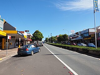
Milton is a village in the South Coast region of New South Wales, Australia, within the City of Shoalhaven. It was founded in 1860, named after the property of post master George Knight and became an important regional centre during the 19th Century. Today, Milton remains one of the two main commercial centres of the Milton-Ulladulla district, with a population at the 2016 census of 1,663. It is a popular stopping place for travellers on the Princes Highway which runs through the centre of town. In recent years, Milton has undergone a resurgence largely influenced by the local tourism industry and an influx of residents to the district seeking a seachange. Several new housing estates are being developed on the fringes of the village and new boutique stores, cafes and bed and breakfast type businesses have located in the town.
Ulladulla is a coastal town in New South Wales, Australia in the City of Shoalhaven local government area. It is on the Princes Highway about 230 kilometres (140 mi) south of Sydney, halfway between Batemans Bay to the south and Nowra to the north. Ulladulla has close links with the nearby historic settlement of Milton and many services are shared between these towns.

Palm Beach is a suburb in the Northern Beaches region of Sydney, in the state of New South Wales, Australia. Palm Beach is located 41 kilometres (25 mi) north of the Sydney central business district, in the local government area of Northern Beaches Council. Palm Beach sits on a peninsula at the end of Barrenjoey Road near Pittwater and is the northernmost beach in the Greater Sydney Metropolitan area. The population of Palm Beach was 1,593 as at the 2016 census.

Fairy Meadow is a suburb in the City of Wollongong, New South Wales, Australia. Located in the Illawarra region and only 4 km from the city centre, it is a mainly low-density residential area, with a large strip of commercial and industrial properties along and off the Princes Highway.
Main Beach is a coastal town and suburb in the City of Gold Coast, Queensland, Australia. In the 2016 census, the suburb of Main Beach had a population of 3,883 people.

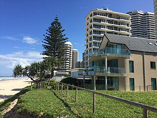
Palm Beach is a coastal suburb in the City of Gold Coast, Queensland, Australia. In the 2016 census, Palm Beach had a population of 14,654 people.
Mollymook is a town located on the South Coast of New South Wales, Australia approximately three hours' drive south of Sydney within the City of Shoalhaven local government area. At the 2016 census, Mollymook had a population of 1,083 while the adjacent locality of Mollymook Beach was home to a further 2,447 people. Geographically, Mollymook is considered part of the Milton-Ulladulla district, a coastal corridor of urban development stretching from Burrill Lake, south of Ulladulla to Mollymook's northern neighbour, Narrawallee and the historic town of Milton a few kilometres inland.

Wamberal is a coastal suburb of the Central Coast region of New South Wales, Australia, just north of Terrigal. It is part of the Central Coast Council local government area and is located adjacent to the Wamberal Lagoon. Wamberal is an Aboriginal word meaning 'where the sea breaks'.
Culburra Beach, commonly referred to as Culburra, is a town located in the South Coast region of New South Wales, Australia. Located within the Shoalhaven local government area, the town is 18 kilometres (11 mi) east-southeast of Nowra on Jerrinja Wandi Wandian Aboriginal Country. At the 2016 census, the town had a population of 2,874 and is the regional centre for the coastal villages of Currarong, Callala Beach, Callala Bay and Orient Point.

Forster is a coastal town in the Mid North Coast region of New South Wales, Australia, in the Mid-Coast Council LGA, about 308 km north-north-east of Sydney. It is immediately adjacent to its twin, Tuncurry, which is the smaller of the two towns. Forster is known for its stunning waters and Manning Valley beauty.

Christies Beach is a seaside suburb in the southern Adelaide metropolitan area, within the City of Onkaparinga. The area is scenic and hence popular with photographers as Witton Bluff provides a natural vantage point over the entire suburb and beyond.
The South Coast refers to the narrow coastal belt from the Shoalhaven district in the north to the state border with Victoria in the south in the south-eastern part of the State of New South Wales, Australia. It is bordered to the west by the coastal escarpment of the Southern Tablelands, and is largely covered by a series of national parks, namely Jervis Bay National Park, Eurobodalla National Park, and Beowa National Park. To the east is the coastline of the Pacific Ocean, which is characterised by rolling farmlands, small towns and villages along a rocky coastline, interspersed by numerous beaches and lakes.

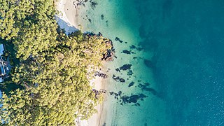
Kioloa is a small hamlet located on the South Coast of New South Wales, Australia and is within the City of Shoalhaven local government area. It is pronounced by locals as 'Ky-ola'. At the 2016 census, Kioloa had a population of 257.
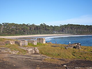
Bawley Point is a small coastal hamlet in New South Wales, Australia, in the Shoalhaven with a population of 698 people at the 2016 census. It is located 30 minutes south of Ulladulla, New South Wales, and 30 minutes north of Batemans Bay on the South Coast of NSW. The town's name is believed to be derived from an Aboriginal word meaning "Brown snake".

Avoca Beach is a coastal suburb of the Central Coast region of New South Wales, Australia, about 95 kilometres (59 mi) north of Sydney. Avoca Beach is primarily a residential suburb, Avoca Beach is also a popular tourist destination. Avoca Beach is known for its surfing and state (regional) surf competitions. It is located within the Central Coast Council local government area.
Red Rock is a small hamlet in the northern beaches of the Coffs Harbour coast beside the banks of the Corindi River on the Mid North Coast of New South Wales, Australia, and is surrounded by National Parks. It is in the City of Coffs Harbour local government area. At the 2016 census, Red Rock had a population of 303 people. The small Red Rock River passes near the town.

Burrill Lake is a small village on the Princes Highway in the South Coast region of New South Wales, Australia. It is a seaside suburb of the Milton-Ulladulla district, a part of the City of Shoalhaven local government area and surrounds the lake of the same name. In 2021, Burrill Lake had a population of 1,782. The name of the town is derived from an Aboriginal word meaning 'wallaby'.
Fairhaven is a coastal locality in the Surf Coast Shire, Victoria, Australia. In the 2021 census, Fairhaven had a population of 390 people.

Mollymook Beach is a suburb in the City of Shoalhaven, New South Wales, Australia. It is located about four km north of Ulladalla on the northern end of Mollymook beach on the shore of the Tasman Sea. At the 2016 census, it had a population of 2,447. It is a mostly residential area incorporating Bannister Headland and is located north of Mollymook, with the eastern part of the border formed by Blackwater Creek. The southern part of the beach lies in Mollymook.

Yatte Yattah is a historically significant suburb on the South Coast of New South Wales. It is located on the Princes Highway about 4 km north of Milton and 2 km south of Conjola Lake. At the 2021 Census, the population was 189.


