Warringah Council was a local government area in the northern beaches region of Sydney, in the state of New South Wales, Australia. It was proclaimed on 7 March 1906 as the Warringah Shire Council, and became "Warringah Council" in 1993. In 1992, Pittwater Council was formed when the former A Riding of Warringah Shire voted to secede. From this point on until amalgamation, Warringah Council administered 152 square kilometres (59 sq mi) of land, including nine beaches and 14 kilometres (9 mi) of coastline. Prior to its abolition it contained 6,000 hectares of natural bushland and open space, with Narrabeen Lagoon marking Warringah's northern boundary and Manly Lagoon marking the southern boundary.

The City of Gosford was a local government area that was located in the Central Coast region in the state of New South Wales, Australia. The incorporation of Gosford dates back to 1886 when the Town of Gosford was proclaimed as the Borough of Gosford, becoming the Municipality of Gosford from 1906. In 1908, the Gosford Municipality merged into Erina Shire which covered the remaining Central Coast area outside of Gosford, but regained its independence in 1936. From 1 January 1947, local government in the Central Coast region was reorganised, creating Gosford Shire and Wyong Shire, and the final boundaries of Gosford City Council date from this period. From 1 January 1980, Gosford Shire was granted city status, becoming the City of Gosford. On 12 May 2016 the Minister for Local Government amalgamated the City of Gosford and Wyong Shire Councils to form the new Central Coast Council.

Wyong Shire was a local government area located in the Central Coast region of New South Wales, Australia. The incorporation of the Wyong area dates back to 7 March 1906 when the entire area of the Brisbane Water Police District outside of the Town of Gosford was proclaimed as the Erina Shire. From 1 January 1947, local government in the Central Coast region was reorganised, creating Gosford Shire and Wyong Shire, which comprised Erina Shire north and east of Kulnura, Central Mangrove and Lisarow.

The City of Hawkesbury is a local government area of New South Wales, Australia, located on the northern and north-western fringe of the Greater Sydney area, about 50 kilometres (31 mi) north-west of the Sydney central business district. Hawkesbury City is named after the Hawkesbury River. Major suburbs in the City of Hawkesbury are Windsor, Richmond and Pitt Town.

Blacktown City Council is a local government area in Western Sydney, situated on the Cumberland Plain, approximately 35 kilometres (22 mi) west of the Sydney central business district, in the state of New South Wales, Australia. Established in 1906 as the Blacktown Shire and becoming the Municipality of Blacktown in 1961 before gaining city status in 1979, the City occupies an area of 246.9 square kilometres (95.3 sq mi) and has a population of 410,419, making it the most populous local government area in Sydney.

Bogan Shire is a local government area in the Orana region of New South Wales, Australia. The Shire is located adjacent to the Mitchell and Barrier highways and its only significant town is Nyngan.

Gundagai Shire was a local government area in the Riverina region of New South Wales, Australia. On 12 May 2016, Gundagai Shire was abolished and merged with the neighbouring Cootamundra Shire to establish Cootamundra-Gundagai Regional Council.

The Bombala Shire was a local government area in the Monaro region of south-eastern New South Wales, Australia. The Shire includes the town of Bombala, the villages of Delegate, Cathcart, Bibbenluke and the localities of Ando, Bungarby, Craigie, Mila, Rockton and Creewah. Bombala Shire was formed on 1 October 1977 by the amalgamation of the Municipality of Bombala and Bibbenluke Shire.

Boorowa Council was a local government area in the South West Slopes region of New South Wales, Australia. The LGA was located adjacent to the Lachlan Valley Way and included Boorowa and the small towns of Rye Park, Rugby, Frogmore and Reids Flat. Burrowa LGA was formed on 1 September 1944 through the amalgamation of Murrungal Shire and the Municipality of Burrowa.

Young Shire was a local government area in the South West Slopes region of New South Wales, Australia. The Shire was located adjacent to the Olympic Highway.

Cootamundra Shire was a local government area in the Riverina region of New South Wales, Australia. The Shire was located adjacent to the Olympic Highway, the Burley Griffin Way and the Main South railway line. The Shire included the town of Cootamundra and the small towns of Stockinbingal, Brawlin and Wallendbeen and the locality of Frampton. The Shire was created on 1 April 1975 by the amalgamation of Jindalee Shire and the Municipality of Cootamundra.

Coolamon Shire is a local government area in the Riverina region of south-western New South Wales, Australia. The Shire comprises 2,433 square kilometres (939 sq mi) and is located adjacent to the Newell Highway and the Burley Griffin Way. The Shire includes the towns of Coolamon, Ganmain, and Ardlethan, and the villages of Matong, Marrar, and Beckom.

The Shire of Erina was a local government area covering the majority of the Central Coast region of New South Wales, Australia. The shire was proclaimed on 7 March 1906 as a result of the passing of the Local Government (Shires) Act 1905 and covered most of the Central Coast region with the exception of the Town of Gosford, which had been incorporated in 1886.
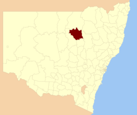
The Coonabarabran Shire was a local government area in the Orana region of New South Wales, Australia. The Shire was proclaimed on 7 March 1906 with the enactment of the Local Government (Shires) Act 1905 and was centred on the town of Coonabarabran, but also covered a wide area extending to smaller towns, such as Baradine and Binnaway. On 25 August 2004, the Shire voluntarily amalgamated with the adjoining Coolah Shire to form the Warrumbungle Shire.

The Central Coast Council is a local government area in the Central Coast region of New South Wales, Australia. It is adjacent to the Pacific Highway, Central Coast Highway, the Northern railway line and the Pacific Ocean. The council was formed on 12 May 2016 following the merger of the City of Gosford and Wyong Shire Councils.
Imlay Shire was a local government area in the South Coast region of New South Wales, Australia.
Wingadee Shire was a local government area in the Orana region of New South Wales, Australia.
Nepean Shire was a local government area in Sydney in New South Wales, Australia.
Kearsley Shire was a local government area in the Hunter region of New South Wales, Australia.
The Shire of Woy Woy was a local government area on the Central Coast region of New South Wales, Australia, centred on the town of Woy Woy. The shire was proclaimed on 1 August 1928 as a result of the proclamation of the separation of the D Riding of Erina Shire and had its council seat at Woy Woy, but covered the majority of the Woy Woy peninsula including Woy Woy Bay, Umina, Blackwall, Kariong, Pearl Beach, and Patonga. Woy Woy Shire was abolished on 1 January 1947 with the reorganisation of local government in the Central Coast region following the end of the Second World War, with the council area amalgamated into Gosford Shire.