Turvey Park is an inner southern suburb of Wagga Wagga in southern New South Wales, Australia. Its boundaries are defined by Fernleigh Road to the south, Glenfield Road to the west, Coleman Street to the north and to the east by Willans Hill. Turvey Park is characterised by single detached dwellings, constructed in the period from the early 1900s through to the 1960s. These dwellings vary from the very substantial, as found in parts of Coleman Street and Grandview Parade, to the brick bungalows of the northern end of the suburb between Urana and Coleman Streets, to modest public housing, and a mixture of brick and fibro and weatherboard cottages at the southern end of the suburb. Another feature of Turvey Park are many corner shops, such on the corner of Heath and Urana Street, the corner of Norman and Coleman Streets, and the Corner of Bourke and Urana Streets.[2]
Turvey Park was named after the property "Turvey Park" established by Thomas Turvey (died 14 January 1889), a licensee and store owner. A large family vault on the property was moved to the Church of England proportion of the Wagga Wagga Monumental Cemetery to allow for the construction of the intersection of Mitchelmore St and Hodson Ave in 1941.[3] A commemorative plaque now marks the vicinity of the original site.[4]
Henry's Tunnel on the Willans Hill Miniature Railway
The suburb was added to the municipality in 1939,[7] however the subdivision of lands and the construction of dwellings commenced well before this, in the early 1900s.[8][9][10][11] The annexure of the suburb followed long campaigns by Turvey Park residents for services available in central Wagga Wagga[12] such as water supply[13] and electricity.[14] Throughout the 1940s and 1950s the New South Wales Housing Commission erected public housing within the suburb, particularly around the Blamey Street and Fernleigh Road areas, with allocation of homes determined by ballot, with a large percentage of the homes being reserved for returned servicemen.[15][16][17][18][19][20][21][22] A number of these properties remain as Housing NSW social housing, whilst others have been transferred into private ownership.
In the late 1940s, Wagga Wagga Municipal Council carried out a replanning exercise in the southern part of Turvey Park in an area bounded by Urana Street, Macleay Street, Fernleigh Road, and Heath Street. Existing narrow laneways were widened to full width streets creating what are now Rudd, Croaker, Heydon, Hodson and Mair Streets, which facilitated more intensive subdivision of the area, by allowing the rear of the lots fronting wider, formal streets (such as Mitchelmore, Heath, Urana and Macleay Streets, as well as Fernleigh Road) to be excised.[23][24] Remnants of this exercise remain, where full widening of the laneways was not possible due to dwellings already being in place, such as Heydon Avenue at the corner with Heath Street, and Rudd Street at its intersection with Blamey Street.
Initially, Turvey Park housed an annex of South Wagga Public School, which opened in 1948,[25][26] and which was located at the Wagga Showgrounds in Bourke Street.[27] A public school was granted to Turvey Park in 1949, on a site in Halloran Street,[28] with Turvey Park Public School being officially open in 1952.[29] Classes, continued at the showground site, however, with construction of the new school continuing for some time before all year groups relocated to the current site.[30] The school was constructed as a 'demonstration school' to be used in the training of teacher's at the nearby Wagga Wagga Teacher's College (later Charles Sturt University South Campus), which is also located in Turvey Park.
Wagga Wagga is a major regional city in the Riverina region of New South Wales, Australia. Straddling the Murrumbidgee River, with an urban population of more than 56,000 as of June 2018, Wagga Wagga is the state's largest inland city, and is an important agricultural, military, and transport hub of Australia. The ninth largest inland city in Australia, Wagga Wagga is located midway between the two largest cities in Australia—Sydney and Melbourne—and is the major regional centre for the Riverina and South West Slopes regions.
Urana is a small town in the Riverina region of New South Wales, Australia. The town is in the Federation Council local government area.
Mount Austin is an inner southern suburb of Wagga Wagga, New South Wales, Australia. Its boundaries are Fernleigh Road and Leavenworth Drive to the north and south respectively, whilst Glenfield Road and Willans Hill form the western and eastern extents.
The Rock is a town with a population of 1,236, in the Riverina region of southern New South Wales, Australia, in Lockhart Shire. It is 32 kilometres (20 mi) south-west of Wagga Wagga on the Olympic Highway.
Culcairn is a town in the south-east Riverina region of New South Wales, Australia. Culcairn is located in the Greater Hume Shire local government area on the Olympic Highway between Albury and Wagga Wagga. The town is 514 kilometres (319 mi) south-west of the state capital, Sydney and at the 2016 census had a population of 1,473.
The Coreen & District Football League was an Australian rules football competition in the Coreen district of the Riverina in New South Wales, initially formed in 1909. The netball competition commenced in 1972 in line with the football fixture. The league was disbanded at the end of the 2007 season after 99 years of competition.
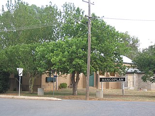
Mangoplah is a town approximately 36 kilometres (22 mi) south of Wagga Wagga in the Riverina region of New South Wales, Australia. At the 2016 census, Mangoplah had a population of 309. The name of the town is believed to mean "Kooris singing" in the Wiradjuri aboriginal language.
Boree Creek is a town in the Riverina district of New South Wales, Australia. The town is located 539 kilometres (335 mi) south west of the state capital, Sydney and 82 kilometres (51 mi) west of the regional centre, Wagga Wagga. Boree Creek is situated in the Federation Council local government area but is closer to the town of Lockhart. At the 2016 census, Boree Creek had a population of 64.
Milbrulong is a locality in the central east part of the Riverina region of New South Wales, Australia.
Osborne is a village community in the central east part of the Riverina. It is situated by road, about 15 kilometres south from Lockhart and 19 kilometres (12 mi) west from Woodend.
The Daily Advertiser is the regional newspaper which services Wagga Wagga, New South Wales Australia and much of the surrounding region. It is published Monday to Friday but also appears as a sister publication called The Weekend Advertiser on Saturdays. The paper reaches about 31,000 people during its Monday to Friday printing, equating to 85% of all people aged over 14 that live in the paper's main coverage area.
The Southern Riverina Football Association was first established in 1905 for towns in the Southern Riverina area of New South Wales, near the Murray River, which evolved into a strong and vibrant Australian rules football competition for the next 27 years.
The Mangoplah Football Club is an Australian Rules Football club. It competes in and around the Wagga Wagga area in New South Wales, Australia. The Mangoplah Football Club was founded in 1913 by D J Lloyd, who became the club's first captain. In 1955 the club merged with Cookardinia United FC.
The Albury & District Football League was established at a delegates meeting in Culcairn in 1930 from the following Australian Rules Football clubs - Albury Rovers, Culcairn, Henty and Holbrook and folded after the 1957 football season.
The Faithful & District Football Association was an Australian Rules Football competition, based in the Riverina region of New South Wales first established in 1920 at a meeting of club delegates from the following football clubs - Greenvale, Faithful and Sandigo, with a draw arranged too. The League went into recess in April 1940 due to World War Two but never reformed after the war.
The Lockhart Football and Netball Club is situated in the Riverina, New South Wales area and currently plays in the Hume Football League and fields four football and five netball teams in this competition.
The South West District Football League was a major Australian rules football competition which ran from 1910 until 1981 in the Riverina region of New South Wales.
The Central Riverina Football League was a minor Australian rules football competition which ran from 1949 until 1981 in the Riverina region of New South Wales. The league contained a number of historic clubs, many of which no longer exist.
This page is based on this Wikipedia article Text is available under the CC BY-SA 4.0 license; additional terms may apply. Images, videos and audio are available under their respective licenses.