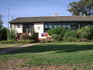
Glenfield Park, or simply 'Glenfield' is a rapidly growing southern suburb of Wagga Wagga, New South Wales, Australia reaching its final stages of development. Glenfield Park's strong residential development is due to its situation so close to the outskirts of the city and availability of relatively flat, cheap land. The suburb is home to the city's first Aldi supermarket and a large shopping centre known as South City Shopping Centre that is home to Wagga's second Coles supermarket.
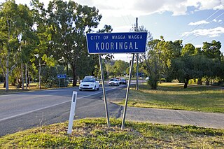
Kooringal is a suburb of Wagga Wagga, New South Wales, Australia. Kooringal is thought to mean "Side of a Hill" in the Wiradjuri aboriginal language. Kooringal is located approximately 4 km from the CBD along Lake Albert Road. Kooringal is the basis for growth in the eastern section of Wagga Wagga. Kooringal High School, on Ziegler Avenue is the largest secondary school in Wagga Wagga. The Kooringal area is also home to other schools including Kooringal Public School, Sturt Public School and the Sacred Heart School. Kooringal has a large suburban shopping centre known as Kooringal Mall and it consists of a Woolworths supermarket, McDonald's, Subway, Domino's Pizza, Australia Post retail store and various specialty stores.

Mount Austin is an inner southern suburb of Wagga Wagga, New South Wales, Australia. Its boundaries are Fernleigh Road and Leavenworth Drive to the north and south respectively, whilst Glenfield Road and Willans Hill form the western and eastern extents.

Bourkelands is a rapidly developing southern suburb of Wagga Wagga in southern New South Wales, Australia which is named after a property which was located within the suburb. The suburb consists predominantly of real estate display homes and housing for military staff at the nearby RAAF Base Wagga and Army Recruit Training Centre. The suburb borders Red Hill Road and is within walking distance of the Tolland shopping centre and Jubilee Park/Oval and contains two play parks. The suburb also contains the area which is commonly marketed by real estate agents and developers as Hilltop, as the name Hilltop is not registered locality.

Bomen is a northern suburb of Wagga Wagga in southern New South Wales, Australia. The suburb is dominated by industrial enterprises including Cargill Beef, Watties, the Wagga Wagga Livestock Marketing Centre (saleyards). The suburb is also home to Wagga Wagga's secondary railway station on the Main Southern line, when the line waited for the construction of a bridge over the Murrumbidgee River. New streets in Bomen are to be named after sheep and cattle breeds.

Forest Hill is a suburb of Wagga Wagga, New South Wales. Forest Hill is located approximately 10 km east of the central business district on the Sturt Highway. RAAF Base Wagga, Wagga Wagga Airport and the Bureau of Meteorology Regional Office are located at Forest Hill.

Collingullie is a village 26 kilometres (16 mi) north-west of Wagga Wagga in the Riverina region of New South Wales, Australia. The village is located on the Sturt Highway, between Wagga Wagga and Narrandera, at the crossroads with the road to Lockhart.
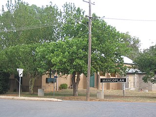
Mangoplah is a town approximately 36 kilometres (22 mi) south of Wagga Wagga in the Riverina region of New South Wales, Australia. At the 2016 census, Mangoplah had a population of 309. The name of the town is believed to mean "Kooris singing" in the Wiradjuri aboriginal language.

Downside is a farming community in the central east part of the Riverina and situated about 15 kilometres north west from Wagga Wagga and 24 kilometres south east from Coolamon.
Alfredtown is a rural community in the central east part of the Riverina. It is about 5 km north of Ladysmith and 14 km east of Wagga Wagga.

Ashmont, known originally as "J.J. Salmon's Estate" is a south-western suburb of Wagga Wagga, New South Wales, Australia. The suburb is named after the Salmon family's original homestead that was located where the suburb now stands.
Kapooka is a suburb in the south-west of Wagga Wagga, New South Wales, Australia.
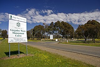
Gregadoo is a suburb of Wagga Wagga situated about 6 km South South-East of Lake Albert, New South Wales, Australia. It is situated by road, about 9 kilometres south east from Wagga Wagga.

Gumly Gumly is a suburb of the city of Wagga Wagga, New South Wales, Australia and is located approximately 8 km east of the CBD on the Sturt Highway.
Moorong, is a small suburb west of Wagga Wagga, New South Wales, Australia. The suburb is named after the pastoral property "Moorong" which is an Aboriginal word for the Wiradjuri Tribe meaning "Bleak" or "Cold" with other meanings "Bark Shelter" and "Camping Ground". Flowerdale Lagoon and Pomingalarna Reserve are located within the suburb.

East Wagga Wagga is a suburb of Wagga Wagga, New South Wales. East Wagga Wagga is mostly an industrial area located approximately 3 km (2 mi) east south-east of the central business district on the Sturt Highway. Home Base Wagga Wagga, WIN Television, Country Energy depot, Riverina Water County Council headquarters, Australia Post Mail Sorting Centre, Busabout Wagga Wagga depot, Australian Clay Target Association (ACTA) National Office and ACTA shooting range are located within East Wagga Wagga.

Charles Sturt University is a suburb and location for Charles Sturt University's Wagga Wagga Campus is located approximately 2.5 kilometres from Estella.

The Gap is a farming community in the central east part of the Riverina close to Wagga Wagga.

Gobbagombalin is a predominantly farming community in the central east part of the Riverina and a suburb of Wagga Wagga. A portion of Gobbagombalin adjacent to the suburb of Estella and to the North of Old Narrandera Road was rezoned for residential purposes under the Wagga Wagga Local Environmental Plan 2010 in July 2010, with suburban development of area commencing in 2013. The suburban part of Gobbagombalin is being marketed under various names including Estella Rise and Estella Heights, as well as Gobbagombalin, despite Estella being a separate locality further to the east of Gobbagombalin.
Dhulura is a rural area in the New South Wales Riverina close to Wagga Wagga. The locality was gazetted in 2015, and is named after the former Dhulura School which was located in the area