
The Murrumbidgee River is a major tributary of the Murray River within the Murray–Darling basin and the second longest river in Australia. It flows through the Australian state of New South Wales and the Australian Capital Territory, descending 1,500 metres (4,900 ft) over 1,485 kilometres (923 mi), generally in a west-northwesterly direction from the foot of Peppercorn Hill in the Fiery Range of the Snowy Mountains towards its confluence with the Murray River near Boundary Bend.

Charles Napier Sturt was a British officer and explorer of Australia, and part of the European exploration of Australia. He led several expeditions into the interior of the continent, starting from Sydney and later from Adelaide. His expeditions traced several of the westward-flowing rivers, establishing that they all merged into the Murray River, which flows into the Southern Ocean. He was searching to prove his own passionately held belief that an "inland sea" was located at the centre of the continent. He reached the rank of Captain, served in several appointed posts, and on the Legislative Council.

Wagga Wagga is a major regional city in the Riverina region of New South Wales, Australia. Straddling the Murrumbidgee River, with an urban population of more than 57,003 as of 2021, Wagga Wagga is the state's second largest inland city after Maitland, and is an important agricultural, military, and transport hub of Australia. The ninth largest inland city in Australia, Wagga Wagga is located midway between the two largest cities in Australia—Sydney and Melbourne—and is the major regional centre for the Riverina and South West Slopes regions.

Charles Sturt University is an Australian multi-campus public university located in New South Wales, Australian Capital Territory and Victoria. Established in 1989, it was named in honour of Captain Charles Napier Sturt, a British explorer who made expeditions into regional New South Wales and South Australia.

Olympic Highway is a 317-kilometre (197 mi) rural road in the central western and south-eastern Riverina regions of New South Wales, Australia. It services rural communities, links Hume Highway with Mid-Western Highway, and provides part of an alternate road link between Sydney and Albury via Bathurst and Cowra as well as servicing Wagga Wagga, linking with Sturt Highway.
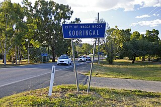
Kooringal is a suburb of Wagga Wagga, New South Wales, Australia. Kooringal is thought to mean "Side of a Hill" in the Wiradjuri aboriginal language. Kooringal is located approximately 4 km from the CBD along Lake Albert Road. Kooringal is the basis for growth in the eastern section of Wagga Wagga. Kooringal High School, on Ziegler Avenue is the largest secondary school in Wagga Wagga. The Kooringal area is also home to other schools including Kooringal Public School, Sturt Public School and the Sacred Heart School. Kooringal has a large suburban shopping centre known as Kooringal Mall and it consists of a Woolworths supermarket, McDonald's, Subway, Domino's Pizza, Australia Post retail store and various specialty stores.

Turvey Park is an inner southern suburb of Wagga Wagga in southern New South Wales, Australia. Its boundaries are defined by Fernleigh Road to the south, Glenfield Road to the west, Coleman Street to the north and to the east by Willans Hill. Turvey Park is characterised by single detached dwellings, constructed in the period from the early 1900s through to the 1960s. These dwellings vary from the very substantial, as found in parts of Coleman Street and Grandview Parade, to the brick bungalows of the northern end of the suburb between Urana and Coleman Streets, to modest public housing, and a mixture of brick and fibro and weatherboard cottages at the southern end of the suburb. Another feature of Turvey Park are many corner shops, such on the corner of Heath and Urana Street, the corner of Norman and Coleman Streets, and the Corner of Bourke and Urana Streets.
San Isidore is a rural suburb located on the outskirts of the city of Wagga Wagga, New South Wales, Australia.

Forest Hill is a suburb of Wagga Wagga, New South Wales. Forest Hill is located approximately 10 km east of the central business district on the Sturt Highway. RAAF Base Wagga, Wagga Wagga Airport and the Bureau of Meteorology Regional Office are located at Forest Hill.
Alfredtown is a rural community in the central east part of the Riverina. It is about 5 km north of Ladysmith and 14 km east of Wagga Wagga.
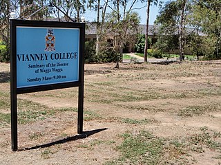
Boorooma is a suburb of Wagga Wagga, New South Wales, Australia, located in the city's north, beyond the floodplains of the Murrumbidgee River. The locality is a southern neighbour of Charles Sturt University—which in fact is referred to as 'Boorooma Campus' and is located directly to the east of the suburb of Estella and to the north of the Olympic Highway. Boorooma is progressively undergoing transition from rural residential type allotments to more intensive urban residential uses. Boorooma is also home to Vianney College Seminary and The Riverina Anglican College, and has land zoned for a future shopping centre.
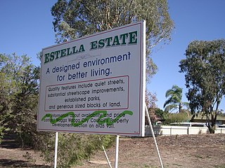
Estella is a northern suburb of Wagga Wagga, New South Wales, Australia. The suburb is relatively new with development commencing in the 1980s, however growth has been slow and land is still being subdivided.

Cartwrights Hill is a north-eastern suburb of Wagga Wagga, New South Wales, Australia. It is located immediately to the west of the industrial suburb of Bomen, which has, due to Bomen's shift towards heavier industries, led to the suburb's development being halted. The Red Steer Hotel/Motel is located in Cartwrights Hill.

The Daily Advertiser is the regional newspaper which services Wagga Wagga, New South Wales Australia and much of the surrounding region. It is published Monday to Friday but also appears as a sister publication called The Weekend Advertiser on Saturdays. The paper reaches about 31,000 people during its Monday to Friday printing, equating to 85% of all people aged over 14 who live in the paper's main coverage area.

Gumly Gumly is a suburb of the city of Wagga Wagga, New South Wales, Australia and is located approximately 8 km east of the CBD on the Sturt Highway.

Riverina Theatre Company was a non-profit organization located in Wagga Wagga, New South Wales, Australia. It was established in 1976 as the Riverina Trucking Company however changed its name to the Riverina Theatre Company in 1983. It was the longest serving theatre company in Regional Australia.

Busabout Wagga Wagga, formerly Fearnes Coaches, is an Australian bus company with depots in Wagga Wagga and Harden, New South Wales.

East Wagga Wagga is a suburb of Wagga Wagga, New South Wales. East Wagga Wagga is mostly an industrial area located approximately 3 km (2 mi) east south-east of the central business district on the Sturt Highway. Home Base Wagga Wagga, WIN Television, Country Energy depot, Riverina Water County Council headquarters, Australia Post Mail Sorting Centre, Busabout Wagga Wagga depot, Australian Clay Target Association (ACTA) National Office and ACTA shooting range are located within East Wagga Wagga.
Faye Beverley McMillan is an Australian academic and pharmacist known for her work on improving Indigenous healthcare. In 2023 she was awarded the Australian Harkness Fellowship in Health Care Policy and Practice. She is a Senior Atlantic Fellow for Social Equity, as well as being a Senior Fellow with Advance HE. She is a founding member of Indigenous Allied Health Australia (IAHA) and was a board member of IAHA from 2009-2017. She joined UTS in 2022 with over 20 years of experience in the Higher Education Sector and over 30 years in the health sector.

