Mount Austin Wagga Wagga, New South Wales | |||||||||||||||
---|---|---|---|---|---|---|---|---|---|---|---|---|---|---|---|
Mount Austin suburb sign | |||||||||||||||
Coordinates | 35°8′10.06″S147°21′7.48″E / 35.1361278°S 147.3520778°E Coordinates: 35°8′10.06″S147°21′7.48″E / 35.1361278°S 147.3520778°E | ||||||||||||||
Population | 3,957 (2016 census) [1] | ||||||||||||||
Postcode(s) | 2650 | ||||||||||||||
LGA(s) | City of Wagga Wagga | ||||||||||||||
County | Wynyard | ||||||||||||||
Parish | South Wagga Wagga | ||||||||||||||
State electorate(s) | Wagga Wagga | ||||||||||||||
Federal Division(s) | Riverina | ||||||||||||||
|
Mount Austin is an inner southern suburb of Wagga Wagga, New South Wales, Australia. Its boundaries are Fernleigh Road and Leavenworth Drive to the north and south respectively, whilst Glenfield Road and Willans Hill form the western and eastern extents.
The suburb is dominated by former and present Housing NSW residences.
Mount Austin Public School is located within the suburb however Mount Austin High School is situated in the neighbouring suburb of Tolland.
Despite its name, the Turvey Tops Shopping centre is located in Mount Austin, and not neighbouring Turvey Park. The shopping centre was first planned by the New South Wales Housing Commission in the 1950s, [2] but it was not until the 1960s, when Great Southern Enterprises Pty Ltd took over ownership of the land that work on the shopping centre started. Turvey Tops opened 3 December 1963, with a crowd of 3000 people in attendance. [3]
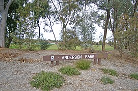
Anderson Park, in the suburb, was opened in 1987. It is named after the one-time Collingwood footballer, and long time local resident, George P. Anderson (1885-1957).
Wagga Wagga is a major regional city in the Riverina region of New South Wales, Australia. Straddling the Murrumbidgee River, with an urban population of more than 56,000 as of June 2018, Wagga Wagga is the state's largest inland city, and is an important agricultural, military, and transport hub of Australia. The ninth fastest growing inland city in Australia, Wagga Wagga is located midway between the two largest cities in Australia–Sydney and Melbourne–and is the major regional centre for the Riverina and South West Slopes regions.
Hornsby is a suburb on the Upper North Shore of Sydney in the Australian state of New South Wales 19 kilometres (12 mi) north-west of the Sydney central business district. It is the administrative centre of the local government area of Hornsby Shire.
Harden–Murrumburrah is a township and community in the Hilltops Region and is located in the South West Slopes of New South Wales in Australia and is adjacent to both the Canberra region of the Australian Capital Territory and the Riverina Region in the southwest area of NSW. The town is a twin town between Harden and Murrumburrah.
Glenfield is a suburb of Sydney, in the state of New South Wales, Australia. Glenfield is located 36 kilometres south-west of the Sydney central business district, in the local government areas of the City of Campbelltown and is part of the Macarthur region.
The Olympic Highway is a rural road in the central western and south-eastern Riverina regions of New South Wales, Australia. The 318-kilometre (198 mi) highway services rural communities and links the Hume Highway with the Mid-Western Highway and provides part of an alternate road link between Sydney and Albury via Bathurst and Cowra as well as servicing Wagga Wagga, linking with the Sturt Highway.
Glenfield Park, or simply 'Glenfield' is a rapidly growing southern suburb of Wagga Wagga, New South Wales, Australia reaching its final stages of development. Glenfield Park's strong residential development is due to its situation so close to the outskirts of the city and availability of relatively flat, cheap land. The suburb is home to the city's first Aldi supermarket and a large shopping centre known as South City Shopping Centre that is home to Wagga's second Coles supermarket.
Horningsea Park is a suburb of Sydney, in the state of New South Wales, Australia. Horningsea Park is located 39 kilometres south-west of the Sydney central business district, in the local government area of the City of Liverpool and is part of the Greater Western Sydney region.
Tolland is a suburb located in the city of Wagga Wagga in the Riverina region of New South Wales, Australia. The suburb is home to Mount Austin High School and Tolland Shopping Centre which has an IGA supermarket and a Domino's Pizza outlet. It is also home to the Tolland Football Club.
The Riverina Football Netball League (RFNL) is an Australian rules football and netball competition containing nine clubs based in the Riverina region of New South Wales, Australia. The league features three grades in the Australian rules football competition, with these being First-Grade, Reserve-Grade and Under 17s. In the netball competition, there are five grades, with these being A-Grade, A Reserve-Grade, B-Grade, C-Grade and Under 17s. In 2020, due to COVID-19 the Hume Football league team Osborne joined the competition for the 6 round season.
Bourkelands is a rapidly developing southern suburb of Wagga Wagga in southern New South Wales, Australia which is named after a property which was located within the suburb. The suburb consists predominantly of real estate display homes and housing for military staff at the nearby RAAF Base Wagga and Army Recruit Training Centre. The suburb borders Red Hill Road and is within walking distance of the Tolland shopping centre and Jubilee Park/Oval and contains two play parks. The suburb also contains the area which is commonly marketed by real estate agents and developers as Hilltop, as the name Hilltop is not registered locality.
Turvey Park is an inner southern suburb of Wagga Wagga in southern New South Wales, Australia. Its boundaries are defined by Fernleigh Road to the south, Glenfield Road to the west, Coleman Street to the north and to the east by Willans Hill. Turvey Park is characterised by single detached dwellings, constructed in the period from the early 1900s through to the 1960s. These dwellings vary from the very substantial, as found in parts of Coleman Street and Grandview Parade, to the brick bungalows of the northern end of the suburb between Urana and Coleman Streets, to modest public housing, and a mixture of brick and fibro and weatherboard cottages at the southern end of the suburb. Another feature of Turvey Park are many corner shops, such on the corner of Heath and Urana Street, the corner of Norman and Coleman Streets, and the Corner of Bourke and Urana Streets.
Wagga Wagga railway station is a heritage-listed railway station and now museum and railway station located on the Main South line in Wagga Wagga, New South Wales, Australia. The station is also known as the Wagga Wagga Railway Station and yard group. The property was added to the New South Wales State Heritage Register on 2 April 1999.
City of Wagga Wagga is a local government area in the Riverina region of south-western New South Wales, Australia.
Ashmont, known originally as "J.J. Salmon's Estate" is a south-western suburb of Wagga Wagga, New South Wales, Australia. The suburb is named after the Salmon family's original homestead that was located where the suburb now stands.
Triple M Riverina is an Australian radio station which transmits on 1152 kHz on the AM band. It is licensed to the city of Wagga Wagga, New South Wales. The station is the first radio station to have a radio receiver built in regional New South Wales and was originally owned by a husband and wife team, the late Eric and Nan Roberts, who were both formerly school teachers in Narrandera. It officially commenced broadcasts from the former Hardys' Building in Fitzmaurice Street overlooking the Wollundry Lagoon, broadcasting on the Oura Road Transmitter site with 2,000 watts on 29 June 1932 and operated between 6.00 am and 11.00 pm. In 1995 2WZD (FM93) began broadcasting.
The history of Wagga Wagga details the growth of the city from a small crossing on the Murrumbidgee River to the largest city and regional centre of the Riverina region of New South Wales, Australia.
The Farrer Football Netball League (FFNL) is an Australian rules football and netball competition containing nine clubs based in the Riverina region of New South Wales, Australia. The league features three grades in the Australian rules football competition, with these being First-Grade, Reserve-Grade and Under 17s. In the netball competition there are four grades, with these being A-Grade, A-Reserve Grade, B-Grade and C-Grade.
Kooringal High School is a government-funded co-educational dual modality partially academically selective and comprehensive secondary day school, located in Kooringal, a suburb of Wagga Wagga in the Riverina region of New South Wales, Australia.
Caddens is a suburb of Sydney, in the state of New South Wales in Australia. It is a new masterplanned residential neighbourhood located 45 kilometres west of the Sydney central business district, in the local government area of the City of Penrith featuring views of the scenic Blue Mountains. The suburb's postcode is 2747.
This Riverina geography article is a stub. You can help Wikipedia by expanding it. |