
Tapin Tops National Park is a 110 km2 (42 sq mi) national park that is located in the Mid North Coast region of New South Wales, Australia.

Pacific Highway is a 790-kilometre-long (491 mi) national highway and major transport route along the central east coast of Australia, with the majority of the highway being part of Australia's Highway 1. The highway and its adjoining Pacific Motorway between Brisbane and Brunswick Heads and Pacific Motorway between Sydney and Newcastle links the state capitals of Sydney in New South Wales with Brisbane in Queensland. It approximately parallels the Tasman Sea and the Coral Sea of the South Pacific Ocean coast. Additionally, between Brunswick Heads and Port Macquarie, the road is also signed as Pacific Motorway, but has not been legally gazetted as such.

Port Macquarie is a town on the Mid North Coast of New South Wales, Australia, 390 km (242 mi) north of Sydney, and 570 km (354 mi) south of Brisbane, on the Tasman Sea coast at the mouth of the Hastings River, and the eastern end of the Oxley Highway (B56). It had a population of 47,974 in 2018, and an estimated population of 50,307 in 2023.

Port Stephens, an open youthful tide-dominated drowned-valley estuary, is a large natural harbour of approximately 134 square kilometres (52 sq mi) located in the Hunter and Mid North Coast regions of New South Wales, Australia.

Dungog is a country town on the Williams River in the Hunter region and a small part of the Mid North Coast region of New South Wales, Australia. Located in the middle of dairy and timber country, it is the centre of the Dungog Shire Local Government Area and at the 2021 Census it had a population of 2,169 people. The area includes the Fosterton Loop, 22 kilometres (14 mi) of road, used in the annual Pedalfest. A small portion of Dungog lies in the Mid-Coast Council Local Government Area.

The Mid North Coast is a country region in the north-east of the state of New South Wales, Australia. The region, situated 416km north of Sydney, covers the mid northern coast of the state, beginning from Port Stephens at Hawks Nest to as far north as Woolgoolga, near Coffs Harbour. The region has many beaches and subtropical national parks and forests as well as rural farmland and logging. Major coastal towns include Coffs Harbour, Forster and Port Macquarie. The Mid North Coast is a popular destination for camping or resorts and surfing, with coastal and hinterland tracks, with the unique heritage-listed mountain village of Bellbrook popular for day trips inland or 4wd campers and keen bass fishers.

Manning River, an open and trained mature wave dominated barrier estuary, is located in the Northern Tablelands and Mid North Coast districts of New South Wales, Australia. It is the only double delta river in the southern hemisphere in which there are two permanent entrances to the river, one at Old Bar and another at Harrington, and is famously one of only two rivers in the world to have permanent multiple entrances with the other being the Nile river in Egypt.
(The) Bucketts Way is a 151-kilometre (94 mi) rural road that links Gloucester to Taree and Raymond Terrace, in New South Wales, Australia. A former alignment of Pacific Highway, it was later named after the Bucketts Mountains, a prominent mountain range near Gloucester. The entire route is designated as Tourist Route 2.

Myall Lakes is an electoral district of the Legislative Assembly in the Australian state of New South Wales. It was represented by Stephen Bromhead of The Nationals until his death in 2023.
The Greater Taree City Council (GTCC) was a local government area on the Mid North Coast of New South Wales, Australia, until 12 May 2016 when it was amalgamated to form part of the Mid-Coast Council. It was originally formed in 1981 from the Manning Shire, and the Taree and Wingham Municipal Councils. The council was centred on Taree, located adjacent to the Manning River, the Pacific Highway and the North Coast railway line.

Great Lakes Council was a local government area in the Mid North Coast region of New South Wales, Australia. The area is situated adjacent to the shores of Port Stephens, Myall Lakes and Wallis Lake and the Pacific Highway and the Lakes Way. On 12 May 2016 the council was dissolved and the area included in the Mid-Coast Council, along with the City of Greater Taree and Gloucester Shire.

Bulahdelah is a town and locality in the Mid North Coast region of New South Wales, Australia in the Mid-Coast Council local government area.

Myall River, an open semi-mature brackish freshwater barrier estuary of the Mid-Coast Council system, is located in the Mid North Coast region of New South Wales, Australia.

Gloucester Shire was a local government area in the Mid North Coast and Upper Hunter regions of New South Wales, Australia. The Shire was situated adjacent to the Bucketts Way and the North Coast railway line.
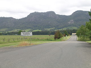
Monkerai is a large rural area in the hills in the land between Dungog and Gloucester in Mid-Coast Council, in the Hunter Region, New South Wales, Australia.
The Crawford River, a perennial river of the Mid-Coast Council system, is located in the Mid North Coast region of New South Wales, Australia.
Mammy Johnsons River, a mostly perennial river of the Mid-Coast Council system, is located in the Mid North Coast and Upper Hunter regions of New South Wales, Australia.
The Branch River, a watercourse of the Mid-Coast Council system, is located in the Mid North Coast and Upper Hunter regions of New South Wales, Australia.
Wards River, a mostly perennial river of the Mid-Coast Council system, is located in the Mid North Coast and Upper Hunter regions of New South Wales, Australia.
Connollys Creek, a watercourse of the Manning River catchment, is located in the Mid North Coast region of New South Wales, Australia.
