The Severn River, a perennial river that forms part of the Border Rivers group, is part of the Macintyre catchment of the Murray-Darling basin, located in the Northern Tablelands and North West Slopes regions of New South Wales, Australia.

Shellharbour is a suburb located in the Illawarra region of New South Wales, Australia. It also gives its name to the local government area, City of Shellharbour.

Central Tilba and Tilba Tilba are two villages near the Princes Highway in Eurobodalla Shire, New South Wales, Australia. At the 2016 census, Central Tilba and surrounding areas had a population of 288. It is the site for the television series: River Cottage Australia.

Collingullie is a village 26 kilometres (16 mi) north-west of Wagga Wagga in the Riverina region of New South Wales, Australia. The village is located on the Sturt Highway, between Wagga Wagga and Narrandera, at the crossroads with the road to Lockhart.

Wrights Beach is a town in the City of Shoalhaven in New South Wales, Australia. It is on the shores of St Georges Basin, near the Jervis Bay Territory.
The Bathurst Region is a local government area in the Central West region of New South Wales, Australia. The area is located adjacent to the Great Western Highway, Mid-Western Highway, Mitchell Highway and the Main Western railway line. At the 2016 census, the Bathurst Region had a population of 41,300.

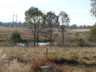
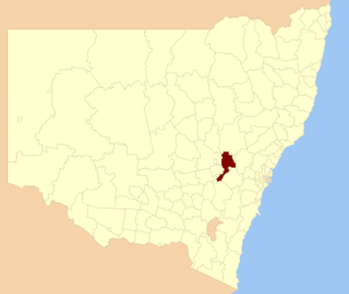
Inverell Shire is a local government area in the North West Slopes region of New South Wales, Australia adjacent to the Macintyre River and the Gwydir Highway.

Rosewood is a village community and locality in the south east part of the Riverina, New South Wales, Australia. It is situated about 16 kilometres (9.9 mi) south east from Carabost and 19 kilometres (12 mi) north west from Tumbarumba. At the 2016 census, Rosewood had a population of 214. The village is administered by two local governments; the northern part of the locality by the Greater Hume Shire and the southern part of the locality by the Snowy Valleys Council. The village of Rosewood is within the Snowy Valleys Council area.
Glenquarry is a locality in the Southern Highlands of New South Wales, Australia, in Wingecarribee Shire. It is a scattered village on the banks of the Wingecarribee River. At the 2016 census, it had a population of 222.
Upper Kangaroo River is a small village in the Southern Highlands of New South Wales, Australia, in Shoalhaven City Council. It is located on the Kangaroo River, a tributary of the Shoalhaven River. At the 2016 census, it had a population of 122.

Lake Bathurst is a shallow lake located 27 kilometres (17 mi) south-east of Goulburn, New South Wales in Australia. It is also the name of a nearby locality in the Goulburn Mulwaree Council.
Harrington is a small village located at the mouth of the Manning River in New South Wales, Australia. It was established in 1853 and proclaimed a village on 26 September 1896. It is 15 km north-east of Taree on the Mid North Coast, and 335 kilometres (208 mi) north east of the state capital, Sydney. At the 2011 census, Harrington had a population of 2,258. It was named after the Earl of Harrington by the explorer, John Oxley.

Cassilis is a village in the central west of New South Wales, Australia.

Majors Creek is a small village in the Southern Tablelands region of New South Wales, Australia. The nearest major town is Braidwood, 16 km (9.9 mi) to the north. At the 2016 census, the population of Majors Creek was 249.

Royalla is a rural locality on the border of New South Wales and the Australian Capital Territory. The area takes its name from the nearby Mount Rob Roy, and was originally a railway settlement on the Bombala railway line known as Rob Roy and changed to the current name in 1905. Modern Royalla is a large rural locality east of the Monaro Highway. The border with the ACT follows the western boundary of the easement of the former railway line to the east of the highway. The town was served by a railway station until 1975. The NSW part of Royalla had a population of 984 at the 2016 census.

Broughton Village is a locality on the border of the Kiama and Shoalhaven local government areas in New South Wales, Australia. It lies on the Princes Highway about 18 southwest of Kiama and 39 km north of Nowra and on Broughton creek. At the 2016 census, it had a population of 86. Broughton Village is to not to be confused with Broughton, a locality that lies to its immediate southwest or Broughton Vale, which lies to its immediate northwest.

Broughton is a locality in the City of Shoalhaven in New South Wales, Australia. It lies on the Princes Highway between Gerringong and Berry and between Broughton and Broughton Mill creeks. At the 2016 census, it had a population of 87. Broughton is to not to be confused with Broughton Village, a locality that lies to its immediate northeast, or Broughton Vale, which lies to its immediate north.

Broughton Vale is a locality in the City of Shoalhaven in New South Wales, Australia. It lies north of the Princes Highway at Berry between Nowra and Gerringong and on Broughton Mill creek. At the 2016 census, it had a population of 165. Broughton Vale is to not to be confused with Broughton Village or Broughton, which both lie to its immediate east.

Cambewarra is located in New South Wales, Australia. It lies on the Kangaroo Valley–Nowra road, about 11 km northwest of Nowra and south of Cambewarra Mountain. At the 2016 census, it had a population of 238. Cambewarra is a largely rural area, which surrounds Cambewarra Village.

Cambewarra Village is a locality in the City of Shoalhaven in New South Wales, Australia. It lies on Main Road, which runs west from Cambewarra Road, which forms part of the Kangaroo Valley–Nowra road, about 9 km northwest of Nowra and south of Cambewarra Mountain. At the 2016 census, it had a population of 1,189. Cambewarra Village is largely surrounded by the locality of Cambewarra.


