Arrawatta County

Last updated
Map all coordinates using: OpenStreetMap  ·  Google Maps
Download coordinates as: KML  ·  GPX
Arrawatta
New South Wales

Arrawatta NSW.PNG

Location in New South Wales
Australia New South Wales location map blank.svg
Red pog.svg
Arrawatta
Coordinates 29°14′27″S151°06′34″E / 29.24083°S 151.10944°E / -29.24083; 151.10944 (Arrawatta County) Coordinates: 29°14′27″S151°06′34″E / 29.24083°S 151.10944°E / -29.24083; 151.10944 (Arrawatta County)
Lands administrative divisions around Arrawatta:
Stapylton Clive (Qld) Clive (Qld)
Burnett Arrawatta Clive
Murchison Hardinge Gough

Arrawatta County, New South Wales is one of the 141 Cadastral divisions of New South Wales. It includes Ashford. The name Arrawatta is thought to be derived from a local aboriginal word for the area that includes Arrawatta County. [1]

Ashford, New South Wales Town in New South Wales, Australia

Ashford is a small village situated in the north-west on the Northern Tablelands of the state of New South Wales. The New England rural village of Ashford lies within the broad sunlit lands 748 km north of Sydney, 500 km south west of Brisbane, close to the Queensland border. Ashford is 430 metres above sea level and located 56 km north of Inverell on a major arterial road, connecting the Gwydir and Bruxner highways through to the Queensland border.

Indigenous Australians are the Aboriginal and Torres Strait Islander people of Australia, descended from groups that existed in Australia and surrounding islands before British colonisation. The time of arrival of the first Indigenous Australians is a matter of debate among researchers. The earliest conclusively human remains found in Australia are those of Mungo Man LM3 and Mungo Lady, which have been dated to around 50,000 years BP. Recent archaeological evidence from the analysis of charcoal and artefacts revealing human use suggests a date as early as 65,000 BP. Luminescence dating has suggested habitation in Arnhem Land as far back as 60,000 years BP. Genetic research has inferred a date of habitation as early as 80,000 years BP. Other estimates have ranged up to 100,000 years and 125,000 years BP.

Parishes

A full list of parishes found within this county; their current LGA and mapping coordinates to the approximate centre of each location is as follows:

Local government in Australia

Local government in Australia is the third tier of government in Australia administered by the states and territories, which in turn are beneath the federal tier. Local government is not mentioned in the Constitution of Australia and two referenda in the 1970s and 1980s to alter the Constitution relating to local government were unsuccessful. Every state government recognises local government in their respective constitutions. Unlike Canada or the United States, there is only one level of local government in each state, with no distinction such as cities and counties.

Parish LGA Coordinates
Alpine Inverell Shire 29°05′54″S151°14′04″E / 29.09833°S 151.23444°E / -29.09833; 151.23444 (Alpine Parish)
Athol Inverell Shire 29°22′54″S151°25′04″E / 29.38167°S 151.41778°E / -29.38167; 151.41778 (Athol Parish)
Astley Inverell Shire 29°26′54″S151°26′04″E / 29.44833°S 151.43444°E / -29.44833; 151.43444 (Astley Parish)
Ashford Inverell Shire 29°19′54″S151°05′04″E / 29.33167°S 151.08444°E / -29.33167; 151.08444 (Ashford Parish)
Ashby Inverell Shire 29°15′54″S151°12′04″E / 29.26500°S 151.20111°E / -29.26500; 151.20111 (Ashby Parish)
Anderson Inverell Shire 28°41′54″S150°45′04″E / 28.69833°S 150.75111°E / -28.69833; 150.75111 (Anderson Parish)
Arthurs Seat Inverell Shire 29°22′54″S150°59′04″E / 29.38167°S 150.98444°E / -29.38167; 150.98444 (Arthurs Seat Parish)
Adowa Inverell Shire 29°10′54″S151°12′04″E / 29.18167°S 151.20111°E / -29.18167; 151.20111 (Adowa Parish)
Bannockburn Inverell Shire 29°34′54″S150°58′04″E / 29.58167°S 150.96778°E / -29.58167; 150.96778 (Bannockburn Parish)
Barden Inverell Shire 29°44′54″S150°42′04″E / 29.74833°S 150.70111°E / -29.74833; 150.70111 (Barden Parish)
Bebo Inverell Shire 29°46′54″S150°46′04″E / 29.78167°S 150.76778°E / -29.78167; 150.76778 (Bebo Parish)
Bengalla Inverell Shire 28°40′54″S150°40′04″E / 28.68167°S 150.66778°E / -28.68167; 150.66778 (Bengalla Parish)
Blloonbah Inverell Shire 29°30′54″S151°26′04″E / 29.51500°S 151.43444°E / -29.51500; 151.43444 (Blloonbah Parish)
Bonshaw Inverell Shire 28°59′54″S151°12′04″E / 28.99833°S 151.20111°E / -28.99833; 151.20111 (Bonshaw Parish)
Bora Inverell Shire 29°47′54″S150°58′04″E / 29.79833°S 150.96778°E / -29.79833; 150.96778 (Bora Parish)
Bowman Inverell Shire 29°14′54″S151°21′04″E / 29.24833°S 151.35111°E / -29.24833; 151.35111 (Bowman Parish)
Buckley Inverell Shire 29°41′54″S151°31′04″E / 29.69833°S 151.51778°E / -29.69833; 151.51778 (Buckley Parish)
Bukkulla Inverell Shire 29°30′54″S151°08′04″E / 29.51500°S 151.13444°E / -29.51500; 151.13444 (Bukkulla Parish)
Bunal Inverell Shire 29°03′54″S150°51′04″E / 29.06500°S 150.85111°E / -29.06500; 150.85111 (Bunal Parish)
Burgundy Inverell Shire 29°38′54″S151°08′04″E / 29.64833°S 151.13444°E / -29.64833; 151.13444 (Burgundy Parish)
Byron Inverell Shire 29°43′54″S150°59′04″E / 29.73167°S 150.98444°E / -29.73167; 150.98444 (Byron Parish)
Campbell Inverell Shire 28°58′54″S150°54′04″E / 28.98167°S 150.90111°E / -28.98167; 150.90111 (Campbell Parish)
Champagne Inverell Shire 29°37′54″S151°04′04″E / 29.63167°S 151.06778°E / -29.63167; 151.06778 (Champagne Parish)
Chapman Inverell Shire 29°20′54″S151°11′04″E / 29.34833°S 151.18444°E / -29.34833; 151.18444 (Chapman Parish)
Cox Inverell Shire 29°49′54″S150°56′04″E / 29.83167°S 150.93444°E / -29.83167; 150.93444 (Cox Parish)
Cucumber Inverell Shire 29°13′54″S150°52′04″E / 29.23167°S 150.86778°E / -29.23167; 150.86778 (Cucumber Parish)
Dight Inverell Shire 29°50′54″S150°48′04″E / 29.84833°S 150.80111°E / -29.84833; 150.80111 (Dight Parish)
Dumaresq Inverell Shire 28°40′54″S150°34′04″E / 28.68167°S 150.56778°E / -28.68167; 150.56778 (Dumaresq Parish)
East Yetman Inverell Shire 29°55′54″S150°52′04″E / 29.93167°S 150.86778°E / -29.93167; 150.86778 (East Yetman Parish)
Egerton Inverell Shire 29°25′54″S151°12′04″E / 29.43167°S 151.20111°E / -29.43167; 151.20111 (Egerton Parish)
Ellis Inverell Shire 28°53′54″S151°02′04″E / 28.89833°S 151.03444°E / -28.89833; 151.03444 (Ellis Parish)
Ena Inverell Shire 29°07′54″S150°53′04″E / 29.13167°S 150.88444°E / -29.13167; 150.88444 (Ena Parish)
Frazer Inverell Shire 29°30′54″S151°11′04″E / 29.51500°S 151.18444°E / -29.51500; 151.18444 (Frazer Parish)
Goonian Inverell Shire 28°55′54″S151°13′04″E / 28.93167°S 151.21778°E / -28.93167; 151.21778 (Goonian Parish)
Gordon Inverell Shire 28°41′54″S150°49′04″E / 28.69833°S 150.81778°E / -28.69833; 150.81778 (Gordon Parish)
Graman Inverell Shire 29°30′54″S150°54′04″E / 29.51500°S 150.90111°E / -29.51500; 150.90111 (Graman Parish)
Hallam Inverell Shire 29°03′54″S151°06′04″E / 29.06500°S 151.10111°E / -29.06500; 151.10111 (Hallam Parish)
Hawthorne Inverell Shire 29°18′54″S151°24′04″E / 29.31500°S 151.40111°E / -29.31500; 151.40111 (Hawthorne Parish)
Hetherington Inverell Shire 28°57′54″S151°03′04″E / 28.96500°S 151.05111°E / -28.96500; 151.05111 (Hetherington Parish)
Hogarth Inverell Shire 29°25′54″S151°19′04″E / 29.43167°S 151.31778°E / -29.43167; 151.31778 (Hogarth Parish)
Holdfast Inverell Shire 28°48′54″S150°42′04″E / 28.81500°S 150.70111°E / -28.81500; 150.70111 (Holdfast Parish)
Holmes Inverell Shire 29°55′54″S150°56′04″E / 29.93167°S 150.93444°E / -29.93167; 150.93444 (Holmes Parish)
Kings Plains Inverell Shire 29°33′54″S151°22′04″E / 29.56500°S 151.36778°E / -29.56500; 151.36778 (Kings Plains Parish)
Leslie Inverell Shire 29°16′54″S150°58′04″E / 29.28167°S 150.96778°E / -29.28167; 150.96778 (Leslie Parish)
Limestone Inverell Shire 29°09′54″S150°59′04″E / 29.16500°S 150.98444°E / -29.16500; 150.98444 (Limestone Parish)
Lockerby Inverell Shire 29°20′54″S151°16′04″E / 29.34833°S 151.26778°E / -29.34833; 151.26778 (Lockerby Parish)
Lorne Inverell Shire 29°17′54″S151°18′04″E / 29.29833°S 151.30111°E / -29.29833; 151.30111 (Lorne Parish)
Macintyre Inverell Shire 29°12′54″S150°57′04″E / 29.21500°S 150.95111°E / -29.21500; 150.95111 (Macintyre Parish)
McDonald Inverell Shire 29°15′54″S151°05′04″E / 29.26500°S 151.08444°E / -29.26500; 151.08444 (Mcdonald Parish)
Mandoe Inverell Shire 29°01′54″S150°56′04″E / 29.03167°S 150.93444°E / -29.03167; 150.93444 (Mandoe Parish)
Meriti Inverell Shire 28°57′54″S150°58′04″E / 28.96500°S 150.96778°E / -28.96500; 150.96778 (Meriti Parish)
Myall Inverell Shire 29°08′54″S151°06′04″E / 29.14833°S 151.10111°E / -29.14833; 151.10111 (Myall Parish)
North Nullamanna Inverell Shire 29°38′54″S151°14′04″E / 29.64833°S 151.23444°E / -29.64833; 151.23444 (North Nullamanna Parish)
Nullamanna Inverell Shire 29°38′54″S151°13′04″E / 29.64833°S 151.21778°E / -29.64833; 151.21778 (Nullamanna Parish)
Pindari Inverell Shire 29°31′54″S151°18′04″E / 29.53167°S 151.30111°E / -29.53167; 151.30111 (Pindari Parish)
Redbank Inverell Shire 29°30′54″S150°58′04″E / 29.51500°S 150.96778°E / -29.51500; 150.96778 (Redbank Parish)
Rose Inverell Shire 29°01′54″S151°00′04″E / 29.03167°S 151.00111°E / -29.03167; 151.00111 (Rose Parish)
Russell Inverell Shire 29°23′14″S150°55′20″E / 29.38722°S 150.92222°E / -29.38722; 150.92222 (Russell Parish)
St Andrews Inverell Shire 29°22′54″S151°22′04″E / 29.38167°S 151.36778°E / -29.38167; 151.36778 (St Andrews Parish)
Samuel Inverell Shire 29°46′54″S150°47′04″E / 29.78167°S 150.78444°E / -29.78167; 150.78444 (Samuel Parish)
Severn Inverell Shire 29°06′54″S150°58′04″E / 29.11500°S 150.96778°E / -29.11500; 150.96778 (Severn Parish)
Swamp Oak Inverell Shire 29°40′54″S151°20′04″E / 29.68167°S 151.33444°E / -29.68167; 151.33444 (Swamp Oak Parish)
Texas Inverell Shire 28°53′54″S151°08′04″E / 28.89833°S 151.13444°E / -28.89833; 151.13444 (Texas Parish)
Trigamon Inverell Shire 29°56′54″S150°46′04″E / 29.94833°S 150.76778°E / -29.94833; 150.76778 (Trigamon Parish)
Vivier Glen Innes Severn Council 29°33′54″S151°30′04″E / 29.56500°S 151.50111°E / -29.56500; 151.50111 (Vivier Parish)
Wallangra Inverell Shire 29°12′54″S150°53′04″E / 29.21500°S 150.88444°E / -29.21500; 150.88444 (Wallangra Parish)
Wandera Inverell Shire 29°04′14″S151°08′04″E / 29.07056°S 151.13444°E / -29.07056; 151.13444 (Wandera Parish)
Weean Inverell Shire 29°34′54″S151°18′04″E / 29.58167°S 151.30111°E / -29.58167; 151.30111 (Weean Parish)
Wyndham Inverell Shire 29°31′54″S151°03′04″E / 29.53167°S 151.05111°E / -29.53167; 151.05111 (Wyndham Parish)
Yetman Inverell Shire 29°53′54″S150°45′04″E / 29.89833°S 150.75111°E / -29.89833; 150.75111 (Yetman Parish)

Related Research Articles

Bonshaw, New South Wales Town in New South Wales, Australia

Bonshaw is a village in New South Wales, Australia 783 km north of Sydney. In 2006 the village had a population of 171 people in the district. It is located near the northern border of the State close to Texas, Queensland, from which it is separated by the Dumaresq River which forms the border between the states. Bonshaw is located in Inverell Shire and Arrawatta County. It is on the Bruxner Highway between Tenterfield and Goondiwindi. It is a village designed to serve the needs of the agricultural holdings in the area.

The Geographical Names Board of New South Wales, a statutory authority of the Land and Property Information division, Department of Finance and Services in the Government of New South Wales, is the official body for naming and recording details of places and geographical names in the state of New South Wales, Australia.

Graman, New South Wales Town in New South Wales, Australia

Graman is a small village nestled on the banks of Graman Creek, 40 km northwest of Inverell and 25 km from Ashford in Inverell Shire, New South Wales, Australia. The village is situated on the Inverell to Yetman road at elevation of about 606 metres. Graman is in Arrawatta County.

Gloucester County, New South Wales Cadastral in New South Wales, Australia

Gloucester County was one of the original Nineteen Counties in New South Wales, and is now one of the 141 cadastral divisions of New South Wales. It includes the area around Port Stephens. It is bounded on the north and west by the Manning River, and on the south-west by the Williams River.

Durham County, New South Wales Cadastral in New South Wales, Australia

Durham County was one of the original Nineteen Counties in New South Wales and is now one of the 141 Cadastral divisions of New South Wales. It is bordered on the south and west by the Hunter River, and on the north and east by the Williams River. It includes Aberdeen and Muswellbrook. Before 1834, the area known as Durham County included what later became Gloucester and most of Brisbane counties, as far west as the Liverpool Range, and east to the Pacific, including Port Stephens, as shown on an 1832 map.

Roxburgh County Cadastral in New South Wales, Australia

Roxburgh County was one of the original Nineteen Counties in New South Wales and is now one of the 141 Cadastral divisions of New South Wales. It includes the area to the north east of Bathurst, lying to the north and east of the Fish River to the junction of the Turon River. It includes Sofala. The Gudgegong River is the border to the north.

Brisbane County Cadastral in New South Wales, Australia

Brisbane County was one of the original Nineteen Counties in New South Wales and is now one of the 141 Cadastral divisions of New South Wales. It includes Scone, Merriwa and Murrurundi. The Goulburn River is the boundary to the south and the Hunter River the boundary to the south-east. The Liverpool Range area is the boundary to the north, and the Krui River the boundary to the west.

Bligh County Cadastral in New South Wales, Australia

Bligh County was one of the original Nineteen Counties in New South Wales and is now one of the 141 Cadastral divisions of New South Wales. The Cudgegong River and the Goulburn River are its southern boundaries; the Krui River is the eastern boundary, and the Burragundy River the northern boundary. It includes the villages of Cassilis and Dunedoo.

Sandon County Cadastral in New South Wales, Australia

Sandon County is one of the 141 Cadastral divisions of New South Wales. It is centred on Armidale, and also includes Uralla.

Buccleuch County Cadastral in New South Wales, Australia

Buccleuch County is one of the 141 Cadastral divisions of New South Wales. It contains the locality of Adjungbilly. The Murrumbidgee River is at the northern boundary, with the Goodradigbee River on the eastern boundary, and the Tumut River on the western boundary. It includes the northern part of the Kosciuszko National Park.

Ashburnham County Cadastral in New South Wales, Australia

Ashburnham County, New South Wales is one of the 141 Cadastral divisions of New South Wales. The Lachlan River and Belubula River is the southern boundary. It includes Parkes and Forbes.

Baradine County Cadastral in New South Wales, Australia

Baradine County is one of the 141 Cadastral divisions of New South Wales. It is bounded in the north by the Namoi River, and includes the land south to Coonabarabran, which is on its southern edge. This includes land on both sides of the Baradine Creek and the town of Baradine.
Darling County Cadastral in New South Wales, Australia

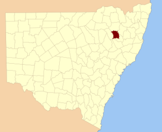
Darling County is one of the 141 Cadastral divisions of New South Wales. It includes Manilla and Barraba

Fitzroy County Cadastral in New South Wales, Australia

Fitzroy County is one of the 141 Cadastral divisions of New South Wales. It lies south of the Orara River, and north of the Bellinger River, and includes Coffs Harbour.

Gowen County Cadastral in New South Wales, Australia

Gowen County is one of the 141 Cadastral divisions of New South Wales. It is located to the east of the Castlereagh River in the area to the east of Gilgandra, to Coonabarabran in the north-east. This includes land on both sides of the Newell Highway.

Macquarie County Cadastral in New South Wales, Australia

Macquarie County is one of the 141 Cadastral divisions of New South Wales, Australia. It is bordered to the north by the Apsley River, and to the south by the Manning River. It includes Port Macquarie and the area around it.
Rankin County, New South Wales Cadastral in New South Wales, Australia

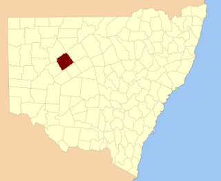
Rankin County is one of the 141 Cadastral divisions of New South Wales. It includes part of the Paroo-Darling National Park. The border to the north-west is the Darling River.

Vernon County, New South Wales Cadastral in New South Wales, Australia

Vernon County is one of the 141 Cadastral divisions of New South Wales, Australia. The Macleay River is part of the border in the north-east. It includes Walcha.

Bukkulla, New South Wales Town in New South Wales, Australia

Bukkulla is a hamlet about 30 kilometres (19 mi) north of Inverell and north-east of Bannockburn on the Ashford Road. This hamlet is within the boundaries of Arrawatta County and Inverell Shire, New South Wales, Australia. The village is at elevation of about 580 metres. In the 2006 census, there were 145 persons usually resident in the Bukkulla area.

References

  1. "Arrawatta". Geographical Names Register (GNR) of NSW. Geographical Names Board of New South Wales.