Clive County, New South Wales

Last updated
Clive
New South Wales

Clive NSW.PNG

Location in New South Wales
Lands administrative divisions around Clive:
Clive (Qld) Bentinck (Qld) Buller
Gough Clive Drake
Gough Gresham Gresham
Map all coordinates using: OpenStreetMap  ·  Google Maps
Download coordinates as: KML  ·  GPX

Clive County is one of the 141 Cadastral divisions of New South Wales.

The name is of unknown origin. [1]

Parishes

Clive County consists of the following parishes:

Parish LGA Coordinates Towns
Addison Tenterfield 29°05′54″S151°55′04″E / 29.09833°S 151.91778°E / -29.09833; 151.91778 (Addison Parish)
Angoperran Tenterfield 29°21′54″S151°56′04″E / 29.36500°S 151.93444°E / -29.36500; 151.93444 (Angoperran Parish)
Annandale Tenterfield 29°12′54″S151°49′04″E / 29.21500°S 151.81778°E / -29.21500; 151.81778 (Annandale Parish)
Bajimba Tenterfield 29°19′54″S152°15′04″E / 29.33167°S 152.25111°E / -29.33167; 152.25111 (Bajimba Parish)
Ballandean Tenterfield 28°57′54″S151°57′04″E / 28.96500°S 151.95111°E / -28.96500; 151.95111 (Ballandean Parish) Jennings
Barney Downs Tenterfield 28°59′54″S152°07′04″E / 28.99833°S 152.11778°E / -28.99833; 152.11778 (Barney Downs Parish) Barney Downs
Bates Tenterfield 29°12′54″S151°44′04″E / 29.21500°S 151.73444°E / -29.21500; 151.73444 (Bates Parish)
Binghi Tenterfield 29°08′54″S151°37′04″E / 29.14833°S 151.61778°E / -29.14833; 151.61778 (Binghi Parish)
Binny Glen Innes Severn 29°30′54″S152°14′04″E / 29.51500°S 152.23444°E / -29.51500; 152.23444 (Binny Parish)
Blain Tenterfield 29°10′54″S151°28′04″E / 29.18167°S 151.46778°E / -29.18167; 151.46778 (Blain Parish)
Bloxsome Tenterfield 29°03′54″S152°16′04″E / 29.06500°S 152.26778°E / -29.06500; 152.26778 (Bloxsome Parish)
Bluff Land Tenterfield 29°09′54″S152°03′04″E / 29.16500°S 152.05111°E / -29.16500; 152.05111 (Bluff Land Parish) Bungulla
Bolivia Tenterfield 29°12′54″S152°00′04″E / 29.21500°S 152.00111°E / -29.21500; 152.00111 (Bolivia Parish) Bolivia
Booroo Tenterfield 29°19′54″S152°01′04″E / 29.33167°S 152.01778°E / -29.33167; 152.01778 (Booroo Parish)
Butterleaf Glen Innes Severn 29°29′54″S152°06′04″E / 29.49833°S 152.10111°E / -29.49833; 152.10111 (Butterleaf Parish)
Capoompeta Glen Innes Severn 29°23′54″S152°04′04″E / 29.39833°S 152.06778°E / -29.39833; 152.06778 (Capoompeta Parish) Capoompeta
Cavendish Tenterfield 28°59′54″S152°19′04″E / 28.99833°S 152.31778°E / -28.99833; 152.31778 (Cavendish Parish)
Clifton Tenterfield 29°03′54″S151°50′04″E / 29.06500°S 151.83444°E / -29.06500; 151.83444 (Clifton Parish) Woodside
Cowper Tenterfield 29°00′54″S151°48′04″E / 29.01500°S 151.80111°E / -29.01500; 151.80111 (Cowper Parish)
Dickson Tenterfield 29°04′54″S152°09′04″E / 29.08167°S 152.15111°E / -29.08167; 152.15111 (Dickson Parish)
Donaldson Tenterfield 29°01′54″S151°39′04″E / 29.03167°S 151.65111°E / -29.03167; 151.65111 (Donaldson Parish)
Dumaresq Tenterfield 29°02′54″S151°29′04″E / 29.04833°S 151.48444°E / -29.04833; 151.48444 (Dumaresq Parish)
Eastern Water Glen Innes Severn 29°34′54″S152°02′04″E / 29.58167°S 152.03444°E / -29.58167; 152.03444 (Eastern Water Parish)
Farnell Glen Innes Severn 29°24′54″S152°10′04″E / 29.41500°S 152.16778°E / -29.41500; 152.16778 (Farnell Parish)
Forest Land Tenterfield 29°10′54″S152°09′04″E / 29.18167°S 152.15111°E / -29.18167; 152.15111 (Forest Land Parish)
Frazer Tenterfield 29°10′54″S151°49′04″E / 29.18167°S 151.81778°E / -29.18167; 151.81778 (Frazer Parish)
Garrett Glen Innes Severn 29°33′54″S152°06′04″E / 29.56500°S 152.10111°E / -29.56500; 152.10111 (Garrett Parish)
Gibraltar Tenterfield 29°05′54″S151°42′04″E / 29.09833°S 151.70111°E / -29.09833; 151.70111 (Gibraltar Parish)
Glen Elgin Glen Innes Severn 29°35′54″S152°08′04″E / 29.59833°S 152.13444°E / -29.59833; 152.13444 (Glen Elgin Parish) Glen Elgin
Glen Lyon Tenterfield 29°01′54″S151°56′04″E / 29.03167°S 151.93444°E / -29.03167; 151.93444 (Glen Lyon Parish)
Goolamanger Tenterfield 29°16′54″S152°10′04″E / 29.28167°S 152.16778°E / -29.28167; 152.16778 (Goolamanger Parish)
Graham Tenterfield 28°59′54″S151°58′04″E / 28.99833°S 151.96778°E / -28.99833; 151.96778 (Graham Parish)
Harden Tenterfield 28°55′54″S151°38′04″E / 28.93167°S 151.63444°E / -28.93167; 151.63444 (Harden Parish)
Hillcrest Tenterfield 29°09′54″S151°53′04″E / 29.16500°S 151.88444°E / -29.16500; 151.88444 (Hillcrest Parish)
Irby Tenterfield 29°10′54″S152°00′04″E / 29.18167°S 152.00111°E / -29.18167; 152.00111 (Irby Parish)
Jeffrey Tenterfield 28°56′54″S151°40′04″E / 28.94833°S 151.66778°E / -28.94833; 151.66778 (Jeffrey Parish)
Jondol Tenterfield 29°14′54″S152°03′04″E / 29.24833°S 152.05111°E / -29.24833; 152.05111 (Jondol Parish) Sandy Flat
Lawson Tenterfield 29°02′54″S151°45′04″E / 29.04833°S 151.75111°E / -29.04833; 151.75111 (Lawson Parish)
Lewis Glen Innes Severn 29°37′54″S152°02′04″E / 29.63167°S 152.03444°E / -29.63167; 152.03444 (Lewis Parish)
Limestone Tenterfield 29°00′54″S151°45′04″E / 29.01500°S 151.75111°E / -29.01500; 151.75111 (Limestone Parish)
Maclean Tenterfield 29°08′54″S152°17′04″E / 29.14833°S 152.28444°E / -29.14833; 152.28444 (Maclean Parish)
Mingoola Tenterfield 28°59′54″S151°34′04″E / 28.99833°S 151.56778°E / -28.99833; 151.56778 (Mingoola Parish) Mingoola
Moogem Glen Innes Severn 29°25′54″S152°15′04″E / 29.43167°S 152.25111°E / -29.43167; 152.25111 (Moogem Parish) Moogem
Morven Glen Innes Severn 29°19′54″S152°08′04″E / 29.33167°S 152.13444°E / -29.33167; 152.13444 (Morven Parish)
Perth Tenterfield 29°06′54″S151°28′04″E / 29.11500°S 151.46778°E / -29.11500; 151.46778 (Perth Parish)
Rock Vale Tenterfield 29°12′54″S151°38′04″E / 29.21500°S 151.63444°E / -29.21500; 151.63444 (Rock Vale Parish)
Romney Tenterfield 29°21′40″S151°51′03″E / 29.36111°S 151.85083°E / -29.36111; 151.85083 (Romney Parish)
Silent Grove Tenterfield 29°09′54″S151°43′04″E / 29.16500°S 151.71778°E / -29.16500; 151.71778 (Silent Grove Parish) Silent Grove
Strathearn Tenterfield 29°09′54″S152°00′04″E / 29.16500°S 152.00111°E / -29.16500; 152.00111 (Strathearn Parish)
Tarban Tenterfield 28°58′34″S151°41′04″E / 28.97611°S 151.68444°E / -28.97611; 151.68444 (Tarban Parish)
Tenterfield Tenterfield 29°03′54″S152°01′04″E / 29.06500°S 152.01778°E / -29.06500; 152.01778 (Tenterfield Parish) Tenterfield
Timbarra Tenterfield 28°59′54″S152°13′04″E / 28.99833°S 152.21778°E / -28.99833; 152.21778 (Timbarra Parish) Timbarra
Woodside Tenterfield 29°06′54″S151°48′04″E / 29.11500°S 151.80111°E / -29.11500; 151.80111 (Woodside Parish)
Wunglebong Tenterfield 29°11′54″S152°12′04″E / 29.19833°S 152.20111°E / -29.19833; 152.20111 (Wunglebong Parish)

Related Research Articles

Shropshire County of England

Shropshire is a county in the West Midlands of England, bordering Wales to the west, Cheshire to the north, Staffordshire to the east, and Worcestershire and Herefordshire to the south. Shropshire Council was created in 2009, a unitary authority taking over from the previous county council and five district councils. The borough of Telford and Wrekin has been a separate unitary authority since 1998 but continues to be included in the ceremonial county.

South Creek (New South Wales) river in New South Wales, Australia

The South Creek or Wianamatta, a creek that is part of the Hawkesbury-Nepean catchment, is located on the Cumberland Plain, also referred to as Greater Western Sydney, New South Wales, Australia.

The Geographical Names Board of New South Wales, a statutory authority of the Land and Property Information division, Department of Finance and Services in the Government of New South Wales, is the official body for naming and recording details of places and geographical names in the state of New South Wales, Australia.

Clive Churchill Australian rugby league player and coach

Clive Bernard Churchill AM was an Australian professional rugby league footballer and coach in the mid-20th century. An Australian international and New South Wales and Queensland interstate representative fullback, he played the majority of his club football with and later coached the South Sydney Rabbitohs. He won five premierships with the club as a player and three more as coach. Retiring as the most capped Australian Kangaroos player ever, Churchill is thus considered one of the game's greatest ever players and the prestigious Clive Churchill Medal for man-of-the-match in the NRL grand final bears his name. Churchill's attacking flair as a player is credited with having changed the role of the fullback.
Dora Creek river in Australia

Dora River is a watercourse that is located in the Upper Central Coast/Lower Hunter regions of New South Wales, Australia.

Darbalara, New South Wales Town in New South Wales, Australia

Darbalara is a rural community on the east bank of the junction of the Murrumbidgee River and Tumut River in the Riverina. It is situated by road, about 25 kilometres north east of Gundagai and 25 kilometres south of Coolac.

Gloucester County, New South Wales Cadastral in New South Wales, Australia

Gloucester County was one of the original Nineteen Counties in New South Wales, and is now one of the 141 cadastral divisions of New South Wales. It includes the area around Port Stephens. It is bounded on the north and west by the Manning River, and on the south-west by the Williams River.

Northumberland County, New South Wales Cadastral in New South Wales, Australia

Northumberland County was one of the original Nineteen Counties in New South Wales and is now one of the 141 Cadastral divisions of New South Wales. It included the area to the north of Broken Bay, including Lake Macquarie and Newcastle. It was bounded by the part of the Hawkesbury River to the south, the Macdonald River to the south-west, and the Hunter River to the north.
Camden County, New South Wales Cadastral in New South Wales, Australia

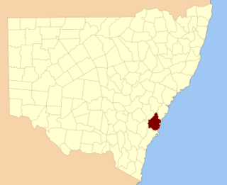
Camden County was one of the original Nineteen Counties in New South Wales and is now one of the 141 Cadastral divisions of New South Wales. It included the coastal area near Wollongong south to the Shoalhaven River, and also inland encompassing Berrima and Picton. Its western boundary was the Wollondilly River. The first settlement in the area was Camden Park, established by John Macarthur in 1806, just across the Nepean River from Cumberland County. It was the first land across the Nepean to be settled. Camden is a present-day suburb of Sydney in the same area, although parts of it are in Cumberland.

St Vincent County Cadastral in New South Wales, Australia

St Vincent County was one of the original Nineteen Counties in New South Wales and is now one of the 141 Cadastral divisions of New South Wales. It included the south coast area encompassing Batemans Bay, Ulladulla, Jervis Bay and inland to Braidwood. The Shoalhaven River is the boundary to the north and west, and the Deua River the boundary to the south.

Cowper County Cadastral in New South Wales, Australia

Cowper County, New South Wales is one of the 141 Cadastral divisions of New South Wales.

Gowen County Cadastral in New South Wales, Australia

Gowen County is one of the 141 Cadastral divisions of New South Wales. It is located to the east of the Castlereagh River in the area to the east of Gilgandra, to Coonabarabran in the north-east. This includes land on both sides of the Newell Highway.

Irrara County Cadastral in New South Wales, Australia

Irrara County is one of the 141 Cadastral divisions of New South Wales. It is located south of the border with Queensland, east of the Paroo River, and west of the Warrego River.
Kennedy County Cadastral in New South Wales, Australia

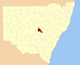
Kennedy County is one of the 141 Cadastral divisions of New South Wales. It is located to the west of the Bogan River in the area around Tottenham and Tullamore.
Mootwingee County Cadastral in New South Wales, Australia

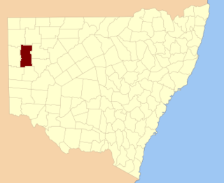
Mootwingee County, New South Wales is one of the 141 Cadastral divisions of New South Wales.

Oxley County Cadastral in New South Wales, Australia

Oxley County, New South Wales is one of the 141 Cadastral divisions of New South Wales. It is located between the Bogan River on the west, and the Macquarie River on the east. This is the area approximately between Warren and Nyngan.

Clive Raleigh Evatt was an Australian politician, barrister and raconteur. He was a member of the New South Wales Legislative Assembly from 1939 until 1959. At various times he sat as a member of the Industrial Labor Party, Labor Party and as an independent.

Clive, New South Wales is a civil parish of Buccleuch County in New South Wales, Australia.

Blowering, New South Wales

Blowering, New South wales is a rural locality in the Snowy Mountains of New South wales and a civil Parish of Buccleuch County.

References

  1. "Clive County". Geographical Names Register (GNR) of NSW. Geographical Names Board of New South Wales.