County of Bentinck

Last updated

Bentinck
Queensland
Bentinck-county-queensland.png
Location within Queensland
Lands administrative divisions around Bentinck:
Marsh Merivale Merivale
Clive Bentinck Buller (NSW)
Clive Clive (NSW) Clive (NSW)
Map all coordinates using: OpenStreetMap

The County of Bentinck is a county located on the southern boundary of the state of Queensland, Australia. [1] Like all counties in Queensland, it is a non-functional administrative unit, that is used mainly for the purpose of registering land titles. The county was named in 1838 after William Cavendish-Bentinck, 3rd Duke of Portland, [1] who served as Prime Minister of Great Britain twice, in 1783 and again between 1807 and 1809. Population centres within the County of Bentinck include the towns of Stanthorpe, Wallangarra, Glen Aplin, Applethorpe and Inglewood. [2]

Contents

Parishes

ParishLGACoordinatesTowns
Ballandean Southern Downs 28°51′S151°46′E / 28.850°S 151.767°E / -28.850; 151.767 (Ballandean Parish)
Bodumba Southern Downs 28°18′S151°25′E / 28.300°S 151.417°E / -28.300; 151.417 (Bodumba Parish)
Broadwater Southern Downs 28°46′S151°53′E / 28.767°S 151.883°E / -28.767; 151.883 (Broadwater Parish) Ballandean, Glen Aplin
Catterthun Southern Downs 28°39′S151°39′E / 28.650°S 151.650°E / -28.650; 151.650 (Catterthun Parish)
Coolmunda Goondiwindi 28°24′S151°14′E / 28.400°S 151.233°E / -28.400; 151.233 (Coolmunda Parish)
Devine Goondiwindi 28°18′S151°15′E / 28.300°S 151.250°E / -28.300; 151.250 (Devine Parish)
Drumsleed Southern Downs 28°32′S151°43′E / 28.533°S 151.717°E / -28.533; 151.717 (Drumsleed Parish)
Folkestone Southern Downs 28°42′S152°00′E / 28.700°S 152.000°E / -28.700; 152.000 (Folkestone Parish)
Glenelg Goondiwindi 28°25′S151°24′E / 28.417°S 151.400°E / -28.417; 151.400 (Glenelg Parish)
Herries Southern Downs 28°25′S151°42′E / 28.417°S 151.700°E / -28.417; 151.700 (Herries Parish)
Inglewood Goondiwindi 28°24′S151°08′E / 28.400°S 151.133°E / -28.400; 151.133 (Inglewood Parish)
Jibbinbar Southern Downs 28°46′S151°35′E / 28.767°S 151.583°E / -28.767; 151.583 (Jibbinbar Parish)
Listohan Goondiwindi 28°12′S151°17′E / 28.200°S 151.283°E / -28.200; 151.283 (Listohan Parish)
Macintyre Goondiwindi 28°29′S151°33′E / 28.483°S 151.550°E / -28.483; 151.550 (Macintyre Parish)
Marsh Southern Downs 28°38′S151°51′E / 28.633°S 151.850°E / -28.633; 151.850 (Marsh Parish)
Moynalty Goondiwindi 28°22′S151°35′E / 28.367°S 151.583°E / -28.367; 151.583 (Moynalty Parish) Gore
Nundubbermere Southern Downs 28°44′S151°45′E / 28.733°S 151.750°E / -28.733; 151.750 (Nundubbermere Parish)
Pikedale Southern Downs 28°34′S151°48′E / 28.567°S 151.800°E / -28.567; 151.800 (Pikedale Parish) Amiens
Stanthorpe Southern Downs 28°37′S151°55′E / 28.617°S 151.917°E / -28.617; 151.917 (Stanthorpe Parish) Stanthorpe, Applethorpe
Tenterfield Southern Downs 28°53′S151°57′E / 28.883°S 151.950°E / -28.883; 151.950 (Tenterfield Parish) Wallangarra
Terrica Goondiwindi 28°32′S151°28′E / 28.533°S 151.467°E / -28.533; 151.467 (Terrica Parish) Terrica
Warroo Goondiwindi 28°37′S151°27′E / 28.617°S 151.450°E / -28.617; 151.450 (Warroo Parish) Warroo

See also

Related Research Articles

<span class="mw-page-title-main">Tannum Sands, Queensland</span> Town in Queensland, Australia

Tannum Sands is a coastal town and locality in the Gladstone Region, Queensland, Australia.

St Kilda is a rural locality in the Bundaberg Region, Queensland, Australia. In the 2016 census, St Kilda had a population of 90 people.

<span class="mw-page-title-main">Thulimbah, Queensland</span> Town in Queensland, Australia

Thulimbah is a rural town and locality in the Southern Downs Region, Queensland, Australia. In the 2016 census the locality of Thulimbah had a population of 319 people. It borders New South Wales.

<span class="mw-page-title-main">Ballandean, Queensland</span> Town in Queensland, Australia

Ballandean is a rural town and locality in the Southern Downs Region, Queensland, Australia. In the 2016 census, the locality of Ballandean had a population of 338 people.

Pages Creek, a mostly perennial stream of the Hunter River catchment, is located in the Hunter region of New South Wales, Australia.

<span class="mw-page-title-main">Mount Tyson, Queensland</span> Town in Queensland, Australia

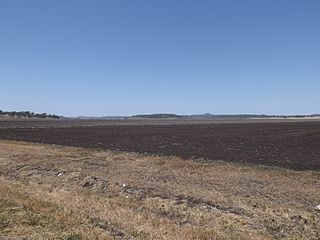
Mount Tyson is a rural town and locality in the Toowoomba Region, Queensland, Australia. In the 2016 census, the locality of Mount Tyson had a population of 285 people.

Lowmead is a rural town and locality in the Gladstone Region, Queensland, Australia. In the 2021 census, the locality of Lowmead had a population of 179 people.

<span class="mw-page-title-main">Maclagan, Queensland</span> Town in Queensland, Australia

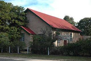
Maclagan is a rural town and locality in the Toowoomba Region, Queensland, Australia. In the 2016 census the locality of Maclagan had a population of 195 people.

<span class="mw-page-title-main">Southbrook, Queensland</span> Town in Queensland, Australia

Southbrook is a rural town and locality in the Toowoomba Region, Queensland, Australia. In the 2021 census, the locality of Southbrook had a population of 626 people.

<span class="mw-page-title-main">Somme, Queensland</span> Suburb of Southern Downs Region, Queensland, Australia

Somme is a rural locality in the Southern Downs Region, Queensland, Australia. In the 2016 census Somme had a population of 53 people.

<span class="mw-page-title-main">Ironpot, Queensland (South Burnett Region)</span> Town in Queensland, Australia

Ironpot is a rural locality in the South Burnett Region, Queensland, Australia. In the 2016 census Ironpot had a population of 45 people.

<span class="mw-page-title-main">Coolmunda, Queensland</span> Suburb of Goondiwindi Region, Queensland, Australia

Coolmunda is a rural locality in the Goondiwindi Region, Queensland, Australia. In the 2016 census, Coolmunda had a population of 141 people.

Cannon Creek is a rural locality in the Southern Downs Region, Queensland, Australia. In the 2016 census, Cannon Creek had a population of 39 people.

Evergreen is a rural town and locality in the Toowoomba Region, Queensland, Australia. In the 2016 census, the locality of Evergreen had a population of 45 people.

<span class="mw-page-title-main">Cottonvale, Queensland</span> Suburb of Southern Downs Region, Queensland, Australia

Cottonvale is a rural locality in the Southern Downs Region, Queensland, Australia. It borders New South Wales and contains the town of Cotton Vale. In the 2021 census, Cottonvale had a population of 153 people.

<span class="mw-page-title-main">Kalpowar</span> Town in Queensland, Australia

Kalpowar is a town in the North Burnett Region and a locality split between the North Burnett Region and the Bundaberg Region, in Queensland, Australia. In the 2016 census, the locality of Kalpowar had a population of 67 people.

<span class="mw-page-title-main">Thane, Queensland</span> Town in Queensland, Australia

Thane is a rural town and locality in the Southern Downs Region, Queensland, Australia. In the 2016 census, Thane had a population of 27 people.

Irvingdale is a locality split between the Toowoomba Region and the Western Downs Region, both in Queensland, Australia. In the 2016 census, Irvingdale had a population of 194 people.

Highland Plains is a rural locality in the Toowoomba Region, Queensland, Australia. In the 2021 census, Highland Plains had a population of 60 people.

Cutella is a rural locality in the Toowoomba Region, Queensland, Australia. In the 2021 census, Cutella had a population of 45 people.

References

  1. 1 2 "Bentinck (entry 2331)". Queensland Place Names. Queensland Government . Retrieved 1 September 2015.
  2. Darling Downs District, County of Bentinck Maps - B3 Series at Queensland Archives.

28°45′S151°45′E / 28.750°S 151.750°E / -28.750; 151.750