Buller County, New South Wales

Last updated

Map all coordinates using: OpenStreetMap  
Download coordinates as: KML  ·  GPX
Buller
New South Wales
Buller NSW.PNG
Location in New South Wales
Lands administrative divisions around Buller:
Merivale (Qld) Merivale (Qld) Ward (Qld)
Bentinck (Qld)Buller Rous
Clive Drake Richmond

Buller County is one of the 141 Cadastral divisions of New South Wales.

Buller County was named in honour of Sir George Buller (1802-1884). [1]

Parishes within this county

A full list of parishes found within this county; their current LGA and mapping coordinates to the approximate centre of each location is as follows:

Local government in Australia

Local government in Australia is the third tier of government in Australia administered by the states and territories, which in turn are beneath the federal tier. Local government is not mentioned in the Constitution of Australia and two referenda in the 1970s and 1980s to alter the Constitution relating to local government were unsuccessful. Every state government recognises local government in their respective constitutions. Unlike Canada or the United States, there is only one level of local government in each state, with no distinction such as cities and counties.

ParishLGACoordinates
Acacia Tenterfield 28°25′54″S152°15′04″E / 28.43167°S 152.25111°E / -28.43167; 152.25111 (Acacia Parish)
Antimony Tenterfield 28°51′54″S152°24′04″E / 28.86500°S 152.40111°E / -28.86500; 152.40111 (Antimony Parish)
Beaury Tenterfield 28°24′54″S152°29′04″E / 28.41500°S 152.48444°E / -28.41500; 152.48444 (Beaury Parish)
Bonalbo Kyogle 28°26′54″S152°34′04″E / 28.44833°S 152.56778°E / -28.44833; 152.56778 (Bonalbo Parish)
Bookookoorara Tenterfield 28°38′54″S152°15′04″E / 28.64833°S 152.25111°E / -28.64833; 152.25111 (Bookookoorara Parish)
Boomi Kyogle 28°26′54″S152°39′04″E / 28.44833°S 152.65111°E / -28.44833; 152.65111 (Boomi Parish)
Boonoo Boonoo Tenterfield 28°53′54″S152°04′04″E / 28.89833°S 152.06778°E / -28.89833; 152.06778 (Boonoo Boonoo Parish)
Boorook Tenterfield 28°46′54″S152°19′04″E / 28.78167°S 152.31778°E / -28.78167; 152.31778 (Boorook Parish)
Buller Kyogle 28°35′54″S152°41′04″E / 28.59833°S 152.68444°E / -28.59833; 152.68444 (Buller Parish)
Burgess Kyogle 28°29′54″S152°41′04″E / 28.49833°S 152.68444°E / -28.49833; 152.68444 (Burgess Parish)
Callanyn Tenterfield 28°51′54″S152°20′04″E / 28.86500°S 152.33444°E / -28.86500; 152.33444 (Callanyn Parish)
Capeen Kyogle 28°35′54″S152°36′04″E / 28.59833°S 152.60111°E / -28.59833; 152.60111 (Capeen Parish)
Carroll Tenterfield 28°49′54″S152°05′04″E / 28.83167°S 152.08444°E / -28.83167; 152.08444 (Carroll Parish)
Cataract Tenterfield 28°40′54″S152°18′04″E / 28.68167°S 152.30111°E / -28.68167; 152.30111 (Cataract Parish)
Clarence Tenterfield 28°38′54″S152°20′04″E / 28.64833°S 152.33444°E / -28.64833; 152.33444 (Clarence Parish)
Claribell Kyogle 28°42′54″S152°30′04″E / 28.71500°S 152.50111°E / -28.71500; 152.50111 (Claribell Parish)
Colongon Tenterfield 28°53′54″S152°15′04″E / 28.89833°S 152.25111°E / -28.89833; 152.25111 (Colongon Parish)
Corry Tenterfield 28°42′54″S152°07′04″E / 28.71500°S 152.11778°E / -28.71500; 152.11778 (Corry Parish)
Coutts Tenterfield 28°27′54″S152°32′04″E / 28.46500°S 152.53444°E / -28.46500; 152.53444 (Coutts Parish)
Cullendore Tenterfield 28°27′54″S152°08′04″E / 28.46500°S 152.13444°E / -28.46500; 152.13444 (Cullendore Parish)
Donaldson Kyogle 28°21′54″S152°38′04″E / 28.36500°S 152.63444°E / -28.36500; 152.63444 (Donaldson Parish)
Ellerslie Tenterfield 28°43′54″S152°26′04″E / 28.73167°S 152.43444°E / -28.73167; 152.43444 (Ellerslie Parish)
Emu Tenterfield 28°48′54″S152°30′04″E / 28.81500°S 152.50111°E / -28.81500; 152.50111 (Emu Parish)
Evans Kyogle 28°48′54″S152°37′04″E / 28.81500°S 152.61778°E / -28.81500; 152.61778 (Evans Parish)
Gilgurry Tenterfield 28°43′54″S152°15′04″E / 28.73167°S 152.25111°E / -28.73167; 152.25111 (Gilgurry Parish)
Girard Tenterfield 28°54′54″S152°18′04″E / 28.91500°S 152.30111°E / -28.91500; 152.30111 (Girard Parish)
Gore Tenterfield 28°20′54″S152°29′04″E / 28.34833°S 152.48444°E / -28.34833; 152.48444 (Gore Parish)
Jenny Lind Tenterfield 28°46′54″S152°26′04″E / 28.78167°S 152.43444°E / -28.78167; 152.43444 (Jenny Lind Parish)
Kangaroo Tenterfield 29°33′54″S152°25′04″E / 29.56500°S 152.41778°E / -29.56500; 152.41778 (Kangaroo Parish)
Kangaroo Tenterfield 28°29′54″S152°26′04″E / 28.49833°S 152.43444°E / -28.49833; 152.43444 (Kangaroo Parish)
Koreelah Tenterfield 28°16′54″S152°29′04″E / 28.28167°S 152.48444°E / -28.28167; 152.48444 (Koreelah Parish)
Lindsay Kyogle 28°26′54″S152°35′04″E / 28.44833°S 152.58444°E / -28.44833; 152.58444 (Lindsay Parish)
Mandle Tenterfield 28°30′54″S152°20′04″E / 28.51500°S 152.33444°E / -28.51500; 152.33444 (Mandle Parish)
Mandle Tenterfield 28°28′54″S152°21′04″E / 28.48167°S 152.35111°E / -28.48167; 152.35111 (Mandle Parish)
Marsh Tenterfield 28°29′54″S152°04′04″E / 28.49833°S 152.06778°E / -28.49833; 152.06778 (Marsh Parish)
Maryland Tenterfield 28°32′54″S152°00′04″E / 28.54833°S 152.00111°E / -28.54833; 152.00111 (Maryland Parish)
Mearimb Kyogle 28°29′54″S152°33′04″E / 28.49833°S 152.55111°E / -28.49833; 152.55111 (Mearimb Parish)
Peacock Kyogle 28°44′54″S152°43′04″E / 28.74833°S 152.71778°E / -28.74833; 152.71778 (Peacock Parish)
Pocupar Kyogle 28°40′54″S152°27′04″E / 28.68167°S 152.45111°E / -28.68167; 152.45111 (Pocupar Parish)
Reid Tenterfield 28°37′54″S152°16′04″E / 28.63167°S 152.26778°E / -28.63167; 152.26778 (Reid Parish)
Robertson Kyogle 28°41′54″S152°37′04″E / 28.69833°S 152.61778°E / -28.69833; 152.61778 (Robertson Parish)
Ruby Tenterfield 28°38′54″S152°02′04″E / 28.64833°S 152.03444°E / -28.64833; 152.03444 (Ruby Parish)
Strathspey Tenterfield 28°38′54″S152°17′04″E / 28.64833°S 152.28444°E / -28.64833; 152.28444 (Strathspey Parish)
Tooloom Kyogle 28°35′54″S152°30′04″E / 28.59833°S 152.50111°E / -28.59833; 152.50111 (Tooloom Parish)
Undercliffe Tenterfield 28°28′54″S152°11′04″E / 28.48167°S 152.18444°E / -28.48167; 152.18444 (Undercliffe Parish)
Woodenbong Tenterfield 28°21′54″S152°35′04″E / 28.36500°S 152.58444°E / -28.36500; 152.58444 (Woodenbong Parish)
Wylie Tenterfield 28°31′54″S152°06′04″E / 28.53167°S 152.10111°E / -28.53167; 152.10111 (Wylie Parish)

Related Research Articles

Boonoo Boonoo River

Boonoo Boonoo River, a watercourse of the Clarence River catchment, is located in the Northern Tablelands district of New South Wales, Australia.

Dyke River is a perennial stream of the Macleay River catchment, located in the Northern Tablelands district of New South Wales, Australia.

Glen Fernaigh River, a perennial river of the Clarence River catchment, is located in the Northern Rivers region of New South Wales, Australia.

Pappinbarra River, a perennial stream of the Hastings River catchment, is located in the Mid North Coast region of New South Wales, Australia.

Towallum River, a perennial river of the Clarence River catchment, is located in the Northern Tablelands region of New South Wales, Australia.

Wallamba River, a watercourse of the Mid-Coast Council system, is located in the Mid North Coast district of New South Wales, Australia.

Worondi Rivulet, a perennial stream of the Hunter River catchment, is located in the Upper Hunter region of New South Wales, Australia.
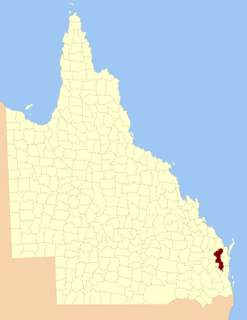
County of Fitzroy, Queensland Cadastral in Queensland, Australia

The County of Fitzroy is a county in Queensland, Australia. Like all counties in Queensland, it is a non-functional administrative unit, that is used mainly for the purpose of registering land titles.
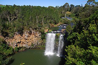
Bielsdown River river in Australia

Bielsdown River, a perennial stream that is part of the Clarence River catchment, is located in the Northern Tablelands of New South Wales, Australia.

Kangaroo River, a watercourse of the Clarence River catchment, is located in the Northern Tablelands district of New South Wales, Australia.

Kalang River, a perennial river of the Bellinger River catchment, is located in the Mid North Coast region of New South Wales, Australia.

Back River, a perennial stream of the Manning River catchment, is located in the Northern Tablelands region of New South Wales, Australia.

Rosewood River, a perennial river of the Bellinger River catchment, is located in the Mid North Coast region of New South Wales, Australia.

The Coopers Creek, a perennial stream of the Richmond River catchment, is located in Northern Rivers region in the state of New South Wales, Australia.

The Beaury Creek, a perennial stream of the Clarence River catchment, is located in the Northern Rivers region of New South Wales, Australia.

The Boundary Creek, a perennial stream of the Clarence River catchment, is located in the Northern Rivers region of New South Wales, Australia.

The Tooloom Creek, a perennial stream of the Clarence River catchment, is located in the Northern Rivers region in the state of New South Wales, Australia.

The Georges Creek, a perennial stream that is part of the Macleay River catchment, is located in the Northern Tablelands and Mid North Coast regions of New South Wales, Australia.

The Ralfes Creek, a perennial stream that is part of the Hastings River catchment, is located in the Mid North Coast region of New South Wales, Australia.

Dingo Creek, a perennial stream of the Manning River catchment, is located in the Mid North Coast region of New South Wales, Australia.

References

  1. "Buller County". Geographical Names Register (GNR) of NSW. Geographical Names Board of New South Wales. OOjs UI icon edit-ltr-progressive.svg

Coordinates: 28°40′S152°29′E / 28.667°S 152.483°E / -28.667; 152.483

Geographic coordinate system Coordinate system

A geographic coordinate system is a coordinate system that enables every location on Earth to be specified by a set of numbers, letters or symbols. The coordinates are often chosen such that one of the numbers represents a vertical position and two or three of the numbers represent a horizontal position; alternatively, a geographic position may be expressed in a combined three-dimensional Cartesian vector. A common choice of coordinates is latitude, longitude and elevation. To specify a location on a plane requires a map projection.