Gresham County

Last updated

Map all coordinates using: OpenStreetMap  
Download coordinates as: KML
Gresham
New South Wales
Gresham NSW.PNG
Location in New South Wales
Lands administrative divisions around Gresham:
Clive Drake Clarence
Gough Gresham Fitzroy
Clarke Clarke Fitzroy

Gresham County is one of the 141 Cadastral divisions of New South Wales.

Gresham County was named in honour of the London merchant, Sir Thomas Gresham (1519–1579). [1] It is located to the south of parts of the Mann River, Nymboida River and Clarence River. It includes parts of the Guy Fawkes River National Park.

Parishes within this county

A full list of parishes found within this county; their current LGA and mapping coordinates to the approximate centre of each location is as follows:

ParishLGACoordinates
Alder Clarence Valley Council 29°59′54″S152°36′04″E / 29.99833°S 152.60111°E / -29.99833; 152.60111 (Alder)
Barool Clarence Valley Council 29°41′54″S152°19′04″E / 29.69833°S 152.31778°E / -29.69833; 152.31778 (Barool)
Boyd Clarence Valley Council 29°49′54″S152°32′04″E / 29.83167°S 152.53444°E / -29.83167; 152.53444 (Boyd)
Braylesford Clarence Valley Council 29°34′54″S152°36′04″E / 29.58167°S 152.60111°E / -29.58167; 152.60111 (Braylesford)
Broadmeadows Clarence Valley Council 29°51′54″S152°21′04″E / 29.86500°S 152.35111°E / -29.86500; 152.35111 (Broadmeadows)
Buccarumbi Clarence Valley Council 29°49′54″S152°37′04″E / 29.83167°S 152.61778°E / -29.83167; 152.61778 (Buccarumbi)
Camelback Clarence Valley Council 29°24′54″S152°31′04″E / 29.41500°S 152.51778°E / -29.41500; 152.51778 (Camelback)
Chaelundi Clarence Valley Council 30°02′54″S152°20′04″E / 30.04833°S 152.33444°E / -30.04833; 152.33444 (Chaelundi)
Chandler Clarence Valley Council 30°01′54″S152°24′04″E / 30.03167°S 152.40111°E / -30.03167; 152.40111 (Chandler)
Cowan Clarence Valley Council 29°40′54″S152°28′04″E / 29.68167°S 152.46778°E / -29.68167; 152.46778 (Cowan)
Cunglebung Clarence Valley Council 29°44′54″S152°31′04″E / 29.74833°S 152.51778°E / -29.74833; 152.51778 (Cunglebung)
Dalmorton Clarence Valley Council 29°45′54″S152°29′04″E / 29.76500°S 152.48444°E / -29.76500; 152.48444 (Dalmorton)
Glen Nevis Glen Innes Severn Council 29°54′54″S152°14′04″E / 29.91500°S 152.23444°E / -29.91500; 152.23444 (Glen Nevis)
Grafton Clarence Valley Council 30°05′54″S152°24′04″E / 30.09833°S 152.40111°E / -30.09833; 152.40111 (Grafton)
Grange Clarence Valley Council 29°26′54″S152°35′04″E / 29.44833°S 152.58444°E / -29.44833; 152.58444 (Grange)
Henry Clarence Valley Council 29°48′54″S152°14′04″E / 29.81500°S 152.23444°E / -29.81500; 152.23444 (Henry)
Jackadgery Clarence Valley Council 29°40′54″S152°33′04″E / 29.68167°S 152.55111°E / -29.68167; 152.55111 (Jackadgery)
Kaloe Clarence Valley Council 29°29′54″S152°30′04″E / 29.49833°S 152.50111°E / -29.49833; 152.50111 (Kaloe)
Marara Clarence Valley Council 29°53′54″S152°36′04″E / 29.89833°S 152.60111°E / -29.89833; 152.60111 (Marara)
Marara West Clarence Valley Council 29°53′54″S152°32′04″E / 29.89833°S 152.53444°E / -29.89833; 152.53444 (Marara West)
Marengo Clarence Valley Council 29°56′54″S152°20′04″E / 29.94833°S 152.33444°E / -29.94833; 152.33444 (Marengo)
Newbold Clarence Valley Council 29°31′54″S152°36′04″E / 29.53167°S 152.60111°E / -29.53167; 152.60111 (Newbold)
Newton Boyd Glen Innes Severn Council 29°47′54″S152°10′04″E / 29.79833°S 152.16778°E / -29.79833; 152.16778 (Newton Boyd)
Nullama Clarence Valley Council 29°54′54″S152°25′04″E / 29.91500°S 152.41778°E / -29.91500; 152.41778 (Nullama)
Oakwood Glen Innes Severn Council 29°52′54″S152°06′04″E / 29.88167°S 152.10111°E / -29.88167; 152.10111 (Oakwood)
Sara Glen Innes Severn Council 29°58′54″S152°06′04″E / 29.98167°S 152.10111°E / -29.98167; 152.10111 (Sara)
Springbrook Clarence Valley Council 29°46′54″S152°23′04″E / 29.78167°S 152.38444°E / -29.78167; 152.38444 (Springbrook)
Stanley Clarence Valley Council 30°04′54″S152°31′04″E / 30.08167°S 152.51778°E / -30.08167; 152.51778 (Stanley)
Sturt Clarence Valley Council 30°01′54″S152°32′04″E / 30.03167°S 152.53444°E / -30.03167; 152.53444 (Sturt)
Urania Clarence Valley Council 29°46′54″S152°19′04″E / 29.78167°S 152.31778°E / -29.78167; 152.31778 (Urania)
Wellington Clarence Valley Council 29°41′54″S152°24′04″E / 29.69833°S 152.40111°E / -29.69833; 152.40111 (Wellington)
Willy Glen Innes Severn Council 29°54′54″S152°03′04″E / 29.91500°S 152.05111°E / -29.91500; 152.05111 (Willy)
Worra Glen Innes Severn Council 29°58′54″S151°59′04″E / 29.98167°S 151.98444°E / -29.98167; 151.98444 (Worra)

Related Research Articles

Merionethshire

Merionethshire or Merioneth is one of thirteen historic counties of Wales, a vice county and a former administrative county.

Culgoa River

The Culgoa River is a river that is part of the Darling catchment within the Murray–Darling basin and is located in South West Queensland.

Colo River

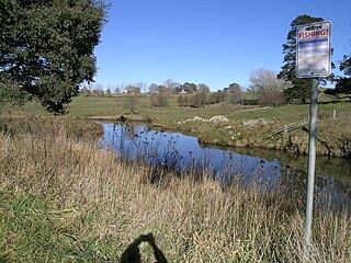
The Colo River, a perennial stream that is part of the Hawkesbury-Nepean catchment, is located in the Central Tablelands of New South Wales, Australia.

Cumberland County, New South Wales Cadastral in New South Wales, Australia

Cumberland County is a county in the State of New South Wales, Australia. Most of the Sydney metropolitan area is located within the County of Cumberland.

Turon River

Turon River, a perennial stream that is part of the Macquarie catchment within the Murray–Darling basin, is located in the central western district of New South Wales, Australia. Partly situated in the Turon National Park, the river is host to numerous recreational and tourist activities such as horse riding, gold panning, canoeing, camping, and seasonal fishing.

Darbalara, New South Wales Town in New South Wales, Australia

Darbalara is a rural community on the east bank of the junction of the Murrumbidgee River and Tumut River in the Riverina. It is situated by road, about 25 kilometres north east of Gundagai and 25 kilometres south of Coolac.

Lands administrative divisions of New South Wales

For lands administrative purposes, New South Wales is divided into 141 counties, which are further divided into parishes. The counties were first set down in the Colony of New South Wales, which later became the Australian state of New South Wales.

Camden County, New South Wales Cadastral in New South Wales, Australia

Camden County was one of the original Nineteen Counties in New South Wales and is now one of the 141 Cadastral divisions of New South Wales. It included the coastal area near Wollongong south to the Shoalhaven River, and also inland encompassing Berrima and Picton. Its western boundary was the Wollondilly River. The first settlement in the area was Camden Park, established by John Macarthur in 1806, just across the Nepean River from Cumberland County. It was the first land across the Nepean to be settled. Camden is a present-day suburb of Sydney in the same area, although parts of it are in Cumberland.

Argyle County Cadastral in New South Wales, Australia

Argyle County was one of the original Nineteen Counties in New South Wales and is now one of the 141 Cadastral divisions of New South Wales. It includes the area around Goulburn. It is bounded by Lake George in the south-west, the Shoalhaven River in the east, and the Wollondilly River in the north-east.

Cowper County Cadastral in New South Wales, Australia

Cowper County, New South Wales is one of the 141 Cadastral divisions of New South Wales.

Drake County Cadastral in New South Wales, Australia

Drake County is one of the 141 Cadastral divisions of New South Wales.

Bellinger River

Bellinger River, an open and trained mature wave dominated, barrier estuary, is located in the Mid North Coast region of New South Wales, Australia.

Cobrabald River

Cobrabald River, a mostly perennial river that is part of the Namoi catchment within the Murray–Darling basin, is located in the Northern Tablelands district of New South Wales, Australia.

Tia River

Tia River, a perennial stream of the Macleay River catchment, is located in the Northern Tablelands district of New South Wales, Australia.

The Tonalli River, a perennial river that is part of the Hawkesbury-Nepean catchment, is located in the Blue Mountains region of New South Wales, Australia.

The Towamba River is an open mature wave dominated barrier estuary or perennial river, located in the South Coast region of New South Wales, Australia.

Forbes River (New South Wales)

Forbes River, a perennial river of the Hastings River catchment, is located in the Mid North Coast region of New South Wales, Australia.

Kalang River, a perennial river of the Bellinger River catchment, is located in the Mid North Coast region of New South Wales, Australia.

Mongarlowe River

The Mongarlowe River is a perennial river of the Shoalhaven catchment located in the Southern Tablelands region of New South Wales, Australia. It was also known as Little River, during the 19th century.

The Chandlers Creek, a perennial stream that is part of the Clarence River catchment, is located in the Northern Tablelands region of New South Wales, Australia.

References

  1. "Gresham County". Geographical Names Register (GNR) of NSW. Geographical Names Board of New South Wales. OOjs UI icon edit-ltr-progressive.svg