
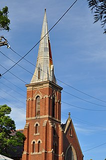
Rous is a small town located in the Northern Rivers Region of New South Wales. [2]
Rous is a small town located in the Northern Rivers Region of New South Wales. [2]

The Tweed River is a river situated in the Northern Rivers district of New South Wales, Australia. From the middle reaches of its course, the state boundary between New South Wales and Queensland is located approximately 10 kilometres (6.2 mi) north.
Muswellbrook is a town in the Upper Hunter Region of New South Wales, Australia, about 243 km (151 mi) north of Sydney and 127 km (79 mi) north-west of Newcastle.
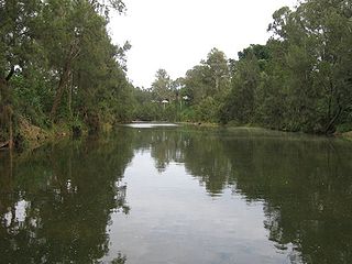
The Richmond River is a river situated in the Northern Rivers region of New South Wales, Australia.
Point Danger is a headland, located at Coolangatta on the southern end of the Gold Coast on the east coast of Australia. Separated by Snapper Rocks and Rainbow Bay to the west, with Duranbah Beach and the Tweed River mouth to the south, present-day Point Danger has also indicated the border between New South Wales and Queensland, Australia, since 1863.
The following lists events that happened during 1828 in Australia.

Muswellbrook Shire is a local government area in the Upper Hunter region of New South Wales, Australia. The Shire is situated adjacent to the New England Highway and the Hunter railway line.

Rocky Creek Dam is a minor rock fill clay core embankment dam across the Rocky Creek, located upstream of Lismore in the Northern Rivers region of New South Wales, Australia. The dam's main purpose is to supply potable water for the region, including Lismore, Ballina, Byron Bay, Evans Head and Alstonville. The impounded reservoir is called Rocky Lake.

Lands administrative divisions of Australia are the cadastral divisions of Australia for the purposes of identification of land to ensure security of land ownership. Most states term these divisions as counties, parishes, hundreds, and other terms. The eastern states of Queensland, New South Wales, Victoria, and Tasmania were divided into counties and parishes in the 19th century, although the Tasmanian counties were renamed land districts in the 20th century. Parts of South Australia (south-east) and Western Australia (south-west) were similarly divided into counties, and there were also five counties in a small part of the Northern Territory. However South Australia has subdivisions of hundreds instead of parishes, along with the Northern Territory, which was part of South Australia when the hundreds were proclaimed. There were also formerly hundreds in Tasmania. There have been at least 600 counties, 544 hundreds and at least 15,692 parishes in Australia, but there are none of these units for most of the sparsely inhabited central and western parts of the country.

Rous County is one of the 141 Cadastral divisions of New South Wales. It is located at the north-east tip of the state. It is bordered on the north by the border with Queensland and on the south by the Richmond River. It contains Lismore, Byron Bay and Murwillumbah.
Byron was an electoral district of the Legislative Assembly in the Australian state of New South Wales created in 1913, replacing Rous, and named after Cape Byron. With the introduction of proportional representation in 1920, Byron absorbed Lismore and Clarence and elected three members. With the end of proportional representation in 1927, it was redivided into the single-member electorates of Byron, Lismore and Clarence. In 1988, Byron was replaced by Ballina and Murwillumbah.
Rous was an electoral district of the Legislative Assembly in the Australian state of New South Wales, created in the 1904 re-distribution of electorates following the 1903 New South Wales referendum, which required the number of members of the Legislative Assembly to be reduced from 125 to 90. It consisted of parts of Lismore and The Tweed. It was named after Rous County, between the Tweed and Richmond Rivers and Henry John Rous, who explored the rivers. In 1913, it was replaced by Byron.

Wilsons River, a perennial river and part of the Richmond River catchment, is situated in the Northern Rivers district of New South Wales, Australia.
Oxley River, a perennial river of the Tweed River catchment, is located in the Northern Rivers region of New South Wales, Australia.
Rous River, a perennial river of the Tweed River catchment, is located in the Northern Rivers region of New South Wales, Australia.
Rous, an electoral district of the Legislative Assembly in the Australian state of New South Wales was created in 1904 and abolished in 1913.
A by-election was held in the New South Wales state electoral district of Rous on 11 February 1905. The by-election was triggered by the death of John Coleman.

Cook Island, formerly Cooks Island, Turtle Island and Joong-urra-narrian, is an island in the Australian state of New South Wales located on the state's north coast about 600 metres (2,000 ft) north-east of Fingal Head and 4 kilometres (2.5 mi) south-east of the town of Tweed Heads.
Rous Lench may refer to:
The Byrrill Creek is a perennial stream located in Northern Rivers region in the state of New South Wales, Australia. It is the namesake of the locality of the same name.
The Richmond, an electoral district of the Legislative Assembly in the Australian state of New South Wales, was created in 1880 and abolished in 1913.
| | This Northern Rivers geography article is a stub. You can help Wikipedia by expanding it. |