
Gosford is a waterfront city at the northern end of Brisbane Water on the Central Coast in the state of New South Wales, Australia. The Gosford waterfront is known for its boating and scenic views on the shores of Brisbane Water. Gosford is the main commercial hub and gateway of the Central Coast. It is situated approximately 77 km (48 mi) north of Sydney and 86 km (53 mi) south of Newcastle. Gosford is located in the local government area of the Central Coast Council.

Perth is the capital and largest city of Western Australia. It is the fourth most populous city in Australia and Oceania, with a population of 2.2 million within Greater Perth. It is part of the South West Land Division of Western Australia, with the majority of Perth's metropolitan area on the Swan Coastal Plain between the Indian Ocean and the Darling Scarp. The city has expanded outward from the original British settlements on the Swan River, upon which its central business district and port of Fremantle are situated.

Box Hill is a suburb of Melbourne, Victoria, Australia, 14 kilometres (8.7 mi) east of the city's Central Business District (CBD), located within the City of Whitehorse local government area. Box Hill recorded a population of 14,353 at the 2021 census.
Kingston is a town on the outskirts of Hobart, Tasmania, Australia. Nestled 12 km south of the city between and around several hills, Kingston is the seat of the Kingborough Council, and today serves as the gateway between Hobart and the D'Entrecasteaux Channel region, which meets the Derwent River nearby. It is one of the fastest-growing regions in Tasmania. The Kingston-Huntingfield statistical area had an estimated population of 13,473 in June 2021.

Northern Rivers is the most north-easterly region of the Australian state of New South Wales, located between 590 and 820 kilometres north of the state capital, Sydney, and encompasses the catchments and fertile valleys of the Clarence, Richmond, and Tweed rivers. It extends from Tweed Heads in the north to the southern extent of the Clarence river catchment which lies between Grafton and Coffs Harbour, and includes the main towns of Tweed Heads, Byron Bay, Ballina, Kyogle, Lismore, Casino and Grafton. At its most northern point, the region is 102 kilometres (63 mi) south-southeast of the Queensland capital, Brisbane.

Ballina is a town in the Northern Rivers region of New South Wales, Australia, and the seat of the Ballina Shire local government area. It lies 740 km (460 mi) north of Sydney and 185 km (115 mi) south of Brisbane. Ballina's urban population at the end of 2021 was 46,190. The town lies on the Richmond River and serves as a gateway to Byron Bay.

Macksville is a small town on the Nambucca River in the Nambucca Valley, New South Wales, Australia. It is halfway between Sydney and Brisbane, along the Pacific Highway, approximately 40 minutes north of Kempsey, 40 minutes south of Coffs Harbour, 70 minutes north of Port Macquarie, five hours south of Brisbane and five hours north of Sydney.
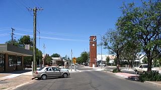
Wee Waa is a town located on the north-western slopes of the New England region in New South Wales, Australia. The town is within the Narrabri Shire local government area and is on the Namoi River. Wee Waa is 41 kilometres (25 mi) north-west of Narrabri and 571 kilometres (355 mi) northwest of Sydney on the Kamilaroi Highway. At the 2016 census, Wee Waa had a population of 2,080.
Sawtell is a suburb of the City of Coffs Harbour in northern New South Wales, Australia. It borders Toormina to the West.

Finley is a town in the Murray region of New South Wales, Australia. It is the largest town in the Berrigan Shire local government area. At the 2016 census, Finley had a population of 2,519 people. The town is located approximately 140 kilometres (87 mi) west of Albury on the intersection of the Newell Highway and Riverina Highways.

Strathfieldsaye is a suburb of the Greater City of Bendigo in Victoria, Australia. It is located 9 kilometres (5.6 mi) south-east of the Bendigo CBD.

Iluka is a small village at the mouth of the Clarence River in north-eastern New South Wales, Australia. It is situated directly across the river from the resort town of Yamba. At the 2021 census, Iluka had a population of 1,764 people. The town's name is derived from an Aboriginal word meaning "near the sea".

Maclean is a town in Clarence Valley local government area in the Northern Rivers region of New South Wales, Australia. It is on the Clarence River and near the Pacific Highway. At the 2021 census, Maclean had a population of 2,778, total urban area including Townsend and Gulmarrad is more than 8,304. The Maclean, Yamba and Iluka area known as the Lower Clarence had a combined population of 17,533. Its industries are tourism, sugar cane production, farming and river-prawn trawling. Together with Grafton, Maclean is the shared administrative centre for the Clarence Valley Council local government area.

Yerrinbool is a Northern Village of the Southern Highlands of New South Wales, Australia, in the Wingecarribee Shire, and is accessible from the Hume Highway and is about a 12 km (7.5 mi) drive from nearby Mittagong. It is 7 km (4.3 mi) to Hill Top as the crow flies, accessible by foot via a fire trail. It is on the western edge of the Upper Nepean Nature Reserve, a vast area of forest, lakes and dams between Yerrinbool and the coastal communities around Wollongong. Yerrinbool was previously officially known as the Town of Yerrinbool. It is located on the historic Old Hume Highway.

Alstonville is a town in northern New South Wales, Australia, part of the region known as the Northern Rivers. Alstonville is on the Bruxner Highway between the town of Ballina and city of Lismore. The village of Wollongbar is 4 km to the west of Alstonville. Alstonville is the service centre of the area known as the Alstonville Plateau.

Ballina Shire is a local government area in the Northern Rivers region of New South Wales, Australia. The Shire was formed on 1 January 1977 by the amalgamation of the Municipality of Ballina and Tintenbar Shire. The Shire is located adjacent to the Tasman Sea and the Pacific Highway. The council seat is located in the town of Ballina. The population of the Ballina Shire area was 46,850 in 2022.
Lawrence is a small town 13 km from Maclean, New South Wales, Australia. It is accessed by the Lawrence car ferry from Woodford Island or by travelling 30 kilometres north from Grafton. At the 2021 census, the population of Lawrence was 925.

Colo Vale is a Northern Village of the Southern Highlands of New South Wales, Australia, in Wingecarribee Shire. Colo Vale is approximately 100 km south west on the Hume Highway from Sydney. It is situated 2 km north-west of Aylmerton, 5 km from the Hume Highway and 12 km drive to Mittagong. The surrounding area is part of the Parish of Colo which includes the villages of Aylmerton, Willow Vale, Alpine and Yerrinbool. Colo Vale has a mixed-business general store and many home-based businesses, including hairdressers, small manufacturing businesses and a large native plant nursery and a Public School on Wattle Street. A large sporting oval is located adjacent to the school with tennis courts, a community hall and a Rural Fire Service station.
Hill Top is a Northern Village of the Southern Highlands of New South Wales, Australia, in Wingecarribee Shire. Previous names of the village include Hilltop and Jellore. It is a 17 km drive to Mittagong and around 10 km drive to the Hume Highway via Colo Vale. It is roughly 6–8 km to Yerrinbool as the crow flies.
The Far North Coast District Rugby Union, or FNCRU, is the governing body for the sport of rugby union within the District of Far North Coast in Australia. It is a member of the New South Wales Country Rugby Union.
