
The Georges River, also known as Tucoerah River, is an intermediate tide-dominated drowned valley estuary, that is located in Sydney in the state of New South Wales, Australia. The Georges River is located south and south-west from the Sydney CBD, with the mouth of the river being at Botany Bay.

Beverly Hills is a southern suburb of Sydney, in the state of New South Wales, Australia. Beverly Hills is located 15 kilometres southwest of the Sydney central business district and is part of the St George area and is split between the local government areas of the Georges River Council and the City of Canterbury-Bankstown. The postcode is 2209, which it shares with neighbouring Narwee.
Holsworthy is a suburb in south-western Sydney, in the state of New South Wales, Australia 31 kilometres south-west of the Sydney central business district, in the local government area of the City of Liverpool.
Casula is a suburb of Sydney, in the state of New South Wales, Australia. It is 34 kilometres south-west of the Sydney central business district, in the local government area of the City of Liverpool.

Greater Western Sydney (GWS) is a large region of the metropolitan area of Greater Sydney, New South Wales (NSW), Australia that generally embraces the north-west, south-west, central-west, far western and the Blue Mountains sub-regions within Sydney's metropolitan area and encompasses 11 local government areas: Blacktown, Blue Mountains, Camden, Campbelltown, Cumberland, Fairfield, Hawkesbury, Liverpool, Parramatta, Penrith and Wollondilly. It includes Western Sydney, which has a number of different definitions, although the one consistently used is the region composed of ten local government authorities, most of which are members of the Western Sydney Regional Organisation of Councils (WSROC). The NSW Government's Office of Western Sydney calls the region "Greater Western Sydney".
Glenfield is a suburb of Sydney, in the state of New South Wales, Australia. Glenfield is located 36 kilometres south-west of the Sydney central business district, in the local government areas of the City of Campbelltown and is part of the Macarthur region.

Panania, a suburb of local government area City of Canterbury-Bankstown, is located 23 kilometres inner south-west of the Sydney central business district, in the state of New South Wales, Australia, and is a part of the South-western Sydney region. The postcode is 2213, which it shares with adjacent suburbs East Hills and Picnic Point.

Canterbury is a suburb of western Sydney, in the state of New South Wales, Australia. Canterbury is located 10.5 kilometres (6.5 mi) south-west of the Sydney central business district in the City of Canterbury-Bankstown.

Liverpool railway station is a heritage-listed railway station located on the Main Southern line, serving the Sydney suburb of Liverpool in Australia. It is served by Sydney Trains T2 Inner West & Leppington, T3 Bankstown and T5 Cumberland services. It was added to the New South Wales State Heritage Register on 2 April 1999.

Glenfield railway station is a junction station serving the Sydney suburb of Glenfield in Australia. It is served by Sydney Trains T8 Airport & South, T2 Inner West & Leppington and T5 Cumberland line services, and by limited NSW TrainLink Southern Highlands Line services.

Bass Hill, a suburb of local government area City of Canterbury-Bankstown, is located 23 kilometres south-west of the Sydney central business district, in the state of New South Wales, Australia, and is a part of the South-western Sydney region.

The East Hills railway line serves the southern and south-western suburbs of Sydney, Australia. The line opened to East Hills in 1931 and was extended to connect to the Main South Line in 1987. Most services along the line form part of the Airport & South Line operated by Sydney Trains.
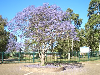
Picnic Point, a suburb of local government area City of Canterbury-Bankstown, is 23 kilometres south-west of the Sydney central business district, in the state of New South Wales, Australia. It is a part of South-western Sydney region. Picnic Point is a residential suburb on the northern bank of the Georges River. Located within Picnic Point is Yeramba Lagoon which is the largest tract of National Park within the Canterbury – Bankstown Council, it is home to numerous species of native fauna and flora.

Narwee is a suburb in southern Sydney, in the state of New South Wales, Australia. Narwee is located 18 kilometres south of the Sydney central business district and is part of the St George area. Narwee is in local government areas of City of Canterbury-Bankstown and Georges River Council. The postcode is 2209, which it shares with neighbouring Beverly Hills.

Moorebank is a suburb of Sydney, in the state of New South Wales, Australia. Moorebank is located 27 kilometres south-west of the Sydney central business district in the local government area of the City of Liverpool.

Chester Hill, a suburb of Sydney, located 25 kilometres west of the Sydney central business district, in the state of New South Wales, Australia. Chester Hill is mostly in the City of Canterbury-Bankstown, with a minor part in the northeast in the Cumberland Council local government area. Part of Western Sydney, Chester Hill shares the postcode of 2162 with the neighbouring suburb of Sefton, to the east.

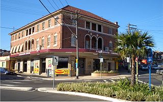
Campsie is a suburb in the state of New South Wales, Australia. Campsie is 11 kilometres south west of the Sydney central business district, on the southern bank of the Cooks River. Campsie is one of the administrative centres of the City of Canterbury-Bankstown.
Earlwood is a suburb of Western Sydney, in the state of New South Wales, Australia. Earlwood is located 10 kilometres south-west of the Sydney central business district, and is part of the Canterbury-Bankstown area. It is in the local government area of the City of Canterbury-Bankstown.

The metropolis of Greater Sydney in New South Wales, Australia, is informally subdivided into a number of geographic regions. The geographical definition of Greater Sydney spans across 33 local government areas and includes the Blue Mountains in the west, the Northern Beaches and the Hawkesbury in the north, the Royal National Park, the Wollondilly and Macarthur in the south, and Botany Bay in the east. These areas sometimes, but not always, roughly coincide with official boundaries of suburbs, local government authorities, or cadastral units, and some of the customary regions do not have well defined boundaries at all. Some commonly referred to regions overlap: for example, Canterbury-Bankstown is often referred to as a region, but it is also part of the South Western Sydney region. The regions themselves are not used as a formal jurisdiction, and generally do not have administrative or legislative bodies, although some regions are coterminous with a local government area, and in a number of regions that include multiple local government areas, Regional Organisations of Councils have been established that represent the councils in the region.

The Inner West & Leppington Line is a commuter rail service currently operated by Sydney Trains, serving the inner west and south-western regions of Sydney, Australia. Consisting of 37 stops, the service commences from the City Circle, then heads west to Granville. The line branches at this point; services either head northwest to Parramatta or south to Leppington. A third terminus at Homebush is used when the part-time Parramatta branch isn't operating. The line commenced operations on 26 November 2017, replacing the T2 Airport, Inner West & South Line.


