South Western Sydney

Last updated

South Western Sydney
Western Sydney.jpg
Overlooking the southwestern suburbs from Smithfield, with the Fairfield skyline on the far left and the Liverpool skyline on the far right
Country Australia
State New South Wales
City Sydney
LGA
Government
   State electorate
   Federal division
Regions around South Western Sydney
Greater Western Sydney
Greater Western Sydney South Western Sydney
Macarthur Holsworthy

South Western Sydney is a region of the city of Sydney, New South Wales, Australia. It is situated in the south-west of the larger Sydney metropolitan area, and is part of the predominantly working class area of Greater Western Sydney. In the early 2010s, urban development has occurred in places like Camden and Campbelltown. Areas such as Leppington, spanning Liverpool, Camden and Campbelltown councils, had higher number of families. [1] In 2004, Leppington was identified as part of Sydney's South West Growth Centre. [2] [3] Edmondson Park, being part of the South West Growth Centre, is also expected to see significant growth and development over the next 10 years. [4] [5]

Contents

There are a number of different boundaries and definitions for Sydney's South-West with majority of definitions including the suburbs within City of Liverpool as well as surrounding areas. This can also include the Macarthur region which is often referred to as 'Outer South-West', [6] particularly referring to the local government area of City of Campbelltown as well as Camden Council and occasionally also the Wollondilly Shire. City of Canterbury-Bankstown is also often included in definitions of Sydney's South-West and usually referenced as being 'Inner South-West'. [7] In the broadest sense, South-Western Sydney can also include Fairfield City Council as it is south of Prospect Reservoir even though geographically the council is west of Sydney CBD and not south-west. [8]

Geographically, the region lies in the Cumberland Plain. The heritage-listed Warragamba Dam, the primary reservoir for water supply for Sydney, is located in the south western suburbs. [9] The region features the Holsworthy Barracks, a large Australian Army reserve where training exercises frequently occur. Several institutions have 'South Western Sydney' in their title, including: South Western Sydney Local Health District, [10] South Western Sydney Institute [11] and South Western Sydney Clinical School [12] Englorie Park is the smallest suburb in New South Wales. [13]

History

Indigenous

Radiocarbon dating suggests human activity occurred in the Sydney metropolitan area from around 30,000 years ago. [14] The Darug people lived in the area that was south western Sydney before European settlement regarded the region as rich in food from the river and forests. [15] For more than 30,000 years, Aboriginal people from the Gandangara tribe have lived in the Fairfield area. Clans of the Tharawal roamed over a wide area from Botany Bay to the Shoalhaven River and inland to Campbelltown. They lived a nomadic hunter-gatherer lifestyle, eating local foods (bush tucker) such as kangaroo, fish, yams and berries. They made tools out of stones, bones and shells to help them build bark shelters, canoes and possum-skin clothing. [16] [17] The Holsworthy bushland still withholds many indigenous sites and has been referred to as "Sydney's Kakadu". There are more than 500 significant Tharawal sites in the area, including campsites, tool-making sites, and rock art. The art is mostly engravings of hands, boomerangs, animals, birds, and fish. [18]

Menangle Park was originally home to the Tharawal people, and it was they who gave the name, transcribed as Manangle or Manhangle, to a small lagoon on the west bank of the Nepean River, which was important to the Tharawal both for its consistent water supply as well as the fish and yabbies that could be caught there. [19] [20] In a rock art site called Bull Cave near Campbelltown, the Dharug people drew a number of cattle with pronounced horns. The Dharug cowpasture tribes described the cattle to British explorers and in 1795 the British found a herd of around 60 cattle grazing in the area now known as Camden. [21] [22]

Colonial era

Camden Park Estate, built from 1819 to 1840 1697 - Camden Park Estate and Belgenny Farm - View of Farm Structures. (L-R) Stables & Creamery (5051536b4).jpg
Camden Park Estate, built from 1819 to 1840

In February 1793, the Auburn area was established as the first free-agricultural settlement thanks to Governor Phillip's repeated applications to the British government for free settlers. [23] [24] In 1795, Matthew Flinders and George Bass explored up the Georges River for about 20 miles beyond what had been previously surveyed, and reported favourably to Governor John Hunter of the land on its banks. [25] The earliest recorded white settlement in the Fairfield district is described in William Bradley's Journal where he noted an expedition from Rose Hill to Prospect Creek to determine whether Prospect Creek led to Botany Bay. [26] In 1789, Governor Arthur Phillip probed the country between Salt Pan Creek beginning at Prospect Creek. [27] The District of Bankstown was named by Governor Hunter in 1797 in honour of botanist Sir Joseph Banks. The area remained very rural until residential and suburban development followed the development of the Bankstown railway line with the passing of the Marrickville to Burwood Road Railway Act by the NSW Parliament in 1890, extending the rail line from Marrickville Station (later Sydenham Station) to Burwood Road (later Belmore Station) by 1895. [28]

In 1798, First Fleet Captain George Johnston received a land grant and constructed his first home located near Prospect Creek, close to Henry Lawson Drive and Beatty Parade. The first incursions and eventual land grants in the area by Europeans led to increasing tensions, culminating in a confrontation between Europeans and a group of Aboriginal people led by Tedbury, the son of Pemulwuy, in what is now Punchbowl in 1809. However, following Tedbury's death in 1810, resistance to European settlement generally ended. [29]

In the 1800s, the area around Prestons was known as "Cross Roads". The name appears to originate from 1821, when a notice published by John Oxley, the Surveyor General of New South Wales stated that "this Cross Road from Windsor ends in the new Bringelly Road". [30] In 1800, just beside Prospect Creek, Lieutenant John Shortland from the First Fleet acquired an initial grant of 100 acres (40 ha) over the northern part of Lansdowne Reserve which he increased to 380 acres (150 ha). [31] In 1848, German explorer Ludwig Leichhardt and politician Sir Henry Parkes cooled their feet in Prospect Creek in Carramar. [32] Very early relations with British settlers were cordial but as farmers started clearing and fencing the land affecting food resources in the area, clashes between the groups arose until 1816 when a number of indigenous people were massacred and the remainder retreated from direct conflict with the settlers. [33]

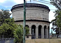
In 1801, Governor King ordered soldiers to fire on the aborigines to keep them from settler's properties. By 1815, Governor Macquarie declared a state of open warfare against aborigines in the Georges River area and forbade them carrying weapons within a mile of any British settlement. Ultimately, the British prevailed. [34] The Liverpool Offtake Reservoir was constructed in 1890 to supply the township of Liverpool, as part of the Upper Nepean Scheme. [35] The Church of the Holy Innocents was opened in 1850 by William Munro. Alexander Riley (1778–1833) was a merchant and pastoralist who in 1809 was granted 3,000 acres (12 km2) of land and called his estate Raby. In March 1895, a petition was submitted to the NSW Colonial Government by 109 residents of the Bankstown area, requesting the establishment of the "Municipal District of Bankstown" under the Municipalities Act, 1867. [36] On 19 January 1898, the Camden Municipal Council proposed to establish a cottage hospital for the municipality. [37]

Early 20th century

Campbelltown, 1920 Queen and Cordeaux Streets, Campbelltown, Sydney, 1920.jpg
Campbelltown, 1920

In the first half of the 20th century, venues such as Latty's Pleasure Grounds, the Butterfly Hall, and Hollywood Park at Lansvale were popular among tourists due to the area's rural feel, so popular in fact that the first games of Rugby League football in Australia, in early 1908, were trial games that took place at Latty's Pleasure Grounds. [38] [39] Liverpool Hospital was founded on a portion of land beside the Georges River, making it the second oldest hospital in Australia. [40] Hammondville was originally a settlement for destitute families during the Great Depression. [41] During the Great Depression, Kentlyn became something of a shantytown for families who had lost their homes. [42] During World War II, Bankstown Airport was established as a key strategic air base to support the war effort and the control of Bankstown Airport was handed to US Forces. Also during the war, Bass Hill was the location for a small transmitting station that was owned and operated by the RAAF. It was located on the corner of Manuka Crescent & Johnston Road. [43]

In World War II, there was a soldiers' settlement at Milperra which consisted mostly of poultry and horticultural enterprises. [44] In 1942 a command bunker (Sydney Air Defence Headquarters) of semi underground construction was established in Bankstown. The primary use of the Sydney Air Defence Headquarters was the location, tracking and interception of all planes in the eastern area of the South West Pacific. [45] From 1948 to 1955 workers camps were set up at Potts Hill to accommodate the European migrant workers who were indentured from the many displaced persons brought to Australia after World War II. [46] The Australian Legion of Ex-Servicemen and Women sponsored the mass production of housing at Panania beginning from 1946 with the construction of 34 houses. [47] During World War II, Picnic Point National Park was the location of a remote receiving station and operations bunker that was owned and operated by the RAAF. [48] In October 1944, the Royal Navy (United Kingdom) opened a hospital (Royal Naval Hospital, Herne Bay) at Riverwood to treat wounded members of the British Pacific Fleet in the vacated buildings. [49]

Contemporary period

Restwell Street, Bankstown, 1956 Restwell st bankstown 1956.jpg
Restwell Street, Bankstown, 1956

Until the 1950s, Liverpool was still a satellite town with an agricultural economy based on poultry farming and market gardening. However the urban sprawl of Sydney across the Cumberland Plain soon reached Liverpool, and it became an outer suburb of metropolitan Sydney with a strong working-class presence and manufacturing facilities. [50] At the time of its opening by the mayor R. J. Schofield on 26 September 1958, the Campsie Library was reputed to be the largest municipal library in Sydney. [51] Campbelltown was designated in the early 1960s as a satellite city by the New South Wales Planning Authority, and a regional capital for the south west of Sydney. [52] The Milperra College of Advanced Education was established in 1974, bringing tertiary education to south-western Sydney, where it then became the Bankstown campus of Western Sydney University in 1989. In January 1975, tenders for the first homes in the Housing Commission's "Kentlyn" subdivision were called but the name Airds was not approved until May 1976. [53]

From the 1970s to 1990s, a small amusement park named Magic Kingdom operated in Lansvale on the banks of the creek and was a popular attraction for visitors. [54] [55] In the 1960s and 1970s, migration from south-east Asia as a result of the Vietnam War transformed Cabramatta into a thriving Asian community. Also in the 1970s, an influx of Middle Eastern immigrants, namely Lebanese people, settled in Lidcombe, Bankstown and the surrounding suburbs. [56] [57] Bankstown's city status was proclaimed in 1980 in the presence of Queen Elizabeth II, becoming the "City of Bankstown". [58] In September 1984, on Father's Day, members of rival motorbike gangs the Comanchero and the Bandidos had a showdown in Revesby. This altercation has since been called the 'Milperra Massacre'. [59]

The Oran Park Town housing development replaced Oran Park Raceway, which stood from 1962 – 2010. The suburb has often become an example of urban sprawl. [60] [61] In 2015, the Abbott government granted 12,000 extra humanitarian visas to persecuted Christians, largely the Assyrians, in the war-torn Middle Eastern countries, which were admitted to Australia as part of its one-off humanitarian intake, with half of them primarily settling in Fairfield and also Liverpool. [62] A 2015 review of local government boundaries by the NSW Government Independent Pricing and Regulatory Tribunal recommended that the City of Canterbury merge with the City of Bankstown to form a new council with an area of 110 square kilometres (42 sq mi) and support a population of approximately 351,000. [63]

In 2019-2020, a tract of dry grass was set ablaze by illegal fireworks, resulting in a bushfire in the area around Cecil Hills. [64] In 2023, the Liverpool reservoir site was upgraded with a new water tank and pumping station, adding 115 megalitres of reservoir capacity to supply the growing suburbs of south-west Sydney. [65] [66] The new pumping station superseded the role of the nearby Bonnyrigg Pumping Station, which was built in 1941. [67] In June 2023, the suburb boundaries with Campbelltown and Airds were amended, with Bradbury losing some area to Campbelltown but gaining some area from Airds. [68] [69] However, in November 2024, this boundary was changed again, with Bradbury losing the areas east of this boundary to Airds. [70] [71] In November 2024, Eschol Park's boundary with Eagle Vale was amended, with the boundary to follow the entirety of Eagle Vale Drive. As a result, Eschol Park gained all areas of Eagle Vale that were west of Eagle Vale Drive. [72] [73]

Geography

A bird's eye view of East Hills and Milperra showing the railway bridge crossing Georges River Aerial View of East Hills, 2004 (19772988019).png
A bird's eye view of East Hills and Milperra showing the railway bridge crossing Georges River

South Western Sydney predominantly lies on the Cumberland Plain and is relatively flat in contrast to the above regions, with most of it sitting on Triassic shales and sandstones [74] with low rolling hills and wide valleys in a rain shadow area. [75] In 1820s, Peter Cunningham described the country west of Parramatta and Liverpool as "a fine timbered country, perfectly clear of bush, through which you might, generally speaking, drive a gig in all directions, without any impediment in the shape of rocks, scrubs, or close forest". This confirmed earlier accounts by Governor Arthur Phillip, who suggested that the trees were "growing at a distance of some twenty to forty feet from each other, and in general entirely free from brushwood..." [76]

The main plant communities in the region are sclerophyll grassy woodlands (i.e. savannas). [77] The grassy woodlands contain eucalyptus trees which are usually in open woodlands that have sclerophyllous shrubs and sparse grass in the understory. [78] Leacock Regional Park in Casula is home to one of the last remaining stands of Cumberland Plain Woodland. In 1795, an early settler named Hatfield referred to the area now known as Cabramatta as “Moonshine Run” because the forest was so dense that moonlight could not penetrate it, discouraging further exploration by settlers. These thick woodlands occupied the marshy, flood-prone lower reaches of Cabramatta Creek and formed a closed riparian forest that extended as far as present-day Cabramatta Road. [79] Although by most customary definitions, Earlwood falls into the traditional region of South Western Sydney or Canterbury-Bankstown, [80] [81] it sits at the far eastern end of that region.

The southwest of Sydney is drained by the Georges River, flowing north from its source near Appin, towards Liverpool and then turning east towards Botany Bay. The centre of the Sydney basin is located beneath Fairfield. [82] [83] [84] The disjointed sandstone lenses within the Bringelly Shale become thicker and more prominent from the Western Sydney Regional Park southwards, shaping the hilly landscape between Campbelltown and Picton. Namely found on Old Hume Highway, approaching Picton, the sandstone cliffs that become thicker are roughly around 200 metres (660 ft) in height. [85] The steep banks of the sandstone lentils influence the flora of the Cumberland Plain Woodland, with such escarpments being observed in Western Sydney Dry Rainforest areas. [86] The region has thus far recorded two earthquakes in history – one occurring in Appin on 17 March 1999, and one in Picton on 9 March 1973. [87] The Picton one had a damage total of $2.8 million, with some minor damage in Bowral and Wollongong. [88] The region experiences a humid subtropical climate (Köppen climate classification: Cfa) with the annual temperatures having an average maximum of 23 °C (73 °F) and a minimum of 12 °C (54 °F)

Demographics

Cabramatta is made up of 87.7% of people from non-English speaking backgrounds, the highest anywhere in Australia (excluding remote indigenous communities). Other Western Sydney suburbs, such as Fairfield, Bankstown and Canley Vale, are also over 80%. The south western suburbs have become Sydney's so-called believer belt, with a high proportion of believers found in a band of suburbs that span the cities of Liverpool, Fairfield, and Canterbury-Bankstown. [89] The proportion of residents in Liverpool City Council who stated a religious affiliation with Islam was in excess of four times the national average; and the proportion of residents with no religion slightly less than one–third the national average. [90] At the 2011 Census, in the City of Bankstown, the proportion of residents in the Bankstown local government area who stated their ancestry as Lebanese was in excess of eight times the national average. Meanwhile, as at the Census date, the area was linguistically diverse, with Arabic or Vietnamese languages spoken in 30% of households, both languages approximately seven times the national averages. [91]

According to the Bureau of Statistics, areas with the highest percentage of Christians were found in south-western suburbs such as, Grasmere (82.3%), Theresa Park (81.1%) and Abbotsbury (81%), with the most popular denominations being Catholic and Anglican, respectively. [92] Buddhism was the common response in the suburbs of Cabramatta, Canley Vale and Canley Heights, with 43.0%, 37.1% and 38.4% adhering to it, respectively. [93] The proportion of residents who stated an affiliation with Islam in the City of Bankstown in the 2011 Census was in excess of eleven times the national average. [91]

In 2015, Liverpool had the highest number of registered firearms in Sydney, with 4,689 owned by 1,732 residents. Chester Hill and Sefton, only partially located in Sydney’s southwest, ranked second-highest with 4,505 registered firearms. [94]

Economy

The moderately affluent suburb of Middleton Grange McIntyre Circuit, Middleton Grange 069.jpg
The moderately affluent suburb of Middleton Grange

Denham Court is one of the most affluent in south-west Sydney, with the median property price standing at $1.60 million in January 2015, over three times higher than the median of properties in surrounding suburbs. [95] It is sometimes referred to as "the south-western millionaires' row". [96] Other affluent suburbs in the area include, Edmondson Park, Cecil Hills, Elizabeth Hills, Middleton Grange, Carnes Hill, Oran Park, Leppington and Spring Farm, among others. [1] Lower middle class and working class neighbourhoods are mainly concentrated near the heart of the central business district areas of Cabramatta and Canley Vale. [97] Yennora is known to be the most poorest suburb of western Sydney overall, where the median personal income is just $19,000, followed by Landsdowne, Blairmount, Wiley Park, Campsie, Roselands, Carramar, Villawood and Punchbowl. [98] Furthmore, Claymore was listed as one of the most socially disadvantaged areas in New South Wales. [99] The City of Canterbury-Bankstown is home to the second highest number of registered businesses in NSW. In 2021–22, the City of Canterbury-Bankstown had an estimated Gross Regional Product (GRP) of $16.7 billion, making it the eight largest economy in the state. [100]

Seven of the top ten suburbs for home purchasers were more than 20 kilometres (12 mi) west of the Sydney CBD, which included areas with high construction activity such as Liverpool, which has become Sydney's most popular area for home buyers, with more sales than any other suburb. [101] In Camden Council area there were 2,168 residential buildings approved to be built in the financial year 2021–22. [102] Macquarie Links is an affluent suburb that has been restricted to local residents since late 2003. A gated community, residents there chose to close the gates at the estate’s only entrance in 2003, as this had dramatically reduced the number of break-ins and vehicle thefts. Security guards log the number plates of all vehicles entering the suburb, and locals carry ID cards as part of efforts to deter criminal activity. [103]

In the 1870s, the areas that were to become Villawood, Yennora and Carramar became significant vineyard locations due to the relatively rich alluvial soil from nearby creeks. [104] Construction of a new city, Bradfield, began in 2024 and is projected to be finished by 2074. It is intended to be the first new city in Australia in a century. [105] In July 2017, the global retailer Amazon purchased a 2.11ha site in Smeaton Grange for $7 million which is used as a data centre for Amazon Web Services. [106] In 2009, land in the south of Cecil Hills was subdivided for Elizabeth Hills. [107] Sometime between 2011-2016, the boundary of Cecil Hills expanded westward, incorporating parkland previously part of Cecil Park. [108] [109] Bradbury was one of the earliest suburbs to have underground powerlines, provide sewerage and design streets to slow car speeds. [110]

Transport

Hume Highway, Bass Hill, one of the major roads crossing the region Hume Highway, 6th October 2024 - Mapillary (527007699937938).jpg
Hume Highway, Bass Hill, one of the major roads crossing the region

Railway lines in the area include the Main Southern railway line, Bankstown railway line, Main Suburban railway line, East Hills railway line and Old Main South railway line, connecting the region to central Sydney. Henry Lawson Drive was conceived of as a scenic drive to follow the north bank of the Georges River. [111] Between 1912 and 1957, electric trams operated along Homer Street to Earlwood, providing service to the city via Marrickville and Newtown. [112]

Cumberland Highway links the Pacific Highway (A1/B83) and Pacific Motorway (M1) at Pearces Corner, Wahroonga in the northeast with the Hume Highway (A22/A28) at Liverpool in the southwest. [113] The M5 Motorway is the primary route from Liverpool to the Sydney CBD, with its terminus being in the south of an interchange near Prestons where the M5 meets the Westlink M7 and the M31 Hume Motorway. [114] The A6 is a major arterial road that provides a link from the northern and western suburbs to the centre western suburbs – Bankstown and the Princes Highway at Heathcote, via Lidcombe and Bankstown. [115]

Lansdowne Bridge is a heritage-listed road bridge that carries the northbound carriageway of the Hume Highway across Prospect Creek between Lansvale and Lansdowne. The Meccano Set is a well-known landmark in Lansdowne, consisting of an overhead tubular steel framework holding traffic lights and road signage, straddling the intersection of the Hume Highway, Henry Lawson Drive and Woodville Road. [116] [117] There are three telecommunications towers situated near the Cecil Park reservoir, one of which is an Airservices Australia radar. [118] [119] [120]

Politics

The region is known to be socially conservative due to its Christian and Muslim communities. [121] The Macarthur Regional Organisation of Councils (MACROC) includes the local government areas of Camden, Campbelltown and Wollondilly. [122] South Western Sydney includes, or partially includes, the NSW Electoral Districts of Badgerys Creek, Camden, Macquarie Fields, Leppington, Campbelltown, Liverpool, Cabramatta, Fairfield, Bankstown and Holsworthy.

Villawood Immigration Detention Centre, located in Villawood, houses asylum seekers who have been refused entry into the country at international airports and seaports, and they may also be detained in the centre. The centre has been the focus of much controversy, with accusations of human rights abuses. [123] The site of the current KFC outlet at Earlwood was at one time the home of former prime minister John Howard. [124] [125]

Culture

Casula Powerhouse Casula Powerhouse Arts Centre 35.jpg
Casula Powerhouse

Opened in 2005, the Campbelltown Arts Centre is a cultural facility of Campbelltown City Council that is partially funded by the New South Wales Government through Create NSW. [126] The Australian Army's Royal Australian Engineers were granted Freedom of Entry in 1959 and re-affirmed in 2018 as part of Liverpool's Centenary of Armistice commemoration. [127] The Australian Air League's Moorebank Squadron were granted Freedom of Entry in 2022 marking 60 years in the Liverpool community and included a formation flypast over Bigge Park. [128] Casula Powerhouse is a multi-disciplinary arts centre in Casula. The Fisher's Ghost festival is held each November in Campbelltown. [129]

Hoxton Park has many churches including Inspire Church , which has been active for more than 25 years with more than 5,000 members. Because of Cabramatta's high Vietnamese population, the suburb has earned the nickname 'Little Saigon'. [130] Since the 2010s, the Mandaean community in the Greater Sydney region has been using the Georges River for their ritual baptisms, called masbuta . Along with the Nepean River, it is one of the few ritual rivers (called yardna in Mandaic) that they use for their baptism and ablution rituals. [131] [132] [133]

Media

Glenfield gained notoriety in 1968 as the site of a hostage siege which ended in bizarre circumstances with the NSW Commissioner of Police Norm Allen acting as witness to the wedding of gunman Wally Mellish and hostage Beryl Muddle. The incident was made into the movie Mr Reliable starring Colin Friels and Jacqueline McKenzie. [134] [135] Serial killer Ivan Milat lived in Eagle Vale for a few years. [136] Little Fish (2005) was filmed in the Cabramatta area and features Hollywood actors Cate Blanchett, Sam Neill and Hugo Weaving. [137] In 2008, Sefton was a filming location for the international, award-winning and critically acclaimed television drama series East West 101 . [138]

In September 2012, an episode of the ABC program Four Corners entitled "Growing up poor" examined the lives of children in poor families in Claymore. [139] It stated that the suburb had the youngest population in Australia. A report "Down and under" in the Al Jazeera 101 East series in February 2013 also pointed to the links between poverty and hopelessness, family tensions and violence and lack of opportunities for Claymore's children, where more than half the families have only one parent. [140]

Radio stations serving the area include 2GLF (Liverpool, Fairfield), 2BACR (Bankstown), 2MCR (Macarthur) and C91.3 (Campbelltown).

Sport

Campbelltown Stadium during the Wests Tigers vs St George Illawarra Dragons match Campbelltown Stadium 14-04-24.jpg
Campbelltown Stadium during the Wests Tigers vs St George Illawarra Dragons match

Sport teams based in the region include the Bankstown District Cricket Club, Macarthur Division Rugby League, Canterbury-Bankstown Bulldogs, Bankstown City Lions FC, Canterbury Bankstown FC, Bankstown Bruins, Western Sydney Wanderers and Macarthur FC. Campbelltown Stadium is a multi-purpose stadium in Leumeah.Minto has a rugby league team, the Minto Cobras playing in the Western Suburbs District Junior Rugby League. They have produced a number of NRL players including Israel Folau, Justin Brooker, John Skandalis, Ken McGuinness, Kevin McGuinness, Jarryd Hayne and Krisnan Inu. [141] The Mounties Club in Mount Pritchard supports a number of local teams in various sports, including the Mounties rugby league team in the NSW Cup and the Mounties Wanderers in the National Premier Leagues NSW 2. [142] Mount Pritchard also has an oval, Mount Pritchard Oval, for the rugby league and football team.

The Sydney International Shooting Centre was built in Cecil Park for the shooting events at the 2000 Summer Olympics, where it remains open to licensed shooters for recreational use. [143] Warwick Farm Raceway was a motor racing facility which was in operation from 1960 to 1973. Located within the Warwick Farm Racecourse site, [144] it hosted numerous major events including the Australian Grand Prix. Built in 1914, Menangle Park Paceway gave the suburb its name and is still its major landmark. In 1996, much of the Paceway activity was relocated to the newly upgraded Harold Park. [145] Moorebank is home to a purpose-built remote control car race track. [146]

Education

The Campbelltown Rotary Observatory is located at the University of Western Sydney (Campbelltown Campus) and Macarthur Astronomical Society holds public lectures at the Macarthur Astronomy Forum and public observing nights at selected locations. Major education facilities include:

A Muslim group, the Quranic Society, made a development application in the Camden area for an A$19 million Muslim school with the capacity for 1,200 students. In May 2008 the Council voted unanimously to reject the application. After reducing its proposal to a school catering for 900 students, the Quranic Society took its case to the Land and Environment Court. The application was met with significant community protest; [148] and the application rejected by the Court on the grounds that the land chosen was suited to rural uses. [149] [150]

Landmarks

Aerial view of Warragamba Dam during spill Warragamba Dam Aerial View.jpg
Aerial view of Warragamba Dam during spill
Macarthur Square, Campbelltown, one of the largest shopping complexes in Sydney Macarthur Square, Campbelltown 016.jpg
Macarthur Square, Campbelltown, one of the largest shopping complexes in Sydney
Bankstown Reservoir Bankstownreservoir.jpg
Bankstown Reservoir

See also

References

  1. 1 2 "Home – WSROC Region". Profile.id.com.au. Retrieved 10 January 2019.
  2. "South West Growth Centre". Growth Centres Commission. Archived from the original on 22 February 2008. Retrieved 13 April 2008.
  3. "South West Growth Centre - Leppington". Growth Centres Commission. Archived from the original on 20 July 2008. Retrieved 13 April 2008.
  4. "Edmondson Park". NSW Government: Planning & Infrastructure. Archived from the original on 13 November 2014. Retrieved 13 November 2014.
  5. "Edmondson Park". NSW Government: Planning & Infrastructure. Archived from the original on 2 June 2009. Retrieved 1 May 2013.
  6. "2021 Sydney - Outer South West, Census All persons QuickStats | Australian Bureau of Statistics".
  7. "2021 Sydney - Inner South West, Census All persons QuickStats | Australian Bureau of Statistics".
  8. "2021 Sydney - South West, Census All persons QuickStats | Australian Bureau of Statistics".
  9. "Warragamba Emergency Scheme". New South Wales State Heritage Register . Department of Planning & Environment. H01376. Retrieved 2 June 2018. CC BY icon.svg Text is licensed by State of New South Wales (Department of Planning and Environment) under CC BY 4.0 licence .
  10. "South Western Sydney Local Health District - Home" . Retrieved 18 December 2016.
  11. "Home- TAFE NSW – South Western Sydney Institute". Swsi.tafensw.edu.au. 1 July 2011. Retrieved 23 November 2013.
  12. "South Western Sydney Clinical School – South Western Sydney Clinical School". Swscs.med.unsw.edu.au. 15 November 2013. Retrieved 23 November 2013.
  13. "PSMA 2018".
  14. Macey, Richard (2007). "Settlers' history rewritten: go back 30,000 years". The Sydney Morning Herald. Retrieved 5 July 2014.
  15. "Parramatta – New South Wales, Australia".
  16. "History of Leumeah". Campbelltown City Council. Archived from the original on 21 July 2005. Retrieved 23 December 2007.
  17. Liston, C: Campbelltown: The Bicentennial History, Allen & Unwin, 1988: p.1-2.
  18. "History of our suburbs: Holsworthy's European Heritage". Liverpool City Council. Archived from the original on 14 October 2007. Retrieved 31 December 2007.
  19. "History of Menangle Park". Campbelltown City Council. Archived from the original on 28 April 2013. Retrieved 31 August 2007.
  20. Liston, C: Campbelltown: The Bicentennial History, Allen & Unwin, 1988: pp. 1–2.
  21. Listo, C: Campbelltown: The Bicentennial History, Allen & Unwin, 1988: pp. 1–4. ISBN   0-04-324015-1
  22. "History of the Macarthur Region". Campbelltown City Council. Archived from the original on 19 July 2008. Retrieved 14 March 2008.
  23. J Henniker Heaton, Australian Dictionary of Dates and Men of the Time, Sydney, 1873
  24. "Reports of a possible French invasion off the Hawksbury". Hawkesbury Historical Society. Archived from the original on 19 March 2012. Retrieved 18 December 2016.
  25. A Voyage to Terra Australis by Matthew Flinders at Project Gutenberg
  26. Walsh, G. P. (1966). "Huon de Kerilleau, Gabriel Louis Marie (1769–1828)". Australian Dictionary of Biography . National Centre of Biography, Australian National University. ISBN   978-0-522-84459-7. ISSN   1833-7538. OCLC   70677943 . Retrieved 2 June 2011.
  27. "1780s". University of Sydney . Retrieved 2 July 2025.
  28. Larcombe, Frederick A. (1979). Change and Challenge: A History of the Municipality of Canterbury. Canterbury: Canterbury Municipal Council. pp. 194–198.
  29. Irish, Paul (2017). "Aboriginal History along the Cooks River" (PDF). Cooks River Alliance. Retrieved 10 October 2021.
  30. "Notice by the Surveyor General's Office, 28th August, 1821". The Sydney Gazette and New South Wales Advertiser, page 2. 8 September 1821. Retrieved 5 December 2024.
  31. "Plan of Management for Mirambeena Regional Reserve" (PDF). City of Canterbury Bankstown . Retrieved 5 July 2025.
  32. "Wine and Grape History in the Sydney Region". Sydney Vignerons Association Inc. Retrieved 18 November 2025.
  33. "The History of Camden". Camden Historical Society. Archived from the original on 3 April 2007. Retrieved 2007-06-14.
  34. "History of our suburbs: Holsworthy's Aboriginal Heritage". Liverpool City Council. Archived from the original on 14 October 2007. Retrieved 31 December 2007.
  35. "Liverpool Offtake Reservoir". Office of Environment & Heritage . NSW Government. Archived from the original on 20 December 2016. Retrieved 16 April 2025.
  36. "BANKSTOWN.—PETITION FOR A MUNICIPALITY". New South Wales Government Gazette. No. 203. 23 March 1895. p. 2021. Retrieved 19 November 2016 via National Library of Australia.
  37. "Camden Cottage Hospital" . Retrieved 11 May 2020.
  38. Pollon, Frances (1990). Book of Sydney Suburbs. North Ryde (New South Wales): Angus & Robertson. p. 148. ISBN   0207144958.
  39. "Summertime in Fairfield". Fairfield City Open Libraries: Heritage Blog. 18 January 2016. Retrieved 12 March 2021.
  40. Raszewski, C. et al. (2013). 'The History of Liverpool Hospital: From early settlement to 1993'. The Liverpool Historical Society, Liverpool City Library and Liverpool Health Service.
  41. O'Neill, Sharon (15 March 2013). "Great Depression hardships set up modern innovations". ABC News. Retrieved 25 March 2013.
  42. "Kentlyn History". Archived from the original on 28 July 2008. Retrieved 23 December 2007.
  43. Transmission Station Royal Australian Air Force
  44. "Bankstown-East Hills railway". The Sydney Morning Herald. 23 November 1920. Retrieved 9 November 2011.
  45. Drucker, G. "Index of Fleet Air Arm Air Stations in the Commonwealth 1939–1945". Fleetairarmarchive.net. Archived from the original on 19 September 2008. Retrieved 23 November 2013.
  46. Sheldon, Peter Michael (1989). Maintaining control: a history of unionism among employees of the Sydney Water Board: Chapter 6. Doctor of Philosophy thesis (Thesis). University of Wollongong.
  47. "34 Homes for Ex-Servicemen". The Sydney Morning Herald. 21 August 1946. Retrieved 10 November 2011.
  48. Bankstown Remote Receiving Building, during WW2
  49. Book of Sydney Suburbs, Frances Pollon (Angus and robertson) 1990, page 222
  50. The Book of Sydney Suburbs, Compiled by Frances Pollon, Angus & Robertson Publishers, 1990, p.155, ISBN   0-207-14495-8
  51. "Library Added to Canterbury Civic Centre". The Sydney Morning Herald. 30 September 1958. p. 20.
  52. The Book of Sydney Suburbs, Frances Pollon, Angus & Robertson Publishers, 1990, p. 45, ISBN   0-207-14495-8.
  53. "Airds History". Archived from the original on 30 July 2008. Retrieved 19 October 2007.
  54. "We Remember Magic Kingdom at Lansvale". WSFM 101.7 Sydney. Retrieved 14 March 2021.
  55. Pitt, Helen (13 July 2019). "Paradise Lost: Sydney's forgotten theme parks". The Sydney Morning Herald. Retrieved 14 March 2021.
  56. From the Irish and English in the late 18th century, to Lebanese and Vietnamese in recent years – Bankstown has always been a hub for migrants
  57. Kass, T. (2008). "Lidcombe". The Dictionary of Sydney.
  58. "Development Over Time". Bankstown City Council. Archived from the original on 29 August 2007. Retrieved 20 July 2007.
  59. "1984: Seven killed in Sydney biker shootings". BBC News. 2 September 1984.
  60. Taylor, Andrew (11 June 2022). "No jobs, no trees: The suburbs where urban sprawl is hurting. Oran park also opened a new road on the 26th of October 2025 Sydney". The Sydney Morning Herald. Retrieved 28 June 2024.
  61. Krncevic, Monika; Zendehdel Arjaghi, Niousha; Makki, Mohammed; Mathers, Jordan (April 2024). "RE-IMAGINING THE URBAN DEVELOPMENT OF WESTERN SYDNEY: THE CASE STUDY OF ORAN PARK" (PDF). University of Technology Sydney.
  62. Dabbagh, Omar (15 May 2017). "Assyrian Australians plead for second special refugee settlement deal" . Retrieved 22 June 2017.
  63. "Merger proposal: Bankstown City Council, Canterbury City Council" (PDF). Government of New South Wales. January 2016. p. 7. Retrieved 28 February 2016.
  64. "Illegal firework prank sparked fire that threatened Sydney homes". 7news.com.au. 1 January 2020. Retrieved 20 April 2025.
  65. Koziol, Michael (22 July 2023). "The new beating heart of outer-western Sydney is about to be switched on". Sydney Morning Herald . Archived from the original on 5 July 2023. Retrieved 16 April 2025.
  66. Harris, Cecilia (8 July 2023). "New pumping station set to bolster growth in Sydney's west". Australian Water Association . Retrieved 16 April 2025.
  67. "Hoxton Park Water Pumping Station". State Heritage Inventory. New South Wales State Heritage Register . Retrieved 16 April 2025.
  68. "GNB 4174-4 Campbelltown City Local Government Area" (PDF). Geographic Names Board of New South Wales. 23 June 2023. Retrieved 25 September 2025.
  69. "Notice of amendment to Address Locality Boundaries in Campbelltown City Local Government Area (272)" (PDF). Government Gazette of the State of New South Wales . 23 June 2023. p. 1018. Retrieved 25 September 2025.
  70. "GNB 4174-5 Bradbury to Airds Campbelltown City Local Government Area" (PDF). Geographic Names Board of New South Wales. 22 November 2024. Retrieved 25 September 2025.
  71. "Notice of amendment to Address Locality Boundaries in Campbelltown City Local Government Area (460)" (PDF). Government Gazette of the State of New South Wales . 22 November 2024. p. 10. Retrieved 25 September 2025.
  72. "GNB 4174-6A Campbelltown LGA" (PDF). Geographic Names Board of New South Wales. 22 November 2024. Retrieved 25 September 2025.
  73. "Notice of amendment to Address Locality Boundaries in Campbelltown City Local Government Area (460)" (PDF). Government Gazette of the State of New South Wales . 22 November 2024. p. 9. Retrieved 25 September 2025.
  74. Chris Herbert. Geology of the Sydney 1:100,000 Sheet 9130
  75. Sydney Basin-Subregions
  76. Kohen, J., The Impact of Fire: An Historical Perspective, in Australian Plants Online, Society for Growing Australian Plants, September 1996
  77. "Coastal Valley Grassy Woodlands". NSW Environment & Heritage. Retrieved 15 December 2019.
  78. "Dry sclerophyll forests (shrub/grass sub-formation)". NSW Environment & Heritage. Retrieved 15 October 2016.
  79. Stephen Gapps (2009). "Cabrogal to Fairfield City: A History of a Multicultural Community". Wakeley, New South Wales: Fairfield City Council. Retrieved 17 July 2025.
  80. Madden, Brian J, Muir, Lesley (1969) Earlwood's Past Archived 9 March 2022 at the Wayback Machine , Canterbury Municipal Council
  81. "Ray White Belmore - Earlwood". 7 September 2018. Archived from the original on 8 June 2021. Retrieved 8 June 2021.
  82. "Sydney Basin – Geological Overview". Australian Museum . Retrieved 24 March 2008.
  83. "Development of the Sydney Basin". NSW Primary Industries . Retrieved 24 March 2008.
  84. "Bringelly Shale". Stratigraphic Search Geoscience Australia. Australian Government. Retrieved 24 October 2012.
  85. Lovering, J. F. "Bringelly Shale" (PDF). Stratigraphy of' the Wianamatta Group. Australian Museum. Retrieved 23 August 2012.
  86. Wianamatta Group by Step Inc. Retrieved May 12, 2025.
  87. "AEES Newsletter" (PDF). aees.org.au. February 2000. Archived from the original (PDF) on 23 March 2012. Retrieved 20 June 2012.
  88. "Picton, NSW: Earthquake". EMA Disasters Database. Emergency Management Australia. 13 September 2006. Retrieved 4 April 2009.[ permanent dead link ]
  89. How we worship by Emily Clark from ABC News, 7 November 2019
  90. Australian Bureau of Statistics (27 June 2017). "Liverpool (C)". 2016 Census QuickStats. Retrieved 26 September 2024. OOjs UI icon edit-ltr-progressive.svg
  91. 1 2 Australian Bureau of Statistics (30 June 2012). "2011 Census QuickStats: Bankstown (C)" . Retrieved 26 June 2012.
  92. Census 2016: Sydney's Bible belt is losing the faith by Matt Wade from the Sydney Morning Herald, October 4, 2017
  93. Australian Bureau of Statistics (27 June 2017). "Cabramatta (State Suburb)". 2016 Census QuickStats. Retrieved 27 June 2016. OOjs UI icon edit-ltr-progressive.svg
  94. James Beech (11 August 2025), Sefton and Chester Hill the gun capitals of Sydney, where there is one gun for every four people, The Daily Telegraph , retrieved 28 November 2025
  95. "Denham Court Property Market". Archived from the original on 4 March 2016. Retrieved 30 October 2015.
  96. "The playground of the super wealthy". Daily Telegraph. 22 April 2016.
  97. Sydney's rich and poor: the rising crisis in our suburbs by The Daily Telegraph
  98. The stark difference between Sydney's richest and poorest suburbs by News.com.au
  99. Taylor, Josie; Branley, Alison. "Dropping Off The Edge: Select suburbs stuck in cycle of disadvantage with little being done to help, report shows". ABC News. Retrieved 25 July 2015.
  100. "City of Canterbury-Bankstown". .id. Retrieved 27 April 2024.
  101. The most liveable suburbs in Sydney's west by Jennifer Duke, 2 August 2016
  102. "Camden Council Area Residential Building Approvals". profileID. 30 June 2022. Retrieved 9 October 2022.
  103. "Behind the urban curtains - National". The Sydney Morning Herald. 4 March 2005. Retrieved 16 May 2017.
  104. Stephen Gapps (2009). "Cabrogal to Fairfield City: A History of a Multicultural Community". Wakeley, New South Wales: Fairfield City Council. Retrieved 17 July 2025.
  105. 7NEWS Australia (4 February 2024). Master plan for the new city of Bradfield revealed | 7 News Australia . Retrieved 21 September 2024 via YouTube.{{cite AV media}}: CS1 maint: numeric names: authors list (link)
  106. "Amazon acquires land in Smeaton Grange".
  107. "Elizabeth Hills". Liverpool City Library. Archived from the original on 17 October 2024.
  108. Australian Bureau of Statistics (31 October 2012). "Cecil Hills (State Suburb)". 2011 Census QuickStats. Retrieved 16 April 2025. OOjs UI icon edit-ltr-progressive.svg
  109. Australian Bureau of Statistics (27 June 2017). "Cecil Hills (State Suburb)". 2016 Census QuickStats. Retrieved 16 April 2025. OOjs UI icon edit-ltr-progressive.svg
  110. "History of Bradbury". Campbelltown City Council. Retrieved 6 February 2024.
  111. "Calls to improve Henry Lawson Drive". Bankstown City Council. Archived from the original on 20 March 2011.
  112. D. Keenan: Tramways of Sydney. Transit Press 1979
  113. "Cumberland Highway". Ozroads. Retrieved 23 October 2016.[ self-published source ]
  114. "Metroad 5". Ozroads. Retrieved 10 June 2013.
  115. "A GUIDE TO SYDNEY'S TOLL ROADS" (PDF). NRMA Motoring and Services. Retrieved 14 March 2012.
  116. "Consultation on the future of the Meccano Set". Roads & Maritime Services . Government of New South Wales. Archived from the original on 20 October 2016.
  117. Georgakopoulos, Chris (9 June 2015). "Meccano set future on hold". Daily Telegraph . Australia. Retrieved 11 January 2017.
  118. "Airservice Australia Radar and Communications Site". Register of Radiocommunications Licences. ACMA . Retrieved 16 April 2025.
  119. "Telstra Radio Terminal off Elizabeth Drive". Register of Radiocommunications Licences. ACMA . Retrieved 16 April 2025.
  120. "Vodafone Tower Off Elizabeth Drive Cecil Park". Register of Radiocommunications Licences. ACMA . Retrieved 16 April 2025.
  121. Eltham, Ben (5 March 2013). "There's Something About Western Sydney". New Matilda . Retrieved 21 May 2016.
  122. "Macarthur Region". MACROC. 2008. Retrieved 13 June 2013.
  123. "Villawood Immigration Detention Facility in Sydney (NSW) - Facilities - Detention Services". Immi.gov.au. 29 October 2008. Retrieved 31 October 2013.
  124. "The childhood homes of Australia's prime ministers – in pictures". The Guardian. 28 October 2014. Archived from the original on 12 November 2020. Retrieved 8 April 2021.
  125. "Tin soldered for the King in Howard's home", Sydney Morning Herald, 19 June 2006, archived from the original on 6 November 2012, retrieved 29 August 2007
  126. "About Us". Campbelltown Arts Centre. Retrieved 12 May 2020.
  127. "Council to grant Freedom of Entry to Royal Australian Engineers". Liverpool City Council. 29 October 2018. Retrieved 22 September 2024.
  128. Gibbons, Melanie (10 August 2022). "Australian Air League Moorebank Squadron". Parliament of NSW. Retrieved 22 September 2024.
  129. "Campbelltown". The Sydney Morning Herald. 8 February 2004. Retrieved 14 March 2008.
  130. Enclave, Place, or Nation? Defining Little Saigon in the Midst of Incorporation, Transnationalism, and Long Distance Activism by Christian Collet and Hiroko Furuya from Amerasia Journal 36:3 (2010): 1-27. January 2010. Retrieved 29 November 2022.
  131. "23rd Biennale of Sydney, River Project". Georges Riverkeeper. Retrieved 1 March 2025.
  132. Ly, Philip (4 November 2015). "Mandaeans to baptise in Georges River". dailytelegraph. Retrieved 14 December 2023.
  133. Hromas, Jessica (27 March 2020). "Keeping the faith: Sydney's Mandaeans perform baptism rituals – in pictures". the Guardian . Retrieved 14 December 2023.
  134. "Allan, Norman Thomas (1909–1977)". Allen, Norman Thomas William. Australian Dictionary of Biography. Retrieved 30 December 2007.
  135. "Mr Reliable (1996)". Internet Movie Database. Retrieved 30 December 2007.
  136. "On the trail of a ... Serial killer".
  137. "Little Fish". AustLit: Discover Australian Stories. Retrieved 24 January 2023.
  138. "East West star heads off in new direction". The West Australian. 18 April 2011. Retrieved 9 December 2020.
  139. Growing up poor in modern Australia
  140. http://www.aljazeera.com/programmes/101east/2013/02/201324131017506955.html Down and under
  141. "Israel Folau". News Limited. Archived from the original on 29 March 2008. Retrieved 6 April 2008.
  142. "Sports & sub clubs". Mounties. Archived from the original on 11 June 2008. Retrieved 1 July 2008.
  143. "COMMUNITIES NSW – ANNUAL REPORT 2009-10" (PDF). Office of Sport (NSW) . Retrieved 16 April 2025.
  144. Galpin, Darren. "Warwick Farm". GEL Motorsport Information Page. Retrieved 1 April 2016.
  145. Paceway History Archived 16 August 2010 at the Wayback Machine
  146. "Moorebank raceway". NSWRCRCC. Archived from the original on 3 October 2011. Retrieved 8 March 2008.
  147. "THE World University Rankings 2021". Times Higher Education. 26 September 2020.
  148. Murray, Elicia (22 April 2009). "Churches oppose Islamic school". The Sydney Morning Herald . Retrieved 13 July 2017.
  149. "Court rejects Sydney Islamic school". ABC News . Australia. 2 June 2009. Retrieved 13 July 2017.
  150. "Quranic Society seeks land sale". Camden-Narellan Advertiser. 13 March 2012. Retrieved 13 July 2017.
  151. "Air Defence Headquarters Ruin Sydney (former)". New South Wales State Heritage Register . Department of Planning & Environment. H01857. Retrieved 18 February 2020. CC BY icon.svg Text is licensed by State of New South Wales (Department of Planning and Environment) under CC BY 4.0 licence .
  152. Herron Todd White Property Advisors: The Month in Review Archived 20 August 2006 at the Wayback Machine , 1 February 2004.
  153. Boulous, Chris (20 April 2018). "Nothing Bland about our Oak tree". Fairfield City Champion. FAIRFAX REGIONAL MEDIA. Archived from the original on 29 August 2018. Retrieved 29 August 2018.
  154. "St. Johns Roman Catholic Church and Cemetery (former)". New South Wales State Heritage Register . Department of Planning & Environment. H00193. Retrieved 18 May 2018. CC BY icon.svg Text is licensed by State of New South Wales (Department of Planning and Environment) under CC BY 4.0 licence .
  155. "Cataract Dam". New South Wales State Heritage Register . Department of Planning & Environment. H01359. Retrieved 18 May 2018. CC BY icon.svg Text is licensed by State of New South Wales (Department of Planning and Environment) under CC BY 4.0 licence .
  156. "Windmill Hill Group, including Ruins". New South Wales State Heritage Register . Department of Planning & Environment. H01931. Retrieved 18 May 2018. CC BY icon.svg Text is licensed by State of New South Wales (Department of Planning and Environment) under CC BY 4.0 licence .
  157. "Nepean Dam". New South Wales State Heritage Register . Department of Planning & Environment. H01368. Retrieved 18 May 2018. CC BY icon.svg Text is licensed by State of New South Wales (Department of Planning and Environment) under CC BY 4.0 licence .
  158. "Wirrimbirra Sanctuary". New South Wales State Heritage Register . Department of Planning & Environment. H01508. Retrieved 18 May 2018. CC BY icon.svg Text is licensed by State of New South Wales (Department of Planning and Environment) under CC BY 4.0 licence .
  159. "Bargo Railway Viaduct". New South Wales State Heritage Register . Department of Planning & Environment. H01024. Retrieved 18 May 2018. CC BY icon.svg Text is licensed by State of New South Wales (Department of Planning and Environment) under CC BY 4.0 licence .
  160. "Camden Park". New South Wales State Heritage Register . Department of Planning & Environment. H00341. Retrieved 18 May 2018. CC BY icon.svg Text is licensed by State of New South Wales (Department of Planning and Environment) under CC BY 4.0 licence .
  161. "Cordeaux Dam". New South Wales State Heritage Register . Department of Planning & Environment. H01360. Retrieved 18 May 2018. CC BY icon.svg Text is licensed by State of New South Wales (Department of Planning and Environment) under CC BY 4.0 licence .
  162. "Menangle rail bridge over Nepean River". New South Wales State Heritage Register . Department of Planning & Environment. H01047. Retrieved 18 May 2018. CC BY icon.svg Text is licensed by State of New South Wales (Department of Planning and Environment) under CC BY 4.0 licence .
  163. "Brownlow Hill Estate". New South Wales State Heritage Register . Department of Planning & Environment. H01489. Retrieved 18 May 2018. CC BY icon.svg Text is licensed by State of New South Wales (Department of Planning and Environment) under CC BY 4.0 licence .
  164. "Jarvisfield". New South Wales State Heritage Register . Department of Planning & Environment. H00305. Retrieved 18 May 2018. CC BY icon.svg Text is licensed by State of New South Wales (Department of Planning and Environment) under CC BY 4.0 licence .
  165. "Picton railway viaduct over Stonequarry Creek". New South Wales State Heritage Register . Department of Planning & Environment. H01051. Retrieved 18 May 2018. CC BY icon.svg Text is licensed by State of New South Wales (Department of Planning and Environment) under CC BY 4.0 licence .
  166. "Abbotsford". New South Wales State Heritage Register . Department of Planning & Environment. H00073. Retrieved 18 May 2018. CC BY icon.svg Text is licensed by State of New South Wales (Department of Planning and Environment) under CC BY 4.0 licence .
  167. "Victoria Bridge over Stonequarry Creek". New South Wales State Heritage Register . Department of Planning & Environment. H01484. Retrieved 18 May 2018. CC BY icon.svg Text is licensed by State of New South Wales (Department of Planning and Environment) under CC BY 4.0 licence .
  168. "Rail Paybus FP1". New South Wales State Heritage Register . Department of Planning & Environment. H01673. Retrieved 18 May 2018. CC BY icon.svg Text is licensed by State of New South Wales (Department of Planning and Environment) under CC BY 4.0 licence .
  169. "Track". New South Wales State Heritage Register . Department of Planning & Environment. H01372. Retrieved 18 May 2018. CC BY icon.svg Text is licensed by State of New South Wales (Department of Planning and Environment) under CC BY 4.0 licence .
  170. "Megarritys Bridge". New South Wales State Heritage Register . Department of Planning & Environment. H01367. Retrieved 18 May 2018. CC BY icon.svg Text is licensed by State of New South Wales (Department of Planning and Environment) under CC BY 4.0 licence .
  171. "Warragamba Dam - Haviland Park". New South Wales State Heritage Register . Department of Planning & Environment. H01375. Retrieved 18 May 2018. CC BY icon.svg Text is licensed by State of New South Wales (Department of Planning and Environment) under CC BY 4.0 licence .
  172. "Warragamba Emergency Scheme". New South Wales State Heritage Register . Department of Planning & Environment. H01376. Retrieved 18 May 2018. CC BY icon.svg Text is licensed by State of New South Wales (Department of Planning and Environment) under CC BY 4.0 licence .
  173. "Wilton Park". New South Wales State Heritage Register . Department of Planning & Environment. H00257. Retrieved 18 May 2018. CC BY icon.svg Text is licensed by State of New South Wales (Department of Planning and Environment) under CC BY 4.0 licence .
  174. "Glenalvon". New South Wales State Heritage Register . Department of Planning & Environment. H00004. Retrieved 18 May 2018. CC BY icon.svg Text is licensed by State of New South Wales (Department of Planning and Environment) under CC BY 4.0 licence .
  175. "Warbys Barn & Warbys Stables". New South Wales State Heritage Register . Department of Planning & Environment. H00497. Retrieved 18 May 2018. CC BY icon.svg Text is licensed by State of New South Wales (Department of Planning and Environment) under CC BY 4.0 licence .
  176. "Campbelltown Post Office (former)". New South Wales State Heritage Register . Department of Planning & Environment. H00265. Retrieved 18 May 2018. CC BY icon.svg Text is licensed by State of New South Wales (Department of Planning and Environment) under CC BY 4.0 licence .
  177. "CBC Bank". New South Wales State Heritage Register . Department of Planning & Environment. H00499. Retrieved 18 May 2018. CC BY icon.svg Text is licensed by State of New South Wales (Department of Planning and Environment) under CC BY 4.0 licence .
  178. "Queen Street Buildings Group". New South Wales State Heritage Register . Department of Planning & Environment. H00007. Retrieved 18 May 2018. CC BY icon.svg Text is licensed by State of New South Wales (Department of Planning and Environment) under CC BY 4.0 licence .
  179. "Dredges Cottage". New South Wales State Heritage Register . Department of Planning & Environment. H00640. Retrieved 18 May 2018. CC BY icon.svg Text is licensed by State of New South Wales (Department of Planning and Environment) under CC BY 4.0 licence .
  180. "Denham Court". New South Wales State Heritage Register . Department of Planning & Environment. H00212. Retrieved 18 May 2018. CC BY icon.svg Text is licensed by State of New South Wales (Department of Planning and Environment) under CC BY 4.0 licence .
  181. "Beulah". New South Wales State Heritage Register . Department of Planning & Environment. H00368. Retrieved 18 May 2018. CC BY icon.svg Text is licensed by State of New South Wales (Department of Planning and Environment) under CC BY 4.0 licence .
  182. "Sugarloaf Farm". New South Wales State Heritage Register . Department of Planning & Environment. H01389. Retrieved 18 May 2018. CC BY icon.svg Text is licensed by State of New South Wales (Department of Planning and Environment) under CC BY 4.0 licence .
  183. "Robin Hood Farm". New South Wales State Heritage Register . Department of Planning & Environment. H01387. Retrieved 18 May 2018. CC BY icon.svg Text is licensed by State of New South Wales (Department of Planning and Environment) under CC BY 4.0 licence .
  184. "Epping Forest". New South Wales State Heritage Register . Department of Planning & Environment. H01298. Retrieved 18 May 2018. CC BY icon.svg Text is licensed by State of New South Wales (Department of Planning and Environment) under CC BY 4.0 licence .
  185. "Bull Cave". New South Wales State Heritage Register . Department of Planning & Environment. H01993. Retrieved 18 May 2018. CC BY icon.svg Text is licensed by State of New South Wales (Department of Planning and Environment) under CC BY 4.0 licence .
  186. "Holly Lea & Plough Inn". New South Wales State Heritage Register . Department of Planning & Environment. H00343. Retrieved 18 May 2018. CC BY icon.svg Text is licensed by State of New South Wales (Department of Planning and Environment) under CC BY 4.0 licence .
  187. "Macquarie Field House". New South Wales State Heritage Register . Department of Planning & Environment. H00424. Retrieved 18 May 2018. CC BY icon.svg Text is licensed by State of New South Wales (Department of Planning and Environment) under CC BY 4.0 licence .
  188. "Glenlee, outbuildings, garden & gatelodge". New South Wales State Heritage Register . Department of Planning & Environment. H00009. Retrieved 18 May 2018. CC BY icon.svg Text is licensed by State of New South Wales (Department of Planning and Environment) under CC BY 4.0 licence .
  189. "Stone Cottage". New South Wales State Heritage Register . Department of Planning & Environment. H01388. Retrieved 18 May 2018. CC BY icon.svg Text is licensed by State of New South Wales (Department of Planning and Environment) under CC BY 4.0 licence .
  190. "Denfield". New South Wales State Heritage Register . Department of Planning & Environment. H00540. Retrieved 18 May 2018. CC BY icon.svg Text is licensed by State of New South Wales (Department of Planning and Environment) under CC BY 4.0 licence .
  191. "St. Helen's Park". New South Wales State Heritage Register . Department of Planning & Environment. H00406. Retrieved 18 May 2018. CC BY icon.svg Text is licensed by State of New South Wales (Department of Planning and Environment) under CC BY 4.0 licence .
  192. "Varroville". New South Wales State Heritage Register . Department of Planning & Environment. H00737. Retrieved 18 May 2018. CC BY icon.svg Text is licensed by State of New South Wales (Department of Planning and Environment) under CC BY 4.0 licence .
  193. "Camden Post Office (Place ID 106176)". Australian Heritage Database . Australian Government . Retrieved 22 September 2018.
  194. "Macquarie Grove". New South Wales State Heritage Register . Department of Planning & Environment. H00493. Retrieved 18 May 2018. CC BY icon.svg Text is licensed by State of New South Wales (Department of Planning and Environment) under CC BY 4.0 licence .
  195. "Nant Gwylan and Garden". New South Wales State Heritage Register . Department of Planning & Environment. H00243. Retrieved 18 May 2018. CC BY icon.svg Text is licensed by State of New South Wales (Department of Planning and Environment) under CC BY 4.0 licence .
  196. "Camden Park Estate and Belgenny Farm". New South Wales State Heritage Register . Department of Planning & Environment. H01697. Retrieved 18 May 2018. CC BY icon.svg Text is licensed by State of New South Wales (Department of Planning and Environment) under CC BY 4.0 licence .
  197. "Raby". New South Wales State Heritage Register . Department of Planning & Environment. H01694. Retrieved 18 May 2018. CC BY icon.svg Text is licensed by State of New South Wales (Department of Planning and Environment) under CC BY 4.0 licence .
  198. "Denbigh". New South Wales State Heritage Register . Department of Planning & Environment. H01691. Retrieved 18 May 2018. CC BY icon.svg Text is licensed by State of New South Wales (Department of Planning and Environment) under CC BY 4.0 licence .
  199. "Gledswood". New South Wales State Heritage Register . Department of Planning & Environment. H01692. Retrieved 18 May 2018. CC BY icon.svg Text is licensed by State of New South Wales (Department of Planning and Environment) under CC BY 4.0 licence .
  200. "Harrington Park". New South Wales State Heritage Register . Department of Planning & Environment. H01773. Retrieved 18 May 2018. CC BY icon.svg Text is licensed by State of New South Wales (Department of Planning and Environment) under CC BY 4.0 licence .
  201. "Orielton". New South Wales State Heritage Register . Department of Planning & Environment. H01693. Retrieved 18 May 2018. CC BY icon.svg Text is licensed by State of New South Wales (Department of Planning and Environment) under CC BY 4.0 licence .
  202. "Studley Park". New South Wales State Heritage Register . Department of Planning & Environment. H00389. Retrieved 18 May 2018. CC BY icon.svg Text is licensed by State of New South Wales (Department of Planning and Environment) under CC BY 4.0 licence .
  203. "Camelot". New South Wales State Heritage Register . Department of Planning & Environment. H00385. Retrieved 18 May 2018. CC BY icon.svg Text is licensed by State of New South Wales (Department of Planning and Environment) under CC BY 4.0 licence .
  204. "Kirkham Stables and Precinct". New South Wales State Heritage Register . Department of Planning & Environment. H01411. Retrieved 18 May 2018. CC BY icon.svg Text is licensed by State of New South Wales (Department of Planning and Environment) under CC BY 4.0 licence .
  205. "Oran Park". New South Wales State Heritage Register . Department of Planning & Environment. H01695. Retrieved 18 May 2018. CC BY icon.svg Text is licensed by State of New South Wales (Department of Planning and Environment) under CC BY 4.0 licence .
  206. "Ashfield Reservoir (Elevated) (WS 0003)". New South Wales State Heritage Register . Department of Planning & Environment. H01622. Retrieved 18 May 2018. CC BY icon.svg Text is licensed by State of New South Wales (Department of Planning and Environment) under CC BY 4.0 licence .
  207. "Bethungra". New South Wales State Heritage Register . Department of Planning & Environment. H00224. Retrieved 18 May 2018. CC BY icon.svg Text is licensed by State of New South Wales (Department of Planning and Environment) under CC BY 4.0 licence .
  208. "Old Sugarmill". New South Wales State Heritage Register . Department of Planning & Environment. H00290. Retrieved 18 May 2018. CC BY icon.svg Text is licensed by State of New South Wales (Department of Planning and Environment) under CC BY 4.0 licence .
  209. "Cooks River Sewage Aqueduct". New South Wales State Heritage Register . Department of Planning & Environment. H01322. Retrieved 18 May 2018. CC BY icon.svg Text is licensed by State of New South Wales (Department of Planning and Environment) under CC BY 4.0 licence .
  210. "Wolli Creek Aqueduct". New South Wales State Heritage Register . Department of Planning & Environment. H01355. Retrieved 18 May 2018. CC BY icon.svg Text is licensed by State of New South Wales (Department of Planning and Environment) under CC BY 4.0 licence .