Camden, New South Wales

Last updated

Camden
Sydney,  New South Wales
Camden NSW 2570, Australia - panoramio (12).jpg
Argyle Street, Camden
Camden, New South Wales
Map
Population3,230 (2016 census) [1]
Established1840
Postcode(s) 2570
Elevation77 m (253 ft)
Location65 km (40 mi) south-west of Sydney CBD
LGA(s) Camden Council
Region Macarthur
State electorate(s) Camden
Federal division(s) Hume
Localities around Camden:
Ellis Lane Cobbitty Kirkham
Grasmere Camden Elderslie
Cawdor Camden South Spring Farm
House designed by John Verge at Camden Park - built between 1832 and 1835 for John Macarthur Camden Park house.jpg
House designed by John Verge at Camden Park – built between 1832 and 1835 for John Macarthur

Camden is a historic town and suburb of Sydney, New South Wales, located 65 kilometres south-west of the Sydney central business district. Camden was the administrative centre for the local government area of Camden Council until July/August 2016 [2] and is a part of the Macarthur region.

Contents

History

Indigenous people

The area now known as Camden was originally at the northern edge of land belonging to the Gandangara people of the Southern Highlands, who called it Benkennie, meaning 'dry land'. North of the Nepean River were the Muringong, the southernmost of the Darug people, while to the east were the Tharawal people. They lived in extended family groups of 20–40 members, hunting kangaroos, possums and eels and gathering yams and other seasonal fruit and vegetables from the local area. They were described as 'short, stocky, strong and superbly built' and generally considered peaceful. However, as British settlers encroached on their land and reduced their food sources, they turned to armed resistance which ended in 1816 after many of their number were massacred. [3]

European settlement

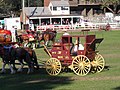
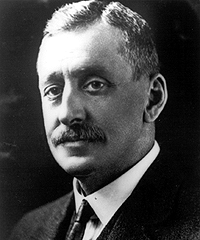
Explorers first visited the area in 1795 and named it 'Cowpastures' after a herd of cattle that had disappeared was discovered there. In February 1805, Governor King instructed (apparently reluctantly) a surveyor to measure 5,000 acres (2,000 ha) for John Macarthur at Cowpastures, where Macarthur had been promised land by the Secretary of State for War and the Colonies, Lord Camden. Macarthur named his property Camden Park in honour of his sponsor. [4]

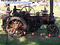
As Macarthur's wool industry thrived, local citizens began pushing for the establishment of a town in the area to support the industry. Surveyor-General Major Thomas Mitchell suggested Macarthur surrender 320 acres (130 ha) of his land for the purpose to which he refused. Following his death in 1834, his children decided to subdivide the land and the first lots in the new town of Camden went on sale in 1840. Camden Post Office opened on 1 May 1841, the day after the nearby Elderslie office (open from 1839) closed. [5] By 1883, the population had grown to over 300 and a movement began to establish a local council which held its first meeting in 1889.

Heritage listings

Commonwealth Heritage List places:

NSW State Heritage Register listed places:

Transport

Between 1882 and 1963, Camden station connected Camden to Campbelltown and Sydney by the Camden railway line. Camden is served by Camden Airport, which is mostly used by trainee pilots for flying schools, the Australian Air League, and other forms of general aviation.

Climate

Camden has a humid subtropical climate (Köppen climate classification: Cfa).

Climate data for Camden Airport
MonthJanFebMarAprMayJunJulAugSepOctNovDecYear
Record high °C (°F)46.4
(115.5)
45.6
(114.1)
41.0
(105.8)
38.5
(101.3)
29.5
(85.1)
24.9
(76.8)
27.0
(80.6)
30.2
(86.4)
36.5
(97.7)
40.5
(104.9)
42.6
(108.7)
43.1
(109.6)
46.4
(115.5)
Average high °C (°F)29.7
(85.5)
28.7
(83.7)
26.8
(80.2)
23.9
(75.0)
20.7
(69.3)
17.7
(63.9)
17.4
(63.3)
19.1
(66.4)
22.0
(71.6)
24.4
(75.9)
26.3
(79.3)
28.6
(83.5)
23.8
(74.8)
Daily mean °C (°F)23.3
(73.9)
22.7
(72.9)
20.8
(69.4)
17.5
(63.5)
13.8
(56.8)
11.1
(52.0)
10.1
(50.2)
11.5
(52.7)
14.4
(57.9)
17.2
(63.0)
19.6
(67.3)
21.9
(71.4)
17.0
(62.6)
Average low °C (°F)16.9
(62.4)
16.8
(62.2)
14.9
(58.8)
11.1
(52.0)
7.0
(44.6)
4.6
(40.3)
2.9
(37.2)
3.9
(39.0)
6.8
(44.2)
10.0
(50.0)
13.0
(55.4)
15.3
(59.5)
10.3
(50.5)
Record low °C (°F)7.9
(46.2)
7.2
(45.0)
5.9
(42.6)
−0.7
(30.7)
−2.2
(28.0)
−5.4
(22.3)
−6.0
(21.2)
−4.0
(24.8)
−1.8
(28.8)
1.3
(34.3)
3.8
(38.8)
5.7
(42.3)
−6.0
(21.2)
Average precipitation mm (inches)79.8
(3.14)
97.3
(3.83)
89.6
(3.53)
67.1
(2.64)
53.0
(2.09)
66.6
(2.62)
35.5
(1.40)
40.7
(1.60)
38.3
(1.51)
60.7
(2.39)
75.1
(2.96)
56.4
(2.22)
788.0
(31.02)
Average precipitation days (≥ 0.2 mm)10.311.010.69.48.59.08.17.67.99.610.39.2111.5
Average afternoon relative humidity (%)49525252525350434447504649
Source: [12]

Education

Camden is the location of research facilities for the veterinary and agricultural schools of the University of Sydney. The local government area has four public high schools, Mount Annan High School, Camden High School, Elderslie High School and Elizabeth Macarthur High School, as well as eight Catholic and three Anglican schools.

Culture

The Camden Show is an annual event which combines amusement park attractions with the elements of a state fair. Camden is served by three local radio stations, 2MCR, Vintage FM and C91.3FM. Local newspapers are the Camden Advertiser, [13] the District Reporter and the Macarthur Chronicle.

People

Demographics

According to the 2016 census, there were 3,230 residents in Camden. In Camden, 80.0% of people were born in Australia. The most common other countries of birth were England 4.5%, New Zealand 1.6%, Scotland 0.9%, Ireland 0.8% and Germany 0.6%. 87.8% of people only spoke English at home. Other languages spoken at home included Spanish 0.6%, German 0.5%, Croatian 0.5%, Mandarin 0.4% and Italian 0.4%. The most common responses for religion in Camden were Catholic 30.7%, Anglican 26.4% and No Religion 19.9%. [1]

Politics

Camden lies within the local government area of Camden Council. The council consists of nine councillors; three for each of the three wards; North Ward (Bringelly, Rossmore, Leppington, Cobbitty, Oran Park, Catherine Field, Harrington Park, Kirkham), Central Ward (Mount Annan, Currans Hill, Smeaton Grange, Narellan Vale) and South Ward (Ellis Lane, Narellan, Grasmere, Camden, Elderslie, Spring Farm, Bickley Vale, Cawdor, Camden South). Lara Symkowiak was elected mayor in 2012.

The southern part of the Camden LGA including Camden town centre is contained within the federal electorate of Hume while the northern end of the LGA (north of Narellan Road) is within the federal electorate of Macarthur. The state seat of Camden covers all of the Camden LGA, and parts of the City of Campbelltown and the City of Liverpool.

The state member for Camden is Peter Sidgreaves, first elected in 2019. The federal member for Macarthur is Mike Freelander, first elected in 2016 and the federal member for Hume is Angus Taylor, first elected in 2013. Both Angus Taylor and Peter Sidgreaves are members of the Liberal Party of Australia while Mike Freelander is a member of the Australian Labor Party.

Planning issues

On 27 May 2008 Camden Council rejected plans from the Quranic Society to build a 1,200-student Islamic school in the nearby suburb of Cawdor on planning grounds. The site was 2.5 kilometres (1.6 mi) south of the centre of Camden adjacent to the Camden General Cemetery and 800 metres (2,600 ft) north of the then recently relocated Camden High School. The issue received national [14] [15] [16] [17] [18] [19] and international media coverage. [20] [21] [22] The proposal was opposed from within the local community, many expressing fear and hatred about the presence of Muslims in an area where relatively few Muslims live. [23] [24] There were angry comments by a number of residents in Camden that were viewed as racist and Islamophobic. [25] The Christian Democratic Party (CDP) opposed the proposal. Speaking at a public meeting in December 2007, CDP leader Fred Nile (present alongside Robert Balzola) said he opposed the school "because Islam opposed Christianity". A spokesman for the Quranic Society said it was "absurd" to claim that Muslims are anti-Christian. [26]

In making its decision several council members, including Mayor Chris Patterson, said the school was inappropriate for the semi-rural area of Camden and likely to cause parking, traffic and other problems. [27] [28] Australian Prime Minister Kevin Rudd indicated before the council decision that he wouldn't support the school on planning grounds. [29] The Quranic Society said it will appeal the council's decision in the Land and Environment Court of New South Wales.

In September 2008, a proposal to build a private Catholic school received media attention for not provoking the same sort of outcry as the previous proposal. Some residents who were not supportive of the Islamic school now welcomed the Catholic school proposal.

On 2 June 2009, The Land and Environment Court passed down the decision to reject the appeal by the Quranic Society, with the court stating that the "development application was not suitable for the rural nature of the land." [30]

However, on 17 May 2021, it was announced that A-League team Macarthur FC had acquired 17 hectares (42 acres) of the planning grounds to construct a football precinct to house the team's future W-League squad, as well as the National Premier Leagues NSW squads. [31]

Notable residents

James William Macarthur-Onslow James MacArthur Onslow.gif
James William Macarthur-Onslow

Related Research Articles

<span class="mw-page-title-main">Campbelltown, New South Wales</span> City in New South Wales, Australia

Campbelltown is a suburb located on the outskirts of the metropolitan area of Sydney, New South Wales, Australia. It is located in Greater Western Sydney 53 kilometres (33 mi) south-west of the Sydney central business district by road. Campbelltown is the administrative seat of the local government area of the City of Campbelltown. It is also acknowledged on the register of the Geographical Names Board of New South Wales as one of only four cities within the Sydney metropolitan area.

<span class="mw-page-title-main">Greater Western Sydney</span> Region in New South Wales, Australia

Greater Western Sydney (GWS) is a large region of the metropolitan area of Greater Sydney, New South Wales (NSW), Australia that generally embraces the north-west, south-west, central-west, far western and the Blue Mountains sub-regions within Sydney's metropolitan area and encompasses 13 local government areas: Blacktown, Blue Mountains, Camden, Campbelltown, Canterbury-Bankstown, Cumberland, Fairfield, Hawkesbury, Hills Shire, Liverpool, Parramatta, Penrith and Wollondilly. It includes Western Sydney, which has a number of different definitions, although the one consistently used is the region composed of ten local government authorities, most of which are members of the Western Sydney Regional Organisation of Councils (WSROC). Penrith, Hills Shire & Canterbury-Bankstown are not WSROC members. The NSW Government's Office of Western Sydney calls the region "Greater Western Sydney".

<span class="mw-page-title-main">Bella Vista, New South Wales</span> Suburb of Greater Western Sydney, New South Wales, Australia

Bella Vista is located 33 kilometres north-west of the Sydney central business district and is part of The Hills Shire. It is a suburb in the Hills District of Greater Western Sydney and is in the state of New South Wales, Australia. Bella Vista's Norwest Business Park is home to several Fortune 500 companies, a number of shopping centres, high-rise buildings, and industrial and recreational spaces.

John Verge (1782–1861) was an English architect, builder, pioneer settler in the Colony of New South Wales, who migrated to Australia and pursued his career there. Verge was one of the earliest and the most important architect of the Greek Revival in Australia. He also brought more comprehensive range of Regency style than any contemporary architects. His design indicates the increasing of sophistication compared to previous architect's design.

<span class="mw-page-title-main">Camden Park, New South Wales</span> Suburb of Sydney, New South Wales, Australia

Camden Park is just outside the metropolitan area of Sydney, Australia. It was named after John Macarthur's estate Camden Park. While most of the suburb is farmland in Wollondilly Shire, the northern part of Camden Park has recently undergone suburban development as an extension of the suburb of Camden South. Camden South is in the Camden Council area and is part of Greater Sydney. The new development is named Bridgewater Estate and features a comprehensive Development Control Plan to guide the style outcomes of the locality.

<span class="mw-page-title-main">Camden Council (New South Wales)</span> Local government area in New South Wales, Australia

Camden Council is a local government area in the Macarthur region of Sydney, in the state of New South Wales, Australia. The area is located south west of the Sydney central business district and comprises 201 square kilometres (78 sq mi) with an estimated population at the 2021 census of 119,325. The mayor of Camden is Cr. Ashleigh Cagney, a member of the Labor Party.

<span class="mw-page-title-main">City of Campbelltown (New South Wales)</span> Local government area in New South Wales, Australia

The City of Campbelltown is a local government area in the Macarthur region of south-western Sydney, in New South Wales, Australia. The area is located about 55 kilometres (34 mi) south west of the Sydney central business district and comprises 312 square kilometres (120 sq mi).

<span class="mw-page-title-main">Narellan, New South Wales</span> Suburb of Sydney, New South Wales, Australia

Narellan is a suburb of Sydney, New South Wales. Narellan is located 60 kilometres south-west of the Sydney central business district, in the local government area of Camden Council and is part of the Macarthur region.

Mulgoa is a village, located in the local government area of the City of Penrith, in the region of western Sydney, in the state of New South Wales, Australia. Mulgoa is located approximately 66 kilometres (41 mi) west of the Sydney central business district.

<span class="mw-page-title-main">Ingleburn, New South Wales</span> Suburb of Sydney, New South Wales, Australia

Ingleburn is a suburb of Sydney, in the state of New South Wales, Australia 40 kilometres south-west of the Sydney central business district, in the local government area of City of Campbelltown. It is part of the Macarthur region. Ingleburn is located approximately halfway between the two commercial centres of Liverpool and Campbelltown.

<span class="mw-page-title-main">Camden South, New South Wales</span> Suburb of Sydney, New South Wales, Australia

Camden South is a suburb of the Macarthur Region of Sydney in the state of New South Wales, Australia in Camden Council. It is to the immediate south of Camden, New South Wales and shares the same postcode 2570.

Catherine Field is a suburb of Sydney and part of the Macarthur Region in the state of New South Wales, Australia. Catherine Field is 43 kilometres south-west of the Sydney central business district, in the local government area of Camden Council.

Cobbitty is a semi-rural town of the Macarthur Region near the town of Camden, southwest of Sydney, in the state of New South Wales, Australia. The area is mostly farmland with a population of around 2000.

Gilead is a suburb of Sydney, in the state of New South Wales, Australia. Gilead is located 58 kilometres south-west of the Sydney central business district, in the local government area of the City of Campbelltown and is part of the Macarthur region.

Oran Park is a suburb of south-west Sydney, within the Macarthur Region, in the state of New South Wales, Australia in Camden Council. The suburb is often used as an example of urban sprawl.

<span class="mw-page-title-main">Macarthur, New South Wales</span> Region in South Western Sydney

Macarthur is a region in the south-west part of the Greater Sydney area, in the state of New South Wales, Australia. The region includes the local government areas of the City of Campbelltown, Camden Council, and Wollondilly Shire. It covers an area of 3,067 square kilometres and has a population of close to 310,000 residents. The region geographically forms the foothills between the Blue Mountains and Southern Highlands regions.

<span class="mw-page-title-main">Menangle, New South Wales</span> Suburb of Wollondilly Shire, New South Wales, Australia

Menangle is a village in the Macarthur region of New South Wales, Australia.

<span class="mw-page-title-main">Wollondilly Shire</span> Local government area in New South Wales, Australia

Wollondilly Shire is a periurban local government area, located on the south west fringe of the Greater Sydney area in New South Wales, Australia, parts of which fall into the Macarthur, Blue Mountains and Central Tablelands regions in the state of New South Wales, Australia. Wollondilly is seen as the transition between Regional NSW and the Greater Sydney Region, and is variously categorised as part of both. Wollondilly Shire was created by proclamation in the NSW Government Gazette on 7 March 1906, following the passing of the Local Government (Shires) Act 1905, and amalgamated with the Municipality of Picton on 1 May 1940.

<span class="mw-page-title-main">Camden Park Estate</span> Historic site in New South Wales, Australia

The Camden Park Estate incorporating the Belgenny Farm is a heritage-listed large working historical farm located at Elizabeth Macarthur Avenue, in the south-western Sydney suburb of Camden South in the Camden Council local government area of New South Wales, Australia. It was designed by Henry Kitchen in c. 1800, John Verge in c. 1835 and A. J. Onslow in c. 1888 and built from 1819 to 1840 by John Macarthur in c. 1800, James English and Sons in c. 1888 and John Sulman c. 1895. The property is owned by Belgenny Farm Trust and Camden Park Preservation Committee. It was added to the New South Wales State Heritage Register on 22 December 2006. Today, part of the original estate contains the Elizabeth Macarthur Agricultural Institute; having originally served as a commercial sheep station and horticultural farm for the Macarthur family since the early 1800s.

Christopher Stewart Patterson, an Australian politician, was a member of the New South Wales Legislative Assembly representing Camden for the Liberal Party from 2011 to 2019.

References

  1. 1 2 Australian Bureau of Statistics (27 June 2017). "Camden(State Suburb)". 2016 Census QuickStats. Retrieved 16 October 2017. OOjs UI icon edit-ltr-progressive.svg
  2. Robillard, Emma (27 July 2016). "History Made As Council Meets For Last Time at Civic Centre" (PDF) (Press release). Camden Council. Retrieved 6 July 2019.
  3. "The History of Camden". Camden Historical Society. Archived from the original on 31 August 2007. Retrieved 14 June 2007.
  4. "The History of Camden". Camden Council. Archived from the original on 3 April 2007. Retrieved 10 June 2007.
  5. Phoenix Auctions History. "Post Office List" . Retrieved 21 February 2021.
  6. "Camden Post Office (Place ID 106176)". Australian Heritage Database . Australian Government . Retrieved 6 July 2019.
  7. "Camden Park". New South Wales State Heritage Register . Department of Planning & Environment. H00341. Retrieved 6 July 2019. CC BY icon.svg Text is licensed by State of New South Wales (Department of Planning and Environment) under CC-BY 4.0 licence .
  8. "Camden Park Estate and Belgenny Farm". New South Wales State Heritage Register . Department of Planning & Environment. H01697. Retrieved 6 July 2019. CC BY icon.svg Text is licensed by State of New South Wales (Department of Planning and Environment) under CC-BY 4.0 licence .
  9. "Macquarie Grove". New South Wales State Heritage Register . Department of Planning & Environment. H00493. Retrieved 6 July 2019. CC BY icon.svg Text is licensed by State of New South Wales (Department of Planning and Environment) under CC-BY 4.0 licence .
  10. "Nant Gwylan and Garden". New South Wales State Heritage Register . Department of Planning & Environment. H00243. Retrieved 6 July 2019. CC BY icon.svg Text is licensed by State of New South Wales (Department of Planning and Environment) under CC-BY 4.0 licence .
  11. "St Johns Anglican Church Precinct". New South Wales State Heritage Register . Department of Planning & Environment. H02006. Retrieved 6 July 2019. CC BY icon.svg Text is licensed by State of New South Wales (Department of Planning and Environment) under CC-BY 4.0 licence .
  12. "Climate statistics for Camden Airport AWS". Bureau of Meteorology. Archived from the original on 28 September 2018. Retrieved 28 September 2018.
  13. "camdenadvertiser.com.au". camdenadvertiser.com.au. Archived from the original on 3 September 2018. Retrieved 3 September 2013.
  14. "Camden locals oppose proposed Islamic school". The World Today. ABC Radio National. 7 June 2008. Archived from the original on 7 June 2008.
  15. "Politicians, locals oppose Islamic school". The Australian . 26 December 2007. Archived from the original on 26 December 2007.
  16. "Backlash over new Islamic school". The Sydney Morning Herald . 6 November 2007. Archived from the original on 30 April 2008.
  17. "Cops block mass Muslim protest". Daily Telegraph. 23 December 2007. Archived from the original on 23 December 2007.
  18. "Camden Council rejects Islamic school". The Age . 30 May 2008. Archived from the original on 30 May 2008.
  19. "Anti-Islamic school Camden 'not racist'". The Age . 29 May 2008. Archived from the original on 29 May 2008.
  20. "Town moves against Islamic school". BBC News. 30 May 2008. Archived from the original on 30 May 2008.
  21. "Australia Muslim school rejected". BBC News. Archived from the original on 30 May 2008.
  22. "Australia Muslim school rejected". Tehran Times. Archived from the original on 28 May 2008.
  23. "Residents uneasy amid opposition to Muslim school". ABC News . Australia. 20 December 2007. Archived from the original on 28 May 2008.
  24. "Pigs heads staked at Islamic-school-site". Camden. 6 August 2008. Archived from the original on 6 August 2008.
  25. "The Islamic school furore in Australia. Camden, Sydney". Youtube.com. Archived from the original on 17 April 2016. Retrieved 3 September 2013.
  26. "Nile party behind anti-Muslim school rally". The Sydney Morning Herald . 21 December 2007. Archived from the original on 30 April 2008. Retrieved 3 September 2013.
  27. Dart, Jonathon (28 May 2008). "Islamic school rejected". The Sydney Morning Herald . Archived from the original on 30 May 2008. Retrieved 28 May 2008.
  28. Lyons, John (28 May 2008). "Camden Council votes down Islamic school". The Australian . Archived from the original on 28 May 2008. Retrieved 31 May 2008.
  29. "Rudd opposed to Islamic school". 29 May 2008. Archived from the original on 29 May 2008. Retrieved 2 June 2008.
  30. "Court rejects Sydney Islamic school". ABC News . Australia. 2 June 2009. Archived from the original on 14 July 2009. Retrieved 3 September 2013.
  31. "Bulls to get $38.5m home to build new talent". Macarthur FC. 17 May 2021. Retrieved 18 May 2021.
  32. Stewart, Ken (1981). "Dwyer, James Francis (1874–1954)". Australian Dictionary of Biography . Vol. 8, (MUP). National Centre of Biography, Australian National University. ISSN   1833-7538.
  33. Walsh, G. P. (1986). "Macarthur-Onslow, Francis Arthur (1875–1938)". Australian Dictionary of Biography . Vol. 10, (MUP). National Centre of Biography, Australian National University. ISSN   1833-7538.
  34. Walsh, G.P. (1986). "Macarthur-Onslow, James William (1867–1946)". Australian Dictionary of Biography . Vol. 10, (MUP). National Centre of Biography, Australian National University. ISSN   1833-7538.
  35. Riordan, Joey (21 February 2021). "Agent Ralph Carr drops Dustin Martin trade bombshell". Seven News . Retrieved 2 July 2021.

34°03′16″S150°41′45″E / 34.05444°S 150.69583°E / -34.05444; 150.69583

Heritage