
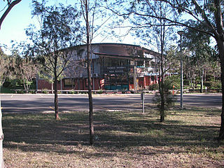
Campbelltown is a suburb located on the outskirts of the metropolitan area of Sydney, New South Wales, Australia. It is located in Greater Western Sydney 53 kilometres (33 mi) south-west of the Sydney central business district by road. Campbelltown is the administrative seat of the local government area of the City of Campbelltown. It is also acknowledged on the register of the Geographical Names Board of New South Wales as one of only four cities within the Sydney metropolitan area.

Camden is a historic town and suburb of Sydney, New South Wales, located 65 kilometres south-west of the Sydney central business district. Camden was the administrative centre for the local government area of Camden Council until July 2016 and is a part of the Macarthur region.
Glenfield is a suburb of Sydney, in the state of New South Wales, Australia. Glenfield is located 36 kilometres south-west of the Sydney central business district, in the local government areas of the City of Campbelltown and is part of the Macarthur region.

Quakers Hill is a suburb of Sydney, in the state of New South Wales, Australia. It is 40 kilometres (25 mi) westnorth-west (WNW) of the Sydney central business district, in the local government area of the City of Blacktown. Quakers Hill is part of the Greater Western Sydney region. Quakers Hill is colloquially known as 'Quakers'.

Macquarie Fields is a suburb of Sydney, in the state of New South Wales, Australia. Macquarie Fields is located 38 kilometres south-west of the Sydney central business district, in the local government area of the City of Campbelltown and is part of the Macarthur region.

Bella Vista is located 33 kilometres north-west of the Sydney central business district and is part of The Hills Shire. It is a suburb in the Hills District of Greater Western Sydney and is in the state of New South Wales, Australia. Bella Vista's Norwest Business Park is home to several Fortune 500 companies, a number of shopping centres, high-rise buildings, and industrial and recreational spaces.

Baulkham Hills is a suburb in the Hills District of Greater Sydney, in the state of New South Wales, Australia. It is located within 30 kilometres north-west of the Sydney central business district mostly within the local government area of The Hills Shire, of which Baulkham Hills was formerly the administrative seat and namesake of The Hills Shire. A small section of the suburb which is located south of the Hills Motorway-Windsor Road intersection is part of the City of Parramatta.

Wentworthville is a suburb in Sydney, in the state of New South Wales, Australia. Wentworthville is located 27 kilometres west of the Sydney central business district and is part of the Greater Western Sydney region. Wentworthville is split between the local government areas of the City of Parramatta and the Cumberland Council. Wentworthville is colloquially known as 'Wenty'.
Ambarvale is a suburb of south-western Sydney in New South Wales, Australia. Ambarvale is located 55 kilometres southwest of the Sydney central business district, in the local government area of the City of Campbelltown, and is part of the Macarthur region. The suburb is predominantly residential and contains a mix of public and private housing.

Lalor Park is a suburb of Sydney, in the state of New South Wales, Australia. Lalor Park is located 35 kilometres west of the Sydney central business district in the local government area of the City of Blacktown. Lalor Park is part of the Greater Western Sydney region. Lalor Park is commonly abbreviated as 'L.P'.
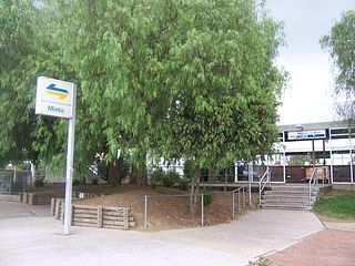
Minto is a suburb of Sydney, in the state of New South Wales, Australia. Minto is located 50 kilometres south-west of the Sydney central business district, in the local government area of the City of Campbelltown and is part of the Macarthur region.
Ingleburn is a suburb of Sydney, in the state of New South Wales, Australia, 45 kilometres (28 mi) south-west of the Sydney central business district, in the local government area of City of Campbelltown. It is part of the Macarthur region. Ingleburn is located approximately halfway between the two commercial centres of Liverpool and Campbelltown.
Mount Annan is a suburb of Sydney, in the state of New South Wales, Australia. Mount Annan is located 60 kilometres south-west of the Sydney central business district, in the local government areas of Camden Council and Campbelltown City Council, and is part of the Macarthur region. The Federal Electorates of Hume and Macarthur divide the Gardens.
Bringelly is a suburb of Sydney, in the state of New South Wales, Australia. It is located on the Northern Road between Penrith and Camden. It has a public school. Bringelly is also the name of a local hill.
Edmondson Park is a suburb in the South West of Sydney, in the state of New South Wales, Australia. Edmondson Park is located 46 kilometres from the Sydney central business district, in the local government area of the City of Liverpool.

Leppington is a suburb of Sydney, in the state of New South Wales, Australia. Leppington is located 52 kilometres south-west of the Sydney central business district, in the local government areas of the City of Liverpool and Camden Council.

The Ponds is a suburb of Sydney, in the state of New South Wales, Australia. The Ponds is about 40 kilometres (25 mi) west-northwest of the Sydney central business district in the Blacktown local government area. The 2016 census recorded the resident population of The Ponds as 11,731.
Carnes Hill is a suburb of Sydney, in the state of New South Wales, Australia. Carnes Hill is located 38 kilometres southwest of the Sydney central business district, in the local government area of the City of Liverpool and is part of the Greater Western Sydney region.

Camden and Campbelltown Hospitals are New South Wales public hospitals servicing the Macarthur region in South West Sydney. Camden and Campbelltown hospitals operate under a single, common executive management structure, with services delivered across both hospitals.
Caddens is a suburb of Sydney, in the state of New South Wales in Australia. It is a new masterplanned residential neighborhood located 48 kilometres west of the Sydney central business district, in the local government area of the City of Penrith featuring views of the scenic Blue Mountains. The suburb's postcode is 2747.
